Angus
| Angus Aonghas Angus |
|
|---|---|
|
Coat of arms |
|
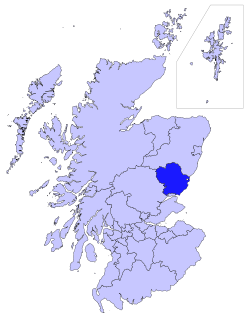
| Location | |
 |
|
| Geography | |
| Area | Ranked 10th |
| - Total | 2,182 km2 (842 sq mi) |
| Admin HQ | Forfar |
| ISO 3166-2 | GB-ANS |
| ONS code | 00QC |
| Demographics | |
| Population | Ranked 19th |
| - Total (2008) | 110,300 |
| - Density | 51 /km2 (132 /sq mi) |
| Politics | |
| Angus Council http://www.angus.gov.uk/ |
|
| Control | Independent/Conservative/Liberal Democrat/Labour |
| MPs |
|
| MSPs |
|

Angus (Aonghas in Gaelic) is one of the 32 local government council areas of Scotland, a registration county and a lieutenancy area. The council area borders onto Aberdeenshire, Perth and Kinross and Dundee City. Main industries include agriculture and fishing.
Angus was historically a county (known officially as Forfarshire from the eighteenth century until 1928, when it reverted to its ancient name) until 1975 when it became a district of the Tayside Region. In 1996, two-tier local government was abolished and Angus was established as a unitary authority. The former county had borders with Kincardineshire to the north-east, county of Aberdeenshire to the north and Perthshire to the west. Southwards, it faced Fife across the Firth of Tay. The boundaries of the present council area are exactly the same as those of the old county minus the City of Dundee.
Areas similar to that of the council area are covered by the Angus Westminster constituency for the UK Parliament and the area is also represented at the Scottish Parliament by both the Angus and North Tayside Holyrood constituencies.
Angus can be split into three geographic areas. To the north and west, the topography is mountainous; this is the area of the five Angus Glens, is sparsely populated and the main industry is hill-farming. To the south and east the topography consists of rolling hills bordering the sea. This area is well populated, with the larger towns and the city of Dundee on the coast. In between lies Strathmore, Gaelic for the Great Valley, which is a fertile agricultural area noted for the growing of potatoes, soft fruit and the raising of Angus cattle.
Contents |
Towns and villages
Towns
- Arbroath, the largest town
- Brechin
- Carnoustie
- Forfar, the county town and administrative centre
- Kirriemuir
- Monifieth
- Montrose
Villages
- Aberlemno
- Arbirlot
- Auchmithie
- Auchterhouse
- Birkhill
- Bridge of Craigisla
- Carmyllie
- Dunnichen
- East Haven
- Edzell
- Farnell
- Friockheim
- Glamis
- Guthrie
- Inverkeilor
- Hillside
- Kingsmuir
- Letham
- Newbigging
- Newtyle
- Memus
- Menmuir
- Monikie
- Muirhead
- Murroes
- St Vigeans
- Tealing
- Tarfside
- Unthank
| County of Angus until circa 1890 |
|
| {{{Image}}} | |
| Geography | |
| Area - Total |
Ranked 11th 568,750 acres (2302 km²) |
|---|---|
| County town | Forfar |
| Chapman code | ANS |
Places of interest
- Aberlemno Sculptured Stones (Pictish symbols)
- Angus Folk Museum, Glamis
- Arbroath Abbey, place of signing of the Declaration of Arbroath[1]
- Barry Mill
- Brechin Cathedral
- Brechin Castle
- Brechin Round Tower
- Caledonian Railway (Brechin)
- Cairngorms National Park
- Carnlochan NNR - National Nature Reserve
- Eassie Stone[2]
- Edzell Castle[3]
- Glamis Castle[4]
- House of Dun
- Loch of Kinnordy Nature Reserve
- The Meffan Museum and Art Gallery (Forfar)
- Monboddo House
- Montrose Basin Nature Reserve
- Montrose Museum
Council political composition
| Party | Councillors | |
| Scottish National Party | 13 | |
| Independent | 6 | |
| Conservative | 5 | |
| Liberal Democrat | 3 | |
| Labour | 2 |
The council is currently controlled by the Angus Alliance which comprises a coalition of Independent/Conservative/Liberal Democrat & Labour councillors[5]
Sister areas
See also
- Earl of Angus
- List of pre-1975 counties of Scotland
References
- ↑ Angus Council: Arbroath Abbey
- ↑ C.Michael Hogan, Eassie Stone, The Megalithic Portal, ed. A. Burnham, Oct., 2007
- ↑ Undiscovered Scotland: Edzell Castle
- ↑ Glamis Castle
- ↑ Angus Council - Councillor Information
- ↑ Angus Council (2002-01-21). "Yantai Visit". Press release. http://www.angus.gov.uk/new/releases-archive/2002/2002-01-22a.html. Retrieved 2010-09-05.
External links
- Angus Council
- Angus at the Open Directory Project
- Website showcasing the best of Angus
- Dundee and Angus information portal
- Angus walks
|
|||||
|
||||||||