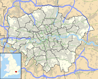
Ealing
| Ealing | |
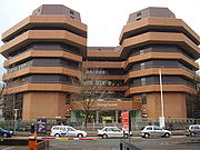
 Ealing Town Hall on Ealing Broadway |
|
 Ealing
|
|
| OS grid reference | |
|---|---|
| - Charing Cross | 7.7 mi (12.4 km) E |
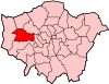
| London borough | Ealing |
| Ceremonial county | Greater London |
| Region | London |
| Country | England |
| Sovereign state | United Kingdom |
| Post town | LONDON |
| Postcode district | W5, W13, W7 |
| Dialling code | 020 |
| Police | Metropolitan |
| Fire | London |
| Ambulance | London |
| EU Parliament | London |
| UK Parliament | Ealing North |
| Ealing, Southall | |
| Ealing Central and Acton | |
| London Assembly | Ealing and Hillingdon |
| List of places: UK • England • London | |
Ealing is a district in west London, England, located in the London Borough of Ealing. It is situated 7.7 miles (12.4 km) west of Charing Cross. The area is identified in the London Plan as one of the metropolitan centres in Greater London,[1] and is often referred to as the "Queen of the Suburbs".[2]
Contents |
History
Etymology
The Saxon name for Ealing was recorded c.700 as 'Gillingas', meaning 'place of the people associated with Gilla', from the personal name Gilla and the Old English suffix '-ingas', meaning 'people of'.[3] Over the centuries, the name has changed, and has been known as 'Illing', 1130; 'Gilling', 1243; and 'Ylling', 1254, until 'Ealing' became the standard spelling in the 19th century.[4]
Early history
Archaeological evidence shows that parts of Ealing have been occupied for at least 7,000 years Iron Age pots have been discovered in the vicinity on Horsenden Hill. A settlement is recorded here in the 12th century amid a great forest that carpeted the area to the west of London. The earliest surviving English census is that for Ealing in 1599. This list was a tally of all 85 households in Ealing village giving the names of the inhabitants, together with their ages, relationships and occupations. It survives in manuscript form in the Public Record Office (PRO E 163/24/35), and has been transcribed and printed by K J Allison.
Settlements were scattered throughout the parish. Many of them were along what is now called St. Mary's Road, near to the church in the centre of the parish. There were also houses at Little Ealing, Ealing Dean, Haven Green, Drayton Green and Castlebar Hill.
The Church of St. Mary's, the parish church, dates back to the early twelfth century. The parish of Ealing was divided into manors, such as those of Gunnersbury and Pitshanger. These were farmed; the crops being mostly wheat, but also barley and rye. There were also animals such as cows, sheep and chickens.
Great Ealing School was founded in 1698 by the Church of St Mary's. This subsequently became the "finest private school in England" and had many famous pupils in the 19th century such as William S. Gilbert and Cardinal Newman. As the area became built-up, it declined and closed in 1908.[5] The first known maps of Ealing were made in the 18th century.
Ealing as a suburb of London
With the exception of driving animals into London on foot, the transport of heavy goods tended be restricted to those times when the non-metalled roads were passable due to dry weather. However, with the passing of the Toll Road Act, this highway was gravelled and so the old Oxford Road became an increasingly busy and important thoroughfare running from east to west through the centre of the parish. This road was later to be known as the Uxbridge Road. The well-to-do of London began to see Ealing as a place to escape from the smoke and smells. In 1800 the architect John Soane bought Payton Place and renamed it Pitzhanger Manor, not to live but just for somewhere green and pleasant, where he could entertain his friends and guests. Soon after (1801) the Duke of Kent bought a house at Castlebar. Soon, more affluent Londoners followed but with the intention of taking up a permanent residence which was conveniently close to London. A one time prime minister, Spencer Perceval made his home at Elm House. Up until that point, Ealing was mostly made up of open countryside and fields where, as in previous centuries, the main occupation was farming.
Old inns and public houses
As London grew in size, more food and materials went in and more finished goods came out. Since dray horses can only haul loads a few miles per day, frequent overnight stops were needed. To satisfy this demand a large number of inns were situated along the Uxbridge Road, where horses could be changed and travellers refresh themselves, prompting its favour by highwaymen. Stops in Ealing included The Feathers, The Bell, The Green Man and The Old Hats. At one point in history there were two pubs called the Half Way House either side of one of the many toll gates on the Uxbridge Road in West Ealing. Following the removal of the toll gate the more easternmost pub was renamed the Olde Hat.
The expansion of Ealing
As London developed, the area became predominantly market gardens which required a greater proportion of workers as it was more labour-intensive. In the 1850s, with improved travel (the Great Western Railway and two branches of the Grand Union Canal), villages began to grow into towns and merged into unbroken residential areas. At this time Ealing began to be called the "Queen of the Suburbs".
Mount Castle Tower, an Elizabethan structure which stood at the top of Hanger Hill, was used as a tea-stop in the 19th century. It was demolished to make way for Fox's Reservoir in 1881. This reservoir, with a capacity of three million gallons, was erected north of Hill Crest Road, Hanger Hill, in 1888 and a neighbouring reservoir for 50 million gallons was constructed c. 1889. This supply of good water helped to make Ealing more attractive than ever.
Ealing as a modern Victorian suburb
The most important changes to Ealing occurred in the 19th century. The building of the Great Western Railway in the 1830s, part of which passed through the centre of Ealing, led to the opening of a railway station on the Broadway in 1879, originally called Haven Green. In the next few decades, much of Ealing was rebuilt, predominantly semi-detached housing designed for the rising middle-class. Gas mains were laid and an electricity generating station was built. Better transport links, including horse buses as well as trains, enabled people to more easily travel to work in London. All this, whilst living in what was still considered to be the countryside. Although much of the countryside was rapidly disappearing during this period of rapid expansion, parts of it were preserved as public parks, such as Lamas Park and Ealing Common. Pitzhanger Manor and the extensive 28 acres (110,000 m2) grounds on which it stands, was sold to the council in 1901 by Sir Spencer Walpole, which had been bought by his father the Rt. Hon. Spencer Horatio Walpole and thus became Walpole Park.[6]
It was during the Victorian period that Ealing became a town. This meant that roads had to be built, drainage provided, and schools & public buildings erected. The man responsible for much of all this was Charles Jones, Borough Surveyor from 1863–1913. He planted the horse chestnut trees on Ealing Common and designed the Town Hall, both the present one and the older structure which is now a bank (on the Mall). Ealing Broadway became a major shopping centre.
It was in 1901 that Ealing Urban District was incorporated as a municipal borough, Walpole Park was opened and the first electric trams ran along the Uxbridge Road – a mode of transport that Transport for London (TFL) tried to reintroduce some 110 years later in the form of the West London Tram scheme. This was abandoned in August 2007 in the face of fierce local opposition and a switch in priorities and funding to Crossrail.
Religion
The ancient parish church of Ealing is St Mary's, in St Mary's Road. Standing near Charlbury Grove, Ealing Abbey was founded by a community of Roman Catholic Benedictine monks in 1897. Twinned with the convent of St. Augustine's Priory, the giant abbey is an example of a traditional, working monastery. There are over fifteen churches in the suburb of Ealing, including Our Lady Mother of the Church, a Polish Roman Catholic church in The Mall, near Ealing Broadway.[7] There are two well-established synagogues, The Ealing United Synagogue (Orthodox)[8] which celebrated its 90th anniversary in November 2009, and the Ealing Liberal Synagogue,[9] now in its 67th year. In surrounding suburbs there are two mosques in Acton, one in West Ealing, and two in Southall. Southall also has a large Hindu community and is famous for being a focal point of London's diverse society, often attracting international stars such as Shilpa Shetty in 2008.
Sport
Ealing is home to Ealing Trailfinders Rugby Club. Due to the nearby football teams, Brentford Football Club and Queens Park Rangers, Ealing has previously not had its own football team, despite its size. However in late 2008 a team by the name of 'Ealing Town Football Club' had been registered with the Football Association and will therefore start playing competitive matches in the 2008/2009 football season. Gaelic Games have a prominent role in the Irish community in Ealing with successful clubs such as St. Josephs GAA and Tir Chonaill GAA in neighbouring Perivale and Greenford. Despite not having its own football team, many youth football clubs such Old Actonians FC and Hanwell Town FC play in local leagues and are popular among the children of the borough. Most of these teams compete in the Harrow League or the Hayes and District Sunday Youth League, although some teams compete in other leagues based further away from Ealing itself.
Community
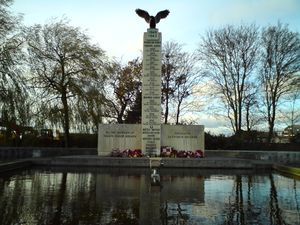
Ealing has a longstanding Irish community. This is particularly visible through the number of Irish pubs in the borough and the popularity of Gaelic games within the community. County flags for example, can be seen flown on the outside or hung inside of various pubs in the area. Additionally Ealing has a large Polish community. This developed during World War II when Polish pilots fighting in the Battle of Britain flew from the nearby aerodrome, RAF Northolt, where there is a landmark Polish War Memorial. The Polish community has grown considerably since Poland joined the EU and its migrant workers have been able to come to the UK freely. This has led to a dramatic increase in the number of Polish orientated shops and social centres in the borough and has seen a rise in the demand for places at local primary schools.
Festivals
Ealing is the host to several annual festivals. The first festival to be regularly staged was the Jazz Festival which is held in Walpole Park. An annual Beer Festival was then started and organized by the Campaign for Real Ale and originally held in the Ealing Town Hall. Due to its popularity, it had outgrown the space available at the Town Hall after a few years, so it too then transferred to the park, where they now have room to offer over 170 real ales. Each stillage is supplied with individual cooling jackets to maintain each barrel at the exactly right temperature. This event is largely run by keen volunteers. The success of theses events encouraged the local council to licence a broader range of festivals.

- Beer Festival (7th to 10th July) [10]
- Blues Festival, [11]
- Comedy Festival, [11]
- Global Festival, [11]
- Jazz Festival. [11]
- Opera in the Park, [11]
Ealing Studios
Ealing is best known for its film studios, which are the oldest in the world and are known especially for the Ealing comedies, including Kind Hearts and Coronets, Passport to Pimlico, The Ladykillers and The Lavender Hill Mob. The studios were taken over by the BBC in 1955 so Ealing locations appeared in television programmes ranging from Doctor Who to Monty Python's Flying Circus. Most recently, these studios have again been used for making films, including Notting Hill and The Importance of Being Earnest. Most recently, St Trinian's, a remake of the classic film, was produced by Ealing Studios; some locations in Ealing can be observed in this film.
Ealing in fiction
- Ealing was the setting for children's comedy show Rentaghost.
- In James Hilton's novel Goodbye, Mr Chips (1934), Katherine, the lovely young wife of the shy schoolmaster protagonist Mr Chipping, is said to have been living with an aunt in Ealing following the death of her parents.
- Ealing and the surrounding area is mentioned in Aldous Huxley's Brave New World (1932). Lenina observes a Delta gymnastic display in the Ealing stadium as she flies overhead in a helicopter with Henry Foster.
- The John Sanders department store (now a branch of Marks & Spencer) was the location for the scenes of the Autons breaking through the shop window and beginning their killing rampage in the 1970 Doctor Who story Spearhead From Space.
- The Doctor Who spin-off, The Sarah Jane Adventures, is set in Ealing
- The main character Kendra Tamale of the book Marshmallows for Breakfast by Dorothy Koomson, was said to have grown up or lived in Ealing or nearby.
- The police station featured in the opening titles of Dixon of Dock Green was the previous Ealing police station, located at number 5 High Street, just north of Ealing Green.[12][13]
- HG Wells' The War of the Worlds makes reference to Castle(bar) Hill in Ealing since the alien gas is heavier than air and the residents at the top of the hill are unaffected
Thomas Merton, in his autobiography Seven Story Mountain, tells of living in Ealing for a time with his Aunt and Uncle.
- Hugh Grant's character in the film Bridget Jones's Diary recites a limerick about Ealing:
There once was a young woman from Ealing/Who had a particular feeling/She lay on her back/And opened her crack/And pissed all over the ceiling.
Further reading
History:
- Oates, Jonathan (2006-07-31) (paperback). Foul Deeds and Suspicious Deaths in Ealing. Barnsley, South Yorkshire UK: Wharncliffe Books. ISBN 1-84563-012-2. http://www.pen-and-sword.co.uk/product.php?productid=1279&cat=0&page=1. Retrieved 2006-09-13.
- Hounsell, Peter (1991) [1991] (Hardback). Ealing and Hanwell Past. London UK: Historical Publications Ltd. ISBN 0-948667-13-3.
- Neaves, Cyrill (1971). A history of Greater Ealing. United Kingdom: S. R. Publishers. ISBN 0-85409-679-5.
- Essen, Richard (1996). Britain in Old Photographs: Ealing & Northfields. Gloucestershire: Alan Smith Publishing Limited. ISBN 0-7509-176-X.
Transport
Tube stations
- Ealing Broadway, Central line, District line
- North Ealing, Piccadilly line (Uxbridge Branch)
- South Ealing, Piccadilly line (Heathrow Airport Branch)
- Ealing Common, District line, Piccadilly line (Uxbridge Branch)
- Northfields tube station, Piccadilly line (Heathrow Airport Branch)
Railway stations
- Ealing Broadway, First Great Western, Heathrow Connect
- West Ealing, First Great Western, Heathrow Connect
- Hanwell, First Great Western, Heathrow Connect
Roads
The A406 North Circular Road runs through Ealing.
Nearest places
- Hanwell
- Hanger Hill
- Perivale
- Alperton
- Acton
- Chiswick
See also
- List of people from Ealing
- 3 August 2001 Ealing bombing
- The Questors Theatre, Ealing
- Ealing Jazz Club
References
- ↑ Mayor of London (February 2008). "London Plan (Consolidated with Alterations since 2004)". Greater London Authority. http://www.london.gov.uk/thelondonplan/docs/londonplan08.pdf.
- ↑ Ealing Times: Ealing Guide: Ealing
- ↑ Room, Adrian: “Dictionary of Place-Names in the British Isles”, Bloomsbury, 1988
- ↑ Ekwall, Eilert: "The Concise Oxford Dictionary of English Place-Names", Oxford University Press, 1936
- ↑ Oates, Jonathan (May 2008). "The days when this grand school truly was 'great'". Around Ealing (UK: Ealing Council): 27. http://www.ealing.gov.uk/ealing3/export/sites/ealingweb/services/nonlgcl/around_ealing/previous_editions/_around_ealing_archive_docs/2008/around_ealing_may08.pdf. Retrieved 2008-06-04.
- ↑ Neaves, Cyrill (1971). A history of Greater Ealing. United Kingdom: S. R. Publishers. pp. 65, 66. ISBN 0-85409-679-5.
- ↑ St Mary's Church: Churches in Ealing<
- ↑ EalingsSynagogue.com
- ↑ EalingLiberalsSynagogue.or.uk
- ↑ West Middlesex CAMRA.Ealing Beer Festival. Accessed 2010-05-23
- ↑ 11.0 11.1 11.2 11.3 11.4 Ealing Council. Ealing Summer. Accessed 2010-05-23
- ↑ Ealing and Brentford: Public services, A History of the County of Middlesex: Volume 7: Acton, Chiswick, Ealing and Brentford, West Twyford, Willesden (1982), pp. 147–149. Date accessed: 10 May 2008.
- ↑ McEwan, Kate (1983). Ealing Walkabout: Journeys into the history of a London borough.. Cheshire, UK.: Nick Wheatly Associates. pp. 45. ISBN 0 9508895 0 4.
External links
|
||||||||||||||||||||
|
||||||||