Hims
| Homs حمص Hims |
|
|---|---|
 |
|
| Nickname(s): The city of Ibn al-Walid | |
 Homs
|
|
| Coordinates: | |
| Country | |
| Governorate | Hims Governorate |
| District | Hims District |
| Settled | 2000 BC |
| Government | |
| - Governor | Mohammed Iyad Ghazal |
| - President of City Council | Nadia Kseibi |
| Area | |
| - Total | 48 km2 (18.5 sq mi) |
| Elevation | 501 m (1,644 ft) |
| Population (2009) | |
| - Total | 1,500,000 |
| Time zone | EET (UTC+3) |
| - Summer (DST) | EEST (UTC+2) |
| Area code(s) | 31 |
| Website | http://www.homscitycouncil.org.sy |
Homs (Arabic: حمص, Ḥims, also spelled Hims and anciently called Emesa[1] (Greek: ἡ Ἔμεσα) is a city in western Syria and the capital of the Hims Governorate. It is 501 metres (1,644 ft) above sea level and is located 162 kilometres (101 mi) north of Damascus.[2] Located on the Orontes River, Hims is also the central link between the interior cities and the Mediterranean coast.
Hims did not emerge into the light of history until the 1st century BCE at the time of Seleucids. It later became the capital of a kingdom ruled by the Emesani dynasty who gave the city its name. Originally a pagan center of worship for the Sun god El-Gabal, it later gained importance in Christianity under the Byzantines. It was conquered by the Muslims in the 7th century and made capital of a district that bore its current name. Throughout the Islamic era, Muslim dynasties contending for control of Syria sought after Hims due to the city's strategic position in the area. It began to decline under the Ottomans and only in the 19th century did the city regain its economic importance when its cotton industry boomed.
Today, Hims is a major industrial center in Syria, and with a population of 1,500,000, it is the third largest city in the country. Its population reflects Syria's general religious diversity, composed mostly of Arabic-speaking Sunni Muslims, with a Christian minority. The city boasts a number of historic mosques and churches and is near the Krak des Chevaliers, a world heritage site.
Contents |
Etymology
"Emesa" is a compound of "Ham-Es", with the Es representing an assemblage of the locally-revered sun god in (El-Gabal) in ancient times.[3] The name "Emesa" or "Hemesa" is also attributed to "Emesenoi", the name of the Arab tribe that ruled the area before its incorporation into the Roman Empire.[4] When the name of the tribe became attached to the city is indiscernible, but is generally thought to have been used under the Romans.[5]
"Emesa" was called "Hems" or "Hims" by its Arab inhabitants, many of whom settled there prior to the Muslim conquest of Syria.[5][6] This name has been preserved throughout the period of Islamic rule continuing to the present day. It was known as "la Chamelle" by the Crusaders, although they never ruled the city.[7][8] A second possibility about the origin of the city's modern name is that it is an Arabic form of the city's Latin name "Emesus", derived from the Greek "Emesa" or "Emesos".[9]
History
For roughly 2,000 years, Hims has served as a key agricultural market, production site, and trade center for the villages of northern Syria. It has also provided security services to the hinterland of Syria, protecting it from invading forces.[5]
Emesani dynasty and Roman rule
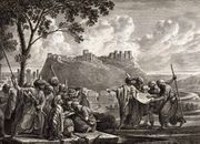
Excavations at the Citadel of Hims indicate that the earliest settlement at the site dates back to around 2300 BCE. Biblical scholars have identified the city with Zobah mentioned in the Bible.[5][10] In 1274 BCE,[11] a battle took place between the forces of the Egyptian Empire under Ramesses II and the Hittite Empire under Muwatalli II at the city of Kadesh on the Orontes River near Hims.[12] It was possibly the largest chariot battle ever fought, involving perhaps 5,000–6,000 chariots.[13][14]
Hims itself may have been founded by Seleucus I Nicator who established the Seleucid Empire upon the death of Alexander the Great, although the city did not emerge in the light of history until the 1st century BCE. At this time, Greek philosopher Strabo spoke of a tent-dwelling tribe called the "Emesani" living in the area around the Orontes and south of the Apamea region.[5] They were an Arab tribe in the area and settled in Emesa—which derived its name from them. Upon Pompey's incorporation of the Seleucid state of Syria into the Roman Empire in 64 BCE, the Emesani dynasty were made vassals to the Romans for aiding their troops in various wars. Their chief at the time, Samsigeramus I, gained the status as king of the Emesanis, but their capital was at Arethusa, a city north of Emesa, also along the Orontes River. At its greatest extent, the kingdom's boundaries extended from the Bekaa Valley in the west to the border with Palmyra in the east, and from Yabrud in the south to al-Rastan (Arethusa) in the north. Semsigeramus's kingdom was the first of Rome's Arab clients on the desert fringes.[4]
The city of Emesa grew to prominence after the new-found wealth of the Emesani dynasty, governed first by Samsigeramus's son Iamblichus who made it the kingdom's capital.[4] The Emesani proved their loyalty to Rome once more when they aided Julius Caesar in his siege of Alexandria in 41 BCE, by sending him army detachments. Subsequently, they became embroiled in the Roman Civil War between the rebelling Mark Antony and the pro-Caesar Octavian. King Iamblichus took the side of Octavian, and so upon encouragement from Antony, the king's brother Alexas usurped the throne and put him to death in 31 BCE. Octavian's forces prevailed in the war, however, and as a result the kingdom's throne was reverted to Iamblichus II after Alexas was executed for treason. Under his stable rule emerged a new era of peace from 20 BCE and 14 CE, known as Emesa's "golden age". In 32 CE, Heliopolis and the Bekaa Valley came under the kingdom's control.[4]
Relations with the Roman government grew closer when King Sohaemus inherited the kingship. Under him, Emesa sent the Roman military a regular levy of archers and assisted them in their siege of Jerusalem in 70 CE. His loyalty to Rome gained the Emesani dynasty little, however; in 75 CE the Kingdom of Emesa was completely incorporated into the Roman Empire, diminishing the dynasty's autonomy. It is unclear whether King Sohaemus abdicated his throne or had died with an incapable heir, prompting the Romans to annex the territory.[15]

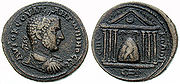
Under the Romans, Emesa began to show attributes of a Greek city-state and traces of Roman town planning still remain. Its transformation into a major city was completed under the reign of Antoninus Pius (138-161) when Emesa began to mint coins.[5] By the 3rd century, it grew prosperous and well-integrated into the Roman Orient. This was partly due to the marriage of Septimus Severus to a woman from a family of notables based in Emesa. It attained the coveted status as a Roman colonia by Severus, and two other emperors of Severan Dynasty were raised in Emesa. One of them was Elagabalus who served as the high priest at the Temple of El-Gabal, the local sun god. He brought the image of this god, a conical black stone, to the Elagabalium in Rome.[16][17]
Emesa also grew wealthy because it formed a link in the eastern trade funneled through Palmyra, however, this dependence also caused the city's downfall when Palmyra sank to insignificance in the 4th century. Nonetheless, Emesa at this time had grown to rank with the important cities of Tyre, Sidon, Beirut, and Damascus. It also continued retain local significance, because it was the market center for the surrounding villages. The city remained a strong center of paganism, because of the Temple of El-Gabal. After one of his victories over Zenobia, emperor Aurelian visited the city to pay thanks to the deity.[16]
Due to the strength of the pagan sun-cult in Emesa, Christians initially did not settle in the city. Eusibius writes that Silvanus, the city's first bishop, had no jurisdiction over the city, but the surrounding villages. He was executed by Emperor Julian and succeeded by Bishop Antonius—the first bishop to settle Emesa.[18] By the 5th century, Christianity was well-established under the Byzantine Empire; however, few ancient Christian inscriptions exist in Hims today.[16] Under the Byzantines, it became an important center for Eastern Christianity.[19] Initially a diocese, Hims was given the status of ecclesiastical metropolis after the discovery John the Baptist's head in a nearby area in 452.[16]
Arab Caliphate
Prior to the Muslim conquest of Syria, Arab tribes, particularly the Banu Kalb settled around Emesa, ensuring its position as an important Yemeni center. The Byzantine emperor Heraclius abandoned the city—which served as his headquarters[20]—after the defeat of his army to that of the Rashidun Muslims under Umar ibn al-Khattab during the Battle of Yarmouk in southern Syria. In 637 CE, the Rashidun army led by Khalid ibn al-Walid captured Emesa peacefully as the city agreed to pay a substantial ransom of 71,000 to 170,000 dinars.[16][21][22] Afterward, they renamed the city "Hims". The caliph Umar established Hims as the capital of Jund Hims, a district within the province of Bilad ash-Sham, encompassing the towns of Latakia, Jableh, and Tartus along the coast, as well as the Palmyra in the Syrian Desert and the territory in between, including the town of Hama.[23] Hims was probably the first city in Syria to have a substantial Muslim population.[24]
The Muslims transformed half of St. John's Church into the city's Friday Mosque (Great Mosque of al-Nuri) and Hims soon became a center of Islamic piety since some 500 companions of Muhammad settled there after its conquest.[16] The tombs of Ibn al-Walid, his son Abd ar-Rahman, and Ubaid Allah, the son of Umar are located in the city.[25] During the conflict between the Umayyads and Ali, the inhabitants of Hims allied themselves with Ali and when the latter was defeated, the Umayyad caliph Mu'awiyah hived the northern half of Jund Hims to form a separate district, Jund Qinnasrin, apparently as punishment.[16] Ali's oratory (mash-had 'Ali) was located in the city, and Islamic tradition claims his fingerprints are engraved on it.[22] During the summer of 745 AD (AH 127), the last Umayyad caliph, Marwan II approached Hims and upon a revolt by the tribesmen of Kalb, Marwan II defeated them and ordered that their slain be crucified and breached a part of the city walls. In 746 AD, the inhabitants of Hims revolted again against Marwan II and repaired the city wall. Marwan II besieged the city for Four months. Hunger forced the city inhabitants to submit to the caliphate.[26] In 750 CE the Abbasids wrested control of Syria, including Hims, from the Umayyads, but the Arab tribes continued to revolt against the Abbasids Caliphate.[16]
During the reign of caliph Harun al-Rashid from 796 to 809 and after his reign, the Abbasid authorities sent numerous punitive expeditions against Hims and although the city was quite prosperous in this era, Abbasid rule was generally not welcomed.[16] Under the reign of al-Mutawakkil, in October 855, an uprising by the Christians of the city erupted in response to additional taxation. The caliph put down the revolt by expelling Christians from the city, burning down its churches, and executing members of its leadership.[27] With Abbasid rule over the Caliphate weakening in the mid-9th century, Hims became sought after by rebel dynasties contending for control of Syria due to the city's strategic position.[16]
Initially, the Egypt-based Tulunids came into control of it, but they were forced out by the Aleppo-based Hamdanids who were briefly succeeded by the Qarmatians,[16] after their Turkish rebel ally Aftakin invaded northern Syria and made Hims his base.[28] In 891 CE, geographer al-Yaqubi wrote that Hims was situated along a broad river from which the inhabitants drink.[29] It was one of the largest cities in Syria and had several smaller districts surrounding it. In 944, the Hamdanids took definitive control of the city dominated it until 1016.[16] Arab geographer al-Mas'udi noted in the early 10th century, that Hims was "noted for the personal beauty of its inhabitants".[29] In 985, al-Muqaddasi claimed that Hims was the largest city in all of Syria, but it had suffered "great misfortunes" and was "threatened with ruin". He stated that when the city was conquered by the Muslims they turned half of its church into a mosque.[30]
For roughly thirty years during the 10th century, Hims was raided by the Byzantines and its inhabitants were subject to slaughter and plunder and the city's mosque was briefly restored to become a church. Throughout most of the 11th century, the Byzantine raids receded greatly and the Mirdasids of the Banu Kalb tribe ruled over Hims, replacing the Hamdanids. Inclined towards Shia Islam, they did not oppose the Shia Fatimids of Egypt who were aiming to extend their rule into northern Syria and Iraq at the time. This precipitated a Sunni reaction led by the Seljuk Turks who occupied Hims under Aq Sunqur al-Hajib in 1090.[16]
Seljuk, Ayyubid, and Mamluk rule
The First Crusade was launched in 1096, and in 1098, the Crusaders captured Antioch to the northeast, looted Ma'arat al-Numan, and finally besieged Hims itself. Although they managed to cut the city off from its main port Tartus, they failed in taking the city. Soon after, Hims came under the control of the Seljuk ruler of Damascus who turned it into a large, fortified camp and key fortress effectively preventing the Crusaders from penetrating deeper into Muslim territory. Immune from attack, the city became a point where the Muslims could marshal their forces and launch raids against Crusader holds along the Mediterranean coast.[16] In the early 12th century, the Seljuks engaged in internal fighting, during which Hims was often a prize. In 1149, the Mosul-based Zengids under Nur al-Din captured Hims in 1149.[31]
al-Idrisi reports in 1154, that the city was populous, had paved streets, possessed one of the largest mosques in Syria, contained open markets, and was frequented by travelers attracted to its "products and rarities of all kinds". He also noted that its residents were "pleasant; living with them is easy, and their manners are agreeable. The women are beautiful and are celebrated for their fine skin."[32] A series of earthquakes in 1157 inflicted heavy damage upon Hims and its fortress, then in 1170, a minor quake finished off the latter. Yet because of its strategic importance, being opposite of the Crusader County of Tripoli, the city and its fortifications were soon restored. In 1164, Nur al-Din handed Hims over to Asad ad-Din Shirkuh as a fief, but reclaimed it five years later after Shirkuh's death. The latter's nephew, Saladin, came into control of the city in 1175 and in 1179, after reorganizing northern Syria, he restored the fief to his Ayyubid dynasty who retained it for nearly a century until 1262. In 1225, geographer Yaqut al-Hamawi mentioned that Hims was large, "celebrated", and walled, having a strongly fortified castle on its southern hill.[22]
During the later Ayyubid period of rule, Hims remained a centerpiece of the wars between them and the Crusaders, as well as internecine conflicts with the Mongol Empire and the Mamluks.[31] The first battle between the Mongols and the Mamluks took place on December 10, 1260, ending in a decisive Mamluk victory. A second battle was fought on October 29, 1281, also ending in a Mamluk victory. The Mamluks were finally defeated in the Battle of Wadi al-Khazandar, also known as the "Third Battle of Hims", in 1299.
Hims declined politically after falling to the Mamluks under Baibars because they effectively drove out the Crusaders and Mongols from the entirety of Syria. At the beginning of the 14th century, the city was merely the capital of the smallest province of Syria and was often included in the province of Damascus.[31] Ibn Batuta visited Hims in 1355, writing that it had fine trees, good markets, and a "fine Friday Mosque", noting that all of its inhabitants were Arabs.[33] Timur seized the city in 1400, and later in the 15th century as Mamluk weakness had brought insecurity to the countryside, Hims was ravaged by Bedouin raids; In 1510, the powerful tribe led by al-Fadl bin Nu'ayr were sent on an expedition by the governor of Damascus to loot the city markets as Hims had failed to pay for his "services".[31]
Ottoman rule
In 1516, Hims was incorporated into the Ottoman Empire and consequently suffered a greater political eclipse, but it continued to thrive as an economic center, processing the agricultural and pastoral products that flowed to it from surrounding districts.[34] Hims was particularly well-known for silk and wool weaving, especially the alaja, which was mottled muslin run through with gold threads and used in feminine apparel. This silk was exported to as far as the Ottoman capital Istanbul. In addition to weaving industries, there were olive oil presses and water mills for wheat and sesame, while grapes and rice, grown in the surrounding marshlands from the 16th century, were found in abundance in the city's markets. Moreover, the markets of Hims were the center of a trade in animal, where flocks of sheep and goats coming from Aleppo met camels and cattle moving north from Damascus.[31]
The coming of the Ottomans brought administrative change to Hims, now becoming the center of a sanjak ("district") attached to the wilaya ("province") of Tripoli—its old rival.[35] At this time, a French visitor noted that the city walls and citadel were in good repair, all within was in decay and only its covered markets "retained their beauty". French traveler, Volney wrote in 1785 of the city's once great importance and its current "miserable" condition. He described it as large, but ruined village administratively dependent on Damascus. The Ottomans did little to revitalize Hims or ensure it security against Bedouin raids. Tribal unrest throughout the 17th and 18th centuries resulted in the sacking of its markets on several occasions. Security was even more hampered, when in the 18th century, the Ottomans tore down the gates of the city's walls.[31]
The countryside of Hims saw an increase in Bedouin ravages in the first half of the 19th century, interrupted by it and Syria's occupation by Muhammad Ali's Egypt led by Ibrahim Pasha between 1832 and 1840.[34][36] The city revolted against Egyptian rule, and its citadel was destroyed when the Egyptians were suppressing the revolt. Ottoman rule was soon restored and up to the 1860s, Hims was large enough to form a discrete economic unit of trade and processing of agricultural products from its satellite villages and the neighboring Bedouin tribe.[31]
The local economy was stimulated when the Ottoman government extended security to the city and its surrounding area; new villages were established and old ones were resettled. Hims found itself faced with European economic competition since Ottoman rule was restored. Hims' economic importance was boosted again during the depression of the 1870s, as its cotton industry boomed due to a decline European textile production. The quality and design of cotton goods from Hims satisfied both the lower and upper classes of the local, Ottoman, and even the foreign market. There were around 5,000 looms in Hims and nearby Hama, and one British consul referred to Hims as the "Manchester of Syria".[31]
Modern era
Throughout the 20th century Hims held high political importance in the country and was home to several heads of state and other high-ranking government officials.[31] Under the French mandate, Hims was part of the State of Damascus. In Autumn 1925, the city joined Damascus and the southern Druze chieftains in a full-blown revolt against French rule.[37] In 1932 the French moved their military academy from Damascus to Hims, and remained the only military academy in Syria until 1967.[38] The Hims Military Academy played a major role in the years following Syria's independence, as many of its graduates went on to become high ranked officers in the Syrian Army and many of them took part in the series of coup d'états that were to follow. An important example was Hafez al-Assad who became the president of Syria from 1971 until his death in 2000.[39]
An oil pipeline between Tripoli and Kirkuk was built in Hims in the early 1930s and it followed an ancient caravan route between Palmyra and the Mediterranean. In 1959, an oil refinery was built to process some of this oil for consumption by Syria.[31] Israel bombed the Hims oil refinery during the Yom Kippur War in 1973.[39]
Geography
The Governorate of Hims is the largest in Syria. Hims, the governorate's capital, is located in central western Syria, situated along the east bank of the Orontes River in a particularly fertile area. The city is in between the southern outliers of al-Ansariyah mountains located to its west and Mount Lebanon, overlooking the Hims Gap. Because of the gap, the area around Hims receives much more rainfall than interior regions to its north and south.[38] To the east of Hims, is the Syrian Desert. Lake Hims, impounded by a huge dam of Roman origins, is to the southwest, lying some 125 kilometers (78 mi) south of Aleppo and 34 kilometers (21 mi) south of Hama, halfway on the road between the capital Damascus and Aleppo.[5] The Orontes River splits the city into two main sections: To the east, on a flat land lies the city center and the main neighborhoods; to the west, lies the more recent and modern suburb of al-Waer. The city spans an area of 4,800 hectares (19 sq mi).[40]
Hims is located 162 kilometres (101 mi) north of Damascus, 193 kilometres (120 mi) south from Aleppo, 47 kilometres (29 mi) south Hama, and 186 kilometres (116 mi) southeast from Latakia.[2] Nearby towns and villages include al-Qusayr to the south, Fairouzeh to the southeast, Marmarita and Zweitina to the west, Qatna to the northeast and Ar-Rastan to the north.
Old City and subdivisions
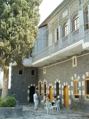
The Old City is the most condensed area of Hims, and it includes the neighborhoods of Bab Tadmur, Bab al-Dreib, and Bab Hud and the area around the citadel, covering an area of 1.2 square kilometres (0.46 sq mi).[40] Little remains of the Old City; its walls and gates were demolished in the Ottoman era, but a short section of fortified wall with a circular corner tower still exists. Half a kilometer to the south, a large earth mound marks the site where the citadel once stood.[41] To the north of the citadel lies the Christian Quarter, known as "al-Hamidiyah".[42] This neighborhood is one of the few areas of Hims that retains its older look, with most of the black-and-white stone buildings dating from the Mamluk era. They are still used as shops and dwellings, and there has been recent renovation.[43]
At the time of the Abbasids, Hims was known for its seven gates. They were Bab al-Souq (Gate of the Market), Bab Tadmor (Gate of Palmyra), Bab al-Dreib (or Bab al-Deir), Bab al-Sebaa (Gate of the Lions), Bab al-Turkman (Gate of the Turkmen), Bab al-Masdoud (Closed Door), and Bab Hud (The Gate of Hud).[31] Only two gates—Bab Tadmor and Bab al-Dreib—remain today.[44] The oldest of Hims' mosques and churches are located in the Old City.[41]
Hims consists of several subdivisions outside the Old City. The large neighborhood of Khaldiyah spreads along its northern edge, while the more modern neighborhoods of al-Sabeel, al-Zahra, and Jub al-Jandali are situated to the east of the Old City. South of it are the neighborhoods of Bab al-Sebaa, al-Mreijeh, al-Nezha, Akrama and beyond them lay the Karm al-Zaytoun and Karm al-Loz neighborhoods.[42] The modern commercial center lies to the west in the neighborhood of Jouret al-Shayyah, and further west are the upscale neighborhoods of Qusoor, al-Mahatta and al-Ghouta. The suburb of al-Waer is located even further west, separated from the city by areas of farmland called al-Basateen and the Orontes river forming a green belt where it is forbidden to build anything.[42] The al-Baath University complex and dormitories are located on the western-southern edge of the city next to the neighborhood of Akrama.[42]
Climate
Hims' location ensures that it receives softening influences and breezes from the Mediterranean . As a result, the city has a much milder climate than nearby Hama, with higher average rainfall of 18 inches (457.2 mm) instead of 14 inches (355.6 mm), but it also experiences greater winds.[5]
| Climate data for Hims | |||||||||||||
|---|---|---|---|---|---|---|---|---|---|---|---|---|---|
| Month | Jan | Feb | Mar | Apr | May | Jun | Jul | Aug | Sep | Oct | Nov | Dec | Year |
| Average high °C (°F) | 14 (57) |
15 (59) |
17 (63) |
20 (68) |
22 (72) |
25 (77) |
27 (81) |
28 (82) |
28 (82) |
25 (77) |
21 (70) |
16 (61) |
21.5 (70.7) |
| Average low °C (°F) | 8 (46) |
10 (50) |
11 (52) |
15 (59) |
17 (63) |
21 (70) |
24 (75) |
25 (77) |
22 (72) |
19 (66) |
14 (57) |
10 (50) |
16 (61) |
| Precipitation mm (inches) | 67 (2.64) |
57 (2.24) |
40 (1.57) |
24 (0.94) |
10 (0.39) |
7 (0.28) |
0 (0) |
0 (0) |
0 (0) |
15 (0.59) |
34 (1.34) |
47 (1.85) |
301 (11.85) |
| Source: Zoover[45] | |||||||||||||
Demographics
| Year | Population |
|---|---|
| 12th century | ~7,000[46] |
| 1785 | ~2,000[31] |
| 1860s | 15,000-20,000[31] |
| 1907 | ~65,000[10] |
| 1932 | 65,000[47] |
| 1960 | 136,000[47] |
| 1978 | 306,000[47] |
| 1981 | 346,871[48] |
| 1994 | 540,133[49] |
| 2005 (estimate) | 750,000[5] |
| 2008 (estimate) | 823,000[19] |
Hims was one of the largest cities in Muslim Syria in the 12th century with a population of 7,000.[46] In 1785, the inhabitants of Hims numbered more than 2,000 and the population was divided almost evenly between Muslims and Greek Orthodox Christians. The 1860s saw a rise in the population to 15,000-20,000.[31] By 1907, Hims had roughly 65,000 inhabitants, of which two-thirds were Muslims and the remainder Christians.[10] In the 1981 census, the population stood at 346,871,[48] rising to 540,133 in 1994.[49] Hims had 750,000 residents in a 2005 estimate,[5] and as of 2008 the population stood at about 823,000.[19]
Today, Hims' population reflects Syria's general religious diversity, and is made up primarily of Arabic-speaking Sunni Muslims, with minorities of Alawite Muslims, Greek Orthodox and Syriac Orthodox Christians.[50][51] In the 1880s, the Survey of Western Palestine noted that there were 5,500 Greek Orthodox Christians and 1,500 Syriac Orthodox Christians. The Syriac Patriarchate was transferred to Hims from Mardin in 1933, but relocated once more to Damascus in 1959.[52]
Hims camp, a Palestinian refugee camp, is located within the city of Hims, and has a population of nearly 14,000. Most of its residents are originally from the Acre and Haifa areas in northern Palestine.[53] During the Armenian Genocide in the early 20th century, about 20,000 Armenians immigrated to Hims and the surrounding villages.[54] A small Greek community also exists in the city.[55]
Economy
After long periods of stagnation under Ottoman rule, Hims started to flourish again in the 20th-century. Its geographic and strategic location has made it a center of agriculture and industry. The "Hims Irrigation Scheme", the first of its kind in modern Syria, brought prosperity to cultivators and the long-established enterprises involved in the processing of agricultural and pastoral products.[56] Crops grown in Hims include, wheat, barley, lentils, sugar beets, cotton, and vines, as well as serving as a point of exchange between the sedentary zone and the desert. Moreover, because of easy access to the Mediterranean, Hims has attracted overland trade from the Persian Gulf and Iraq.[38]
Hims is also home to several large public heavy industries, such as the oil refinery west of the city which opened in 1959.[56] A fertilizer plant was built in 1971 to process phosphates from their deposits near Palmyra; the fertilizer is for domestic consumption and export.[57] A growing private industrial sector has flourished in the past decade and many small to medium sized enterprises occupy the industrial zones northwest and south of the city. A new sugar refinery is being built by a Brazilian company, and an automobile plant is under construction by Iran Khodro. Also a new phosphate plant and oil refinery are being built east of the city. Hims is also the hub of an important road and rail network, it is the central link between the interior cities and the Mediterranean coast.
A major industrial project was the establishment of a new industrial city in Hissaya, 47 kilometers (29 mi) south of the city of Hims. Spreading across some 2,500 hectares (25 km2), the city covers four main industrial sectors: textiles, food, chemical, engineering and vocational. In all, the facilities are designed to accommodate up to 66,000 workers and their families. Moreover, a free zone has been established within the city.[58]
The hinterland of Hims is well-known for its grapes which are used in Syria's liqueur industry, particularly in producing arak, nectar wine, and red wine.[59] The city is considered a good base for day trips and excursions to the many historical and touristic sights nearby. Popular destinations include Krak des Chevaliers, Qatna, Talkalakh and Marmarita. Hims has several hotels; Safir Hotel is considered one of Syria's best five-star hotels and the only one of that status in the city. An-Nasr al-Jedid Hotel is built in a 100-year-old mansion and is labeled by tour guides as the "best budget hotel in Hims". Other hotels include Hotel al-Mimas, Ghazi Hotel, and Hotel Khayyam.[60][61]
Culture
Cuisine
Although people in Hims eat the same foods common in Levantine cuisine, the city is well-known throughout Syria for its own cuisine. A prominent dish is Batarsh, a type of baba ghanouj made with yogurt and garlic instead of tahini.[62] Hims is also home to a variety of kibbeh mishwiyyeh or "grilled kibbeh". It consists of two pancakes of kibbeh stuffed with ground lamb, cooked with lamb fat and various spices.[63] Batata mahshi ("stuffed potatoes") is native dish in Hims and is made of baby potatoes stuffed with ground lamb, pine nuts, and pomegranate molasses.[64] The city specializes in cooking a type of okra meal, known as bamya bi-l zayt ("okra with olive oil").[65]
Hims has an array of restaurants, some of the most highly acclaimed are those within the Safir Hotel: Mamma Mia and Mersia. The former specializes in Italian cuisine, while the latter serves Arabic food. For the local population, popular restaurants include Prince Restaurant which acts as a type of fast-food place, serving shawarma, grilled chicken, and other common Syrian foods, as well as homemade juices. In the Old City, low-price restaurants are grouped together along Shoukri al-Quwatly Street and sell similar foods, such as hummus, falafel, various salads (mezze), kebabs and chicken dishes. Restaurants and coffeehouses typically offer hookahs and are a common place for men to gather and smoke.[66]
Like counterparts in Damascus and Aleppo, many houses in the Old City of Hims have been renovated and turned into restaurants specializing in Levantine cuisine. Most notable of these is Beit al-Agha restaurant, situated in a renovated palace that dates back to the mid 19th-century with Ottoman and Mamluke architecture,[67] and Julia Dumna Restaurant, which has been described as the best example of traditional Himsi houses, with its white and black stones.[68]
Museums
There are two main museums in Hims, both located in the central part of the city. Azze Hrawe Palace, a former Mamluk-era palace belonging to Ali ibn Abi al-Fadl al-Azzhari, a subordinate of Baibars, the Mamluk sultan, is now the National Folklore Museum.[60] Outside the building is a courtyard, occupied on one side by a large terraced liwan with a conch shell semi-dome. In the opposite wall, there is a carving of two lions, a symbol of Baibars. The first museum built in the city is located along Shoukri al-Quwatly Street and contains a selection of artifacts from the Hims region, covering the time between the pre-historic to Islamic eras.[69]
Festivals
Hims has several festivals, and the city annually co-hosts the Desert Folk Festival and the Al-Badiya Festival with Palmyra. The Desert Folk Festival is an annual festival of the ancient traditions and costumes of the Badiya (Syrian Desert) and it includes exhibitions and concerts between Hims and Palmyra. The festival is held in the first week of May.[70] The Al-Badiya Festival, which is held mainly in Palmyra with some events in Hims, draws approximately 60,000 tourists during the last week of May. Activities include horse, camel, and car races, horse contests, music and theatre shows, antique exhibitions, and a crafts market.[71] Other festivals include the al-Nasarah Festival and the Festival of Krak des Chevaliers and the Valley. An annual festival is held at the Church of Saint Elian, attracting large numbers of pilgrims.[72]
Sports
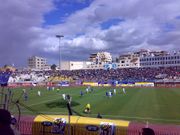
Hims is the home city of two football clubs. The Al-Karamah Sports Club was founded in 1928 and is one the oldest sports club in Syria.[73] The Al-Karamah Sports Club is widely acclaimed on the regional and national levels,[74] having won eight Syrian League titles, and seven Syrian Cup titles. Al-Karamah was runner-up in the 2006 AFC Champions League. The second sports club of the city is Al-Wathba Sports Club, which was founded in 1937. The Khaled bin Walid Stadium has a 35,000-seat capacity and is home to both football clubs.[73][75] Hims has produced a number of well-known sportsmen, including footballers Firas Al Khatib and Jehad Al Hussain.
Government
Hims is the capital of the Hims District, and the capital of the Hims Governorate—the largest governorate in Syria, and houses the seat of its governor, Muhammed Iyad Ghazal, appointed by the president. The city of Hims is governed by a city council and is home to the Executive Office. The latter consists of nine elected members, in addition to the president of the city council. The Office aids the Governor in making management decisions related to the Governorate, while the city council is responsible for decisions specific to the city of Hims. It is headed by a president, Nadia Kseibi, and is responsible for the day-to-day management of the city.[76]
The council's organizational structure is composed of the top leadership, consisting of the president, vice president, and secretary, and the lower leadership, made up of the directors of seventeen city branches: Administrative Affairs, Finance, Technical Affairs, Health Affairs, Legal Affairs, the Fire Department, Mechanisms, Parks, Hygiene, Property, Provisional Register, Services and Maintenance, Works, IT, Planning and Statistics, Culture, and Internal Oversight Service.[77]
Education

Hims is home to the Al-Baath University, one of four major universities in Syria was founded in 1979. A specialist engineering foundation, the university has one of the largest student bodies.[78] It houses several faculties including medicine, engineering, liberal arts, and sciences and a number of two-year career (vocational) institutions. It is the only university in the country to have departments in petroleum engineering and veterinary medicine.[79]
The German University at Wadi al-Nasarah opened in 2004 and is located 30 kilometers (19 mi) west of the city. In 2005, the International School of Choueifat opened a school outside the city.[80] Al-Andalus University for Medical Sciences was established in 2005 near Hims, and is constructing one of its University Hospitals in the city.[81]
There are 1,727 schools and 15,000 kindergartens in the Hims Governorate, most of which are public facilities. In 2007, 375,000 students in the governorate were enrolled in elementary schools (6–15 years), 36,000 in high schools (15–18 years), and around 12,000 in vocational training schools.[82]
Local infrastructure
Transportation
Hims is considered a transportation hub in Syria, by virtue of its central location between the coastal cities and the interior.[83] The main bus terminal is Karnak, situated along Hama Street, 1.5 kilometers (1 mi) north of the city center on the outskirts. The terminal offers connections to most Syrian cities and Beirut, Lebanon.[84] It also has international bus connections to Lebanon, Jordan, Saudi Arabia and Turkey. A second "luxury" bus station is located a little further north. Minibuses operate from Karnak station with destinations to Tartus, Palmyra, and Hama in northern Syria, as well as Baalbek, Tripoli, and Beirut in Lebanon. Newer microbuses that mostly travel to Hama are also based in Karnak and are mostly used for quick transportation.
Hims has a large railway station, with two Chemins de Fer Syriens operated daily departures to Damascus and Aleppo.[84] The nearest airports are Bassel Al-Assad International Airport in Latakia to the west, Damascus International Airport to the south, and Palmyra Airport in the Syrian Desert to the east.
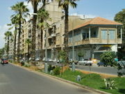
Hama Street starts at the Old Clock Square in the city center and crosses Hims from south to north, where it continues along the neighborhood of al-Khaldiyah on to the Karnak station, and turns into the Hims-Hama-Aleppo highway. Quwatli Street, named after former president Shukri al-Quwatli, is a short but vital street that connects the Old Clock Square and Quwatli Square in Downtown Hims. It branches into several smaller streets on its western end, one of which is al-Dablan Street which is the main commercial block in the city, and the other continues west to connect with the Hims-Tripoli highway. On the eastern end, al-Quwatli street continues as al-Hamidiyah Street which crosses the old Christian quarter and continues to the eastern edge of the city. The Hims-Damascus highway crosses the city from the south and reaches the city center in Quwatli Square.[85]
Landmarks
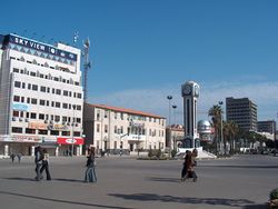
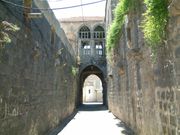
The city itself is famous its ancient mosques and churches. It is also well recognized by its twin clock-towers. The older one, facing al-Hamidiya Street, was built by the French in the early 1930s, and the newer one in al-Quwatli Square facing al-Dablan street. Hims is well-known for its historical roofed souks. These consist of a complex maze of narrow streets and covered commercial alleys extending from the south and east from the Great Mosque towards the ancient citadel. The souks—lined with grocery and clothing stores, and workshops for carpenters, artisans, cobblers, metalworkers, and knife-sharpeners—are busiest in the evening.[86][87]
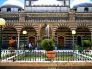
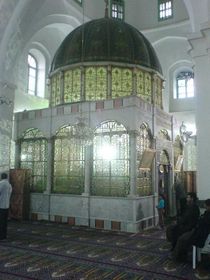
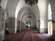
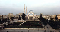
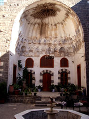
Hims and the surrounding countryside bear many landmarks, including a world heritage site, the Krak des Chevaliers and Citadel of Salah Ed-Din. Other landmarks include the Great Mosque of al-Nuri. Originally a pagan temple dedicated to El-Gabal, it was consecrated as the Church of Saint John the Baptist under the Byzantines. Later, it was established as a Friday mosque during the Islamic Arab rule of Hims.[88] The Khalid ibn al-Walid Mosque has been considered "the only edifice of any real note" in Hims, and was built in the last few years of Ottoman rule in Syria during 1900s. The mosque is named after early Arab general Khalid ibn al-Walid, whose tomb is located within the building.[89]
The Um al-Zennar Church ("Church of the Virgin's Girdle") was built in 1852 atop an earlier church dating back to the 4th century, and perhaps 59 CE. The other prominent church in Hims is the 5th-century Church of Saint Elian, built in honor of Christian martyr Saint Elian, whose tomb is located in the crypt.[72]
The Citadel of Hims is situated on one of the largest urban tells of Syria. It has been archaeologically neglected because of military occupation until recent years. The tell dates back at least to the Early Bronze Age. The extant Islamic-style walls were built during the Ayyubid period and the Mamluk sultan Baybars subsequently carried out restorations. All of this work is testified by inscriptions although without exception, they are lost. In 1994, a joint Syrian-British team studied the Citadel of Hims, recording the remains of the walls and towers.[90]
Sister cities
 Belo Horizonte, Brazil (2001)[91]
 Aksaray, Turkey[92]
See also
- List of cities in Syria
- List of notable people from Hims
Photos from Hims
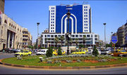
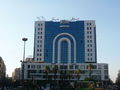 City Center |
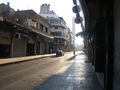 Al-Dablan Street |
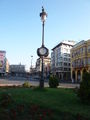 The Old Clock |
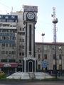 The New Clock |
References
- ↑ Vailhé, Siméon (1909). "Emesa". Catholic Encyclopedia. Robert Appleton Company. http://www.newadvent.org/cathen/05402a.htm. Retrieved 26 February 2009.
- ↑ 2.0 2.1 "Distance Between Main Syrian Cities". HomsOnline. 16 May 2008. http://www.homsonline.com/EN/Syria/Distance.htm. Retrieved 26 February 2009.
- ↑ Bryant, Jacob (1807). A New System; or, an Analysis of Antient Mythology. Volume I. W. Marchant.
- ↑ 4.0 4.1 4.2 4.3 Ball, 2000, pp.34-35.
- ↑ 5.0 5.1 5.2 5.3 5.4 5.5 5.6 5.7 5.8 5.9 Dumper, 2007, p.171.
- ↑ Gibbon and Ockley, 1870, p.177.
- ↑ Grousset, René. Histoire des Croisades III. pp. 18.
- ↑ Jackson, Peter (2007). The Seventh Crusade, 1244-1254: Sources and Documents. Ashgate Publishing. p. 83. ISBN 0754657221.
- ↑ Room, 2006, p.167.
- ↑ 10.0 10.1 10.2 Cook, 1907, p.362.
- ↑ around "Year 5 III Shemu day 9" of Ramesses II's reign (BAR III, p.317<) or more precisely: May 12, 1274 BCE based on Ramesses' commonly accepted accession date in 1279 BCE.
- ↑ Kitchen, K.A, "Ramesside Inscriptions", Volume 2, Blackwell Publishing Limited, 1996, pp.16-17
- ↑ Healy, 1993, p. 22
- ↑ Healy, 1993, p. 39
- ↑ Ball, 2000, p.36.
- ↑ 16.00 16.01 16.02 16.03 16.04 16.05 16.06 16.07 16.08 16.09 16.10 16.11 16.12 16.13 Dumper, 2007, p.172.
- ↑ Herodian, Roman History, V.3.5
- ↑ Herbermann, 1913, p.403.
- ↑ 19.0 19.1 19.2 Carter, 2008, p.155.
- ↑ Kennedy, 2007, p.74
- ↑ Mannheim, 2001, p.205.
- ↑ 22.0 22.1 22.2 Yaqut al-Hamawi quoted in le Strange, 1890, p.356.
- ↑ le Strange, 1890, p.25.
- ↑ Kennedy, 2007, p.86.
- ↑ Ibn Jubair quoted in le Strange, 1890, p.355.
- ↑ Robert G. Hoyland quoted in (Seeing Islam as Others Saw it), 2007, p.663-664
- ↑ Gil, 1997, pp.296-297.
- ↑ Gil, 1997, p.343.
- ↑ 29.0 29.1 le Strange, 1890, p.353.
- ↑ al-Muqaddasi quoted in le Strange, 1890, p.354.
- ↑ 31.00 31.01 31.02 31.03 31.04 31.05 31.06 31.07 31.08 31.09 31.10 31.11 31.12 31.13 Dumper, 2007, p.173.
- ↑ le Strange, 1890, p.354.
- ↑ Ibn Batuta quoted in le Strange, 1890, p.357.
- ↑ 34.0 34.1 Collelo, Thomas (1987). "Syria - Ottoman Empire". Syria: A Country Study. GPO for the Library of Congress. http://countrystudies.us/syria/7.htm. Retrieved 28 February 2009.
- ↑ Talhami, 2001, p.2
- ↑ Shaw, 1977, p.33
- ↑ Cleveland, 2000, p.215.
- ↑ 38.0 38.1 38.2 Commins, 2004, p.130.
- ↑ 39.0 39.1 Seale, 2007, p.210.
- ↑ 40.0 40.1 "Overview" (in Arabic). Homs City Council. 2008. http://www.homscitycouncil.org.sy/modules/0/3.php. Retrieved 28 February 2009.
- ↑ 41.0 41.1 Carter, 2004, p.157.
- ↑ 42.0 42.1 42.2 42.3 "A Map of the divisions of Hims City" (in Arabic). Hims City Council. http://www.homscitycouncil.org.sy/modules/0/2.php. Retrieved 26 February 2009.
- ↑ Carter, 2008, p.157.
- ↑ "Homs". HomsOnline. 2008. http://www.homsonline.com/EN/Citeis/Homs.htm. Retrieved 26 February 2009.
- ↑ "Homs Weather forecast". Zoover. 2009. http://www.zoover.com/syria/syria/homs/weather. Retrieved 24 August 2010.
- ↑ 46.0 46.1 Shatzmiller, 1994, p.59.
- ↑ 47.0 47.1 47.2 Winckler, 1998, p.72.
- ↑ 48.0 48.1 Population Census Report (1981), Central Bureau of Statistics
- ↑ 49.0 49.1 PUN Demographic Yearkbook (1999)
- ↑ Baylson, 1987, p.27.
- ↑ "Ḥimṣ". Encyclopædia Britannica Online. Encyclopædia Britannica. 2009. http://www.britannica.com/EBchecked/topic/266142/Hims. Retrieved 11 February 2009.
- ↑ Fahlbusch and Bromiley, 2008, p.282.
- ↑ "Homs Refugee Camp". United Nations Relief and Works Agency. 30 June 2002. http://www.un.org/unrwa/refugees/syria/homs.html. Retrieved 26 February 2009.
- ↑ Toynbee, 1916, p.550.
- ↑ "Relations with Syria: The Greek community". Greek Ministry of Foreign Affairs. 2008. http://www.mfa.gr/www.mfa.gr/en-US/Policy/Geographic+Regions/Mediterranean+-+Middle+East/Bilateral+Relations/Syria/. Retrieved 26 February 2009.
- ↑ 56.0 56.1 Dumper, 2007, p.174.
- ↑ Commins, 2004, p.136.
- ↑ "About Homes". Homs Chamber of Commerce. 2005. http://www.homschamber.org.sy/index.php?name=Sections&req=viewarticle&artid=2&page=1. Retrieved 26 February 2009.
- ↑ "Wine Profile". Cortas Winery. 2007. http://www.cortasco.com/templates/en/profile.htm. Retrieved 29 February 2009.
- ↑ 60.0 60.1 Carter, 2004, p.158.
- ↑ Carter, 2008, p.158
- ↑ Wright, 2003, p.63.
- ↑ Wright, 2003, p.427.
- ↑ Wright, 2003, p.223.
- ↑ Wright, 2003, p.182.
- ↑ Carter, 2004, pp.158-159.
- ↑ "Beit al-Agha Restaurant". Beit al-Agha Restaurant. 2006. http://agha-syria.com/index2.html. Retrieved 27 February 2009.
- ↑ "Julia Dumna Restaurant" (in Arabic). eHoms. 2006. http://www.ehoms.sy/_places.php?filename=200812031455011. Retrieved 26 February 2009.
- ↑ Mannheim, 2001, p.209.
- ↑ "Desert Folk Festival in Palmyra". KadmusArts. 2009. http://www.kadmusarts.com/festivals/3860.html. Retrieved 17 February 2009.
- ↑ "Al Badya Fesival (Badyet Al-Chaam)". KadmusArts. 2009. http://www.kadmusarts.com/festivals/3858.html. Retrieved 17 February 2009.
- ↑ 72.0 72.1 Beattie, 2001, p.208.
- ↑ 73.0 73.1 "Al-Karamah Sports Club". Welt Fussball Archive. http://www.weltfussballarchiv.com/Vereinsprofilnew.php?ID=22055. Retrieved 27 February 2009.
- ↑ Carter, 2004, p.67.
- ↑ "Al-Wathba". Welt Fussball Archive. http://www.weltfussballarchiv.com/Vereinsprofilnew.php?ID=22067. Retrieved 27 February 2009.
- ↑ "Electronic Portal of Syria" (in Arabic). E-Syria. 2007. http://e.sy/govmember.php?pid=NTEz&mid=2. Retrieved 28 February 2009.
- ↑ "Homs City Council Organizational Structure" (in Arabic). Homs City Council. 2008. http://74.125.45.132/translate_c?hl=en&sl=ar&u=http://www.homscitycouncil.org.sy/modules/1/0.php&prev=/search%3Fq%3DHoms%2Bcity%2Bcouncil%26hl%3Den%26client%3Dfirefox-a%26rls%3Dorg.mozilla:en-US:official%26hs%3DADz%26sa%3DG&usg=ALkJrhgwQrvO0S6WhJoIS5Dh5-GjvUdVeQ. Retrieved 28 February 2009.
- ↑ Beattie, 2000, p.150.
- ↑ Collelo, Thomas (1987). "Syria - Education". Syria: A Country Study. GPO for the Library of Congress. http://countrystudies.us/syria/37.htm. Retrieved 26 February 2009.
- ↑ "History and Achievements". The International School of Choueifat. 2006. http://www.ischoms-sabis.net/AboutIscHoms.aspx. Retrieved 26 February 2009.
- ↑ "Overview". Al-Andalus University. 2008. http://www.au.edu.sy/english/index.php?catid=210&lang=en. Retrieved 26 February 2009.
- ↑ "Directorate of Education in Hims" (in Arabic). SANA. 7 September 2008. http://www.sana.sy/ara/157/2008/08/18/188999.htm. Retrieved 26 February 2009.
- ↑ Mannheim, 2001, p.204.
- ↑ 84.0 84.1 Carter, 2004, p.159.
- ↑ Carter, 2008, p.156.
- ↑ Beattie, 2001, p.207.
- ↑ Carter, 2008, pp.156-157.
- ↑ Mannheim, 2001, p.205-206.
- ↑ Beattie, 2001, p.53.
- ↑ King, Geoffrey (2002). Archaeological fieldwork at the Citadel of Homs, Syria: 1995-1999. School of Oriental and African Studies. http://cat.inist.fr/?aModele=afficheN&cpsidt=15222300. Retrieved 17 February 2009.
- ↑ Câmara Municipal de Belo Horizonte. "Lei nº 8.272, de 26 de dezembro de 2001" (in Portuguese). http://cmbhapweb.cmbh.mg.gov.br:8080/silinternet/consultaNormas/detalheNorma.do?id=2c907f76166df5df01166f6286e30f57&metodo=detalhar#. Retrieved February 20, 2009.
- ↑ "Aksaray". Wikipedia, The Free Encyclopedia. http://en.wikipedia.org/w/index.php?title=Aksaray&oldid=271579782. Retrieved 20 February 2009.
Bibliography
- Ball, Warwick (2000). Rome in the East: The Transformation of an Empire. Routledge. ISBN 0415113768, 9780415113762. http://books.google.com/?id=8Q2XxXx5ZdsC&pg=PA33&dq=Emesa..
- Baylson, Joshua C. (1987). Territorial Allocation by Imperial Rivalry: The Human Legacy in the Near East. University of Chicago, Dept. of Geography. ISBN 0890651256, 9780890651254. http://books.google.com/?id=lTS2AAAAIAAJ&dq=Homs+population&q=Homs+Alawis..
- Beattie, Andrew; Pepper, Timothy (2001). The Rough Guide to Syria. Rough Guides. ISBN 1858287189, 9781858287188. http://books.google.com/?id=9iCfkTe8v2EC.
- Besant, Walter (1881). The Survey of Western Palestine: Special Papers on Topography, Archaeology, Manners and Customs, Etc. The Committee of the Palestine Exploration Fund. http://books.google.com/?id=-8MrAAAAYAAJ&pg=PA119&dq=Homs+population..
- Carter, Terry; Dunston, Lara; Humphreys, Andrew (2004). Syria & Lebanon. Lonely Planet. ISBN 1864503335, 9781864503333. http://books.google.com/?id=EskzgI-229IC&pg=PA300&lpg=PA300&dq=Homs+Syria+sister+cities.
- Carter, Terry; Dunston, Lara; Thomas, Amelia (2008). Syria & Lebanon. Lonely Planet. ISBN 1741046092, 9781741046090. http://books.google.com/?id=_R-I_Gx5OgQC&pg=PA67&lpg=PA67&dq=Karamah+Homs.
- Cleveland, William L. (2000). A History of the Modern Middle East: 2nd Edition. Westview Press. ISBN 0813334896, 97808133348991. http://books.google.com/?id=Jhqgg3rCHLMC&pg=PA215&dq=Homs+French.
- Commins, David Dean (2004). Historical Dictionary of Syria: 2nd Edition. Scarecrow Press. ISBN 0810849348, 9780810849341. http://books.google.com/?id=_EhACvcqVXkC&pg=PA136&dq=Homs+foods.
- Cook, Thomas (1907). Cook's Handbook for Palestine and Syria. Thos. Cook & Son. http://books.google.com/?id=EvxtAAAAMAAJ&pg=PA362&dq=Homs+population#PPA362,M1.
- Dumper, Michael; Stanley, Bruce E.; Abu-Lughod, Janet L. (2007). Cities of the Middle East and North Africa: A Historical Encyclopedia. ABC-CLIO. ISBN 1576079198, 9781576079195. http://books.google.com/?id=3SapTk5iGDkC&pg=PA172&lpg=PA172&dq=First+crusade+emesa..
- Fahlbusch, Erwin; Bromiley, Geoffrey William (2008). The Encyclopedia Of Christianity: Volume 5: Si-Z. Wm. B. Eerdmans Publishing. ISBN 080282417X, 9780802824172. http://books.google.com/?id=lZUBZlth2qgC&pg=PA279&dq=Latakia+2005+population#PPA279,M1..
- Gil, Moshe (1997). A History of Palestine, 634-1099. Cambridge University Press. ISBN 0521599849. http://books.google.com/?id=M0wUKoMJeccC&pg=PA42&dq=Ijnadayn+Lajjun..
- Healy, Mark (1993). Qadesh 1300 B.C, Clash of the Warrior Kings. Osprey Publishing. ISBN 1855323001, 9781855323001. http://books.google.com/?id=2GlVcfVebeUC&printsec=frontcover.
- Herbermann, Charles George (1913). The Catholic Encyclopedia: An International Work of Reference on the Constitution, Doctrine, Discipline, and History of the Catholic Church. Universal Knowledge Foundation..
- Kennedy, Hugh (2007). The Great Arab Conquests: How the Spread of Islam Changed the World We Live in. Da Capo Press. ISBN 0306815850, 9780306815850. http://books.google.com/?id=oLyZhTuIczMC&pg=PA86&dq=Homs+Mosque..
- Mannheim, Ivan (2001). Syria & Lebanon Handbook: The Travel Guide. Footprint Travel Guides. ISBN 1900949903, 9781900949903. http://books.google.com/?id=GOJ80DlXwwMC&pg=PA205&dq=nouri+mosque+homs.
- Room, Adrian (2006). Placenames of the World: Origins and Meanings of the Names for 6,600 Countries, Cities, Territories, Natural Features, and Historic Sites. McFarland. ISBN 0786422483, 9780786422487. http://books.google.com/?id=M1JIPAN-eJ4C&pg=PA167&dq=Homs+Syria+etymology..
- le Strange, Guy (1890). Palestine Under the Moslems: A Description of Syria and the Holy Land from A.D. 650 to 1500. Committee of the Palestine Exploration Fund. ISBN 0404562884. http://books.google.com/?id=ENANAAAAIAAJ&pg=PA493&dq=Lajjun+Guy+le+Strange..
- Seale, Patrick; McConville, Maureen (1990). Asad of Syria: The Struggle for the Middle East. University of California Press. ISBN 0520069765, 9780520069763..
- Shatzmiller, Maya (1994). Labour in the medieval Islamic world. BRILL. ISBN 9004098968, 9789004098961. http://books.google.com/?id=Bzo0Skd1kcYC&pg=PA65&dq=Population+of+Egypt+Ayyubid.
- Shaw, Ezel Kural (1977). History of the Ottoman Empire and Modern Turkey. Cambridge University Press. ISBN 0521291666, 9780521291668. http://books.google.com/?id=M1DQooVS_oYC&printsec=frontcover.
- Talhami, Ghada Hashem (2001). Syria and the Palestinians. University Press of Florida. ISBN 0813031214, 9780813031217. http://books.google.com/?id=PqmlHwnSdNQC&printsec=frontcover#PPA2,M1.
- Wright, Clifford A. (2003). Little Foods of the Mediterranean: 500 Fabulous Recipes for Antipasti, Tapas, Hors d'œuvre, Meze, and More. The Harvard Common Press. ISBN 1558322272, 9781558322271. http://books.google.com/?id=x3t2IJeFIh8C&pg=PA182&dq=Homs+foods.
- Winckler, Onn (1998). Demographic developments and population policies in Baʻathist Syria. Sussex Academic Press. ISBN 1902210166. http://books.google.com/?id=ki6yXV0qxw4C&pg=PA71&dq=Hama+Syria.
External links
- eHoms - Official website for Hims.
- Homs Online - Brief information about the city of Hims.
- Emesa-net (Arabic)
- Executive Branch of Homs (Arabic)
- Hims travel guide from Wikitravel
|
|||||||||||||
|
||||||||||