Matanzas
| Matanzas (San Carlos y San Severino de Matanzas) |
|
|---|---|
| — Municipality — | |
 |
|
| Nickname(s): La Atenas de Cuba City of bridges |
|
 |
|
| Coordinates: | |
| Country | |
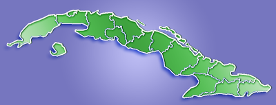
| Province | Matanzas |
| Settled | 1572 |
| Founded | 1693[1] |
| Established | 1695 |
| Area[2] | |
| - Total | 317 km2 (122.4 sq mi) |
| Elevation | 20 m (66 ft) |
| Population (2004)[3] | |
| - Total | 143,706 |
| - Density | 453.3/km2 (1,174/sq mi) |
| Time zone | EST (UTC-5) |
| Area code(s) | +53-52 |
Matanzas is the capital of the Cuban province of Matanzas. It is famed for its Afro-Cuban folklore.
It is located on the northern shore of the island of Cuba, on the Bay of Matanzas (Spanish Bahia de Matanzas), 90 kilometers (56 mi) east of the capital Havana and 32 kilometers (20 mi) west of the resort town of Varadero.
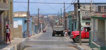
Matanzas is called the city of bridges, of which there are seventeen crossing the three rivers that traverse the city (Rio Yumuri, San Juan, and Canimar). For this reason it was referred to as the "Venice of Cuba." It was also called "La Atenas de Cuba" (the Athens of Cuba) for its poets.
Contents |
History
Matanzas was founded in 1693 as San Carlos y San Severino de Matanzas.[1]
Matanzas was one of the regions that saw intensive development of sugar plantations during the colonial era. Consequently, many African slaves were imported to support the sugar industry, particularly during the first half of the nineteenth century. For example, in 1792 there were 1900 slaves in Matanzas, roughly 30% of its population. In 1817, the slave population of Matanzas had grown to 10,773, comprising nearly 50% of the overall population. By 1841, 53,331 slaves made up 62.7% of the population of Matanzas.[4]Census figures for 1859 put the Matanzas slave population at 104,519.[4] Matanzas was the site of several slave insurrections and plots, including the infamous Escalera conspiracy (discovered in late 1843). Due to the high number of both slaves and, importantly, free Afro-Cubans in Matanzas, the retention of African traditions is especially strong there. In 1898, Matanzas became the location of the first action in the Spanish/American War. The city was bombarded by American Navy vessels on April 25th 1898, just after the beginning of the war.
Name origin
The name Matanzas means "massacre" and refers to a putative slaughter at the port of the same name in which 30 Spanish soldiers were crossing one of the rivers to attack an aboriginal camp on the far shore. The Spanish soldiers didn't have any boats, so they enlisted the help of some native fishermen. However, once they reached the middle of the river, the fishermen flipped the boats, and due to the Spanish soldiers' heavy metal armor, most of them drowned.[5] Only two women -- one said to be the beautiful María de Estrada -- survived, the result of being "taken" by a Cacique. De Estrada is said to have later escaped the "power of the Cacique" and married Pedro Sánchez Farfán in the city of Trinidad. From 1900 to the 1950's Portuguese descendents moved to Cuba because of the hard times and they planted themselves in Matanzas to live build their families. Because of this change to Cuba's atmosphere, the town changed and people spoke Portuguese and Spanish, some not all, but that was the way of the town and to this day it is still strong.
Geography
The city is located on the north shore of the island of Cuba, on all three sides of the Bay of Matanzas. The bay cuts deep in the island, and three rivers flow in the bay inside city limits (Rio Yumuri, San Juan, and Canimar). To the south-east, the landscape rises into a hill called Pan de Matanzas, divided from the Atlantic coast by the Yumuri Valley and a coastal ridge.
THe city of Matanzas is divided into three neighborhoods: Versalles, Matanzas, and Pueblo Nuevo. The municipality is divided into the barrios of Bachicha, Bailén, Barracones, Bellamar, Camarioca, Cárcel, Ceiba Mocha, Colón, Corral Nuevo, Guanábana, Ojo de Agua, Refugio, San Luis, San Severino, Simpson y Monserrate, Versalles and Yumurí.[1]
Infrastructure
- Transportation
Matanzas is served by Juan Gualberto Gómez Airport, 15 km east of the city.
The city has two railway stations. The main station is on the main line from Havana to Santiago de Cuba. The electrified Hershey train operates by a different route to Havana from a separate station in the barrio of Versalles.
Matanzas is also served by Viazul and Astro buses.
The Via Blanca highway connects the city with both Havana in the west and Varadero in the east.
- Education
The University of Matanzas is the province's secondary education institution.
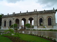
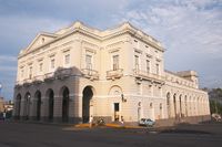
Attractions
- Pharmaceutical Museum - established in 1882
- Museo Historico Provincial de Matanzas - Provincial History Museum
- Sauto Theater - Teatro Sauto - Opened in 1863, the theatre hosts plays, opera, ballet, and symphonic concerts. It is a National Monument of Cuba.[6]
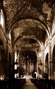
- Catedral San Carlos De Borromeo
- nearby Bellamar caves, also a National Monument of Cuba.[6]
- boating on the Canimar River
- Matanzas bridges
- Casino Español - Now being restored (May 2008).
- Matanzas High School (Palm Coast)
- Necropolis de San Carlos Borromeo
- Quinta de Bellamar, heritage house and church
Demographics
In 2004, the municipality of Matanzas had a population of 143,706.[3] With a total area of 317 km2 (122.4 sq mi),[2] it has a population density of 453.3 /km2 (1,174/sq mi).
Notable residents
- Lyen Wong - Cuban-German fitness athlete was born in Matanzas in 1974
- Leo Cardenas - Former major league baseball player and 5-time All-Star was born in Matanzas in 1938
- Perez Prado - Famous mambo bandleader and composer was born in Matanzas.
- Elian Gonzalez - A little boy who was the subject of a custody dispute in Miami, Florida
- Jose Cardenal - MLB player for the San Francisco Giants, California Angels, Cleveland Indians, St. Louis Cardinals, Milwaukee Brewers, Chicago Cubs, Philadelphia Phillies, New York Mets, and the Kansas City Royals
- Carlos Lamar - Olympic fencer was born in Matanzas in 1908.
Further reading
- Miguel A. Bretos. Matanzas: The Cuba Nobody Knows (University Press of Florida; 2010) 317 pages; combines scholarly and personal perspectives in a history of Matanzas, a city that was known as the "Athens of Cuba" during a sugar boom of the 19th century.
References
- ↑ 1.0 1.1 1.2 Guije.com. "Matanzas". http://www.guije.com/pueblo/municipios/matanzas/index.htm. Retrieved 2007-10-07. (Spanish)
- ↑ 2.0 2.1 Statoids (July 2003). "Municipios of Cuba". http://www.statoids.com/ycu.html. Retrieved 2007-10-07.
- ↑ 3.0 3.1 Atenas.cu (2004). "2004 Population trends, by Province and Municipality". http://www.atenas.inf.cu/todo/Estadisticas/TABLA%20No_3balance.htm. Retrieved 2007-10-07. (Spanish)
- ↑ 4.0 4.1 Bergad, Laird W. Cuban Rural Society in the Nineteenth Century: The Social and Economic History of Monoculture in Matanzas. Princeton University Press, 1990.
- ↑ Matanzas legend (pdf)
- ↑ 6.0 6.1 National Council for Cultural Heritage. "National Monuments in Cuba". http://www.cnpc.cult.cu/cnpc/monumen/Pag002.htm. Retrieved 2007-10-09. (Spanish)
External links
- es:Matanzas (Cuba)
- Ciudad de Matanzas - City of Matanzas (Spanish)
- Portal de la Ciencia en Matanzas (Spanish)
- Radio 26 Matanzas 97.3 FM (Spanish)
 |
Bay of Matanzas | Varadero | |
|
| Santa Cruz del Norte | Juan Gualberto Gómez Airport | |||
| Madruga | Unión de Reyes | Limonar |
|
||||||||||||||||||||