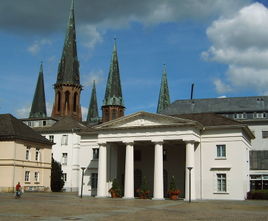
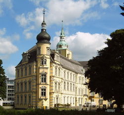
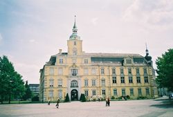
Oldenburg
| Oldenburg | |
 |
|
 |
|
 Oldenburg
|
|
| Coordinates | |
| Administration | |
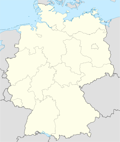
| Country | Germany |
|---|---|
| State | Lower Saxony |
| District | Urban district |
| City subdivisions | 42 Stadtteile und 9 statistische Bezirke |
| Lord Mayor | Gerd Schwandner (Ind.) |
| Basic statistics | |
| Area | 102.96 km2 (39.75 sq mi) |
| Elevation | 4 m (13 ft) |
| Population | 161,334 (31 December 2009)[1] |
| - Density | 1,567 /km2 (4,058 /sq mi) |
| Other information | |
| Time zone | CET/CEST (UTC+1/+2) |
| Licence plate | OL |
| Postal codes | 26001–26135 |
| Area code | 0441 |
| Website | www.oldenburg.de |
Oldenburg (Low German: Ollnborg) is an Independent City in Lower Saxony, Germany. It is situated in the western part of the state between the cities of Bremen and Groningen, Netherlands, at the Hunte river. It has a population of 160,279 (as of 2008) which makes it the fourth biggest in Lower Saxony after Hanover, Braunschweig and Osnabrück. In German, the city is known officially as Oldenburg (Oldenburg) or Oldenburg (Oldb) to distinguish it from Oldenburg in Holstein.
Contents |
History
The town was first mentioned in 1108, at that time known under the name of Aldenburg. It became important due to its location at a ford of the navigable Hunte River. Oldenburg became the capital of the County of Oldenburg (later a Duchy, Grand Duchy and Republic), a small state in the shadow of the much more powerful Hanseatic city of Bremen.
In the 17th century, Oldenburg was a wealthy town in a time of war and turmoil and its population and power grew considerably. In 1667 the town was struck by a disastrous plague epidemic and, shortly after, a fire destroyed Oldenburg. The Danish kings, who were also counts of Oldenburg at the time, were not much interested in the condition of the town and it lost most of its former importance. In 1773, Danish rule ended. It was only then that the destroyed buildings in the city were rebuilt in a Classicist style.
In 1893 a canal connecting the Hunte and the Ems rivers was finished connecting the port of Oldenburg with the North Sea which greatly increased the city's economic importance.
In 1945 after World War II, Oldenburg grew to more than 100,000 inhabitants when refugees migrated into the city that was only sparingly bombed during World War II. In 1946, Oldenburg became part of the new German Land of Lower Saxony. ![]() This article incorporates text from a publication now in the public domain: Chisholm, Hugh, ed (1911). Encyclopædia Britannica (Eleventh ed.). Cambridge University Press.
This article incorporates text from a publication now in the public domain: Chisholm, Hugh, ed (1911). Encyclopædia Britannica (Eleventh ed.). Cambridge University Press.
Demography
Up to 1870, the figures are estimates.
Points of interest
- Botanischer Garten Oldenburg, a botanical garden
- Carl von Ossietzky University of Oldenburg
Economy and infrastructure
Traffic
The city centre of Oldenburg is surrounded by a ring of highways (Autobahnen) consisting of A28, A29 and A293. Oldenburg is part of the railway connections between Norddeich-Leer-Oldenburg-Bremen and Wilhelmshaven-Oldenburg-Osnabrück. InterCity railway connections to Berlin, Leipzig and Dresden and an InterCityExpress connection to Frankfurt and Munich Central Station exist.
Oldenburg is connected to shipping through the Küstenkanal, a ship canal connecting the rivers Ems and Weser. With 1.6 Million tons of goods annually it is the most important non-coastal harbour in Lower Saxony.
Bicycles play a very important part in personal transport.
Because of its close proximity to the city of Bremen, the city is only about half an hour drive from the Bremen Airport.
Media
- Nordwest-Zeitung, daily newspaper for the region
- Oldenburger Sonntagszeitung, Sunday newspaper
- Huntereport, came out on Wednesday and Sunday
- Mox, fortnightly information magazine
- Oldenburger Stachel, alternative monthly newspaper
- sisol, school information
- Oldenburg Eins, local semi-open TV and Radio station
Education
- Carl von Ossietzky University, founded 1973 and named after Carl von Ossietzky
- Jade Fachhochschule (University of Applied Sciences), founded 1971 as Fachhochschule Oldenburg, 2000−2009: joined with several others Universites of Applied Sciences to the "Fachhochschule Oldenburg/Ostfriesland/Wilhelmshaven"
- Altes Gymnasium Oldenburg (AGO)
- RAB-Bildungszentrum für moderne Medien (University of modern Media)
- Gymnasium Graf-Anton-Guenther School
- Liebfrauen Schule Oldenburg
Agriculture
The city is in a largely agricultural area. There are farms near and even in the city. Common agricultural activities are the cultivation of livestock (especially dairy cows and other grazing animals) and crops such as asparagus, corn, and kale.
References
- ↑ "Bevölkerungsfortschreibung" (in German). Landesbetrieb für Statistik und Kommunikationstechnologie Niedersachsen. 31 December 2009. http://www1.nls.niedersachsen.de/statistik/html/parametereingabe.asp?DT=K1000014&CM=Bev%F6lkerungsfortschreibung.
External links
- Official City Website
- Tourist Information
- Oldenburg Panoramas
- History of Oldenburg (German)
- Streets in Oldenburg (German)
- Oldenburg travel guide from Wikitravel
|
||||||||||||||
|
|||||||||||