OpenStreetMap
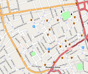
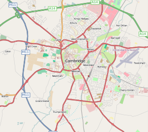 OpenStreetMap of Cambridge, England |
|
| URL | http://www.openstreetmap.org |
|---|---|
| Slogan | The Free Wiki World Map |
| Commercial? | No |
| Type of site | Collaborative mapping |
| Registration | required for contributors |
| Owner | OpenStreetMap Community[1] |
| Created by | Steve Coast |
| Launched | July 1, 2004 |
OpenStreetMap (OSM) is a collaborative project to create a free editable map of the world.
The maps are created using data from portable GPS devices, aerial photography, other free sources or simply from local knowledge. Both rendered images and the vector graphics are available for download under a Creative Commons Attribution-ShareAlike 2.0 licence.[2]
OpenStreetMap was inspired by sites such as Wikipedia; the map display features a prominent 'Edit' tab and a full revision history is maintained. Registered users can upload GPS track logs and edit the vector data using the given editing tools.[3]
Contents |
History
.jpg)
OpenStreetMap (OSM) was founded in July 2004 by Steve Coast. In April 2006, a foundation was established to encourage the growth, development and distribution of free geospatial data and provide geospatial data for anybody to use and share. In December 2006, Yahoo confirmed that OpenStreetMap could use its aerial photography as a backdrop for map production.[4]
In April 2007, Automotive Navigation Data (AND) donated a complete road data set for the Netherlands and trunk road data for India and China to the project[5] and by July 2007, when the first OSM international The State of the Map conference was held there were 9,000 registered users. Sponsors of the event included Google, Yahoo and Multimap. In August 2007 an independent project, OpenAerialMap, was launched, to hold a database of aerial photography available on open licensing[6] and in October 2007 OpenStreetMap completed the import of a US Census TIGER road dataset.[7] In December 2007 Oxford University became the first major organisation to use OpenStreetMap data on their main website.[8]
In January 2008, functionality was made available to download map data into a GPS unit for use by cyclists.[9] In February 2008 a series of workshops were held in India.[10] In March two founders announced that they have received venture capital funding of 2.4m euros for CloudMade, a commercial company that will use OpenStreetMap data.[11]
Users
By August 2008, shortly after the second The State of the Map conference was held, there were over 50,000 registered contributors; by March 2009 there were 100,000 and by the end of 2009 the figure was nearly 200,000.[12]
Not all registered contributors actually contribute to the map; a minority of individuals contribute the majority of the content: in March 2008 approximately 10% of the registered user base were contributing map data each month.[13]
Map production

Technique
The initial map data was built from scratch by volunteers performing systematic ground surveys using a handheld GPS unit and a notebook, digital camera, or a voice recorder. This data was then entered into the OpenStreetMap database.
More recently the availability of aerial photography and other data sources from commercial and government sources has greatly increased the speed of this work and has allowed land-use data to be collected more accurately.
When large datasets are available a technical team will manage the conversion and import of the data.
Structured ground surveys
Ground surveys are performed by a mapper, on foot, bicycle or in a car or boat. Map data are usually collected using a GPS unit, although this isn't strictly necessary if an area has already been traced from satellite imagery.
Once the data have been collected, they are entered into the database by uploading it on the project's website. At that point in time, no information about the kind of uploaded track is available - it could be e.g. a motorway, a footpath or a river. Thus, in a second step, editing takes place using one of several purpose-built map editors. This is usually done by the same mapper, sometimes by other users registered at OpenStreetMap.
As collecting and uploading data is separated from editing objects, contribution to the project is possible also without using a GPS unit. In particular, placing and editing objects such as schools, hospitals, taxi ranks, bus stops, pubs etc. is done based on editors' local knowledge.
Some committed contributors are systematically mapping whole towns and cities over a period of time, or organising mapping parties to intensively map a particular area over an evening or a weekend.
In addition to structured surveys, a large number of smaller edits are made by contributors to correct errors or add features.
Government data sources
Some government agencies have released official data on appropriate licenses. Much of this data has come from the United States, where the federal government does not copyright such data.
- Landsat 7 satellite imagery
- Prototype Global Shorelines (PGS)
- TIGER data of the United States
Various authorities have also made more local detailed aerial photography available on suitable licenses through OpenAerialMap.
The UK Ordnance Survey is legally a Trading Fund and as such is required to earn money from selling its data and is not open to contributing data to the project.[14] Consideration is however currently being given to changing the structure of the organization to make its data more available.[15] In 2006 The Guardian launched a campaign named 'Free our data' to support freeing up government data including mapping data.[16]
As from 1 April 2010 Ordnance Survey was mandated by the UK Government to release OS OpenData a subset of its data products with an open source license.[17] Various groups and individuals had campaigned for this release of data, but some were disappointed when some of datasets were not included in the release.[18]
Out-of-copyright maps can be good source of information about features which don't change frequently. Copyright periods vary, but in the UK Crown copyright expires after 50 years and hence Ordnance Survey maps until the 1950s can legally be used. A complete set of UK 1 inch/mile maps from the late 1940s and early 1950s has been collected, scanned and is available online as a resource for contributors.
Commercial data sources
Some commercial companies have donated data to the project on suitable licenses. Notably, Automotive Navigation Data (AND) who provided a complete road dataset for Netherlands and details of trunk roads in China and India.
In December 2006, Yahoo! confirmed that OpenStreetMap was able to make use of their vertical aerial imagery and this photography is now available within the editing software as an overlay. Contributors can create their vector based maps as a derived work, released with a free and open license.[19]
NearMap Pty Ltd have, since launch in November 2009, made their high-resolution PhotoMaps (currently of major Australian cities, plus some rural Australian areas) available for deriving OpenStreetMap data under a CC-BY-SA licence.[20]
Licensing
The OpenStreetMap database
OpenStreetMap data is published under an open content license, with the intention of promoting free use and re-distribution of the data (both commercial and non-commercial). The license used is currently the Creative Commons Attribution-Share Alike 2.0 licence, however legal investigation work and community consultation is under-way to re-license the project under the Open Database License (ODbL) from Open Data Commons (ODC) which is more suitable for a map dataset.[2]
Input data
All data added to the project needs to have a license compatible with the Creative Commons Attribution-Share Alike license. This can include out of copyright information, public domain or other licenses. All contributors must register with the project and agree to provide data on a Creative Commons BY-SA 2.0 licence or determine that the licensing of the source data is suitable: this may involve examining licences for government data to establish it if they are compatible.
A subset of contributors have made their contributions available as public domain.[21]
Software
Software used in the production and presentation of OpenStreetMap data is available from many different projects and each may have their own licencing. The core Ruby on Rails code to manage the databases, much user interaction and the API are available under a GNU General Public License.[22]
Usage
OpenStreetMap data is available through an increasing number of sites and in different formats:
Online raster maps
Mapping is available online at general mapping sites:
| Map | Theme | Area |
|---|---|---|
| OpenStreetMap | general, cyclists, debugging | Worldwide |
| Information Freeway | general, almost realtime | Worldwide |
| OSM WMS Servers | general, Web Map Services | Worldwide |
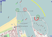
| OpenSeaMap | nautical chart | Worldwide, multilingual: seas, oceans and waterways |
| OpenStreetBrowser | features highlighting | Europe |
| FreeMap | walkers | parts of the UK |
| Topo | walkers and riders | Austria, Germany, Switzerland |
| OpenCycleMap | cyclists | Worldwide |
| YourNavigation | routing | Worldwide |
| OpenRouteService | routing | Europe |
| OpenPisteMap | skiing | some European and USA resorts[23] |
| Bing OSM "Map App" | general | Worldwide |
| CloudMade | general, mobile and various other custom styles | Worldwide |
| OpenAviationMap | Airspace indexing and classification | Braunschweig Germany |
| MapQuest Open (beta) | general, routing | Worldwide |
| NearMap | up-to-date photomaps | populated areas of Australia |
| OSMTransport | public transport | Worldwide |
| ÖPNV-Karte | public transport | Europe |
| OSM Mapper | Debugging maps by Ito World Ltd |
Off-line raster maps
- Marble Renderer for KDE
- Kosmos Renderer for Windows
- OpenSeaMap downloadable charts for PC (all operating systems), Garmin, Lowrance, PDA, PNA
Handheld GPS receivers
- Garmin: There are several programs available that can convert OpenStreetMap data into Garmin compatible maps [24]
Mobile phones
A wide variety of programs exist by now that use OpenStreetMap data to display maps on mobile phones[25], supporting a large number of different devices. Amongst supported devices are nearly all phones that can run Java ME, making OpenStreetMap available to the majority of current phones, as well as platforms like Android[26], the iPhone[27], Windows Mobile[28] or Openmoko. The various programs distinguish themselves according to key features like if they use raster maps or vector maps, need an Internet connection or can be used offline, support alternate render layers such as cycle paths[29], support address search or advanced features like routing, thus catering for a large number of different needs for viewing maps. With the inclusion of OpenStreetMap support in several programming libraries for mobile phones[30][31] it is also possible to include OSM maps in other location-based service.
Flickr
Yahoo has started using OpenStreetMap data within its Flickr service for various cities around the world, including Baghdad, Beijing, Kabul, Sydney and Tokyo.[32][33][34]
Blog/CMS Integration
The WordPress OpenStreetMap plug-in[35] inserts maps and adds geo meta tags to posts / pages of WordPress blogs.
Drupal has multiple OpenStreetMap plug-in modules [36] to integrate database content with OpenStreetMaps.
Joomla also has a variety of OpenStreetMap related modules[37] and plug-ins.[38]
Map data
Map data is available for download in a variety of formats and for different geographical areas:
Monopoly City Streets
In 2009, Hasbro, the games company behind the property trading board game Monopoly, launched Monopoly City Streets, a massively multiplayer online game which allowed players to buy streets all over the world. Although the game used map tiles from Google Maps and the Google Maps API to display the game board, the underlying vector street data was obtained from OpenStreetMap.[42]
Streets Clock - OpenStreetMap vectors in physical product design
In 2009, Austrian mass customization company Fluid Forms introduced the vectors of OpenStreetMaps into the proprietary product "Streets Clock". it is an online design interface with which people design customized wall clocks from a city's street-map. Fluid Forms uses the vectors to enable visitors of the website to get previews of how the clock will look in real-time.[43]
Haiti earthquake
During the 2010 Haiti earthquake, OpenStreetMap and Crisis Commons volunteers used available satellite imagery [44] to map the roads, buildings and refugee camps of Port-au-Prince in just two days, building "the most complete digital map of Haiti's roads"[45].
The resulting data and maps have been used by several organisations providing relief aid, such as the World Bank[46], the European Commission Joint Research Centre[47], the Office for the Coordination of Humanitarian Affairs[48], UNOSAT[48] and others[49].
Software
Map rendering and presentation
- Online Ajax-style OpenLayers based slippy map interface. Displaying map tiles rendered by:
- Mapnik — C++ open source map rendering software used on the main OSM site
- Osmarender — XSLT style sheets for generating SVG images from OSM data. Used as part of the Tiles@home distributed map-rendering system for the main OSM site.
- MapOSMatic — generates city maps of using OSM data with the map split in squares allowing to easily look for streets, and an index of the streets with references to the squares on the map.
- Cartagen - javascript/HTML5 "canvas" element based renderer (client-side rendering).
- Desktop
- osm-gps-map - Open source Gtk+ widget for displaying map and track data.
- GMap.NET — Offers a Free .NET control for displaying OSM and other maps on desktop and windows mobile.
- Kosmos — Windows application for rendering maps, with an interactive mode and a local tile server mode
- OSMMap — Windows tool for browsing the OSM Maps (using Mapnik and Osmarender)
- tangoGPS — Open source, Linux-based mapping application for use with or without GPS. Suitable for use on many Linux platforms including desktops, the eeePC and phones such as the Openmoko Neo.
- Prune - Open source Java application for viewing and editing data recorded by GPS. Uses OSM for the map layers.
- GPSDrive - Open source car navigation application running on Linux/BSD/OS X
- Marble - Free and open source desktop-globe, which supports OpenStreetMap data.
- Navit Free, modular, touch screen friendly, navigation system with GPS tracking, which can use and render OpenStreetMap data.
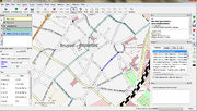
- Quantum GIS — Open source desktop GIS which includes OSM plugin
- luckyGPS - Open source mapping,tracking and offline routing/navigation software
- Phone and GPS displays
- AndNav2, Mapdroyd and Navit for Android
- Opentouchmap.org a web interface optimized for touch screen devices such as the iPhone
- GpsMid Java ME application
- HotSpot Navigator Java ME application
- OSMDroid tools for Android to interact with OpenStreetMap data.
- Wordpress Blogs via OSM Plugin
Map data collection
- GPSBabel — converts tracklogs from one format to another.
- AFTrack — Symbian 60v3 for Nokia mobile phones, live tracking and routing software, from version 1.03 onwards
- WhereAmI - Symbian S60, S80, and UIQ live tracking and OSM data download and rendering (GPL'ed)
- MyMotion — Windows CE tracking software
- TrackMyJourney (TMJ) - Java ME tracking software, which show OSM data, and uses OSM data for routing over the air.
- OSM2Go — Mobile/Desktop Hildon/Gtk editor includes tracking functionality
- OSM Live - displays who is editing the Open Street Map in realtime
- iLOE - (iPhone Little OpenStreetMap Editor) Editor for the iPhone (Upload and edit nodes, collecting and editing)
- MapZen POI Collector — iPhone Points of Interest editor by CloudMade
- OSMTracker — track logging with quick tagging ability. It's available for Android and Windows Mobile.
Map data editing
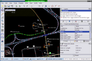
- Potlatch — Online Flash editor
- JOSM — Desktop Java editor
- Merkaartor — Desktop Qt editor
- OSM2Go — Mobile/Desktop Hildon/Gtk editor
- Quantum GIS — Desktop GIS which includes OSM plugin
Routing
List of Online Routing on the OSM wiki [1] List of Offline Routing on the OSM wiki [2]
- CycleStreets
- Gosmore
- Navit
- Pyroute
- OpenRouteService
- Traveling salesman - Open source Java application working as route-planner and GPS-Navigator using the map-data from OpenStreetMap via LibOSM
GPS tracking
- GSP-Trace Orange - personal GPS tracking service, based on OSM[50]
Data format
OpenStreetMap uses a topological data structure.
- Nodes are points with a geographic position.
- Ways are lists of nodes, representing a polyline or polygon.
- Relations are groups of nodes, ways and other relations which can be assigned certain properties.
- Tags can be applied to nodes, ways or relations and consist of name=value pairs.
Up to version 0.4 of its protocol, an intermediate element between nodes and ways (segments(=line segments which two node produced)) was also used.
An optional ontology of map features (the meaning of tags) is maintained on a wiki.
See also
- Wikimapia
- Google Map Maker
- Neogeography
- OpenLayers
- Collaborative mapping
References
- ↑ "FAQ - OpenStreetMap". http://wiki.openstreetmap.org/wiki/FAQ#Who_owns_OpenStreetMap.3F.
- ↑ 2.0 2.1 Richard Fairhurst (2008-01-07). "The licence: where we are, where we’re going". OpenGeoData. http://www.opengeodata.org/?p=262. Retrieved 2008-07-24.
- ↑ Steve Coast in derStandard.at, 2009-07-13 (in German)
- ↑ "OpenGeoData » Yahoo! aerial imagery in OSM". http://www.opengeodata.org/?p=120.
- ↑ "OpenGeoData » AND donate entire Netherlands to OpenStreetMap". http://www.opengeodata.org/?p=223.
- ↑ "OpenGeoData » OpenAerialMap – Community contributed aerial imagery". http://www.opengeodata.org/?p=230.
- ↑ "Linux.com :: OpenStreetMap project imports US government maps". http://www.linux.com/feature/119493?theme=print.
- ↑ "geothought: Oxford University using OpenStreetMap data". http://geothought.blogspot.com/2007/12/oxford-university-using-openstreetmap.html.
- ↑ "Systeme D: Cycle map on your GPS". http://www.systemed.net/blog/entry080113140415.html.
- ↑ openstreetmap:India
- ↑ "CloudMade » We’re funded!". http://blog.cloudmade.com/2008/03/17/were-funded/.
- ↑ "Stats". OpenStreetMap. http://wiki.openstreetmap.org/wiki/Stats. Retrieved 2010-01-01.
- ↑ "OpenGeoData » We’re on a road to everywhere". http://old.opengeodata.org/2008/07/index.html.
- ↑ Ordnance Survey - Trading on geographic intelligence
- ↑ The Office of Fair Trading: OFT welcomes government review of public sector information
- ↑ SA Mathieson and Michael Cross (2006-03-23). "Ordnance Survey challenged to open up". The Guardian. http://www.guardian.co.uk/society/2006/mar/23/epublic.technology. Retrieved 2009-02-23.
- ↑ "Ordnance Survey launches OS OpenData in groundbreaking national initiative". Ordnance Survey. 2010-04-01. http://www.ordnancesurvey.co.uk/oswebsite/media/news/2010/April/OpenData.html. Retrieved 2010-04-16.
- ↑ "The Ordnance Survey has opened up its map data for free after a long campaign. Find out what was released". The Guardian. 2010-04-02. http://www.guardian.co.uk/news/datablog/2010/apr/02/ordnance-survey-open-data. Retrieved 2010-04-16.
- ↑ Steve Coast (2006-12-04). "Yahoo! aerial imagery in OSM". OpenGeoData. http://www.opengeodata.org/?p=120. Retrieved 2008-07-23.
- ↑ "NearMap - Free Community Licence". http://www.nearmap.com/products/community-licence. Retrieved 2010-08-02.
- ↑ "OpenStreetMap Legal FAQ". http://wiki.openstreetmap.org/wiki/Legal_FAQ. "Several contributors additionally make their code available under different licences"
- ↑ "OpenStreetMap License". http://wiki.openstreetmap.org/wiki/OpenStreetMap_License. "OpenStreetMap software is licensed under the GNU GPL"
- ↑ openstreetmap:WikiProject Piste Maps
- ↑ Openstreetmap:OSM Map On Garmin
- ↑ openstreetmap:Software/Mobilephones
- ↑ "Android Open Street Map Wiki". http://wiki.openstreetmap.org/wiki/Android.
- ↑ openstreetmap:IPhone
- ↑ openstreetmap:WinPDA
- ↑ "AndNav Feature Comparison - Bicycle Navigation". http://wiki.andnav.org/index.php/Feature-Comparison.
- ↑ "mgmapslib". http://www.nutiteq.com/mgmapslib.html.
- ↑ "Cloudmade mobile API". http://www.cloudmade.com/products/iphone-maps-library.
- ↑ "Around the world and back again". blog-flickr.net. http://blog.flickr.net/en/2008/08/12/around-the-world-and-back-again/. Retrieved 2008-11-07.
- ↑ "More cities". blog-flickr.net. http://blog.flickr.net/en/2008/10/30/more-cities/. Retrieved 2008-11-07.
- ↑ "Japanese progress in osm. Amazing stuff!". http://thinkwhere.wordpress.com/2008/09/16/japan-osm-progress/.
- ↑ "WordPress OpenStreetMap plug-in". http://wordpress.org/extend/plugins/osm/. Retrieved 4 April 2010.
- ↑ "Drupal OpenStreetMap plug-in modules". http://drupal.org/search/apachesolr_search/openstreetmap?filters=type%3Aproject_project. Retrieved 11 Auguest 2010.
- ↑ "Joomla OpenStreetMap osmMap Module". http://extensions.joomla.org/extensions/maps-a-weather/maps-a-locations/maps/7913. Retrieved 11 August 2010.
- ↑ "Joomla OpenStreetMap WISroGIS plug-in". http://extensions.joomla.org/extensions/maps-a-weather/maps-a-locations/maps/5414. Retrieved 11 August 2010.
- ↑ "Index of /". http://planet.openstreetmap.org/.
- ↑ "CloudMade Downloads". http://downloads.cloudmade.com/.
- ↑ "GEOFABRIK Downloadbereich". http://download.geofabrik.de/osm/.
- ↑ Raphael, JR: 'Monopoly City Streets' Online Game: Will Buying Park Place Be Any Easier?, PC World, September 9, 2009.
- ↑ Williams, Stephen:The OpenStreetMap Streets Clock
- ↑ Forrest, Brady (01/02/2010). "Technology Saves Lives In Haiti". Forbes.com. http://www.forbes.com/2010/02/01/text-messages-maps-technology-breakthroughs-haiti.html.
- ↑ Richmond, Riva (2010-01-27). "Digital Help for Haiti". New York Times. http://gadgetwise.blogs.nytimes.com/2010/01/27/digital-help-for-haiti/.
- ↑ Turner, Andrew (03/02/2010). "World Bank Haiti Situation Room - featuring OSM". http://www.flickr.com/photos/ajturner/4329833289/in/photostream/.
- ↑ "Haiti Earthquakes: Infrastructure Port-au-Prince 15/01/2010" (PDF). 15/01/2010. http://ec.europa.eu/dgs/jrc/downloads/jrc_pp_haiti_map_04.pdf.
- ↑ 48.0 48.1 Batty, Peter (14/02/2010). "OpenStreetMap in Haiti - video". http://geothought.blogspot.com/2010/02/openstreetmap-in-haiti-video.html.
- ↑ "WikiProject Haiti". http://wiki.openstreetmap.org/wiki/WikiProject_Haiti. Retrieved 05/02/2010.
- ↑ http://gps-trace.com/?page=features
External links
- www.openstreetmap.org - project page with editing interface
- Open streetmap browser - simple map viewer
- OpenStreetMap Foundation
- Project Wiki
- geo.topf.org online-comparison between Google Maps and OpenStreetMap
- OpenSource navigation system
- walking-papers.org Print maps, draw on them, scan them back in to improve map coverage
- Illustrated BBC report about OpenStreetMap helping in Haiti after the earthquake
- Android application that uses OpenStreetMap module
|
||||||||||||||||||||||||||