Saharanpur
| Saharanpur | |
| — city — | |
|
|
|
| Coordinates | |
| Country | |
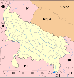
| State | Uttar Pradesh |
| District(s) | Saharanpur |
| Population | 1,252,925 (2001[update]) |
| Time zone | IST (UTC+5:30) |
| Website | saharanpur.nic.in |

Saharanpur (Hindi: सहारनपुर, Urdu: سهارنپور) is a city and a Municipal Corporation in the state of Uttar Pradesh in northern India. It is the administrative headquarters of Saharanpur District as well as Saharanpur Division. Dating back to the Mughal period, situated close to the borders of Haryana and Uttarakhand states, and surrounded by a very fertile agricultural region famous for plentiful yields in grains and fruits, Saharanpur is now one of the most flourishing cities of Uttar Pradesh. Saharanpur is internationally famous for its wood carving work cottage industry. It is a thriving market of local agricultural produce, including basmati rice and mangoes. A variety of agro-based industrial enterprises - such as textiles, sugar, paper and cigarette factories - are located in it.
Politics
The vast area of Saharanpur was called Gujarat Sarkar during Mughal Rule due to the complete dominance of Gujjars in this district.The powerful dominant communities in Saharanpur is the Gujjar, as about 30% of its population consists of Gujjars. The two MLA out of 7 MLA seats in Saharanpur are Gujjars,from Nakud ( Chaudhary Mahipal Majra ) and Deoband ( Manoj Chaudhary ). Chaudhary Yashpal Singh , a Gujjar leader of the Congress has immense following in the region and he was also Agriculture Minister of UP. Nakli Singh, a Gujjar became MP of this lok Sabha two times by defeating Kashi Ram,of BSP.
Saharanpur has been an active political ground. For many decades after independence, it was dominated by the Indian National Congress, but the trend has changed: In 1980 Bharatiya Janata Party (BJP) got a good position in the city with the help of businessmen like O.D. Tyagi, Nirbhay Pal Sharma and Chaudhary Nakli Singh(Gujjar); Thakur Jagdish Singh Rana became a cabinet-minister of Samajwadi Party more than once.
Caste wise MLA of Saharanpur district 1.Nakud - Chaudhary mahipal Majra - Gujjar 2.Deoband - Manoj Chaudhary --------- Gujjar 3.Muzaffarabad- Imran masood--------------Muslim 4.Sarsawa - Dharam Pal Saini----------Saini 5.Saharanpur- Raghav Lakhanpal ---------Pandit 6.Harora - Reserved Seat 7.Nagal - Reserved Seat
History
Prehistoric, Ancient Indus Valley and Aryan periods
Saharanpur city, as an urban centre, was established during the Mogul period. It is located in a fertile Doab region, that was forested till the medieval period, but in which human habitation can be traced as far back as 2000 B.C.[1]; remains of Indus Valley Civilization and Harappan culture have been found in it. Its original inhabitants (like Drawid, Kinner, Dasa and Dasyns) were subdued by the Aryans, the new settlers from Punjab region. Ancient invaders, who came from near and far through the ages (e.g. Nanda, Greek, Maurya, Shunga, Indo-Greek, Yaudheya, Kushana, Gupta, White Huns, Yasodharman, Vardhana, Maukhari, Rajputs-Pundir, Chandela, Muktapida, Ayuddhas, Gurjara-Pratihara, Palas etc.), have left legacies and their descendants in the region have first or last names that reflect these historical (and at times also mythological, e.g. Suryavanshi/Chandravanshi) kinships. On the basis of extant meager evidence, some sketchy accounts of these periods may be pieced together as 'history', for which reference may be made to the article on Saharanpur division. Historical accounts are better documented from the start of the medieval period that covers Ghaznavid, Kalachuri, Gahadvala, Chauhan, Ghorid/Turkic-Sultanate, Mogul dynasties etc.
Medieval period
After the early destabilising Central Asian Turkic invasions (1018–1033 A.D.) through the lands of present Saharanpur region – which has been a part of the westerly ‘highway’, since ancient times, to attack Delhi and the eastern lands beyond – this region was invaded and ruled by many others successively, most notable among them being Bhoja Paramara, Lakshmikarna Kalachuri, Chandra Dev Gahadvala and the Chauhans, who ruled it till the establishment of Delhi Sultanate (1192–1526 A.D.).
During the reign of Shamsu’d-Din Iltutmish (1211–36), this region became a part of his Delhi Sultanate. At that time, most of it was covered with forests and marshlands, through which rivers - like the Saharanpur city’s ‘Paondhoi', 'Dhamola' and 'Ganda Nala’ (Kregi Nala) rivers – flowed ; the climate was humid and hence prone to producing malaria. Muhammad bin Tughluq, the Sultan of Delhi (1325–1351), undertook a campaign in the northern Doab to crush the rebellion of Shivalik kings in 1340, when according to local tradition he learned of the presence of a Sufi saint on the banks of the Paondhoi river. After visiting the sage, he ordered that henceforth this region would be known as 'Shah-Harunpur', after the Sufi Saint, Shah Harun Chishti [2] The simple but well-preserved tomb of this saint is situated in the oldest quarter of Saharanpur city, between Mali Gate/Bazar Dinanath and Halwai Hatta. By the end of fourteenth century, the power of Sultanate had declined and it was attacked by Emperor Timur of Central Asia. Timur had marched through Saharanpur region in 1399 to sack Delhi and people of the region fought his army unsuccessfully. A weakened Sultanate was conquered later by the Central Asian Mogul king Babar.
Mughal period
During the Mughal period, Emperor Akbar(1542–1605) made Saharanpur a sarkar (administrative unit) under the Province of Delhi. He bestowed the Jagir of Saharanpur to Raja Shah Ran Veer Singh – who, laid the foundation of the present city at the site of an army cantonment and the name of Saharanpur became famous after his name; the nearest settlements at that time were Shekhpura and Malhipur. The family of Freedom Fighter Late Shri Jugmandar Das Jain Special Magistrate First Class and his family are the descendents of Raja Shah Ran Veer Singh. His worthy son Ashok Jain (Singhal) built a new Fort near Officers Colony Delhi Road at Naveen Nagar and named it Raja Shah Ran Veer Singh Kila. Raja Shah Ran Veer Singh’s Saharanpur was a walled city, with four gates: the Sarai Gate, the Mali Gate, the Buria Gate and the Lakhi Gate; Nakhasa Bazar, Shah Behlol, Rani Bazar and Lakhi Gate were inhabited localities in this walled city of Saharanpur. The ruins of Shah Ran Veer Singh’s old fort can still be seen in the Chaudharian locality of Saharanpur. He also built a temple in Muhallah Chaundhariyan[3].
The Sayyeds and Rohillas
Mogul emperors, Akbar and later Shah Jehan (1592–1666), had bestowed on Sayyed families the Pargana of Sarwat; in 1633, one of them founded a city and named it as well as the region around it as Muzaffarnagar, in honour of his father, Sayyed Muzaffar Ali Khan. The Sayyeds ruled it till the 1739-invasion by Nadir Shah. After his departure, anarchy prevailed in the entire Doab and this region was ruled or ravaged in succession by Rajputs, Tyagis, Brahmins and Jats and was also plundered repeatedly by the Sikhs. Taking advantage of the anarchy, the Rohillas took control of the entire trans-Gangetic region.
Najeeb-ud-Daula, Nawab of Saharanpur (1748–1770 A.D.)
Ahmad Shah Durrani, the Afghan ruler who arrived after Nadir Shah, conferred the territory of Saharanpur as Jagir on Rohilla Chief Najaf Khan, who assumed the title of Nawab Najeeb-ud-Daula and, in 1754, started living in Saharanpur. He made Gaunsgarh his capital and tried to strengthen his position against Maratha attacks by entering into a friendship with the Gujjar Chieftain Manohar Singh. In 1759 A.D., Najeeb-ud-Daula issued a Deed of Agreement handing over 550 villages to Manohar Singh who became the Raja of Landaura. Thus the Rohillas and the Gujjars now controlled Saharanpur en masse.
Maratha rule (1789–1803 A.D.)
In 1757, Maratha army’s invasion of Saharanpur region resulted in loss of control of Najeeb-ud-Daula on his Jagir of Saharanpur for a short while - Raghunath Rao and Malharao Holkar occupied it then - but the Nawab regained control when Raghunath Rao left Saharanpur for Punjab campaign. The conflict between Rohillas and the Marathas went on and came to an end only on 18 December 1788 with the arrest of Ghulam Qadir, the grandson of Najeeb-ud-Daula, who was defeated by the Maratha general Mahadaji Scindia. The most significant contribution of Nawab Ghulam Qadir to Saharanpur city is the Nawab Ganj area and the Ahmedabadi fortress therein, which still stands in front of the Vijay Talkies.The death of Ghulam Qadir put an end to the Rohilla administration in Saharanpur and it became the northernmost district of the Maratha Empire. Ghani Bahadur Banda was appointed its first Maratha governor. During the Maratha Regime, the Bhuteshwar Temple and Bagheshwar Temple - came into existence in Saharanpur city.
The British colonial period (1803–1947 A.D.)
Marathas were ousted by the British East India Company, which occupied the region of Saharanpur in 1803; it also included the present Muzaffarnagar and Haridwar districts. Saharanpur passed firmly into the hands of British invaders in 1804, when they had eliminated the Maratha resistance and suppressed the frequent Sikh attackers completely. When the British usurped the vast holdings of Raja Dayal Singh Gujjar, a local uprising by the Gujjars took place in 1813, but the British suppressed it with a heavy hand. Local chiefs planned a collective revolt in 1824, but the plan leaked and the movement was crushed, again ruthlessly.
When North India rebelled in 1857 against the foreign Company’s occupation, now referred to as the First War of Indian Independence, the Saharanpur/Muzaffarnagar region was part of this uprising. The centre of freedom fighters’ operations was Shamli, a small town in the present Muzaffarnagar District, which was liberated for some time. After the uprising failed, British retribution was severe here. Death and destruction was particularly directed against the Muslims of this region, whom the British considered as the main instigators of the rebellion; it devastated the Muslim society beyond recognition. When their social reconstruction started, the cultural and political history of Muslims began to revolve around Deoband and Aligarh and Maulana Muhammad Qasim Nanotvi and Maulana Rashid Ahmad Gangohi, both proponents of the reformer Shah Waliullah's ideology for social and political rejuvenation, established a school in Deoband in 1867. It found popularity and global recognition as the Darul Uloom. Its founders' mission was twofold:
- To raise and spread a team of scholars able to awaken the religious and social consciousness of Muslims through peaceful methods and to make efforts, through them, to educate Muslims in their faith and culture; and
- To bring about a feeling of nationalism and national unity by promoting the concept of Hindu-Muslim unity and a united India.
Muslim scholars in the city of Saharanpur were active supporters of this ideology and went on to establish their own theological seminary six months later, along identical lines; it is named as Mazahir-ul-Uloom. Today, Saharanpur is well known for its spirit of inter-religious harmony.
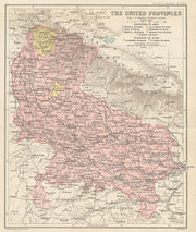
The British Crown administration - which had taken over as a Colony the Indian holdings of the Company in the aftermath of the1857 rebellion - created Muzaffarnagar district in 1901, which was carved out of Saharanpur district, and both became part of the Meerut Division of the United Provinces of Agra and Oudh of the so called colonial British Raj in India.[4].
Post-independence period (1947 A.D. – 21st century)
After India achieved independence from the British in August 1947, a sizable number of people migrating from West Punjab made this city their home, adding to its cultural diversity. This enterprising and hard working group has made its mark not only in business but also in other professions. The region is gradually absorbing them in its midst; but the ‘Exhibition Grounds’ of Saharanpur city, which was turned into a refugee camp to accommodate them, has grown into a thriving modern township, and an outpost of vibrant Punjabi culture, which now literally has the feel of a city of Punjab.
Till the end of the British rule, the clout and social prestige of the descendants of the past ruling classes was formidable, especially in the rural interiors; often called the upper castes, they lorded over the rest, the lower caste people. After independence, democratic dispensation of the country has enabled these under-privileged and ex-untouchable Dalit classes to move forward gradually in all fields in India. Late Master Kanshi Ram, the founder of pro-Dalit Bahujan Samaj Party (BSP) had started his political career in Saharanpur. His protégé Kumari Mayavati, a dalit from Saharanpur, is ruling over Uttar Pradesh as a BSP Chief Minister presently (2010). The Jains and Aggarwals are influential business communities; the latter have "Agarwal Sabha" and elect their presidents annually.
On 28 December 1988, Saharanpur district lost the region of Haridwar, which was made into a new district, within the Saharanpur division. Subsequently, Haridwar district was taken out of Saharanpur division and merged with what is now Uttarakhand, a new state that was carved out of Uttar Pradesh on 9th Nov 2000. With this territorial reorganization, Saharanpur lost many famous places of religious and cultural heritage and also the great educational city of Roorkee, disappointing Saharanpur people. Political debate is still simmering on whether parts of Saharanpur, including the city itself, can be merged with Uttarakhand. Another political view is that a new state of Harit Pradesh should be carved out of the present Western Uttar Pradesh region; Kumari Mayawati is inclined towards this option. She is for a roughly longitudinal trifurcation of the state of Uttar Pradesh. Either course of history is expected to be favourable for Saharanpur’s future.
Government
- Current Member of Parliament: Jagdish Singh Rana (BSP)
- Current Member of State Assembly: Raghav Lakhanpal (BJP)
- Current Chairman of Municipal Corporation: Imran Masood (Samajwadi Party)
Geography
Saharanpur is located at [5], about 140 km south-southeast from Chandigarh and 170 km north-northeast from Delhi. It has an average elevation of 269 metres (882 feet).saini is more than guujjjar in sharanpur
Demographics
As of 2001[update] India census[6], Saharanpur had a population of 452,925. Males constitute 53% of the population and females 47%. Saharanpur has an average literacy rate of 78%, higher than the national average of 59.5%: male literacy is 88%, and female literacy is 70%. In Saharanpur, 14% of the population is under 6 years of age.
Economy
Saharanpur is a flourishing business city: an important regional centre of wholesale and retail trade, particularly in grain, timber and textiles.
Its grain market receives the bumper agricultural produce of the Doab region and the massive wholesale market (Anaaj Mandi), for grains and other agricultural produce, is located on Chilkana Road.
The timber market traditionally receives supplies from the extensive northern hilly forest regions to support the local wood carving cottage industry and other demands. The description of Saharanpur's economy is incomplete without mentioning the contribution of the wooden handicrafts industry, which is the basis of livelihood for half of the population and source of recognition globally. Beautiful art and utilitarian woodwork objects are displayed and sold in the sprawling market from near Ambala Road up to Chilkana Road. The founding father of wooden handicraft industry in Saharanpur was Atta Hussain, an ancestor of the present S.M.Imam M.Ikram family, still active in this handicraft.
In the last few decades, the Punjabi Market and Kamboh Katehra market have become famous for their high volume of textile trade. Hosiery has become a significant cottage industry, supplying goods to Ludhiana market, other nearby cities and Uttarakhand’s markets.
Historically, the common householder's market is centred in the compact area around the landmark Jama Masjid. Within a radius of less than half a kilometre around it, a network of narrow roads is lined with groups of shops selling practically all the commodities, right from jewellery to groceries.
Modern show rooms, retail outlets of upper end branded goods and branches of several major banks are located in the up scale Court Road market, near the city’s Civil Court and the Collectorate offices. However, the city does not boast yet of any ultra modern Shopping Malls, catering to the tastes of high-fashion sophisticated buyers.
A fascinating spectacle is the weekly Mangal Bazar (Tuesday Market) that springs up on the long road of popular Nehru Market and around, when the city's shops are closed for the weekly holiday; it is literally an ‘open air mall’ of the poor. Every thinkable item of household needs, tools needed for various trades, simple appliances and their parts are available; the quality and price are aimed at the lower end customers. The crowd that throngs this market has to be seen to be believed.
A multinational cigarette manufacturing company, the Indian Tobacco Company (ITC Limited) previously known as the Anglo-American Tobacco company or Imperial Tabaco Company, is located in Saharanpur. This factory was built in the 1930s by Baba Shib Dayal Bedi. He also was the Municipal Commissioner of Saharanpur during this period.
Star Paper Mill, Sugar Mill, Hardboard Mill, Textile Mill and Wood-seasoning Mill are other important industrial enterprises located in the city.
Culture
Culturally, Saharanpur is like any other city of western Uttar Pradesh e.g. in language, dress, food habits, festivals and other traditions and ceremonial functions. Cinemas, hotels and eateries are available for entertainment. Local editions of Hindi and Urdu newspapers are published. Khadiboli, in the form of its literary variants Hindi and Urdu, is the lingua franca in which local Punjabi speakers are also fluent.
Higher education
The Indian Institute of Technology, Roorkee (IIT Roorkee), top engineering institutions in India, has a campus at Saharanpur. Engineering courses in Paper Technology and Polymer Science and Process Engineering are offered at this campus. The campus is located on Paper Mill Road with Star Paper Mills, Saharanpur on one side and the Central Pulp and Paper Research Institute (CPPRI), (which is one of its kind institute in Asia), on the other side.
Mazahir-ul-Uloom, Saharanpur, the famous seminary, imparts advanced education in Sunni theology, closely following the Darul Uloom, Deoband school and is at par with it in academic ranking. It is located at Arabi Madrassa.
Saharanpur is also has some good students those have done their education from foreign University among those sourabh Rohila S/O Shri Manjeet Singh he done his 12th from B.D Bajoria inter college with 1st div and after that he did B.com from J.V.Jain College saharanpur. he also got good percentile in some Aptitude test like CAT,IBSAT,ATMA etc. sourabh Rohila did his higher education in Master Of Business Administration from Edith Cowan University Australia.
Mt Carmel Christian Academy, Fatehpur behind Police Station is a recognized school serving in this region for over 17yrs imparting quality education.
Several colleges, affiliated to Meerut University, conduct university level courses in a number of arts and science subjects.
In 2000, a new engineering college was started with the name 'Shobhit Institute of Engineering & Technology' (College Code-103).
Another new engineering college, with the name 'Doon College of Engineering & Technology' (College Code-426),was started in 2008.
A project to establish a medical college is being implemented now and (as on 2009), civil works for the proposed 'Master Kanshi Ram Allopathic Government College' are under way near Saharanpur city.
However, in relation to the size, population and economic strength of Saharanpur District and in comparison to the educational facilities in neighbouring districts, the city lacks adequate infrastructure for advanced education and research. It is being felt as an anomaly that needs expeditious rectification by establishing a university in the city, with its own engineering colleges, covering a wide gamut of courses, and medical colleges for allopathy and ayurveda education. These feelings have heightened further since the loss of academically well endowed Roorkee city, due to its separation from Saharanpur district and merger in the newly formed Uttarakhand state in September 2000.
Places of interest
In Saharanpur, there are many places of interest. The Saharanpur botanical gardens, known as Company Garden, once the preserve of the British East India Company, is a very beautiful botanical garden. It is one of the oldest existing gardens in India and dates back to before 1750. Then named Farahat-Bakhsh, it was originally a pleasure ground, set out by a local chief, Intazam ud-ullah. In 1817, it was acquired by the British East India Company,[7] and placed under the authority of the District Surgeon. Joseph Dalton Hooker says of this Botanical Garden that "Amongst its greatest triumphs may be considered the introduction of the tea-plant from China, a fact I allude to, as many of my English readers may not be aware that the establishment of the tea-trade in the Himalaya and Assam is almost entirely the work of the superintendents of the gardens of Calcutta and Seharunpore."[8]
In 1887, when the Botanical Survey of India was set up to reform the country's botanical sciences, Saharanpur became the centre for the survey of the northern Indian flora. Overall, the Garden is seen historically as being second only to the Calcutta Gardens in terms of national significance, for its contribution to science and economy. Although under private auspices today, it is full of greenery and has many different kinds of plants and flowers.[9]
Other places of interest are Ambedkar Park, founded by Chief Minister Mayawati, and the sprawling wood carvings market, which starts from near Ambala Road and extends up to Chilkana Road, where wonderful examples of the art of this city are displayed, sold and exported all over the world.
The Dhamola and Paon Dhoi rivers meet and pass under an old Tees Dara Pul (Bridge). Lala Das Ka Bada is another peaceful place; it has beautiful temples and a minaret, from where people can have a bird's eye view of Saharanpur city.
Gughal Mela, a historic socio-religious festival of Saharanpur, is organized every year in the month of September and enjoyed by people of all religions.
Temples and other religious places
5000 years old Mandir in Barsi near to Nanauta. Barsi is situated 37 KM from saharanpur to gangoh to deoband road.The main thing on this village is shiv temple . that is very old and famous temple . it is developed by pandav and karaw .
Patheshwar Temple (Court Road), Shiv Mandir (Naveen Nagar), Jainbagh (Chilkana Road), Bhuteshwar Temple (Bhuteshwar Road), Bagheshwar Temple (Chakrauta Road), Laxmi Narayan Temple (Court Road), Balaji Temple (Badh-tala), Sai Baba Dham (Behat Road),Shri Hari Darshan Mandir'PT.RAKESH SHARMA,{Chilkana Road}, Pataleshwar Temple (Rani Bazar), Jama Masjid, Madarsa Mazahir-ul-Uloom, Nau-gaza Peer shrine, Ojhria Peer shrine (Shah Behlole), Teliyon Ki Masjid (Purani Mandi), Clocktower & mosque (Ghantaghar), Shahjahani mosque, Angoori (grapes) mosque, railway station mosque, Tableegh-markaz (Banjaron ka pul). There is total 195 Temples till 2010.
There are also Shakumbhri Devi mandir, a holy place of Hindus, and Parshwanath, a notable Jain temple. Recently a temple of Sai Baba has also been established on the Behat Road, 10 km away from Saharanpur.
New townships
Saharanpur’s older parts are broadly separated from the new ones by the railway track. A long railway over-bridge, Kachehri-ka-pul, is a land mark that connects the important hubs in the two parts. The city is expanding in all directions; townships in contemporary architectural style are being costructed, but there are no high-rise skyscrapers yet. Multistoried commercial complexes are also being constructed.
Among the notable new townships are: South City Colony, Hakikat Nagar, Avas Vikas Colony, Central Park, Gill Colony, Indraprastha Colony, Jagadish Colony, Laxman Singh Colony, Mission Compound, Neha Garden, New Patel Nagar, Devi Niwas, Paramount Tulip, Royal Palm, Ansariyan Street, Basera Haji Abdul Ghafoor, Shankerpuri Coloney, Sun City and Sun City Grand. A village named Matki Jharoli, adopted by Punjab National Bank and developed with a multi-crore fund, is now among the most developed areas of the city: strong in business, 100% literacy and many political leaders and big business class families residing therein.
Travel and transport
The backbone of city centre public transport is the cycle-rickshaw, with auto-rickshaws being available at important hubs. In addition, private buses and taxis are available in the city on rent for special occasions.
However, Saharanpur is well connected to all the major cities by bus and train. The city is located on the National Highway NH-73. It is a major junction of Indian Railways; several important trains connecting the farthest ends of India pass through it. The main Railway Station, Saharanpur-Junction, is in the middle of the city and the Tapri Railway Station is on Paper Mill Road. The Roadways Bus-stand is located near the Saharanpur Junction Railway Station; buses of Uttar Pradesh Government Roadways and other Government and Private Sector services are available from here for all nearby towns and major cities such as Dehradun, Roorkee, Ambala, Haridwar, Meerut, Moradabad, Lucknow, Agra, Chandigarh, Delhi, Indore, Ujjain, Ambehata chand and Jaipur at any time. Saharanpur Airport is at Sarsawa, but it is only used by the Indian Air Force.
See also
- Shakumbhri Devi, a famous temple area north of Saharanpur
References
- ↑ website of the Archaeological Survey of India is http://asi.nic.in/
- ↑ History The Imperial Gazetteer of India, v. 21, p. 369. 1909.
- ↑ Madhu Jain, O. C. Handa, and Omacanda Ha??a, Wood Handicraft: A Study of Its Origin and Development in Saharanpur, Indus Publishing (2000), pp. 22-24.ISBN 81-7387-103-5
- ↑ Muzaffarnagar District The Imperial Gazetteer of India, 1909, v. 18, p. 83.
- ↑ Falling Rain Genomics, Inc - Saharanpur
- ↑ "Census of India 2001: Data from the 2001 Census, including cities, villages and towns (Provisional)". Census Commission of India. Archived from the original on 2004-06-16. http://web.archive.org/web/20040616075334/http://www.censusindia.net/results/town.php?stad=A&state5=999. Retrieved 2008-11-01.
- ↑ Sharad Singh Negi, Biodiversity and its conservation in India 2nd revised ed. New Delhi, Indus Publishing (2008) ISBN 978-81-7387-211-2
- ↑ Joseph Dalton Hooker, Himalayan Journals, or Notes of a Naturalist ..., Kew (1854), vol. I, p. 5.
- ↑ Saharanpur Botanic Garden
External links
- A comprehensive web portal and forum for and about Saharanpur
- Wiki map of Saharanpur
- Saharanpur Official website
- Saharanpur History in the Imperial Gazetteer of India, 1909
- Maharaj Singh College
- Lions Club District's official Website
- Rotary Club's official website
- Cast Iron industry in Saharanpur
- Saharanpur is proud of these people
- Health Services in Saharanpur
- Saharanpur : The City of Peace
|
||||||||
|
||||||||||||||||||||
|
||||||||||||||||||||||||||||||||