Saint-Dié-des-Vosges
|
Saint-Dié-des-Vosges |
|
 |
|
| Cathedral | |
 |
|
 Saint-Dié-des-Vosges
|
|
|
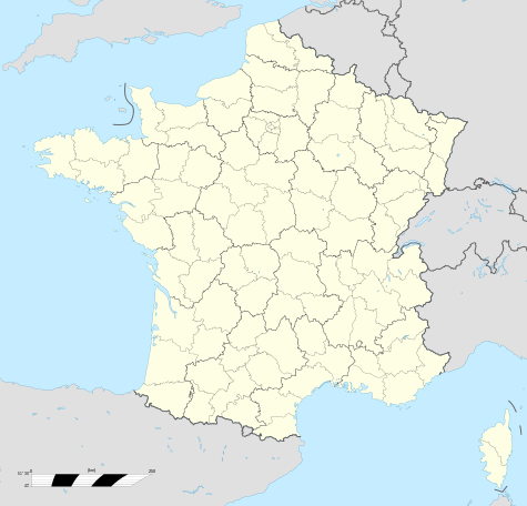
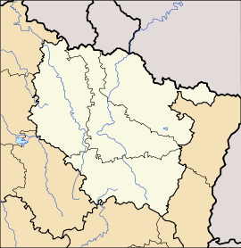
Location within Lorraine region
 Saint-Dié-des-Vosges
|
|
| Administration | |
|---|---|
| Country | France |
| Region | Lorraine |
| Department | Vosges |
| Arrondissement | Saint-Dié-des-Vosges |
| Mayor | Christian Pierret |
| Statistics | |
| Elevation | 310–901 m (1,020–2,956 ft) (avg. 343 m/1,125 ft) |
| Land area1 | 46.15 km2 (17.82 sq mi) |
| Population2 | 22,926 (2006) |
| - Density | 497 /km2 (1,290 /sq mi) |
| INSEE/Postal code | 88413/ 88100 |
| 1 French Land Register data, which excludes lakes, ponds, glaciers > 1 km² (0.386 sq mi or 247 acres) and river estuaries. | |
| 2 Population sans doubles comptes: residents of multiple communes (e.g., students and military personnel) only counted once. | |
Saint-Dié-des-Vosges, commonly referred to as Saint-Dié, is a commune in the Vosges department in Lorraine in northeastern France.
It is a sub-prefecture of the department.
Contents |
Geography
Saint-Dié is located in the vosgian mountain 80 km (50 mi) southeast of Nancy and 45 km (28 mi) of Lunéville. This way principally on the valley of Meurthe was always the more frequented, and first adapted by rail in 1864, that now it lounges the mainchief road.
Saint-Dié-des-Vosges, headchief of an arrondissement called with the same name, belongs to the Vosges département of France. This commune with a little town in her center, is approximately 50 km (31 mi) northeast of the headchief Épinal, which is joined by two roads, southerly the passes of Haut-Jacques and Bruyères or northerly the pass of Haut-du-Bois and the ancient land of Rambervillers. By rail Épinal is 61 km (38 mi) far from Saint-Dié.
The river Meurthe flows in the Permian basin of Saint-Dié surrounded by well-wooded mountains called Ormont, Kemberg and La Madeleine. The upper top of these mountains upon 550 m high is made of Triassic formations, especially the so-called "vosgian sandstone", a kind of red sandstone.
Features
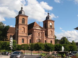
The town was completely redesigned and vastly rebuilt. In fact, it was largely created in French uniform style after the fire of 1757. But a major part was destroyed in November 1944 and was rebuilt largely in a material imitating red sandstone. Its cathedral has a Gothic nave and choir designed in the 14th century; the portal of red stone was created by Giovanni Betto in the beginning of 18th century. A fine cloister, begun in 14th and 15th century but never finished, contains a stone pulpit, and communicates with the Petite-Eglise or Notre-Dame-de-Galilée, a well-preserved specimen of Romanesque architecture in the 12th century. All of the monuments were restored or rebuilt in the same manner after 1950.
Since 1880 the Council House named "Mairie" contained a marvelous theater, a library with some old and valuable manuscripts, a hall of reading, and a museum of rocks and antiquities collected by the members of the Vosgian Philomatic Society. This society, which engaged in the collection and diffusion of knowledge, was founded in 1875 by Henry Bardy, who was soon a member of editing council of the first local republican paper named La Gazette Vosgiennne. All this center of town was destroyed in November 1944.
After 1948, a new hôtel-de-ville was built 100 meters to the west, without the last cultural equipment. At its west side there is now a monument by Merci to Jules Ferry, long ago in an old union place under the Cathedral. Born in the town in 1832, Jules Ferry was a great French politician of the beginning conservative Republic, constitutionally called Third Republic in 1875.
After World War II, the right side of the Meurthe was completely eradicated and most people lived outside the town in wood cabins for decades. The radical plan created by Le Corbusier in 1945 calling for a large plaza with factories and other buildings in the heart of the city was rejected in 1947, and only one private factory belonging to Jean-Jacques Duval was ever built. There were no means nor materials in this terrible period and the great street called "rue Thiers" was fisnished only at the end 1954.
Economy
The town was industrial in nature long before the local economy reaped the benefits from a migration of Alsatians, who arrived after the Franco-Prussian War of 1870-1871. Its industries included the spinning, weaving and bleaching of cotton, wire-drawing, metal-founding, the manufacture of hosiery, woodwork of various kinds (toleware), machinery, iron goods and wire screen. Since the world wars major industrial activities have declined precipitously. Now the town is primarily a center of public services, educational institutions, a hospital, and the usual private merchant places like supermarkets.
History
Saint-Dié (Deodatum, Theodata, S. Deodati Fanum) is named after saint Deodat. This holy men, as he is named popularly "le bonhomme", is foundator of a ban, a political and Christian subdivision of the royal territory, originally called "foresta" in the 7th century. Old religious historians believed he was episcopus of Nevers and was precisely Deodatus of Nevers. Deodatus would had given up his episcopal functions to retire to a desert place. Some sources connect the name, however, with an earlier saint, Deodatus of Blois (d. 525).[1]
Archeology and historic toponymes proves the large anteriority of human occupations. A hypothesis of a columna constructed by Romans, in a locus originally dedicated to Tiwaz, Tius, god of war, may explain ancients ceremonies in old saint-Dié chapelle, under the Kemberg mountain locally called Saint-Martin. Deodatus who may be at his end of life a hiberniensis papa - and not a niverniensis pope, a bishop from Nevers - would have lived in an old monasterium or "vieux moutier" above this old chapelle and water.
Legends written since 11th century and popular traditions says saint Dié dreamed a new monasterium in a little hill called "monticule des Jointures" in the other riverside he could see. A little monastic community dedicated to saint Maurice, has been probably founded during the Carolingians times. It is proved in this locus since the 10th century. After 1006 the monastery has taken the name Saint-Dié that progressively erase the first name. The little monastery was also partially destroyed by fire in 1065 and in 1155.
Maybe they were a chapter of canons, maybe they became two centuries later. Historians deny Brunon de Dabo-Egisheim, future Pope Leo X, to be young monk and great provost here, but his family plays a great role in the elevated status of this religious place, giving after the first crusades their blason. But canons who subsequently held the rank of provost or dean were coming from very rich and noble family. Among those Giovanni de Medici and several princes coming from the ducal House of Lorraine. Among the extensive privileges enjoyed by them was that of coining money. The Duchy of Lorraine buys last rights of monnoyage in 1601.
Though they co-operated in building the town walls in 1290, the canons and the dukes of Lorraine soon became rivals for the authority over Saint-Dié. Towards the end of the 15th century it was supposed by a local historian one of the earliest printing presses of Lorraine was founded at Saint-Dié. But all the printing figures and even filigraned papers were the same in a strasburg's printer. The institution of a town council in 1628 which appropriated part of their temporal jurisdiction, and numerous French occupation contributed greatly to diminish the financial influence of the canons. During the Stanislas reign and after the Lorraine annexion in 1776, the establishment in 1777 of a bishopric condemned the venerable institution. They serve the first bishop Monseigneur de Chaumont. With the French Revolution all the religious people were completely swept away.
During the wars of the 15th, 16th and 17th centuries the town was repeatedly sacked. The little but religiously very prestigious town was partially destroyed by fire in 1554 and 1757. Funds for the rebuilding of the portion of the town destroyed by the last fire were supplied by Stanislas, last duke of Lorraine.
Ecclesiastical history
The diocese of Saint-Dié was erected in 1777, but suppressed by the Concordat of 1801. It was restored in 1822 as a suffragan of the Diocese of Besançon covering the department of the Vosges, of which 18 parishes were transferred to the Diocese of Strasbourg in 1871.
The diocese of Saint-Dié originated in the celebrated abbey, initially called by legends "Galilée", established by Saint Deodatus (Dié) (7th century), around which the town of Saint-Dié grew up. The Benedictines of the original foundation saint Maurice were replaced in 996 by Augustinian Canons.
During the sixteenth century, and the long vacancy of the see of Toul, the abbots of the several monasteries in the Vosges, without actually declaring themselves independent of the diocese of Toul, claimed to exercise a quasi-episcopal jurisdiction. In 1718 the Bishop of Toul requested the creation of a see at Saint-Dié, but the suggestion was opposed by the King of France. The see was eventually created by Pope Pius VI in 1777 by the elevation of the abbey of Saint-Dié into a bishopric. The new diocese was removed from the diocese of Toul and was instead a suffragan of the Diocese of Trier.
Cosmography
Vautrin Lud, Canon of St-Dié in charge of the mines of the valleys is chaplain and secretary of René II, Duke of Lorraine. He aimed set up a printing-establishment at St-Dié. But he surely facilitates reflexions on the theme of earth representation and also meetings with who we could named nowadays geographers, the German cartograph Martin Waldseemüller, and the Alsatian professor Matthias Ringmann and clever Canons.
The team began at once to produce an edition of a Latin translation of Ptolemy's "Geography". In 1507 René II received from Lisbon the Soderini Letter, an abridged account of the four voyages of Amerigo Vespucci. Lud had this translated into Latin by Basin de Sandaucourt. The translation dedicated to Emperor Maximilian was completed at St-Dié on 24 April 1507; it was prefaced by a short explanatory booklet, entitled Cosmographiae Introductio, certainly the work of Waldseemüller, an introduction to cosmography that can be seen as the baptismal certificate of the New Continent. Indeed Waldseemüller and the scholars of the Vosgean Gymnasium then made a capital decision writing: "...And since Europe and Asia received names of women, I do not see any reason not to call this latest discovery Amerige, or America, according to the sagacious man who discovered it".
First and second print in August 1507 appeared may-be at St-Dié, a third at Strasburg in 1509, and thus the name of America was spread about. Thus Saint-Dié-des-Vosges is honored today with the title of "godmother of America", the city that named America. The work was re-edited with an English version by Charles Herbermann (New York, 1907). M Gallois proved that in 1507 Waldseemüller inserted this name in two maps, but that in 1513, in other maps Waldseemüller, being better informed, inserted the name of Columbus as the discoverer of America. But it was too late; the name of America had been already firmly established.
In 1507, Martin Waldseemüller produced in St Dié also a world globe bearing the first use of the name "America".
Born, has been educated or has lived in Saint-Dié
- Jean Fredel, captain of the Duke of Lorraine, Charles II
- Claude Bausmont, "châtelain" and "cellerier" of Saint-Dié (1430–1477). This old warrior didn't save and capture in January 1477 Charles le Téméraire escaping from the battle of Nancy.
- Vautrin Lud (1448–1527), canon, master of the brotherhood saint Sébastien, and hypothetical creator of the Vosgian Gymnasium for the year 1507.
- Mother Mechtilde, institutrice des bénédictines de l'adoration perpétuelle (born Catherine Barre in 1619, dead in Paris in 1698)
- Jacques Augustin (1759–1832), miniaturist painter born in St-Dié
- Dieudonné Dubois (1759–1803), lawyer and member of Conseil des Cinq-Cents in the revolutionnary year IV and conseil d'État in year VIII.
- Nicolas Souhait (1773–1799), colonel du génie born in Saint-Dié
- Nicolas Philippe Guye (1773–1845), general and mayor of Saint-Dié in 1829
- Père Antoine, catholic missionnaire in Canada born in Saint-Dié
- Léon Carrière (1814–1877), physician and geologue, father of the forestry restaurator in the south Alps Paul Carrière.
- Jean-Romary Grosjean (1815–1888), musicologist and cathedral organist.
- Henry Bardy (1829–1909), pharmacist, president-foundator of the Société Philomatique Vosgienne.
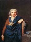
- Emile Erckmann, writer who lived in the château de l'Hermitage between 1870 and 1880.
- Jules Ferry (1832–1893), lawyer and politician, born in Saint-Dié.
- Henri Rovel (1849–1926), painter and meteorologist born and dead in Saint-Dié
- Paul Descelles (1851–1915), painter
- Victor Franck (1852–1907), photographer born in Saint-Dié.
- Ferdinand Brunot (1860–1938), grammatician (linguistics) born in Saint-Dié.
- Léon Julien Griache (1861–1914), général de brigade d’artillerie born in Saint-Dié
- Fernand Baldensperger (1871–1958), academic (literature)
- Brothers Grollemund, polytechnicians and généraux de brigade: Marie-Joseph (1875–1954) and Marie-Paul Vincent (1879–1953)
- Victor-Charles Antoine (1881–1959), sculptor et gravor born in Saint-Dié
- Albert Ohl des Marais, gravor et historian
- Georges Baumont (1885–1974), professor of literature, librarian et local historian
- Yvan Goll (1891–1950), poet and novelist, student only few years in Saint-Dié
- Jacques Brenner (1922–2001), writer and critic born in saint-Dié.
Higher education
University Institute of Technology: IUT (Institut universitaire de technologie)
Twin cities
.svg.png) Arlon (Belgium)
Arlon (Belgium) Cattolica (Italy)
 Crikvenica (Croatia)
 Friedrichshafen (Germany)
 Lowell (United States)
 Meckhe (Senegal)
 Ville de Lorraine (Canada)
 Zakopane (Poland)
See also
- Communes of the Vosges department
References
 This article incorporates text from a publication now in the public domain: Chisholm, Hugh, ed (1911). Encyclopædia Britannica (Eleventh ed.). Cambridge University Press.
- This article incorporates text from a publication now in the public domain: Herbermann, Charles, ed (1913). Catholic Encyclopedia. Robert Appleton Company.
External links
|
|||||