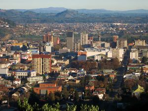
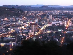
Temuco
| Temuco | |||
|---|---|---|---|
 |
|||
|
|||
 |
|||
 Temuco
|
|||
| Coordinates: | |||
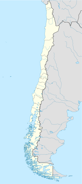
| Country | |||
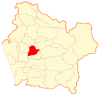
| Region | Araucanía | ||
| Province | Cautín | ||
| Founded as | Fuerte Recabarren | ||
| Founded | 24 February 1881 | ||
| Government | |||
| - Mayor | Miguel Becker Alvear (RN) (2008-2012) |
||
| Area | |||
| - Total | 464 km2 (179.2 sq mi) | ||
| Population (2002) | |||
| - Total | 260,878 | ||
| - Density | 608.36/km2 (1,575.6/sq mi) | ||
| Time zone | Chile Time (CLT)[1] (UTC-4) | ||
| - Summer (DST) | Chile Summer Time (CLST)[2] (UTC-3) | ||
| Area code(s) | 45 | ||
| Website | http://www.temucochile.com | ||
Temuco is the capital of the Araucanía Region, Chile. The name comes from the Mapudungun language, meaning "temu water"; "temu" (Blepharocalyx cruckshankii) is a tree used by Mapuches for medicinal purposes. The city is located 670 km south of Santiago. Because it is near lake-based resort centers, it is considered a hub for tourist excursions.
Chilean poetry has deep roots in Temuco. Nobel Poets Gabriela Mistral and Pablo Neruda (Neftali Reyes) both lived in Temuco. Mistral was the principal of an all-girls school where Neruda would visit her and show her his first verses when he was around 15 years old.
Contents |
History
The city was founded on February 24, 1881 as a fort during the Occupation of the Araucanía. Manuel Recabarren, in charge of the project, named the place Fuerte (Fort) Recabarren.
Formed as a military encampment, Temuco had in its origins the attributes of a camp, and a year after its founding, the first major streets started to form in the downtown area.
On April 15, 1888, the first city officers were elected including the first mayor José del Rosario Muñoz. The city grew quickly; a census in 1895 indicated a population of 7,708 people, and when Cautin was declared a province, Temuco became its capital, with its population by that time of 16,037 people.
The city was affected by the 27 February 2010 earthquake.[3]
Geography and climate
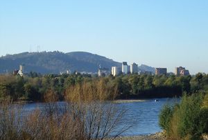
Temuco is located in the center-south of Chile, equidistant between the Pacific Ocean and the Andes. Morphologically, the city placement corresponds to Cautín River-originated fluvial land masses that developed in a crushed form between two hills, Ñielol (350m) and Conunhueno (360m).
The city is surrounded by an environment typical to central-southern Chile, consisting mostly of plantations of coniferous forests in the midst of a central prairie of moraines and cones next to the foothills of the Andes. The zone produces many crops and fruits, and has an abundance of forests, particularly alerce, roble and lingue. Despite all this, air quality has deteriorated because burning wood is the primary source of heat for most of the city. Air pollution is generally kept under control by the frequent rain in winter.
Climatologically, Temuco corresponds to Chile's central valley Mediterranean region, with more humid and temperate weather. Through the year, cyclonic and anticyclonic influences alternate, with a short dry summer period (when compared to Santiago or other central valley cities). Its mean annual temperature is 12°C, with highest median during the warmest month of 23.5°C and lowest median during the coldest month of 3.9°C (Ciren-Corfo, 1992). Annual mean rain during 1961-1990 (Dirección Meteorológica de Chile, 1991) was 1.157 mm (Capelli de Steffens et al., 1997).
Demographics
Greater Temuco has a population of 260,878 (2002 census), with a population projection by the National Statistics Institute, of 377.495 in 2010 which makes it the second largest city south of Santiago (behind Concepción), and the fourth largest in the country. One of the distinctive features of Temuco is the strong presence of the Mapuche culture, who make up (13.05%) of the population in the Temuco commune, and numerous German immigrant colonies (29,82%). Temuco proper has a population of 227,086.
The locals are called temuquences. Most inhabitants are of different origins. Temuco has a high percentage being of Basque ancestry other than Castilian and other Spanish nationalites. Thus we can find indigenous, mainly Mapuche, who account for 13% of the population of Temuco what makes it the largest city of Chile with an indigenous presence, and a small community of other (North) American Indians of Cherokee origin of U.S. American culture said to arrived in the late 19th century.
There is also a large percentage of temuquences that are directly descended from European immigrants, many of the early arrivals during 1883-1901, after the pacification of Araucanía. The main sources are from Switzerland, Spain, France, Germany, Italy and the United Kingdom and other less numerous in many other parts of Europe such as Holland, Austria, Croatia, Armenia, Greece, Portugal and others arrived after that first migration, especially during the World Wars, the Spanish Civil War (1930's) a large percentage being Aragonese, Asturians, Catalans, Galicians, Navarrese and Basques; reaching a significant number of immigrants from Europe (mainly Germany and Spain).
There are also small communities of Jews (i.e. from Russia, Poland, Macedonia, Hungary, Central and Eastern Europe) and Arabic (Lebanon, Syria and Palestine) peoples, proof of this phenomenon of immigration from Europe and to a lesser extent, Jewish and Arabic are the various clubs, schools, and sections of the city of Temuco. There are East Asian colonies of Chinese, Japanese and Koreans in Temuco, dating back to the end of the Korean War in the 1950s when thousands of Korean refugees settled through U.N. relocation programs to Chile.
In 2010, Temuco was affected by the earthquake on February 27. It was one of the most affected regions of Chile besides Santiago, Concepcion, Valparaiso and others. The earthquake was 8.8 on the Richter scale, had horrible aftershocks, and tsunamis (which didn't affect Temuco due to its not being near the coast). Temuco continues to rebuild from the disaster, and the alpine region hopes to be awarded the 2022 Winter Olympics, though the host city is Santiago or the alternative site: Chillan with plans for an olympic ceremony stadium under way.
Transport
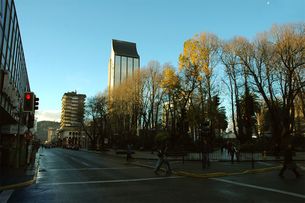
Traffic is frequently congested during working hours and parking on public streets in the downtown sector is difficult to find and is controlled with parking fees being charged. Many streets are one-way, and marked with an arrow, if and when visible or installed.
In residential areas people frequently park on either side of the street, regardless of traffic direction and in some areas vehicles may be seen parked either entirely or partially—with only one side of the vehicle—on the sidewalk or grass area.
Traffic signals frequently use green arrows to control turns and right hand turns are not permitted when a red light is showing unless there is a specific sign authorizing such a turn.
Drivers often disregard marked traffic lanes and many buses and collective taxis will stop virtually anywhere to take on or discharge passengers.
Buses and collective taxis are the most popular massive transport. The bus fare is $140 or $170 for students an $350 for adults; the colectivos charge $400 ($500 at night). Regular taxis are also available.
Maquehue Airport is commercial air terminal for Temuco located to the South of the city. Because its low capacity, the Chilean Airport Direction is projecting a new and bigger airport for Temuco. It would be located near Freire, about 20 minutes southern from Temuco. At the time there is a controversy because it would be located in Mapuche areas.
The railroad connects Temuco with Victoria to the north and points in between.
Temuco does not have a rapid transit rail system.
Important places
- Alemania Avenue
Is the principal artery in Temuco. Here we can find The Araucaria Museum building (19th century Chilean style); the Menchaca Lira Campus of Art Building (a Victorian Style building, recently restored); The English Alley, where we can find the Red Cross Building and not long ago an blue house which was dismantled to be reconstructed in another place (as a Heritage recovery project by a known University), both Neoclassical styled.
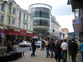
Recently, Alemania Av. has become an important commercial centre. Several restaurants, drug stores, boutiques, supermarkets and two shopping malls have been opened there. There is also a Casino and a five stars hotel in the same avenue.
The core of Downtown Temuco is the Main Square Anibal Pinto. Temuco's Main Square is the only one in Chile that was not built with a water fountain in its centre; an art gallery was built in 1981 as part of a total renewal. Compared to other main squares of southern Chile, Temuco's main square is modern. It was named one of Chile's most beautiful plazas.
It is a tradition, in all creole cities in Chile, that some specific buildings must be in front of the main square; in Temuco, this tradition was broken. Main Squares are supposed to be surrounded by : a Cathedral (which is in front of Temuco's main square, as traditionally), the Municipality (which also, is located in front of the square), a Theatre (there used to be a film theatre in front of it), a Fire Station (there is not a fire station in front of the square, as it should),a School (there is no school in front of the main square), and a Bank (there are four banks around the main square)
- Cerro Ñielol
The Ñielol Hill represents the original forest of the whole southern Chile area as it was before the Spanish people colonize it. It has also a special meaning for the Mapuche population. We can also find a restaurant at the top and a viewpoint of the east side of the city and Padre Las Casas, across the river. It is a "must" for visitors. The Southern Andean Volcano Observatory has its office there.
Other features
The central market is one of the best places to get Mapuche crafts. It has a meat market and shops selling woodcrafts, artifacts, wool knits, and similar goods.
Famous people
- Pablo Neruda Poet,Nobel Prize of Literature 1971.
References
- ↑ "Chile Time". World-Time-Zones.org. http://www.world-time-zones.org/zones/chile-time.htm. Retrieved 2007-05-05.
- ↑ "Chile Summer Time". World-Time-Zones.org. http://www.world-time-zones.org/zones/chile-summer-time.htm. Retrieved 2007-05-05.
- ↑ (French) Easy Voyage, "Le Chili 5 jours après le séisme", 4 March 2010 (accessed 4 March 2010)
External links
Spanish
- Ilustre Municipalidad de Temuco
- Cuerpo de Bomberos de Temuco
- Primera Compañía de Bomberos de Temuco
- Mercado Municipal de Temuco
- Foro de Jóvenes de Temuco
- Foro de Opinion de Temuco
- Museo Nacional Ferroviario Pablo Neruda
English
|
||||||||||

|
|||||