Athens, Ohio
| Athens, Ohio | |
|---|---|
| — City — | |
 |
|
 |
|
| Coordinates: | |
| Country | United States |
| State | Ohio |
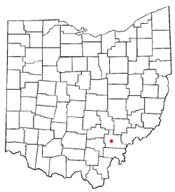
| County | Athens |
| Government | |
| - Mayor | Paul Wiehl (D) |
| Area | |
| - Total | 8.3 sq mi (21.6 km2) |
| - Land | 8.3 sq mi (21.6 km2) |
| - Water | 0.0 sq mi (0 km2) |
| Elevation | 719 ft (663 m) |
| Population (2000) | |
| - Total | 21,342 |
| - Density | 2,558.9/sq mi (988/km2) |
| Time zone | EST (UTC-5) |
| - Summer (DST) | EDT (UTC-4) |
| ZIP code | 45701 |
| Area code(s) | 740 |
| FIPS code | 39-02736[1] |
| GNIS feature ID | 1075290[2] |
| Website | http://www.ci.athens.oh.us |
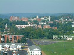
Athens is the largest city in, and the county seat of, Athens County, Ohio, United States. It is located along the Hocking River in the southeastern part of Ohio. A historic college town in the southeastern part of the state, Athens is home to Ohio University and is the principal city of the Athens, Ohio Micropolitan Statistical Area. The population was 21,342 in the 2000 census; it was estimated to be 21,909 in 2007.[3]
Athens is a qualified Tree City USA by the National Arbor Day Foundation.[4]
Contents |
History
The first permanent European settlers arrived in Athens in 1797. In 1800, the town site was first surveyed and plotted, but was not incorporated as a village until 1811. In the meantime, Ohio became a state in 1803, and Ohio University was chartered in 1804 becoming the first public institution of higher learning in the Northwest Territory. Previously part of Washington County, Ohio, Athens County was formed in 1805, named for the ancient center of learning, Athens, Greece.
Athens did not receive city status until 1912 (in Ohio, 5,000 permanent residents are required to receive city status).
Originally, large tracts of land (Athens and Alexander Townships) were set aside through a contract between the Congress (under the Articles of Confederation) and the Ohio Company of Associates, a group of Revolutionary War veterans. These lands were thus given to Ohio University by the Federal government. This was the first federal land grant for a university, pre-dating the Morrill Act by more than 70 years. At first, lands were mostly leased out, but the failure of many lessors to pay their rents resulted in most of the land being sold. The sale of these lands funded the growth of Ohio University. Today it is one of the larger institutions of higher learning in Ohio, with an enrollment of over 19,000 on the Athens campus (28,000+ for all campuses).
The earliest industry in the area was salt production, followed by iron production and coal extraction. Today, the largest employer in the county is Ohio University.
In 1843, the Hocking Canal opened, enabling shipping from the Ohio River up the Hocking River, which passes through Athens, to Nelsonville, Ohio, and points beyond. However, the canal was closed during cold winters when it froze over. The first railroad reached Athens in 1857. In the late 19th century, an interurban line opened between Athens and Nelsonville and operated for some years.
The Athens Lunatic Asylum, later called the Athens State Hospital, opened in 1874. This was located on high ground to the south of town and to the south of the Hocking River, and in the late 19th century was the town's largest employer. The state hospital was eventually decommissioned and the property was deeded to Ohio University. It is now known as The Ridges. Much of the building space has been renovated for offices and research space, and most of the grounds have been set aside as open space, including a land lab.
Large sections of Athens and Ohio University are located in the floodplain of the Hocking River. Over the last two centuries the town suffered from many destructive floods, including notable floods in 1832, 1873, 1907, 1937, 1949, 1964 and 1968.[5] In 1969 the Army Corps of Engineers completed a major work that rerouted and expanded the channel of the Hocking River, for a stretch of several miles around the town, moving the river hundreds of feet to the south.[5] That project and the ongoing efforts to maintain the channel have greatly reduced the negative effects of seasonally high river levels.
In 1904 both the U.S. Army and the Ohio National Guard were conducting training exercises at the same time at the city. When some guardsmen became drunk and caused a disturbance, they were arrested by Army MPs. The ensuing quarrel escalated into a battle on Washington Street, during which one guardsman was killed and several combatants were wounded.
During the cold war, Athens was designated the alternate capital city of Ohio in the event that Columbus was destroyed by a Soviet nuclear strike. An exercise was held in which Governor Rhodes and the statehouse were evacuated and state government was relocated to Athens.
Geography
Athens is located in the unglaciated Allegheny Plateau. Athens is surrounded by hills that rise about three hundred feet from river valley to the narrow ridge tops. The county extends west from the Ohio River, mostly centered around the lower Hocking River watershed. According to the United States Census Bureau, the city has a total area of 8.3 square miles (21.6 km²), all of it land.
Athens is located mostly on and around a south-jutting ridge bordered by a loop in the Hocking River. The underlying geology is mostly sandstone and shale, including "redbed" shale that presents a severe slip hazard when structures are built over it on hillsides. However, there are safe zones above sandstone beds, most notably the Connelsville Sandstone that outcrops high on the hillsides. The old Athens Mental Hospital grounds (now part of the university) was built on the top of a hillside in the late 1860s, and is completely stable due to its position atop the hill rather than on a slope. The recent University Courtyard Apartments is also built on similar underlying geology across a small valley, but the hilltop was extensively removed in order to create a stable base.
The city receives all its water supply from wells in unconsolidated river aquifers, and is reputed to be the largest city in the United States to do so.
Demographics
| Historical populations | |||
|---|---|---|---|
| Census | Pop. | %± | |
| 1810 | 578 |
|
|
| 1820 | 1,094 | 89.3% | |
| 1830 | 728 | −33.5% | |
| 1840 | 710 | −2.5% | |
| 1850 | 808 | 13.8% | |
| 1860 | 2,852 | 253.0% | |
| 1870 | 1,696 | −40.5% | |
| 1880 | 2,457 | 44.9% | |
| 1890 | 2,620 | 6.6% | |
| 1900 | 3,066 | 17.0% | |
| 1910 | 5,463 | 78.2% | |
| 1920 | 6,418 | 17.5% | |
| 1930 | 7,252 | 13.0% | |
| 1940 | 7,696 | 6.1% | |
| 1950 | 11,660 | 51.5% | |
| 1960 | 16,470 | 41.3% | |
| 1970 | 23,310 | 41.5% | |
| 1980 | 19,801 | −15.1% | |
| 1990 | 21,265 | 7.4% | |
| 2000 | 21,342 | 0.4% | |
| Est. 2008 | 22,028 | 3.2% | |
As of the census[1] of 2000, there were 21,342 people, 6,271 households, and 1,906 families residing in the city. The population density was 2,560.4 people per square mile (988.0/km²). There were 6,715 housing units at an average density of 805.6/sq mi (310.9/km²). The racial makeup of the city was 89.16% White, 3.82% Black or African American, 0.15% Native American, 4.47% Asian, 0.06% Pacific Islander, 0.60% from other races, and 1.74% from two or more races. 1.41% of the population were Hispanic or Latino of any race.
There were 6,271 households. 12.9% had children under the age of 18 living with them. 22.9% were married couples living together, 5.6% had a female head of household with no husband present, and 69.6% were non-families. 34.5% of all households were made up of individuals and 6.6% had someone living alone who was 65 years of age or older. The average household size was 2.25 and the average family size was 2.72.
In the city 6.7% of the population was under the age of 18, 66.7% were from 18 to 24, 13.7% were from 25 to 44, 8.0% were from 45 to 64, and 4.9% were 65 years of age or older. The median age was 22 years. For every 100 females there were 88.2 males. For every 100 females age 18 and over, there were 86.9 males.
The median income for a household in the city was $17,122, and the median income for a family was $53,391. Males had a median income of $35,849 versus $28,866 for females. The per capita income for the city was $11,061. About 14.8% of families and 51.9% of the population were below the poverty line, including 19.1% of those under age 18 and 7.2% of those age 65 or over.
Economy
Ohio University is now the largest employer in Athens County. Coal was once a huge source of employment in the county, but is now a very minor source, as the best and most available coal has been extracted. One of the manufacturing companies that once existed in Athens was the Midget Motors Corporation, makers of the small automobile, the King Midget.
The only truly heavy industry located in Athens is the Athens Mold & Machine Company, located on the near east side and primarily manufactures tire molds. Other significant employers include Stewart-MacDonald Company, which handles supplies for stringed instruments, Diagnostic Hybrids, additionally the Ed Map Corporation, Gem Coatings (an industrial powdercoating company) and Specialty Books, are located in The Plains, nearby.
Arts and culture
Since the 1970s Athens has earned a reputation as one of the more progressive communities in Southeastern Ohio. That reputation includes democratic political leaning [6], presence of some intentional communities, support for use of alternative energy, development of small farms emphasizing sustainable and organic produced crops, and support for local businesses. Many of these attributes are illustrated the long established (since 1972) farmer's market [7] currently held year round on Saturdays and Wednesdays at The Market on State on the city's east side.
Folklore
Old buildings, long established cemeteries and their conjunction at a decommissioned asylum, The Ridges, help inspire a persistent folk lore surrounding Athens as an especially haunted locale. Athens was vaunted as one of the top fifteen most haunted cities in America on the Fox Family Channel special "Scariest Place On Earth" that aired on October 23, 2000. Locals with knowledge of the history of the Ridges criticized the Fox portrayal as sensationalistic and misleading on details of the situation [8]. While the haunted Athens folklore may be persistent it is not clearly substantiated by professional investigative reporters.
Museums and other points of interest
In addition to numerous venues for performing arts, Athens is home to several museums including The Kennedy Museum of art, housed in Lin Hall at The Ridges, which features rotating art collections and free admission. Also located in Athens is the Athens County Historical Society & Museum, which features a collection of over 40,000 items showcasing Athens County's culture and history. The Dairy Barn is an arts and crafts center with exhibits, and educational programming, including art camp events for young children.
Music
Athens has a long musical tradition that includes local acts and events for touring musicians, performing at Ohio University and festivals in Athens. The folk song "Athens County" by Jonathan Edwards refers to Athens Ohio, where Edwards attended college in the 1970s.
Bands hailing from Athens include the The Snapdragons, Southeast Engine[9], and the death metal band Skeletonwitch[10].
In 1973, the Ohio Valley Summer Theater began a production called the Appalachian Green Parks Project. It featured music, dance, and theater derived from the Appalachian region. The group won the Governor's Award for Community Action, released an album of music, performed at the Sylvan Amphitheater in Washington, D.C. on July 4, 1974, made numerous television appearances, provided the soundtrack for an Ohio Department Of Natural Resources public service film titled Sweet Ohio, were designated as the official Bicentennial Touring Group for the state of Ohio, and were the subject of a documentary film during their four year run.
Two former members of the Appalachian Green Parks Project, Jim McGaw and Charlie Lewis began performing with Jimmy Prouty and went on to form the New Vinton County Frogwhompers Marching, Singing, Strumming and Plucking Society in 1976, which was to become one of the most popular groups to come out of the region in the 1970s.
Annual cultural events
Several significant annual festivals and events are held in or near Athens:
- Blackout Fest is held annually at The Union and features many up-and-coming national underground rock acts.
- The Athens Community Music Festival is held each August and features dozens of local bands.
- The Ohio Brew Week has been held every year in Athens since 2006. It features the best of Ohio craft brews, a homebrew competition, and a wide variety of scheduled events.
- The Hockhocking Folk Festival is held annually in May at Hocking College. An audio slideshow of the event can be found in the Music in Athens series here
- High Street Festival
- Ark Fest and other student-organized festivals.
- The Pagan Spirit Gathering, sponsored by Circle Sanctuary, is held near Athens during the week of the Summer solstice.
- The Athens Area Sustainability Festival is held annually at the beginning of October at the Athens Fairgrounds; it began in 2001.
- The Pawpaw Festival has been held annually since 1999 in September at Lake Snowden just southwest of Athens, near Albany.
- The annual Halloween bash in Athens caters to roughly 20,000 to 30,000 dressed up partygoers on four closed blocks of downtown streets. It is touted to be the third largest block party in the nation.
- The annual Boogie on the Bricks is a fast growing, all day event held in July. It allowed drinking of alcoholic beverages in the streets during a limited time for the first time in the history of the town in 2006.
- For many years, an annual Springfest was held on the OU Campus. Primarily due to changes in state alcohol laws, it was replaced by an annual event at Ervin's Big Red Barn (and field), a private "party-farm" just outside the city. After the move, the festival was originally called Derby days and, starting in 2004, the festival name is changed each year to represent the number of years it has been held (for example, 2010 was 7Fest).
- Athens DIY Fest (Do-It-Yourself Festival)
- Palmerfest and other street parties attended by mainly Ohio U students.
- Lobsterfest is an annual free concert hosted by Ohio U's All Campus Radio Network.
- Ohio University sponsors an annual Literary Festival every spring, with various alumni and non-alumni authors and poets participating in readings.
- Bongfest is held on the weekend of 4/20 every year on the top of Bong Hill. An all day and night celebration is put on to honor the holiday.
- Since 1983, the 970WATH-Power 105 Chili Bowl has been an annual event and each year raises money for a charity. Currently it takes place in October, at The Market on State.
- Hookah in the hills, an annual festival held twice a year at Poston Lake Music Park in the Spring and Fall, featuring the Columbus based band Ekoostik Hookah, as well as other local bands.
- The annual Athens International Film and Video Festival is one of the few festivals that are on the official list of Academy Award-qualifying festivals.
Sports
Intercollegiate athletics at Ohio University provide excitement for fans with the most popular games in town being Ohio Bobcats football, men's basketball, and women's volleyball. The 2007 Sporting News list of the "best sports cities" ranked Athens 105 out of 388 eligible cities, putting it far ahead of much larger cities such as Norfolk, Virginia; El Paso, Texas; Spokane, Washington; and Fresno, California.
In addition to Ohio Bobcats athletics, Athens is home to the Southern Ohio Copperheads, a baseball team of the Great Lakes Summer Collegiate League.
Athens City Schools fields teams at the Middle School (7th & 8th grades) and at Athens High School as the 'Green & Gold' Bulldogs with over 14 male/female teams offered.
Parks and recreation
The City of Athens Ohio Community Recreation center offers programming in athletics, childcare, sports camps, community events and more. Located in the East State Street area, the center is accessible from the Hockhocking Adena Bikeway. Facilities include an outdoor swimming pool, a skate park, fitness equipment, event rental facilities, playgrounds
The Arts, Parks and Recreation Department actively supports a variety of initiatives. It sponsors adult summer and fall slow-pitch softball that is popular among residents in Athens and the county, though the separate men and women's leagues have fallen apart this year. Co-ed softball continues its popularity, however. Youth sports, such as soccer and little league, are also supported by local residents. In addition, the department maintains the Athens Skate Park, which is the second largest skate park in Ohio. briefly describe. Several city parks and play grounds. Soccer fields. Recreation center. Arts West. Athens operates two off-leash enclosed dog parks.
The City has been developing an extensive scenic trail system in the city lands, adjacent Strouds Run State Park, and the Blair Preserve owned by the Athens Conservancy.
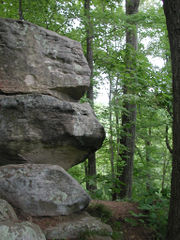
Strouds Run State Park is located just outside the city, bordering the city line. This park features 2,606 acres (11 km²) of wooded hills, including many bluffs and rock shelters, centered around a man-made lake. Camping is available.
The City of Athens has recently established the Strouds Ridge Preserve project, currently including some 345 acres (140 hectares), to save land from development adjacent to the state park. This preserve includes an 85-acre (340,000 m²) old-growth forest known as "Hawk Woods", or, more formally, the Dale & Jacki Riddle State Nature Preserve. Also adjacent to the state park is the 75-acre Blair Preserve, owned by the Athens Conservancy.
Bikeways
The Hockhocking Adena Bikeway is a multi-use asphalt trail with its main hub (mile marker 0) at the Athens Community Center on East State Street. The trail extends 16.4 miles northwest to Robbins' Crossing and Hocking College near Nelsonville, and approximately 1.5 miles further east along East State Street to Holzer Clinic. Construction currently underway will extend the trail farther in this direction. Access points with parking are located at mile 4 at the West State Street Park, mile 10.2 off Rt. 682 in The Plains, and mile 16.4 at Robbins' Crossing and Hocking College. The trail, which generally follows the course of the Hocking River, provides access to the East State Street commercial areas, Ohio University's campus (at South Green and Peden Stadium), The Plains, and Hocking College. It is designed for walking, running, biking, cross-country skiing, skating, and wheelchairs. Additionally several city streets are marked as bike lanes.[11]
Other trails
The Athens Trail Network is a multi-use trail network branching out from Sells' City Park at the end of Avon Place. A series of twelve trails and connectors branch out into the surrounding woods, heading eastwards to eventually connect with the trails of Strouds Run State Park. The trails are designed for hiking, running, and biking, although some sections are off-limits to bicycles. The trails provide scenic views of the East State Street commercial area and travel past and through notable features such as Sells Pond, Riddle State Nature Preserve (also known as Hawk Woods), Boulder Cove, Turtlehead Cave (also known as Blue Ash Rockhouse), Finger Rock, Pioneer Cemetery, and Dow Lake at Strouds Run State Park. The trail network is maintained by community and university volunteers.[12]
Government
Athens is governed by a mayor/council form of government. The elected Mayor and the department heads (some of whom are elected) run the city's daily operations. Nine council members are the cities law-makers. The city is divided into wards and voters select a mayor, a council member representing their ward and three at-large council members in staggered four year terms. As part of the city government, Athens also has department of health, community development, human services.
Education
The residents of Athens are served by the Athens City School District made up of five elementary buildings: K-6 (Chauncey, East, Morrison, The Plains & West), a Middle School (grades 7-8) and Athens High School. They are also served by the Nelsonville Public Library system (which is the Athens County Public Library system) with branches in Albany, Athens, Chauncey, Coolville, Glouster, Nelsonville, and The Plains.
Higher education
Ohio University is a public university located in Athens that is situated on an 1,800 acre campus. Founded in 1804, it is the oldest university in Ohio, oldest in the Northwest Territory, and ninth oldest public university in the United States.
In its 2010 edition, U.S. News & World Report ranked the university's undergraduate program 115th among national universities.[13]
Media
News publications
Athens is served by several news publications:
- The Athens Messenger, a daily paper published by Brown Publishing, which also publishes a weekly entertainment paper named the Athens Insider
- The Athens News, a free semi-weekly tabloid published by Bruce Mitchell
- The Post, a student newspaper of Ohio University
- ATHENSi.com, a community portal Web site run by the E.W. Scripps School of Journalism
- The Matrix, Athens High School's student-run newspaper.
Broadcast media
In addition, Ohio University's telecommunications center provides public radio and television. The FM radio system covers all of southeastern Ohio.
- FM Public Radio
- WOUB-FM, Athens, 91.3 FM - relayed on the following frequencies:
- WOUC-FM, Cambridge, 89.1 FM
- WOUH-FM, Chillicothe, 91.9 FM
- WOUL-FM, Ironton, 89.1 FM (the "L" is from Lawrence Co.)
- WOUZ-FM, Zanesville, 90.1 FM
- WMRT-FM (88.3), Marietta, 98.7 FM in Athens relayed from Marietta College
- WOUB-FM, Athens, 91.3 FM - relayed on the following frequencies:
- AM Public Radio: WOUB-AM, 1340 AM (Athens only)
- Internet Radio: ACRN (All-Campus Radio Network)
- Public Television: WOUB-TV, broadcast channel 20/WOUB-DT, broadcast digital channel 27
Private broadcast media include:
- WATH-AM, 970 AM (oldies) (Athens; Flagship of OU Baseball)
- WXTQ-FM, 105.5 (CHR) (Athens; Flagship of OU Men's Basketball and Football)
- WSEO-FM 107.7 (country) and WAIS, 770 AM (talk) (Nelsonville)
- WJKW, 95.9 FM (Athens; Contemporary Christian format)
- WEAK-LP-FM, 106.7, "Union Station" (Athens, oldies)
- WYWH-LP-FM, 104.5 FM (Christian) (3ABN Radio Network)
Former pirate radio stations:
- 94.5 FM The Doja
Internet media
- Athens County Convention & Visitors Bureau a website with tourist attractions and calendar events
- The Athens Musician Network, a website founded in 1997 dedicated to archiving and promoting Athens' rich musical heritage. Site contains audio, video, venue information, musician blogs and more.
- The Athens Area Chamber of Commercea website highlighting member businesses, community calendar of events, economic development resources and membership services
Notable natives and residents
- Cindy Ovenrack Crabb, radical zinester, author of "Doris"
- Earl Cranston, an American Bishop of the Methodist Episcopal Church
- Dow Finsterwald, professional golfer best known for winning the 1958 PGA Championship.
- Atul Gawande, a surgeon who has written extensively on medicine and public health for The New Yorker and Slate, pieces which have been collected in his books Complications and Better.
- Charles B. "Chuck" Greene, All-American javelin thrower at Western Michigan University (1981); World Maccabiah Games Champion (1985)
- William James Hoge, born in Athens, noted Presbyterian clergyman, college professor and Biblical scholar[14]
- Maya Lin, noted architect and designer of the Vietnam Veterans Memorial.
- David Wilhelm, Chairman of the Democratic National Committee from 1993 to 1994
- John Cumberland, prominent 1930s social activist.
- Kevin Hartman, Kansas City Wizards goalie.
- Mark Rosenberg, President Florida International University
- Yang Miller, improviser, actor and filmmaker
- Skeletonwitch, trash/black metal band
- Art Tripp, Athens-born percussionist notable for his work with Frank Zappa and Captain Beefheart, among others.
References
- ↑ 1.0 1.1 "American FactFinder". United States Census Bureau. http://factfinder.census.gov. Retrieved 2008-01-31.
- ↑ "US Board on Geographic Names". United States Geological Survey. 2007-10-25. http://geonames.usgs.gov. Retrieved 2008-01-31.
- ↑ "Subcounty population estimates: Ohio 2000-2007" (CSV). United States Census Bureau, Population Division. 2009-03-18. http://www.census.gov/popest/cities/files/SUB-EST2007-39.csv. Retrieved 2009-04-04.
- ↑ "Tree Cities Around the Nation," [1]." Arbor Day Foundation, accessed 28 July 2008.
- ↑ 5.0 5.1 Straw, Richard. "Images of America: Athens" Arcadia Publishing. 2007.
- ↑ Exner,Rich. "Ohio presidential election results: A swing state without many swing counties." Cleveland.com. 2008. http://blog.cleveland.com/datacentral/2008/08/Ohio-Presidential-Election-Results-by-County-1992-1996-2000-2004.gif
- ↑ Athens Farmers Market.org http://www.athensfarmersmarket.org/index.php?page=AFMHistory
- ↑ Evans, Chris. "Fox ghost story more of a fish story." The Post. Wednesday, 25 October 2000. Accessed April 20, 2010.
- ↑ http://southeastengine.com/about.html
- ↑ http://www.myspace.com/skeletonwitch
- ↑ "Hockhocking Adena Bikeway," [2]", Trail Link, 2007. Accessed 28 July 2008.
- ↑ "Athens Trail," [3]", Cycle Path. Accessed 28 July 2008.
- ↑ "Ohio University". http://colleges.usnews.rankingsandreviews.com/best-colleges/athens-oh/ohio-university-3100.
- ↑ Who Was Who in America, Historical Volume, 1607-1896. Chicago: Marquis Who's Who. 1963.
Further reading
- Beatty, Elizabeth G. and Marjorie S. Stone. 1984. Getting to Know Athens County. The Stone House, Athens OH.
External links
- Athens County Convention and Visitors Bureau
- City of Athens, Ohio
- Athens Area Chamber of Commerce
- The Athens County Historical Society & Museum
- Kennedy Museum of Art
- The Dairy Barn Arts Center
|
||||||||||||||||||||||||||
