Brandon, Manitoba
| Brandon | |||
|---|---|---|---|
| — City — | |||
| City of Brandon | |||
 |
|||
|
|||
| Nickname(s): The Wheat City | |||
| Motto: "Vires Acquirit Eundo" (Latin) "She acquires strength through progress" |
|||
 Brandon
|
|||
| Coordinates: | |||
| Country | Canada | ||
| Province | Manitoba | ||
| Region | Westman | ||
| Incorporated | 1882, May 30 | ||
| Government | |||
| - Mayor | Dave Burgess | ||
| - MLA Brandon West | Rick Borotsik (PC) | ||
| - MLA Brandon East | Drew Caldwell (NDP) | ||
| - MP Brandon—Souris | Merv Tweed (CPC) | ||
| Area | |||
| - City | 465.16 km2 (176.1 sq mi) | ||
| - Urban | 76.89 km2 (29.7 sq mi) | ||
| - Metro | 1,712.37 km2 (661.1 sq mi) | ||
| Elevation | 409.40 m (1,343.18 ft) | ||
| Population (2006) | |||
| - City | 41,511 (2nd) | ||
| - Density | 539.9/km2 (1,398.3/sq mi) | ||
| - Metro | 48,256 | ||
| - Metro density | 28.2/km2 (73/sq mi) | ||
| Time zone | Central (CST) (UTC-6) | ||
| - Summer (DST) | Central (CDT) (UTC-5) | ||
| Postal code | R7A-R7C | ||
| Area code(s) | 204 | ||
| Demonym | Brandonite | ||
| Website | City of Brandon | ||

Brandon is a city in southwestern Manitoba, Canada. The surrounding area is often referred to as "Westman".
The city started as a major junction on the Canadian Pacific Railway, and the Assiniboine River and was then incorporated in 1882. Brandon, the second largest city and service centre in Manitoba after Winnipeg, is a major hub for the surrounding agricultural area. The population of its trading area is between 70,000 and 150,000 people, while the city has a population of over 46,000. Brandon's industry reflects its agricultural history; its major industries are related to agriculture and include fertilizer and hog processing plants, as well as retail and government services for the surrounding area of Westman. Brandon is also home to Brandon University and Assiniboine Community College as well as the Brandon Wheat Kings.
Spruce Woods Provincial Park and CFB Shilo are a relatively short distance (by car) to the southeast of the city. Minnedosa Lake is only half an hour to the north.
Brandon's Army Reserve unit is the 26th Field Artillery Regiment, Royal Canadian Artillery, and the Canadian warship HMCS Brandon was named after the city.
Contents |
History
Prior to the influx of people from Eastern Canada, the area around Brandon was primarily used by the Sioux people, the Bungays, the Yellow Quills, and the Bird Tails.[1] After the Plains Bison were nearly completely wiped out by over hunting practices. With the destruction of their way of life, the buffalo, the nomadic Sioux people began to agree to settle in reservations such as the Sioux Valley Dakota Nation, or left the area entirely.
French Canadians also passed through the area on river boats on their way to the Hudson Bay Post, Fort Ellice located near present day St. Lazare, Manitoba. The city of Brandon gets its name from the Blue Hills south of the city, which got their name from a Hudson's Bay trading post known as Brandon House, which got its name from a hill on an island in James Bay where Captain James had anchored his ship in 1631.[1]
During the 1870s it was believe by most that the trans-continental railway would take a northwesterly direction from Portage la Prairie. Many thought that the route would most likely go through either Minnedosa or Rapid City, Manitoba due to the fact they were both located at natural river crossings. Rapid City was the front runner for the site of the new railway and had prepared for the impending building boom accordingly. But suddenly in 1881 the builders of the railway decided to take a more westerly route from Winnipeg, towards Grand Valley.[1] Grand Valley was located on the northern side of the Assinboine, opposite the side of the river where present day Brandon sits.
Grand Valley was originally settled by two brothers John and Dougal McVicar, and their families. With the expectation of the new railroad, settlers and prospectors now rushed to an area they had previously avoided.[1] Around 1879 a few settlers led by Reverend George Roddick had begun to build their new homes about 10 miles south of Grand Valley, at the foot of the Brandon Hills.[1]
Meanwhile in Grand Valley with expectation of the railway, the town began to boom. Regular voyages were made by steam sternwheelers to the city, each bring more and more settlers.[1] In the spring of 1881 General Rosser, Chief Engineer of the Canadian Pacific Railway arrived in Grand Valley. It was Rosser's job to choose the townsites for the railway. Rosser approached Dougald McVicar of Grand Valley and offered him $25,000 for the railway in Grand Valley. McVicar countered with $50,000 to which Rosser replied that “I’ll be damned if a town of any kind is ever built here".[1] So instead Rosser crossed the Assiniboine river and built the site of the railway on the high sandy south of the River, two miles west of Grand Valley. So the site was then moved to a site just west of today's current first street bridge in Brandon. A shanty had been built there by a man named J.D. Adamson, and it was on this quarter section Adamson claimed that Rosser chose as the townsite for the CPR Railway and named Brandon.[1]
After the location of the railway was once again changed, there was still hope that Grand Valley could become a rival neighbour to Brandon. But late in June 1881 it became clear that Grand Valley would not have lasted as a city long term. A flood hit in late June, and as the city was built on a low lying part of the river, flooded quickly and dramatically.[1] Because Grand Valley was built on a low flood plain, and Brandon was built on the heights on the other side. It became apparent that Brandon was the best place for a city in the area.
Rosser had chosen Brandon as the townsite in May 1881, within a year settlers had flocked to Brandon in such numbers that it was incorporated as a city. Brandon never spent any time as a town or village but has only existed as a city.[1]
Geography
Brandon is located in western Manitoba, on the banks of the Assiniboine river. It is located in the Canadian Prairies and the resides in the aspen parkland ecoregion of the prairies.[2] The terrain is generally flat and rolling surrounding Brandon. The Brandon hills are located to the south, and the Manitoba Escarpment is located to the north. Duck Mountain Provincial Park and Riding Mountain National Park lie within the escarpment north of Brandon.
Climate
| Climate data for Brandon | |||||||||||||
|---|---|---|---|---|---|---|---|---|---|---|---|---|---|
| Month | Jan | Feb | Mar | Apr | May | Jun | Jul | Aug | Sep | Oct | Nov | Dec | Year |
| Record high °C (°F) | 8.3 (46.9) |
15.0 (59) |
25.6 (78.1) |
36.0 (96.8) |
38.5 (101.3) |
42.2 (108) |
43.3 (109.9) |
41.1 (106) |
37.8 (100) |
32.5 (90.5) |
22.2 (72) |
14.4 (57.9) |
43.3 (109.9) |
| Average high °C (°F) | -11.9 (10.6) |
-7.5 (18.5) |
-0.5 (31.1) |
10.7 (51.3) |
19.2 (66.6) |
23.5 (74.3) |
25.9 (78.6) |
25.4 (77.7) |
18.8 (65.8) |
11.3 (52.3) |
-0.6 (30.9) |
-9.1 (15.6) |
8.8 (47.8) |
| Average low °C (°F) | -23.7 (-10.7) |
-19.3 (-2.7) |
-11.7 (10.9) |
-2.7 (27.1) |
4.4 (39.9) |
9.8 (49.6) |
11.9 (53.4) |
10.5 (50.9) |
4.9 (40.8) |
-1.5 (29.3) |
-10.6 (12.9) |
-20.1 (-4.2) |
-4.0 (24.8) |
| Record low °C (°F) | -46.2 (-51.2) |
-46.7 (-52.1) |
-43.9 (-47) |
-27.8 (-18) |
-13.9 (7) |
-3.9 (25) |
0.0 (32) |
-3.3 (26.1) |
-11.7 (10.9) |
-26.5 (-15.7) |
-40.6 (-41.1) |
-43.0 (-45.4) |
-46.7 (-52.1) |
| Precipitation mm (inches) | 19.2 (0.756) |
16.0 (0.63) |
23.5 (0.925) |
29.3 (1.154) |
52.6 (2.071) |
75.7 (2.98) |
72.5 (2.854) |
69.2 (2.724) |
48.3 (1.902) |
28.5 (1.122) |
18.6 (0.732) |
20.7 (0.815) |
474.0 (18.661) |
| Source: Environment Canada[3] | |||||||||||||
Demographics
| Ethnic Origins[4] | ||
|---|---|---|
| Population | Percentage | |
| English | 15,455 | 38.0 |
| Scottish | 12,520 | 30.8 |
| Canadian | 8,370 | 20.6 |
| Irish | 7,910 | 19.4 |
| German | 6,375 | 15.7 |
| Ukrainian | 5,885 | 14.5 |
| French | 4,520 | 11.1 |
| Polish | 2,865 | 7.0 |
| Census | Population |
|---|---|
| 1891 | 3,778 |
| 1901 | 5,620 |
| 1911 | 13,839 |
| 1921 | 15,397 |
| 1931 | 17,082 |
| 1941 | 17,172 |
| 1951 | 20,598 |
| 1961 | 28,166 |
| 1971 | 31,150 |
| 1981 | 36,242 |
| 1991 | 38,567 |
| 2001 | 39,716 |
| 2006 | 41,511 |
As of the 2006 Census, 41,511 inhabitants in Brandon itself, and 48,256 inhabitants in the Brandon Census Agglomeration (CA).[5] Brandon is Manitoba's second largest city, and the nations 64th largest CMA/CA.[5] [6] The regional Municipality of Cornwallis, including the unincorporated urban area of Shilo CFB-BFC, the Regional Municipalities of Whitehead, and Elton all make up the Brandon Census Agglomeration.
For Brandon, 47.4% of the city's population were male, and the remaining 52.6% were female.[7] The average age of Brandonites in 2006 was 37.0, slightly below the provincial average of 38.1.[7] Brandons population increased by 4.5% above the average 2.6% for the province but below the 5.6% increase for the nation.[7]
While the vast majority of Brandonites are of European descent, or identify themselves as Canadians. 9.8% of Brandon's citizens identify themselves as Aboriginal, and 4.0% of Brandon's citizens are part of a visible minority.[7] Though English is the dominant mother tongue for most people in Brandon (90%), some 600 citizens or 1.5% claim French as some part of their first language.[7] However 8.9% of people within the city claim that some other language besides French or English is their monther tongue.[7]
According to the 2001 census 76.6% of Brandonites belonged to a Christian denomination.[8] The census also revealed that 21.9% of the city's residents did not affiliate with any religion, this is on par with the largest city in Manitoba with 21.7% of Winnipeggers not following a religion.[8] This is above the 18.7% of Manitobans as a whole that do not affiliate with a religion.
Education
Public schools in Brandon are governed by the Brandon School Division #40. There are approximately 7200 students, 900 staff, 22 schools and a budget exceeding $50 million.[9] There are three high schools: Vincent Massey High School, Crocus Plains Regional Secondary School, and Neelin High School, as well as Neelin High School's Off-Campus learning centre. Brandon is also home to four post-secondary institutions: Brandon University, Assiniboine Community College, Robertson College, as well as the Manitoba Emergency Services College.
Sports
Local teams
- Brandon University Bobcats (Basketball/CWUAA)
- Brandon University Bobcats (Volleyball/CWUAA)
- Brandon Wheat Kings (Hockey/Western Hockey League)
Past sporting events
- The Brier - Canadian Men's Curling Championship (1963, 1982)
- The Scott Tournament of Hearts - Canadian Women's Curling Championship (1993, 2002)
- World Curling Championship - Men's & Women's World Curling Championship (1995)
- Canadian Olympic Curling Trials - Men's & Women's Olympic Curling Trials (1997)
- Canada Winter Games - Canada Winter Games (1979)
- Canada Summer Games - Canada Summer Games (1997)
- Special Olympics Canada - Canada Special Olympics Summer Games (2006)
- Memorial Cup - 2010 MasterCard Memorial Cup (2010)
Transportation
- Taxi service is available from numerous local taxi companies.
- The city of Brandon runs Brandon Transit, which provides daily bus service throughout the city. The system comprises 10 routes that operate only six days a week. (Monday to Saturday)
- Brandon is serviced by the Brandon Airport, a municipal airport.
- Brandon has a Greyhound bus station downtown that has daily service to Winnipeg and to other communities in Western Canada.
- Brandon has a system of walking / bike trails throughout the city.
Media
Music and the arts
Brandon hosts numerous arts festivals every year, such as the Brandon Festival of the Arts, Brandon Jazz Festival, and the Brandon Folk Festival whom has seen performers such as Crash Test Dummies, Rheostatics, Fred Penner, and the Wailin' Jennys. The Brandon Folk Festival takes place every summer on the Keystone Centre grounds. In addition to the music festivals the Brandon University School of Music hosts the annual 'Pro Series' which has included guests like Bob Brookmeyer, George Crumb, and the Winniped Symphoney Orchestra. In 2009 Brandon was host to the Western Canadian Music Awards.
The "Words Alive" is an annual literary festival held in downtown Brandon. Authors to have participated in this festival include Robert J. Sawyer, Maggie Siggins, Fred Stenson and Corey Redekop.
Some of the local arts venues include the Westman Centennial Auditorium, Lorne Watson Recital Hall, Evans Theatre, and the Art Gallery of Southwestern Manitoba.
Events and exhibitions
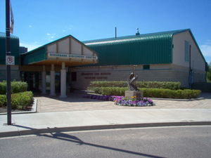
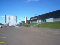
- The Provincial Exhibition of Manitoba is a non-profit organization established in 1872, which is now housed at the city's extensive Keystone Centre complex. It hosts the
- Royal Manitoba Winter Fair (March)
- Manitoba Summer Fair (June)
- Manitoba Livestock Expo (November)
- AgDays - Canada's largest indoor Agricultural Trade Show and Program, and one of the premier shows of its kind in North America. Held in mid January each year at Brandon's Keystone Centre.
- Brandon Folk Music and Arts Festival is a weekend event held annually in late July. The festival is held outdoors on the grounds of the Keystone Centre.
- The Commonwealth Air Training Plan Museum, located at the Brandon Municipal Airport.
Notable residents
|
|
|
See also
- 26th Field Artillery Regiment, Royal Canadian Artillery
- St. Matthew's Anglican Cathedral, Brandon
Further reading
- MB.ca, Special issue of Manitoba History (October 2007) on history of Brandon
References
- ↑ 1.0 1.1 1.2 1.3 1.4 1.5 1.6 1.7 1.8 1.9 "History of Brandon". City of Brandon. http://www.city.brandon.mb.ca/main.nsf/Pages+by+ID/584. Retrieved 2010-07-02.
- ↑ "Aspen Parkland". University of Alberta. http://www.environment.ualberta.ca/Cansoils/aspen.html. Retrieved 2010-07-05.
- ↑ Environment Canada—Canadian Climate Normals 1971–2000. Retrieved 09 July 2009.
- ↑ "City of Brandon". Ethnocultural Portrait of Canada Highlight Tables, 2006 Census. Statistics Canada. http://www12.statcan.ca/census-recensement/2006/dp-pd/hlt/97-562/pages/page.cfm?Lang=E&Geo=CSD&Code=4607062&Table=2&Data=Count&StartRec=1&Sort=3&Display=All&CSDFilter=5000. Retrieved 2010-08-02.
- ↑ 5.0 5.1 "Brandon Census Agglomeration (CA) with census subdivision (municipal) population breakdowns". Statistics Canada, 2006 Census of Population. 2007-03-13. http://www12.statcan.ca/english/census06/data/popdwell/Table.cfm?T=303&SR=1&S=3&O=D&RPP=25&CMA=602. Retrieved 2007-08-02.
- ↑ "Population and dwelling counts, for census metropolitan areas (ALL), 2006 and 2001 censuses - 100% data". Statistics Canada, 2006 Census of Population. 2007-03-13. http://www12.statcan.ca/english/census06/data/popdwell/Table.cfm?T=303&SR=1&S=3&O=D&RPP=25&PR=0&CMA=610. Retrieved 2010-08-02.
- ↑ 7.0 7.1 7.2 7.3 7.4 7.5 "Community Highlights for Brandon". Statistics Canada. 2006. http://www12.statcan.ca/census-recensement/2006/dp-pd/prof/92-591/details/page.cfm?Lang=E&Geo1=CSD&Code1=4607062&Geo2=PR&Code2=46&Data=Count&SearchText=Brandon&SearchType=Begins&SearchPR=01&B1=All&Custom=Code2=46&Data=Count&SearchText=Steinbach&SearchType=Begins&SearchPR=46&B1=All&Custom=. Retrieved 2010-08-02.
- ↑ 8.0 8.1 "Community Profile of the City of Brandon". Statistics Canada, 2001 Census of Population. 2007-09-30. http://www12.statcan.ca/english/Profil01/CP01/Details/Page.cfm?Lang=E&Geo1=PR&Code1=46&Geo2=CSD&Code2=4607062&Data=Count&SearchText=winnipeg&SearchType=Begins&SearchPR=01&B1=All. Retrieved 2010-08-02.
- ↑ Brandon School Division#40 "Quick Facts"
External links
- Brandon.ca, City of Brandon
|
|||||||||||
 |
Rivers | Minnedosa | Neepawa | |
| Virden | Carberry | |||
| Souris | Minto Boissevain |
Wawanesa, Glenboro |