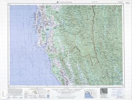
Cox's Bazar
Cox's Bazar is a town, a fishing port and district headquarters in Bangladesh. It is known for its wide sandy beach which, believed to be the world's longest natural sandy sea beach.[1][2][3] It is an unbroken 125 km sandy sea beach with a gentle slope. It is located 150 km south of Chittagong. Cox’s Bazar is also known by the name "Panowa", the literal translation of which means "yellow flower". Its other old name was "Palongkee". The modern Cox's Bazar derives its name from Captain Cox (died 1799), an officer serving in British India. In the 18th century, an officer of British East India Company, Captain Hiram Cox was appointed as the Superintendent of Palongkee outpost after Warren Hastings became the Governor of Bengal. Captain Cox was specially mobilised to deal with a century long conflict between Arakan refugees and local Rakhains. The Captain was a compassionate soul and the plight of the people touched his heart. He embarked upon the mammoth task of rehabilitating refugees in the area, and made significant progress. A premature death took Captain Cox in 1799 before he could finish his work. But the work he had done earned him a place in the hearts of the locals and to commemorate his role in rehabilitation work a market was established and named after him as Cox's Bazaar ("Cox's Market"). Although Cox's Bazar is one of the most visited tourist destinations in Bangladesh, it has yet to become a major international tourist destination, due to lack of publicity.
Contents |
The Town
Located along the Bay of Bengal in South Eastern Bangladesh, Cox's Bazar Town is a small port and health resort. But it is mostly famous for its long natural sandy beach. The municipality covers an area of 6.85 km² with 27 mahallas and 9 wards and has a population of 51,918.[4] Cox's Bazar is connected by road and air with Chittagong.[5]
History
The greater Chittagong area including Cox's Bazar was under the rule of Arakan Kings from the early 9th century till its conquest by the Mughals in 1666 AD.[6] When the Mughal Prince Shah Shuja was passing through the hilly terrain of the present day Cox’s Bazar on his way to Arakan, he was attracted to the scenic and captivating beauty of the place. He commanded his forces to camp there. His retinue of one thousand palanquins stopped there for some time. A place named Dulahazara, meaning "one thousand palanquins", still exists in the area. After the Mughals, the place came under the control of the Tipras and the Arakanese, followed by the Portuguese and then the British.
The name Cox's Bazar/Bazaar originated from the name of a British East India Company officer, Captain Hiram Cox who was appointed as the Superintendent of Palonki (today's Cox's Bazar) outpost after Warren Hastings became the Governor of Bengal following the British East India Company Act in 1773. Captain Cox was especially mobilised to deal with a century long conflict between Arakan refugees & local Rakhains at Palonki. The Captain made significant progress in rehabilitation of refugees in the area, but had died (in 1799) before he could finish his work. To commemorate his role in rehabilitation work a market / bazaar was established and was named after him as Cox's Bazaar (market of Cox). Cox's Bazar thana was first established in 1854 and a municipality was constituted in 1869.[6]
After the Sepoy Mutiny (Indian Rebellion of 1857) in 1857, the British East India Company was highly criticised & questioned on humanitarian grounds, specially for its Opium trade monopoly over the Indian Sub-Continent. However, after its dissolution on 1 January 1874, all of the company's assets including its Armed Forces were acquired by the British Crown. After this historic take over, Cox's Bazar was declared a district of the Bengal Province under the British Crown.
After the end of British rule in 1947, Cox's Bazar remained as a part of East Pakistan. Captain Advocate Fazlul Karim, the first Chairman (after independence from the British) of Cox's Bazar Municipality established the Tamarisk Forest along the beach to draw tourist attention in this town and also to protect the beach from tidal waves. He also donated many of his father in law’s and his own lands for establishing a Public Library and a Town Hall for the town. He was inspired to build Cox's Bazar as a tourist spot after seeing beaches of Bombay and Karachi, and one of the pioneers in developing Cox's Bazar as such. He founded a Maternity Hospital, the Stadium and the drainage system by procuring grants from the Ford Foundation and Rockefeller Foundation through correspondence. Mr. T. H. Matthews, the principal of the Dacca Engineering College (1949~1954) was his friend who had helped him in doing this. Engineer Chandi Charan Das was the government civil engineer who had worked on all these projects. In 1959 the municipality was turned into a town committee.[6] In 1961 the erstwhile Geological Survey of Pakistan initiated investigation of radioactive minerals like monazite around the cox's bazar sea-beach area and a number of precious heavy minerals were identified the same year.[7]
In 1971, Cox's bazar wharf was used as a naval port by the Pakistan Navy's gunboats. This and the nearby airstrip of the Pakistan Air Force were the scene of intense shelling by the Indian Navy during Bangladesh Liberation War. During the war, Pakistani soldiers killed many people in the town including eminent lawyer Jnanendralal Chowdhury. The killing of two freedom fighters named Farhad and Subhash at Badar Mokam area is also recorded in history.[8]
After the independence of Bangladesh Cox's Bazar started to get the administrative attention. In 1972 the town committee of Cox's Bazar was again turned into a municipality. In 1975, The Government of Bangladesh established a pilot plant at Kalatali, Cox's Bazar to assess the commercial viability of the heavy mineral content in the placer deposits of the area with the cooperation of the Australian Government.[7] Later, in 1984 Cox's Bazar subdivision was promoted to a district and 5 years later (in 1989) the Cox's Bazar municipality was elevated to B-grade.[6] In 1994 (jobs) the Marine Fisheries and Technology Station (MFTS) was established at Cox's Bazar. MFTS is a research station of Bangladesh Fisheries Research Institute (BFRI) headquartered in Mymensingh. The station covers a land area of 4 hactor and is equipped with 5 specialised laboratories, and one indoor and one outdoor cistern complex.[9] In April 2007 Bangladesh got connected to the submarine cable network as a member of the SEA-ME-WE-4 Consortium, as Cox's Bazar was selected as the landing station of the submarine cable.[10]
Geography and climate
Cox's Bazar town with an area of 6.85 km², is located at and bounded by Bakkhali River on the north and East, Bay of Bengal in the West, and Jhilwanj Union in the south.
The climate of Bangladesh is mostly determined by its location in the tropical monsoon region: high temperature, heavy rainfall, often excessive humidity, and distinct seasonal variations. The reversal of the wind circulation between summer and winter is another important feature of the climate of the country.[11] The climate of Cox's bazar is mostly similar to the rest of the country. It is further characterised by the location in the coastal area. The annual average temperature in Cox's Bazar remains at about a maximum of 34.8 °C and a minimum of 16.1 °C. The average amount of rainfall remains at 4,285 mm.
| Climate in Cox's Bazar | |||||||||||||
|---|---|---|---|---|---|---|---|---|---|---|---|---|---|
| Month | Jan | Feb | Mar | Apr | May | Jun | Jul | Aug | Sep | Oct | Nov | Dec | |
| Avg high temperature (°F) | 80° | 83° | 87° | 90° | 91° | 87° | 86° | 86° | 87° | 87° | 85° | 80° | |
| Avg low temperature (°F) | 57° | 61° | 68° | 75° | 78° | 77° | 81° | 77° | 77° | 75° | 67° | 60° | |
| Average Precipitation (inches) | 0.1" | 0.5" | 1.5" | 4.2" | 12.7" | 31.1" | 35.5" | 27.8" | 15.3" | 7.2" | 3.3" | 1.0" | |
| Source: WeatherBase.Com; Retrieved on 2008-01-25 | |||||||||||||
Economy and development
As one of the most beautiful and famous tourist spots in Bangladesh, the major source of economy in Cox's Bazar is tourism. Millions of foreigners and Bangladeshi natives visit this coastal city every year. As a result, a large number of hotels, guest houses and motels have been built in the city and coastal region. Many people are involved in hospitality and customer service orientated businesses. A number of people are also involved in fishing and collecting seafood and sea products for their livelihood. Various kinds of Oyster, Snail, Pearl and their ornaments are very popular with tourists in seaside and city stores. A number of people are also involved in the transportation business for tourists. Cox's Bazar is also one of the few major spots for aquaculture in Bangladesh.[12] Along with Khulna, it is considered a major source of revenue from foreign exchanges. Beside a mix of small-scale agriculture, marine and inland fishing and salt production are other industrial sources from this region that play important roles in the national economy.
Tourist attractions near the town
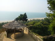
The beach is the main attraction of the town. Larger hotels provide exclusive beachside area with accessories for the hotel guests. Visitors in other hotels visit the Laboni beach which is the area of the beach closest to the town. Other than the beach there are several places of interest near the town which can easily be visited from town center.
- Aggmeda Khyang: a large Buddhist monastery, and a place revered by around 400,000 Buddhist people of Cox’s Bazar; and the Chittagong Hill Tracts. The main sanctuary is posted on a series of round timber columns. It has a prayer chamber and an assembly hall along with a repository of large and small bronze Buddha images and a number of old manuscripts.
- Ramu: about 10 km from Cox’s Bazar,[13] is a village with a sizeable Buddhist population. The village is famous for its handicrafts and homemade cigars. There are monasteries, khyangs and pagodas containing images of Buddha in gold, bronze and other metals inlaid with precious stones. One of the most interesting of these temples is on the bank of the Baghkhali river. It houses not only interesting relics and Burmes handicrafts but also a large bronze statue of Buddha measuring thirteen feet high and rests on a six feet high pedestal. The wood carving of this khyang is very delicate and refined. The village has a charm of its own. Weavers ply their trade in open workshops and craftsmen make handmade cigars in their pagoda like houses.
- Dulhazra Safari Park: This safari park is an extension of an animal sanctuary located along the Chittagong-Cox's Bazar road about 50 km from Cox's Bazar town. The sanctuary itself protects a large number of wild elephants which are native to the area. In the safari park there are domesticated elephants which are available for a ride. Other animal attractions include lions, Bengal tigers, Crocodiles, Bears, Chitals and lots of different types of birds and monkeys.
Risks and Hazards
The coastal areas of Cox's Bazar are prone to devastating cyclones and landslides on a yearly basis. The areas near the Cox’s Bazar town are located directly in the high risk area for surge water heights above 1 metre[14] as well as landslides.[15] There was a 70% casualty rate near the town area during the 1991 cyclone.[14] Another hazard of the Cox's Bazar area is the high natural background radiation which has been found to be above global average.[16] There has been reported incidents of human casualty due to actions of wild elephants in the locality.[17] The threat of mosquito borne diseases like Malaria also may be higher in the area.[18] However, all these hazards mainly affect long term residents of the area and visiting tourists should be able to guard against these risks with appropriate precautions. For them these are not at all a considerable problem. emergency health services are available in the Cox's bazar district hospital which is secondary level hospital in Bangladesh.
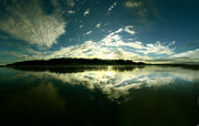
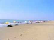
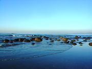
The beach
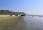
The main attraction of Cox's Bazar is the long sandy beach that stretches from the mouth of the Bakkhali river going all the way to Teknaf. Although commonly known as Cox's Bazar beach, it stretches far beyond the area designated as Cox's Bazar town.
Tourists and accommodation
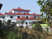
Cox's Bazar, arguably the best tourist spot in Bangladesh, is visited by a large number of tourist from Britain, America, Korea, Japan, India, Nepal, Pakistan and many more countries each year. Though there is no specific record in Bangladesh Porjatan Corporation (BPC) on how many people usually visit Cox's Bazar each year but an AFP report says that during the winter 10,000 available rooms in the beach area hotels usually remain occupied almost seven days a week.[19] Accommodation near the beach varies from an expensive range to a reasonable price. Many private hotels, BPC Motels and two Five Star hotels [1] are located near the beach.
Places of interest along the beach
Cox’s Bazar, mostly famous for its beautiful sea beach and the sunset, has several other attractions, including:
- Laboni Beach: This is the main beach of Cox's Bazar and is considered the main beach due to the fact that it is closest to the town. Close to the beach, there are hundreds of small shops selling souvenirs and beach accessories to the tourists.
- Himchari: Located about 18 km south of Cox’s Bazar[13] along the sea beach, is a nice place for the picnic and film shooting. This picnic spot is famous for its waterfalls. The road to Himchari runs by the open sea on one side and hills on the other which makes the journey to Himchari very attractive. Its another attraction is the Christmas tree.
- Enani Beach: Located 35 km south of Cox’s Bazar, this white sandy beach is located within Ukhia Thana.[20] This beach is famous for its golden sand and clean shark free water which is ideal for sea bathing. Most tourists prefer to come down here for relaxing because it is free from the crowd of tourists that is usually seen at the Laboni beach.
Mineral content in beach sand
The sand at Cox's Bazar beach and surrounding areas is rich in heavy-metal mineral content.[21] The heavy minerals of Cox's Bazar beach sands are dominated by hornblende, garnet, epidote, ilmenites (both unaltered and altered) with magnetite, rutile, pyrite and some hydroxides.[22] Cox's Bazar beach alone is believed to have a deposit of 5.119 Mt of minerals @ 0.04% mon, while nearby Enani beach is expected to have another deposit of 0.729 Mt. of minerals @ 0.13% mon.[21] Surrounding islands of Maheshkhali, Kutubdia and Nijhum Deep as well as mainland beach in Teknaf area are also believed to have similar large deposits.[21] The total deposit in these locations is about 20.5 million tons of raw sand, which contains 4.4 million tons of heavy minerals (sp gr > 2.9).[7]
Other tourist attractions near Cox's Bazar
- Maheshkhali is a small island (268 square kilometres) off the Cox’s Bazar coast. The island offers panoramic scenic beauty and is covered by a range of low hills, about 300 feet (91 m) high, streatches through the center of the island and along its eastern coastline. The coasts of the island on the west and north form a low-lying tract that is fringed by the mangrove forests.[23] Adinath Temple, a temple of Shiva, and a Buddhist pagoda are also located on this island.
- Sonadia Island, a small crescent shaped island of only 9 square kilometres, it is 7-km north-west of Cox's Bazar. The western side of the island is sandy and different kinds of shells are found on the beach. Off the northern part of the island, there are beds of window pane oysters. During winter, fisherman set up temporary camps on the island and dry their catches of sea fish. Sonadia Island supports the last remaining part of mangrove forest in southeast Bangladesh. Sonadia's mangroves are distinct from the well-known sunderbans, due to their development in a coastal lagoon setting rather than in a delta.[24]. Another attraction of this island is the sight of game birds migrating here in great numbers during the winter seasons.[23]
- Teknaf, a place situated by the side of Naf river is the southernmost part of mainland Bangladesh. This also marks the end point of Cox's Bazar beach. Tourists usually come here to have a river cruise along beautiful Naf river, which flows between Bangladesh and Myanmar.
- St. Martin's Island, a small island in the northeast part of the Bay of Bengal, about 9 km south of the tip of the Cox's Bazar-Teknaf peninsula. It is the only coral island in Bangladesh. It is about 8 km west of the northwest coast of Myanmar at the mouth of the Naf River. The local name of the island is "Narical Gingira", also spelled "Narikel Janjina/Jinjera", translated from Bangla, meaning 'Coconut Island'. St. Martin's Island has become a popular tourist spot. Three shipping liners run daily trips to the island. They are Kutubdia, Sea-Truck and Keary-Sindbad. Tourists can book their trip either from Chittagong or from Cox's Bazar. The surrounding coral reef of the island has an extension named Chera Dwip. The island is home to several endangered species of turtles, as well as the corals, some of which are found only on this island.
- Chakaria: One of most large area in Cox's Bazar.
- Bandarban: Bandarban lies three hours away from Cox's Bazaar by bus. The Buddha Dhatu Jadi, the largest Buddhist temple in Bangladesh, located in Balaghata, 4 km from the town, is an excellent place to visit. This Theravada Buddhist temple is made completely in the style of South-East Asia and houses the second largest statue of Buddha in Bangladesh. The waterfall named Shoilo Propat at Milanchari is also an excellent site. In addition, the numerous Buddhist temples, known as kyang in local tongue, and vihars in the town include the highly notable the Rajvihar (royal vihar) at Jadipara and the Ujanipara Vihar. Bawm villages around Chimbuk, and Mru villages a little further off, are also lie within a day's journey from the town. Prantik Lake, Jibannagar and Kyachlong Lake are some more places of interest. And, a boat ride on the river Sangu is also an excellent proposition.
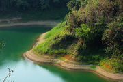
- Rangamati: One can reach Rangamati from Cox's Bazar either via Chittagong or Bandarban. Rangamati offers several attractions including local tribal museum, Buddhist temple, tribal markets, hanging bridge and even the palace of traibal kings. The major attraction of the district is Kaptai Lake. It is a man-made lake in the Kaptai upazila of Rangamati District. The lake was created as a result of building the Kaptai Dam on the Karnaphuli River, as part of the Karnaphuli Hydro-electric project. The beautiful view of surrounding green hills has turned the lake into a wonderful spot for boating and cruising.
See also
- Cox's Bazar District
- Cox's Bazar Sadar Upazila
References
- ↑ "The Longest Beach". http://thelongestlistofthelongeststuffatthelongestdomainnameatlonglast.com/long34.html. Retrieved 2008-01-10.
- ↑ "Cox's Bazar, Bangladesh - the World's Longest Beach 120km". http://www.thingsasian.com/stories-photos/2334. Retrieved 2008-01-10.
- ↑ "World's longest beach hidden in Bangladesh". The Sydney Morning Herald. 31 January 2007. http://www.smh.com.au/news/travel/the-worlds-longest-beach/2007/01/31/1169919381993.html. Retrieved 2008-01-10.
- ↑ Municipal data; Bangladesh Bureau of Statistics
- ↑ Cox’s Bāzār. (2008). In Encyclopædia Britannica. Retrieved 2008-01-14, from Encyclopædia Britannica Online.
- ↑ 6.0 6.1 6.2 6.3 Siddiqi, Mahibbullah (2003). "Cox's Bazar District". In Islam, Sirajul. Banglapedia: national encyclopedia of Bangladesh. Dhaka: Asiatic Societyof Bangladesh. ISBN 9843205766. http://banglapedia.search.com.bd/HT/C_0364.htm.
- ↑ 7.0 7.1 7.2 Chowdhury, Sifatul Quader (2003). "Beach Sand Heavy Mineral". In Islam, Sirajul. Banglapedia: national encyclopedia of Bangladesh. Dhaka: Asiatic Societyof Bangladesh. ISBN 9843205766. http://search.com.bd/banglapedia/HT/B_0370.htm.
- ↑ Alam, Badiul (2003). "Cox's Bazar Sadar Upazila". In Islam, Sirajul. Banglapedia: national encyclopedia of Bangladesh. Dhaka: Asiatic Societyof Bangladesh. ISBN 9843205766. http://banglapedia.search.com.bd/HT/C_0365.htm.
- ↑ Kabir, SM Humayun (2003). "Bangladesh Fisheries Research Institute". In Islam, Sirajul. Banglapedia: national encyclopedia of Bangladesh. Dhaka: Asiatic Societyof Bangladesh. ISBN 9843205766. http://banglapedia.search.com.bd/HT/B_0176.htm.
- ↑ "Much needed Submarine Cable - Bangladesh". Bangladesh Development Gateway. 2006-03-02. http://www.bangladeshgateway.org/submarineCable.php. Retrieved 2008-01-14.
- ↑ Ahmed, Rafique (2003). "Climate". In Islam, Sirajul. Banglapedia: national encyclopedia of Bangladesh. Dhaka: Asiatic Society of Bangladesh. ISBN 9843205766. http://search.com.bd/banglapedia/HT/C_0288.htm.
- ↑ "The Development of Export-Oriented Shrimp Aquaculture in Bangladesh: a preliminary assessment of moves to more intensive production in southeastern Bangladesh". http://www.sociology.ed.ac.uk/sas/conf16/panel51.htm. Retrieved 2008-02-01.
- ↑ 13.0 13.1 Hossain, Mofazzal (2003). "Cox's Bazar". In Islam, Sirajul. Banglapedia: national encyclopedia of Bangladesh. Dhaka: Asiatic Societyof Bangladesh. ISBN 9843205766. http://search.com.bd/banglapedia/HT/C_0363.htm.
- ↑ 14.0 14.1 Molnar, Mike. "Hazard Map". The 1991 Bangladesh Cyclone and its Impact on Flooding. Geog 361, Spring 2005. http://www.uwec.edu/jolhm/EH2/Molnar/map.htm. Retrieved 2008-01-21.
- ↑ Chowdhury, Sifatul Quader (2003). "Landslide". In Islam, Sirajul. Banglapedia: national encyclopedia of Bangladesh. Dhaka: Asiatic Societyof Bangladesh. ISBN 9843205766. http://search.com.bd/banglapedia/HT/L_0057.htm.
- ↑ Mollah, A.S.; Rahman, M.M.; Koddus, M.A.; Husain, S.R. and Malek, M.A. (1 January 1987). "Measurement of High Natural Background Radiation Levels by TLD at Cox's Bazar Coastal Areas in Bangladesh" (abstract). Radiation Protection Dosimetry (Oxford University Press) 18 (39-41): 39. http://rpd.oxfordjournals.org/cgi/content/abstract/18/1/39. Retrieved 2008-01-21.
- ↑ Ahmed, Nizam (2008-01-24). "Elephants kill man, destroy homes in Bangladesh". Reuters, UK. http://uk.reuters.com/article/environmentNews/idUKDHA30862420080124. Retrieved 2008-01-25.
- ↑ Malaria due to Plasmodium falciparum in Chakaria, Cox's Bazaar district; ICDDR,B; Health and Science Bulletin. 2003 Sep;1(4):10-14.
- ↑ "An AFP report by Nadeem Qadir". http://www.thingsasian.com/stories-photos/2334Z. Retrieved 2008-01-14.
- ↑ "Cox's Bazar". Tourist Spots: Beaches. Bangladesh Parjatan Corporation. http://www.bangladeshtourism.gov.bd/beach_coxs.php. Retrieved 2008-01-14.
- ↑ 21.0 21.1 21.2 Mineral Concentrations and Hydrocarbon Accumulations in the ESCAP Region (1988); Mineral sands in Asia and the Pacific: New York, United Nations, Economic and Social Commission for Asia and the Pacific and Australian Bureau of Mineral Resources, Geology and Geophysics; v. 4, 129 p.
- ↑ Sachinath Mitra, Syed Samsuddin Ahmed and Hi-Soo Moon; Mineralogy and chemistry of the opaques of Cox's Bazar (Bangladesh) beach sands and the oxygen fugacity of their provenance; Sedimentary Geology, Volume 77, Issues 3-4, May 1992, Pages 235-247.
- ↑ 23.0 23.1 Hossain, Mofazzal. 2003. Cox's Bazar. In the Banglapedia. The Asiatic Society of Bangladesh, Dhaka. P. 145
- ↑ Islam, M Aminul (2003). "Ecologically Critical Area". In Islam, Sirajul. Banglapedia: national encyclopedia of Bangladesh. Dhaka: Asiatic Society of Bangladesh. ISBN 9843205766. http://banglapedia.search.com.bd/HT/E_0017.htm.