Lake Erie
| Lake Erie | |
|---|---|
 |
|
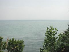
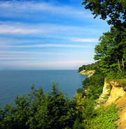
| From a high bluff near Leamington, Ontario | |
 |
|
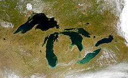
| Lake Erie and the other Great Lakes. | |
| Location | North America |
| Group | Great Lakes |
| Primary inflows | Detroit River |
| Primary outflows | Niagara River |
| Basin countries | Canada, United States |
| Max. length | 241 mi (388 km) |
| Max. width | 57 mi (92 km) |
| Surface area | 9,940 sq mi (25,744 km2)[1] |
| Average depth | 62 ft (19 m) |
| Max. depth | 210 ft (64 m)[1] |
| Water volume | 116 cu mi (480 km3) |
| Residence time | 2.6 years |
| Shore length1 | 850 mi (1,370 km) |
| Surface elevation | 571 ft (174 m)[1] |
| Islands | 24+ (see list) |
| Settlements | Buffalo, New York Erie, Pennsylvania Toledo, Ohio Cleveland, Ohio |
| References | [1] |
| 1 Shore length is not a well-defined measure. | |
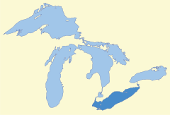
Lake Erie[2] (pronounced /ˈɪri/) (French: Lac Érié) is the fourth largest lake (by surface area) of the five Great Lakes in North America, and the thirteenth largest globally.[3] It is the southernmost, shallowest, and smallest by volume of the Great Lakes[4][5] and therefore also has the shortest average water residence time. It is bounded on the north by the Canadian province of Ontario, on the south by the U.S. states of Ohio, Pennsylvania, and New York, and on the west by the state of Michigan. The lake is named after the Erie tribe of Native Americans who lived along its southern shore.[4]
Contents |
Geography
Lake Erie (42.2° N, 81.2° W) has a mean elevation of 571 feet (174 m)[1] above sea level. It has a surface area of 9,940 square miles (25,745 km²)[1] with a length of 241 miles (388 km) and breadth of 57 miles (92 km) at its widest points.
It is the shallowest of the Great Lakes with an average depth of 62 feet (19 m) and a maximum depth of 210 feet (64 m).[1] For comparison, Lake Superior has an average depth of 483 feet (147 m), a volume of 2,900 cubic miles (12,100 km³) and shoreline of 2,726 miles (4385 km). Because it is the shallowest, it is also the warmest of the Great Lakes.[6]
Lake Erie is primarily fed by the Detroit River (from Lake Huron and Lake St. Clair) and drains via the Niagara River and Niagara Falls into Lake Ontario. Navigation downstream is provided by the Welland Canal, part of the Saint Lawrence Seaway. Other major contributors to Lake Erie include the Grand River, the Huron River, the Maumee River, the Sandusky River, the Buffalo River, and the Cuyahoga River.
Point Pelee National Park, the southernmost point of the Canadian mainland, is located on a peninsula extending into the lake. Several islands are found in the western end of the lake; these belong to Ohio except for Pelee Island and 8 neighboring islands, which are part of Ontario. The cities of Buffalo, New York; Erie, Pennsylvania; Toledo, Ohio; Port Stanley, Ontario; Monroe, Michigan; and Cleveland, Ohio are located on the shores of Lake Erie.
The drainage basin covers 30,140 square miles (78,000 km2).
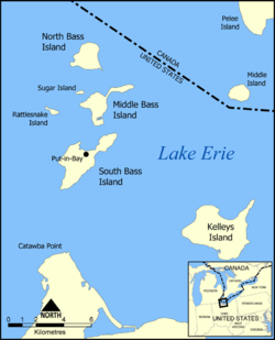
Islands
|
|
Hydrology
Lake Erie has a lake retention time of 2.6 years, the shortest of all the Great Lakes.[7]
Lake Erie's water level fluctuates with the seasons as in the other Great Lakes. The lowest levels are in January and February, and the highest in June or July. The average yearly level varies depending on long-term precipitation.
Short-term level changes are often caused by seiches that are particularly high when southwesterly winds blow across the length of the lake during storms. These cause water to pile up at the eastern end of the lake. Storm driven seiches can cause damage onshore. During one storm in November 2003, the water level at Buffalo rose by 7 feet (2.1 m) with waves of 10–15 feet (3-4.5 m) for a rise of 22 feet (6.7 m).[8] Meanwhile, at the western end of the lake, Toledo experienced a similar drop in water level.
Water Levels
Historic High Water The lake fluctuates from month to month with the highest lake levels in October and November. The normal highwater mark is 2.00 feet (0.61 m) above datum (569.2 ft or 173.5 meters). In the summer of 1986, Lake Erie reached its highest level at 5.08 feet (1.55 m) above datum.[9] The high water records were set from 1986 (April) through January 1987. Levels ranged from 4.33 feet (1.32 m) to 5.08 feet (1.55 m) above Chart Datum.[9]
Historic Low Water Lake Erie experiences its lowest levels in the winter. The normal lowwater mark is 1.50 feet (0.46 m) above datum (569.2 ft or 173.5 meters). In the winter of 1934, Lake Erie reached its lowest level at 1.50 feet (0.46 m) below datum.[9] Monthly low water records were set from July 1934 through June 1935. During this twelve month period water levels ranged from 1.50 feet (0.46 m) to the Chart Datum.[9]
Geology
Lake Erie in its current form is less than 4,000 years old, a short amount of time geologically speaking. Prior to this, the land on which the lake now sits has gone through several complex stages. Over two million years ago, a large lowland basin formed as a result of an eastern flowing river that existed well before the Pleistocene ice ages. This ancient drainage system was destroyed by the first major glacier in the area while at the same time deepening and enlarging the lowland allowing water to settle and form a lake. The glaciers were able to carve away more land on the eastern side of the lowland because the bedrock is made of shale which is much softer than the carbonate rocks on the western side. Thus, the eastern side of the modern lake is much deeper than the western portion which averages only 25 feet (7.6 m) deep. Lake Erie is the shallowest of the Great Lakes because the ice was so thin and lacked erosion power needed when it reached that far south.
As many as three glaciers advanced and retreated over the land causing temporary lakes to form in the time periods in between each of them. Because each of the lakes had a different amount of water volume, their shorelines rested at differing elevations. The last of these lakes to form, Lake Warren, existed between about 13,000 and 12,000 years ago. It was deeper than the current Lake Erie, so its shoreline existed about eight miles (13 km) inland from the modern one. The shorelines of these lakes left behind high ground sand ridges that cut through swamps and were used as trails for Indians and later, pioneers. These trails became primitive roads which were eventually paved. U.S. Route 30 west of Delphos and U.S. Route 20 west of Norwalk and east of Cleveland were formed in this manner. One can still see some of these ancient sand dunes that formed in the Oak Openings Region in Northwestern Ohio. There, the sandy dry lake bed soil was not enough to support large trees with the exception of a few species of oaks, forming a rare oak savanna.[10]
History
Native American
At the time of European contact, there were several groups of Iroquoian cultures living around the shores of the eastern end of the lake. The Erie tribe (from whom the lake takes its name) lived along the southern edge, while the Neutrals (also known as Attawandaron) lived along the northern shore. Both tribes were conquered and assimilated by their hostile eastern neighbors, the Iroquois Confederacy between AD 1651 and 1657, in what is referred to as part of the Beaver Wars.[11]
For decades after those wars, the land around eastern Lake Erie was claimed and utilized by the Iroquois as a hunting ground. As the power of the Iroquois waned during the last quarter of the seventeenth century, several other, mainly Anishinaabe Native American tribes, displaced them from the territories they claimed on the north shore of the lake.[12]
European exploration and settlement
In 1669, the Frenchman Louis Jolliet was the first documented European to sight Lake Erie, although there is speculation that Etienne Brule may have come across it in 1615.[13] Lake Erie was the last of the Great Lakes to be explored by Europeans, since the Iroquois who occupied the Niagara River area were in conflict with the French, and they did not allow explorers or traders to pass through. Explorers had followed rivers out of Lake Ontario and portaged into Lake Huron. During the War of 1812, Oliver Hazard Perry captured an entire British fleet near Put-in-Bay, Ohio.
Great Lakes Compact
In 2008, the Great Lakes States of Ohio, Michigan, New York, Pennsylvania, Illinois, Indiana, Wisconsin, Minnesota and the Canadian Province of Ontario formed an alliance to save the Great Lakes. The Great Lakes Compact is an international policy written by the compact concerning water rights that protects the Great Lakes from distant states exploiting it. This compact is not popular in the southwestern states because of recent drought conditions. The compact was signed into law by President George W. Bush in September 2008. Its supporters range from United States Senator George Voinovich (R-OH) to Governor Jennifer Granholm (D-MI).
Environment
Weather
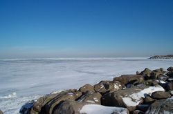
Like the other Great Lakes, Erie produces lake effect snow when the first cold winds of winter pass over the warm waters, making Buffalo, New York and Erie, Pennsylvania the eleventh and thirteenth snowiest places in the entire United States respectively, according to data collected from the National Climatic Data Center.[14] The lake effect ends or its effect is reduced, however, when the lake freezes over. Being the shallowest of the Great Lakes, it is the most likely to freeze and frequently does.[15]. On February 16, 2010, meteorologists reported that the lake had frozen over marking the first time the lake had completely frozen over since the winter of 1995-1996 [1].
The lake is also responsible for microclimates that are important to agriculture. Along its north shore is one of the richest areas of Canada's fruit and vegetable production, and along the southeastern shore in Ohio, Pennsylvania, and New York is an important grape growing region, as are the islands in the lake. Apple orchards are abundant in northeast Ohio to western New York.
Water quality
Lake Erie infamously became very polluted in the 1960s and 1970s as a result of the quantity of heavy industry situated in cities on its shores. The water quality deteriorated due to increasing levels of the nutrient phosphorus in both the water and lake bottom sediments. The resultant high nitrogen levels in the water caused eutrophication, which resulted in algal blooms. Algae masses and fish kills increasingly fouled the shoreline during this period, but a 1969 Time magazine article about a fire on the Cuyahoga River, a tributary feeding the lake at Cleveland, Ohio so embarrassed officials that the United States Congress quickly passed the Clean Water Act of 1972.[16] In 1972 the Great Lakes Water Quality Agreement between the United States and Canadian governments also significantly reduced the dumping and runoff of phosphorus into the lake. The lake has since become clean enough to allow sunlight to infiltrate its water and produce algae and sea weed, but a dead zone persists in the central Lake Erie Basin during the late summer. The clearing of the water column is also partly due to the introduction and rapid spread of zebra mussels, each of which can filter up to one litre (1L) of water per day. The United States Environmental Protection Agency is currently studying this cyclic phenomenon.[17]
Since the 1970s environmental regulation has led to a great increase in water quality and the return of economically important fish species such as walleye and other biological life.[18]
Economy
Fisheries

Lake Erie is home to one of the world's largest freshwater commercial fisheries. Once a mainstay of communities around the lake, commercial fishing is now predominantly based in Canadian communities, with a much smaller fishery—largely restricted to yellow perch—in Ohio. The Ontario fishery is one of the most intensively managed in the world. It was one of the first fisheries in the world managed on individual transferable quotas and features mandatory daily catch reporting and intensive auditing of the catch reporting system. Still, the commercial fishery is the target of critics who would like to see the lake managed for the exclusive benefit of sport fishing and the various industries serving the sport fishery.
Commercial landings are dominated by yellow perch and walleye, with substantial quantities of rainbow smelt and white bass also taken. Anglers target walleye and yellow perch, with some effort directed at rainbow trout. A variety of other species are taken in smaller quantities by both commercial and sport fleets. Up until the end of the 1950s, the most commonly caught commercial fish (more than 50% of the commercial catch) was a subspecies of the walleye known as the Blue Walleye (sander vitreus glaucus) sometimes erroneously called "blue pike". The combination of overfishing and the eutrophication of the lake by pollution caused the population to collapse, and in the mid 1980s, the Blue Walleye was declared extinct.
Management of the fishery is by consensus of all management agencies with an interest in the resource (the states of New York, Pennsylvania, Ohio and Michigan and the province of Ontario) under the mandate of the Great Lakes Fishery Commission, which is driven by comprehensive fisheries assessment programs and sophisticated mathematical modeling systems. The Commission remains the source of considerable recrimination, primarily from United States based angler and charter fishing groups with a historical antipathy to the commercial fishery. This conflict is complex, dating from the 1960s, with in U.S. fisheries management that led to elimination of commercial fishing in most U.S. Great Lakes states. The process began in Michigan, and its evolution is well documented in Szylvian (2004)[19], using Lake Michigan as a case study. The underlying issues are universal, wherever sport and commercial fishing coexist, but their persistence in the Lake Erie context, one of the most intensively scrutinized and managed fisheries, suggests that these conflicts are cultural, not scientific, and therefore not resolvable by reference to ecological data. These debates are largely driven by social, political and economic issues, not ecology.[20]
The lake consists of a long list of well established introduced species. Common non-indigenous fish species include the rainbow smelt, alewife, white perch and common carp. Non-native sport fish such as rainbow trout and brown trout are stocked specifically for anglers to catch. Attempts failed to stock coho salmon and its numbers are once again dwindling.

The lake has recently been plagued with a number of invasive species, including Zebra and quagga mussels, the goby and the grass carp. Zebra mussels and gobies have been credited with the increased population and size of smallmouth bass in Lake Erie.[21]
Agriculture
The lake's formerly more extensive lakebed creates a favorable environment for agriculture in the bordering areas of Ontario, Ohio, Michigan, Pennsylvania, and New York. The lake also supports a strong commercial and sport fishery. But since high levels of pollution were discovered in the 1960s and 1970s, there has been continued debate over the desired intensity of commercial fishing.
The drainage basin has led to well fertilized soil. Ohio's north coast is widely referred to as the nursery capital.[22]
Transportation
The Port of Cleveland generates over $350 million and over 15 million tons of cargo. The port will begin work on a new set of docks with more efficient railway, road, and crane access. The current port facility is unable to handle larger cargo ships, and the cranes needed to lift goods such as steel to truck trailers are insufficient to current shipping standards. This project is planned to start in 2010 and will be completed by 2020.
The ship traffic in Lake Erie being the highest among the Great Lakes, along with it being the shallowest and roughest of the lakes has led to it having the highest number of known shipwrecks in the Great Lakes.
The Great Lakes Circle Tour is a designated scenic road system connecting all of the Great Lakes and the St. Lawrence River.[23]
See also
- Bass Islands
- Battle of Lake Erie
- Bessie - the reported Lake Erie monster
- Cedar Point
- Erie Canal
- Lake Erie belt
- List of lakes by area
- List of lakes in Ohio
- Maumee Bay
Notes
- ↑ 1.0 1.1 1.2 1.3 1.4 1.5 1.6 Wright, John W. (ed.); Editors and reporters of The New York Times (2006). The New York Times Almanac (2007 ed.). New York, New York: Penguin Books. pp. 64. ISBN 0-14-303820-6.
- ↑ United States Geological Survey Hydrological Unit Code: 04-12-02-00
- ↑ Large Lakes of the World. Factmonster.com.
- ↑ 4.0 4.1 Lake Erie - Facts and Figures, Great Lakes Information Network.
- ↑ Erie, Lake, Factmonster.com.
- ↑ Dr. Charles E. Herdendorf
- ↑ Great Lakes; Basic Information: Lake Erie. U.S. Environmental Protection Agency.
- ↑ Great Lakes Storm Surges November 12-13, 2003 http://www.glerl.noaa.gov/seagrant/glwlphotos/Seiche/1113Storm/November2003.html
- ↑ 9.0 9.1 9.2 9.3 Monthly bulletin of Lake Levels for The Great Lakes; September 2009; US Army Corps of Engineers, Detroit District
- ↑ Hansen, Michael C. "The History of Lake Erie" http://www.ohiodnr.com/geosurvey/lakeerie/lefact1/tabid/7829/Default.aspx
- ↑ Trigger, Bruce; The Children of Aataentsic (McGill-Queen's University Press, Kingston and Montreal,1987, ISBN 0-7735-0626-8), pgs.789-797.
- ↑ Schmalz, Peter S.; The Ojibwa of Southern Ontario (University of Toronto Press, Toronto, Buffalo, London, 1991, ISBN 0-8020-2736-9), pgs.13-34.
- ↑ Ashworth, William (1987). The Late, Great Lakes: An Environmental History, p. 36. Detroit: Wayne State University Press. ISBN 0814318878.
- ↑ Answers: 10 snowiest 'cities' aren't all in New York. Also creating the snow belt from Cleveland to Buffalo. Chris Cappella, USATODAY.com.
- ↑ What's the physics behind "lake effect snow"?. the Straight Dope Science Advisory Board.
- ↑ Ashworth (1987), pp. 143-44.
- ↑ Lake Erie 'Dead Zone'. US EPA Lake Erie 'Dead Zone'. URL accessed on December 15, 2005.
- ↑ Recovery of Lake Erie Walleye a Success Story. Michigan Department of Natural Resources.
- ↑ Szylvian,K.M. 2004. Transforming Lake Michigan into the 'World's Greatest Fishing Hole': The Environmental Politics of Michigan's Great Lakes Sport Fishing, 1965–1985.
- ↑ Berkes, F. 1984. Competition between commercial and sport fishermen: an ecological analysis. Human Ecology 12: 413-429.
- ↑ ESPN - 2003/04 New York Northern Open: Smallmouth haven Erie to host Northern anglers
- ↑ Lake County Ohio Business and Personal Directory
- ↑ Great Lakes Circle Tour.
Further reading
- Assel, R.A. (1983). Lake Erie regional ice cover analysis: preliminary results [NOAA Technical Memorandum ERL GLERL 48]. Ann Arbor, MI: U.S. Department of Commerce, National Oceanic and Atmospheric Administration, Environmental Research Laboratories, Great Lakes Environmental Research Laboratory.
- Saylor, J.H. and G.S. Miller. (1983). Investigation of the currents and density structure of Lake Erie [NOAA Technical Memorandum ERL GLERL 49]. Ann Arbor, MI: U.S. Department of Commerce, National Oceanic and Atmospheric Administration, Environmental Research Laboratories, Great Lakes Environmental Research Laboratory.
Images
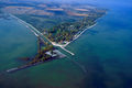 Howard Farms Beach and Cooley Canal on Lake Erie near Toledo, Ohio |
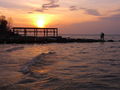
 Sunset over Lake Erie near Cleveland, Ohio |
 Sunset over Lake Erie near Cleveland, Ohio |
 Sunset from Avon Lake, Ohio |
 Lake Erie from space, looking from the west. Lake Ontario is to the upper-left, with Lake St. Clair and the southern tip of Lake Huron at center-left. |
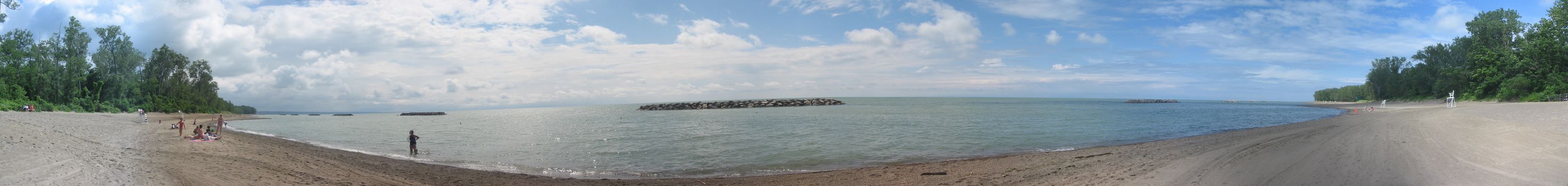
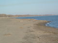 The shore of Lake Erie as seen from Long Point |
External links
- Lake Erie Islands Directory
- How many Islands are there in Lake Erie?
- EPA's Great Lakes Atlas
- Great Lakes Coast Watch
- Lake Erie Bathymetry - National Geophysical Data Center
|
|||||||||||||||||||||||||