Madison County, New York
| Madison County, New York | |
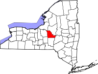 Location in the state of New York |
|
 New York's location in the U.S. |
|
| Founded | 1806 |
|---|---|
| Seat | Wampsville |
| Area - Total - Land - Water |
662 sq mi (1,715 km²) 656 sq mi (1,699 km²) 6 sq mi (16 km²), 0.86% |
| Population - (2000) - Density |
69,441 106/sq mi (41/km²) |
| Website | www.madisoncounty.org |
Madison County is a county located in the U.S. state of New York. As of the 2000 census, the population was 69,441. It is named after James Madison, fourth President of the United States of America. Its county seat is Wampsville.
Madison County is part of the Syracuse, NY Metropolitan Statistical Area.
Contents |
History
When counties were established in New York State in 1683, the present Madison County was part of Albany County. This was an enormous county, including the northern part of New York State as well as all of the present State of Vermont and, in theory, extending westward to the Pacific Ocean. This county was reduced in size on July 3, 1766 by the creation of Cumberland County, and further on March 16, 1770 by the creation of Gloucester County, both containing territory now in Vermont.
On March 12, 1772, what was left of Albany County was split into three parts, one remaining under the name Albany County. One of the other pieces, Tryon County, contained the western portion (and thus, since no western boundary was specified, theoretically still extended west to the Pacific). The eastern boundary of Tryon County was approximately five miles west of the present city of Schenectady, and the county included the western part of the Adirondack Mountains and the area west of the West Branch of the Delaware River. The area then designated as Tryon County now includes 37 counties of New York State. The county was named for William Tryon, colonial governor of New York.
In the years prior to 1776, most of the Loyalists in Tryon County fled to Canada. In 1784, following the peace treaty that ended the American Revolutionary War, the name of Tryon County was changed to Montgomery County in honor of the general, Richard Montgomery, who had captured several places in Canada and died attempting to capture the city of Quebec, replacing the name of the hated British governor.
In 1789, Montgomery County was reduced in size by the splitting off of Ontario County. The actual area split off from Montgomery County was much larger than the present county, also including the present Allegany, Cattaraugus, Chautauqua, Erie, Genesee, Livingston, Monroe, Niagara, Orleans, Steuben, Wyoming, Yates, and part of Schuyler and Wayne Counties.
Herkimer and Tioga Counties were two of three counties split off from Montgomery County (the other being Otsego County) in 1791.
Chenango County was formed in 1798 from parts of Tioga and Herkimer Counties.
Finally, Madison County was created from Chenango County in 1806.
Geography
According to the U.S. Census Bureau, the county has a total area of 662 square miles (1,713 km²), of which 656 square miles (1,699 km²) is land and 6 square miles (15 km²) (0.86%) is water.
Madison County is located in west central New York State, east of Syracuse, north of Binghamton, and slightly north of due west from Albany. Madison County contains the geographic center of the state at Pratts Hollow in the Town of Eaton.
Oneida Lake and Oneida Creek define part of the northern boundary. Chittenango Creek defines part of the western boundary.
Adjacent counties
Demographics
| Historical populations | |||
|---|---|---|---|
| Census | Pop. | %± | |
| 1810 | 25,144 |
|
|
| 1820 | 32,208 | 28.1% | |
| 1830 | 39,038 | 21.2% | |
| 1840 | 40,008 | 2.5% | |
| 1850 | 43,072 | 7.7% | |
| 1860 | 43,545 | 1.1% | |
| 1870 | 43,522 | −0.1% | |
| 1880 | 44,112 | 1.4% | |
| 1890 | 42,892 | −2.8% | |
| 1900 | 40,545 | −5.5% | |
| 1910 | 39,289 | −3.1% | |
| 1920 | 39,535 | 0.6% | |
| 1930 | 39,790 | 0.6% | |
| 1940 | 39,598 | −0.5% | |
| 1950 | 46,214 | 16.7% | |
| 1960 | 54,635 | 18.2% | |
| 1970 | 62,864 | 15.1% | |
| 1980 | 65,150 | 3.6% | |
| 1990 | 69,120 | 6.1% | |
| 2000 | 69,441 | 0.5% | |
| Est. 2007[1] | 69,829 | 0.6% | |
| Source[2] | |||
As of the census[3] of 2000, there were 69,441 people, 25,368 households, and 17,580 families residing in the county. The population density was 106 people per square mile (41/km²). There were 28,646 housing units at an average density of 44 per square mile (17/km²). The racial makeup of the county was 96.49% White, 1.32% African American, 0.52% Native American, 0.56% Asian, 0.01% Pacific Islander, 0.26% from other races, and 0.84% from two or more races. Hispanic or Latino of any race were 1.06% of the population. 16.1% were of German, 15.6% English, 15.5% Irish, 12.1% Italian and 8.0% American ancestry according to Census 2000. 95.6% spoke English and 1.9% Spanish as their first language.
There were 25,368 households out of which 33.60% had children under the age of 18 living with them, 55.10% were married couples living together, 9.70% had a female householder with no husband present, and 30.70% were non-families. 24.50% of all households were made up of individuals and 10.30% had someone living alone who was 65 years of age or older. The average household size was 2.55 and the average family size was 3.04.
In the county the population was spread out with 24.90% under the age of 18, 12.00% from 18 to 24, 27.60% from 25 to 44, 23.00% from 45 to 64, and 12.50% who were 65 years of age or older. The median age was 36 years. For every 100 females there were 96.30 males. For every 100 females age 18 and over, there were 93.80 males.
The median income for a household in the county was $40,184, and the median income for a family was $47,889. Males had a median income of $33,069 versus $25,026 for females. The per capita income for the county was $19,105. About 6.30% of families and 9.80% of the population were below the poverty line, including 10.50% of those under age 18 and 8.80% of those age 65 or over.
Much of Madison County is rural. However, Oneida and the other towns along NY Route 5 are suburbs of Syracuse and Utica, as is Cazenovia.
Cities, Towns, and Villages
- Bridgeport (hamlet)
- Brookfield (town)
- Canastota (village)
- Cazenovia (village)
- Cazenovia (town)
- Chittenango (village)
- DeRuyter (village)
- DeRuyter (town)
- Earlville (village)
- Eaton (town)
- Fenner (town)
- Georgetown (town)
- Hamilton (village)
- Hamilton (town)
- Lebanon (town)
- Lenox (town)
- Lincoln (town)
- Madison (village)
- Madison (town)
- Morrisville (village)
- Munnsville (village)
- Nelson (town)
- Oneida (city)
- Smithfield (town)
- Stockbridge (town)
- Sullivan (town)
- Wampsville (village)
- Label in parentheses indicates official political level
Note: in this context "town" refers to a political subdivision synonymous with township rather than a small city.
The towns in southern Madison County originated from the Twenty Townships ceded by the Oneida tribe to the State of New York.
Adjacent counties and areas
Chenango County is across the southern border. Onondaga and Cortland Counties form the western border. Otsego County forms a short boundary in the southeast corner of Madison County. Oneida County shares a long northeast border with Madison County. Oneida Lake is the northern border with part of Oswego County on the opposite shore.
Education
- Colgate University
- Cazenovia College
- State University of New York at Morrisville
- Brookfield Central School District
- Canastota Central School District
- Cazenovia Central School District
- Chittenango Central School District
- DeRuyter Central School
- Hamilton Central School District
- Madison Central School District
- Morrisville-Eaton Central School District
- Oneida City School District
- Stockbridge Valley Central School District
See also
References
- ↑ Population Estimates as of July 1, 2007 by U.S. Census Bureau
- ↑ New York State Department of Economic Development
- ↑ "American FactFinder". United States Census Bureau. http://factfinder.census.gov. Retrieved 2008-01-31.
External links
- Information on hotels, B&B's, Country Inns and attractions in Madison County
- Barbagallo, Tricia (June 1, 2005). "Black Beach: The Mucklands of Canastota, New York" (PDF). http://www.archives.nysed.gov/apt/magazine/MagSummer05FeatureArticle_000.pdf. Retrieved 2008-06-04.
- Madison County, NY
- Madison County at the Open Directory Project
- Brief history of Madison County
- Early Madison County history
- Historical summaries of Madison County history, maps, photos
 |
Oswego County | Oneida County | |
|
| Onondaga County | ||||
| Cortland County | Chenango County | Otsego County |
|
||||||||||||||||||||||||||
|
|||||||||||||||||