Nashua, New Hampshire
| Nashua, New Hampshire | |||
|---|---|---|---|
| — City — | |||
 |
|||
|
|||
| Nickname(s): Gate City | |||
 |
|||
| Coordinates: | |||
| Country | United States | ||
| State | New Hampshire | ||
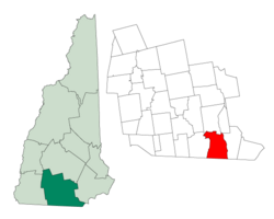
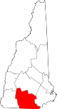
| County | Hillsborough | ||
| Incorporated | 1746 | ||
| Government | |||
| - Mayor | Donnalee Lozeau | ||
| Area | |||
| - Total | 31.8 sq mi (82.5 km2) | ||
| - Land | 30.9 sq mi (80.0 km2) | ||
| - Water | 0.9 sq mi (2.5 km2) 2.98% | ||
| Elevation | 151 ft (46 m) | ||
| Population (2007) | |||
| - Total | 86,837 | ||
| - Density | 2,810.3/sq mi (1,085.5/km2) | ||
| Time zone | Eastern (UTC-5) | ||
| - Summer (DST) | Eastern (UTC-4) | ||
| ZIP codes | 03060-03064 | ||
| Area code(s) | 603 | ||
| FIPS code | 33-50260 | ||
| GNIS feature ID | 0868677 | ||
| Website | www.nashuanh.gov | ||
Nashua is a city in Hillsborough County, New Hampshire, USA. As of the 2000 census, Nashua had a total population of 86,605[1], making it the second largest city in the state (and in the three northern New England states) after Manchester (pop. 107,219). The estimated population of Nashua in 2007 was 87,150.[2]
Built around the now-departed textile industry, in recent decades it has been swept up in southern New Hampshire's economic expansion as part of the Boston region. Nashua was twice named "Best Place to Live in America" in annual surveys by Money magazine.[3] It is the only city to get the No. 1 ranking two times—in 1987 and 1997. In 2007, the Morgan Quitno Press ranked Nashua as the 27th safest city in the country.
Contents |
History
The area was part of a 200-square-mile (520 km2) tract of land in Massachusetts called Dunstable, which had been awarded to Edward Tyng of Dunstable, England. Nashua lies approximately in the center of the original 1673 grant. When New Hampshire separated from Massachusetts in 1741, the state line between them was redrawn. As a consequence, the township of Dunstable was divided in two. Tyngsboro and some of Dunstable remained in Massachusetts, while Dunstable, New Hampshire was incorporated in 1746 from the northern section of the town.
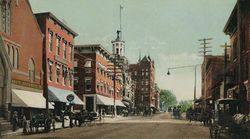
Located at the confluence of the Nashua with the Merrimack River, Dunstable was first settled about 1655 as a fur trading town. But like many 19th century riverfront New England communities, it would be developed during the Industrial Revolution with textile mills operated from water power. By 1836, the Nashua Manufacturing Company had built three cotton mills which produced 9.3 million yards of cloth annually on 710 looms. On December 31, 1836, Dunstable was renamed Nashua after the Nashua River by a declaration of the New Hampshire legislature. The Nashua River was named by the Nashuway Indians, and in the Penacook language it means "beautiful stream with a pebbly bottom."[4] The town split in two for eleven years following a tax dispute in 1842 between the area north of the Nashua River, where most of the wealthy lived, and the area south of the river. During that time the northern area called itself Nashville, while the southern part kept the name Nashua. They would eventually reconcile and join together to charter the city of Nashua in 1853. Six railroad lines crossed the mill town, with 56 trains entering and departing daily before the American Civil War.
Like the rival Amoskeag Manufacturing Company upriver in Manchester, the Nashua Manufacturing Company prospered until about World War I, after which it began a slow decline. Water power was replaced with newer forms of energy to run factories. Cotton could be manufactured into fabric where it grew, saving transportation costs. The textile business started moving to the South during the Great Depression, with the last mill closing in 1949. Many citizens were left unemployed. But then Sanders Associates, a newly created defense firm that is now part of BAE Systems, moved into one of the closed mills and launched the city's rebirth. Sam Tamposi is credited with much of the city's revival. The arrival of Digital Equipment Corp. (now part of Hewlett-Packard) in the 1970s made the city part of the Boston-area high-tech corridor.
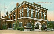
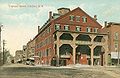 Tremont House c. 1908 |
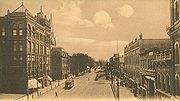
 Canal St. Bridge, c. 1908 |
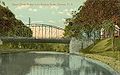
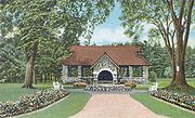
 The Willows, c. 1910; the road is now Route 101A near Somerset Plaza |
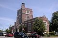 Hunt Memorial Library in 2006 |
Notable residents
- James Collins, MacArthur fellow and professor of Biomedical Engineering at Boston University
- John G. Foster, Union Army general during the Civil War
- Jeff Giuliano, ice hockey player
- Michael Graziadei, film and television actor, plays Daniel Romalotti on The Young and the Restless
- Judd Gregg, U.S. senator
- Randy Harrison, actor
- Jack Kerouac, writer - summered at grandparent's Vine Street home
- Ray LaMontagne, folk singer
- Greg Landry, football player
- Jennifer Lavoie, Playboy Playmate
- Paul Michael Levesque (Triple H), professional WWE wrestler
- Walter Long, actor
- John Lovewell, Jr., soldier and early explorer
- Alvin Lucier, composer
- Roujet D. Marshall, justice, Wisconsin Supreme Court
- Mandy Moore, singer
- Jared Nathan, actor
- Mike O'Malley, actor, TBS series Yes, Dear
- Rico Petrocelli, shortstop and third baseman for the Boston Red Sox, 1963–1976
- Ted Phillips, CEO of the Chicago Bears
- John Roper, pitcher for the Cincinnati Reds, 1993
- Alexandra Socha, Broadway actress
- Birdie Tebbetts, Major League Baseball catcher, scout, and manager
Geography
Nashua is located at (42.751038, -71.480817).[5]
According to the United States Census Bureau, the city has a total area of 31.8 square miles (82.4 km2), of which 30.9 sq mi (80.0 km2) is land and 0.9 sq mi (2.3 km2) is water, comprising 2.98% of the city. The eastern boundary of Nashua is formed by the Merrimack River, and the city is drained by the Nashua River and Salmon Brook, tributaries of the Merrimack. The Nashua River roughly bisects the city. The highest point in Nashua is Long Hill in the southern part of the city, at 418 feet (127 m) above sea level.
Neighboring cities and towns
The city is bordered on the east by the Merrimack River, across which lies the town of Hudson, New Hampshire.
 |
Amherst | Merrimack | Litchfield | |
| Hollis | Hudson | |||
| Pepperell, Massachusetts | Dunstable, Massachusetts | Tyngsborough, Massachusetts |
Climate
| Climate data for Nashua, NH | |||||||||||||
|---|---|---|---|---|---|---|---|---|---|---|---|---|---|
| Month | Jan | Feb | Mar | Apr | May | Jun | Jul | Aug | Sep | Oct | Nov | Dec | Year |
| Average high °F (°C) | 33 (0.6) |
37 (2.8) |
45 (7.2) |
57 (13.9) |
69 (20.6) |
78 (25.6) |
83 (28.3) |
81 (27.2) |
72 (22.2) |
61 (16.1) |
50 (10) |
38 (3.3) |
58.67 (14.817) |
| Average low °F (°C) | 12 (-11.1) |
15 (-9.4) |
24 (-4.4) |
34 (1.1) |
45 (7.2) |
54 (12.2) |
59 (15) |
57 (13.9) |
49 (9.4) |
37 (2.8) |
29 (-1.7) |
18 (-7.8) |
36.08 (2.267) |
| Precipitation inches (mm) | 3.86 (98) |
3.09 (78.5) |
4.07 (103.4) |
3.92 (99.6) |
3.66 (93) |
3.91 (99.3) |
3.7 (94) |
3.78 (96) |
3.63 (92.2) |
3.93 (99.8) |
4.17 (105.9) |
3.71 (94.2) |
45.43 (1,153.9) |
| Source: The Weather Channel[6] | |||||||||||||
Demographics
As of the census[7] of 2000, there were 86,605 people, 34,614 households, and 22,083 families residing in the city. The population density was 2,803.5 people per square mile (1,082.5/km2). There were 35,387 housing units at an average density of 1,145.5/sq mi (442.3/km2). The racial makeup of the city was 89.25% White, 2.01% African American, 0.32% Native American, 3.88% Asian, 0.03% Pacific Islander, 3.05% from other races, and 1.46% from two or more races. Hispanic or Latino of any race were 6.22% of the population.
There were 34,614 households out of which 31.6% had children under the age of 18 living with them, 49.3% were married couples living together, 10.4% had a female householder with no husband present, and 36.2% were non-families. 28.3% of all households were made up of individuals and 8.7% had someone living alone who was 65 years of age or older. The average household size was 2.46 and the average family size was 3.05.
In the city the population was spread out with 24.7% under the age of 18, 8.1% from 18 to 24, 33.5% from 25 to 44, 22.2% from 45 to 64, and 11.6% who were 65 years of age or older. The median age was 36 years. For every 100 females there were 97.6 males. For every 100 females age 18 and over, there were 95.2 males.
The median income for a household in the city was $51,969, and the median income for a family was $61,102. Males had a median income of $43,893 versus $29,171 for females. The per capita income for the city was $25,209. About 5.0% of families and 6.8% of the population were below the poverty line, including 8.7% of those under age 18 and 6.4% of those age 65 or over.
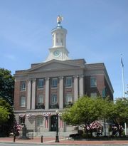
Government
The city's government is headed by a mayor and fifteen aldermen: six at-large aldermen elected three at a time every four years, and nine ward aldermen, one for each ward in the city, elected every two years.
In the New Hampshire General Court, Nashua is represented in the House by Hillsborough County's 20th (Ward 1), 21st (Ward 2), 22nd (Ward 3), 23rd (Ward 4), 24th (Ward 6), 25th (Ward 7) and 26th (Wards 5, 8 and 9) districts and in the Senate by District 12 (Wards 1, 2, 5 and 9, shared with Hollis, Mason, and Brookline) and District 13 (Wards 3, 4, 6, 7, and 8).
Economy
Nashua's downtown is a regional commercial, entertainment, and dining destination. Recent plans have incorporated the Nashua River into the design of a pedestrian-friendly walkway. The Nashua Riverwalk is a large, public/private venture funded through the use of Tax Increment Financing (TIF).
The large commercial districts located on Amherst Street (Route 101A) and Daniel Webster Highway are shopping havens, with the one at Daniel Webster Highway, including the Pheasant Lane Mall, attracting many people from Massachusetts taking advantage of the nonexistence of sales tax in New Hampshire.
The city is home to a number of technical firms, including Nashua Corporation, which took its name from the city and river. Nashua Corp. was a leading producer of floppy disks through the early 1990s, making the Nashua name well-known in the world of personal computers.
Defense contractor BAE Systems (formerly Sanders Associates), computer firm Hewlett-Packard, and software company Oracle Corporation are the largest representatives of the high-tech industry prominent in the region. The Boston Air Route Traffic Control Center is located in Nashua.
Transportation

The Everett Turnpike is the major highway running through the city. U.S. Route 3 follows the turnpike from the Massachusetts border north to exit 7E, where it branches to the northeast along the two-lane Henri A. Burque Highway to Concord Street and then heads north into the town of Merrimack. Nashua Municipal Airport (Boire Field), a general aviation facility, is in the city's northwest corner. Public transportation is provided by the Nashua Transit System, which runs a bus line. Efforts are being made to extend the Massachusetts Bay Transportation Authority's commuter rail Lowell Line from Lowell to Nashua.
Maps of the Nashua area often show a stretch of freeway forming a circumferential highway through Nashua and the neighboring town of Hudson. Only a small section of the south end of this highway (Exit 2 off U.S. Route 3) has been built, and it is unclear whether the highway will ever be completed. If finished, the Nashua-Hudson Circumferential Highway would be part of the Everett Turnpike, and would rejoin the mainline highway at a hypothetical Exit 9 in northern Nashua.
Boston Express, a subsidiary of Concord Trailways operates a Nashua-Boston bus line that runs out of the Nashua Welcome Center off of Exit 6 on the Everett Turnpike. This bus line transports passengers to South Station and Logan International Airport in Boston. [1]
Media
The city has a daily newspaper, the Nashua Telegraph, which is printed in neighboring Hudson, New Hampshire. Nashua also has two weekly newspapers, The Broadcaster and The Hippo. Nashua radio stations include WGHM 900 AM (FOX Sports Radio), talk WSMN 1590 AM, back on the air after going dark in January 2005, and 106.3 WFNQ, a classic hits station owned by Nassau Broadcasting Partners. WEVS 88.3 and 90.3 serve as the stations for New Hampshire Public Radio. One television station is licensed to Nashua: WYCN-LP, a low power, community-based television station branded as tv13 Nashua, with studios located at Rivier College.
Education
In the 2000 U.S Census, 22,700 residents over age three were enrolled in a Nashua educational institution, approximately a fourth of the city.[8]
Secondary schools
In 2005, Nashua's public high school was split into Nashua High School South (home of the Purple Panthers, opened in 1976 and rebuilt/reopened in 2004) and the new Nashua High School North (home of the Titans, opened in 2002) off Broad Street.
The city has two private religious high schools: Bishop Guertin High School, a coeducational Catholic high school, and Nashua Christian Academy, a coeducational K-12 Christian school.
Mount Saint Mary Seminary, a high school for girls, merged with Bishop Guertin High School (formerly all-boys) in the fall of 1992, forming a single, expanded co-ed school.
Before Nashua High School (now Nashua High School South) opened in 1976, what is now Elm Street Middle School was the city's high school. With the new high school opening in 1976, the old high school became Elm Street Junior High School. In 2005, the school became Elm Street Middle School, after a city-wide reorganization of grades: Nashua's elementary schools went from [K]-1-6 to [K]-1-5, and junior high schools serving grades 7-9 were replaced by middle schools serving grades 6-8. Elm Street is still commonly referred to as Elm St. Junior High by many city residents and officials.
Middle schools
- Elm Street Middle School
- Fairgrounds Middle School
- Pennichuck Middle School
- Phoenix Program
- Christian Bible Church Academy
- Nashua Christian Academy
- Nashua Catholic Regional Junior High School
Elementary schools
|
|
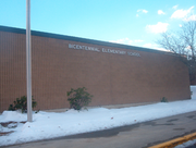
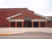
Bicentennial Elementary School
|
Colleges
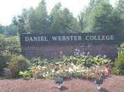
Nashua is not considered a college town compared to locales such as Durham, New Hampshire, but as of 2006 the city has 5,000 students enrolled at six colleges: Daniel Webster College, Nashua Community College, Rivier College, Hesser College Nashua campus, Southern New Hampshire University Nashua campus, and Franklin Pierce University Nashua campus.
Sports
Nashua has had a series of professional baseball teams, though no team plays in the city as of 2010. The Nashua Pride, a Can-Am minor league baseball team, played at Holman Stadium from 1998 through 2008, then changed to the American Defenders of New Hampshire in the 2009 season. The Defenders were evicted from the venue in August 2009, however, because of non-payment of rent, and moved to Pittsfield, Massachusetts to become the Pittsfield Colonials. Before the Pride, Holman was the home stadium for the independent Nashua Hawks; the AA Nashua Pirates; the AA Nashua Angels; and the A Nashua Dodgers, the first racially integrated professional baseball team in the 20th century.[9]
In collegiate sports, Nashua is home to the Daniel Webster College Eagles and Rivier College Raiders, who compete in the Great Northeast Athletic Conference or GNAC.
The Spartans Drum and Bugle Corps (1997, 1998, 2004, and 2007 Drum Corps International Division II World Champions) are based in Nashua.
Popular culture
A few episodes of TV show The Office were set in a fictional Nashua branch of Dunder Mifflin. An episode of MTV's MADE was filmed in 2004 at Nashua High School North.
See also
- Citizens Action for Southern New Hampshire
- Mine Falls Park
- Nashua River Rail Trail
- City Arts Nashua
- Greater Nashua Habitat for Humanity
References
- ↑ "Nashua city, New Hampshire - Population Finder - American FactFinder", December 2006
- ↑ ""2007 Population Estimates of New Hampshire Cities and Towns"" (PDF). NH Office of Energy and Planning. June 2008. http://www.nh.gov/oep/programs/DataCenter/Population/documents/2007_population_estimates.pdf. Retrieved 2008-06-03.
- ↑ "Not the best, but not too shabby", Nashua Telegraph, July 18, 2006.
- ↑ NashuaHistory.com
- ↑ "US Gazetteer files: 2000 and 1990". United States Census Bureau. 2005-05-03. http://www.census.gov/geo/www/gazetteer/gazette.html. Retrieved 2008-01-31.
- ↑ "Monthly Averages for Nashua, NH". Weather.com. 2010. http://www.weather.com/outlook/health/allergies/wxclimatology/monthly/USNH0156. Retrieved 2010-08-18.
- ↑ "American FactFinder". United States Census Bureau. http://factfinder.census.gov. Retrieved 2008-01-31.
- ↑ "Profile of Selected Social Characteristics. 2000", U.S. Census Bureau, Census 2000 Summary File 3 (SF 3) - Sample Data.
- ↑ Gray, Kevin (2005-10-06). "Don Newcombe diversity dinner speaker Jan. 16". New Hampshire Cultural Diversity Awareness Council. http://www.nhcdac.org/news/baseball_MLK2006.asp. Retrieved 2007-10-20. "As members of the Nashua Dodgers, Campanella and Newcombe were the first professional, African-American baseball players to compete on a racially integrated U.S. team in the 20th century."
External links
- City of Nashua, New Hampshire Official Website
- History of Nashua, New Hampshire
- Nashua Historical Society
- Nashua Public Library
- Nashua Regional Planning Commission
- New Hampshire Economic and Labor Market Information Bureau Profile
|
|||||||||||||||||
|
|||||||||||||||||||||||