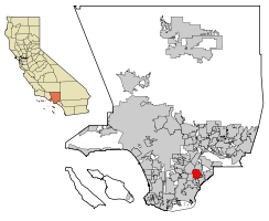
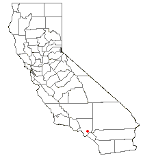
Norwalk, California
| City of Norwalk | |||
|---|---|---|---|
| — City — | |||
|
|||
 |
|||
| Coordinates: | |||
| Country | United States | ||
| State | California | ||
| County | Los Angeles | ||
| Incorporated | August 26, 1957 | ||
| Government | |||
| - Type | Charter City, Council-Manager |
||
| - City Council | Gordon Stefenhagen (mayor) Jesse M. Luera (vice-mayor) Mike Mendez Rick Ramirez Cheri Kelley |
||
| - City Manager | Ernie V. Garcia | ||
| - Finance Director/ Treasurer | Raul Romero |
||
| - City Clerk | Theresa Devoy | ||
| Area | |||
| - Total | 9.35 sq mi (24.2 km2) | ||
| - Land | 9.35 sq mi (24.2 km2) | ||
| - Water | 0.1 sq mi (0.1 km2) 0.51% | ||
| Elevation | 92 ft (28 m) | ||
| Population (2000) | |||
| - Total | 103,298 | ||
| - Density | 10,667.6/sq mi (4,120.2/km2) | ||
| U.S. Census, 2000 | |||
| Time zone | PST (UTC-8) | ||
| - Summer (DST) | PDT (UTC-7) | ||
| ZIP code | 90650-90652, 90659 | ||
| Area code(s) | 562 | ||
| FIPS code | 06-52526 | ||
| GNIS feature ID | 1661123 | ||
| Website | ci.norwalk.ca.us | ||
Norwalk is a suburban city in Los Angeles County, California, United States. The population was 103,298 at the 2000 census. In 2009 the population was 107,698. Founded in the late 1800s, Norwalk was incorporated in as a city in 1957. It is located 17 miles (27 km) southeast of downtown Los Angeles, and 12 miles (19 km) northwest of Garden Grove.
Norwalk operates under a Council/Manager form of government, established by the Charter of the City of Norwalk which was drafted in 1957. The five-member City Council acts as the City's chief policy-making body. Every two years, Councilmembers are elected by the citizens of Norwalk to serve four-year, overlapping terms. Councilmembers are not limited to the number of terms they may serve. The Mayor is selected by the Council and serves a one-year term.
Norwalk is a member of the Gateway Cities Council of Governments. Norwalk's sister cities are Hermosillo, Sonora and Fresnillo, Zacatecas in Mexico.
Contents |
Geography
Norwalk is located at (33.906914, -118.083398).[1]
According to the United States Census Bureau, the city has a total area of 24.2 km2 (9 sq mi). 24.2 km² (9.35 mi²) of it is land and 0.1 km² (0.5 mi²) of it (0.60%) is water.
Norwalk is bordered by Downey on the Northwest, Bellflower on the Southwest, Cerritos and Artesia on the South, and Santa Fe Springs on the North and East.
Climate
Norwalk, like the rest of the Los Angeles basin is well-known for its year-round pleasant weather:
-On average, the warmest month is August.
-The highest recorded temperature was 111°F in 1961.
-On average, the coolest month is January.
-The lowest recorded temperature was 25°F in 1963.
-The maximum average precipitation occurs in February.
Norwalk has a Mediterranean climate or Dry-Summer Subtropical (Köppen climate classification Csb on the coast, Csa inland), enjoying plenty of sunshine throughout the year, with an average of 263 sunshine days and only 35 days with measurable precipitation annually.[2]
| Norwalk, California | ||||||||||||||||||||||||||||||||||||||||||||||||||||||||||||
|---|---|---|---|---|---|---|---|---|---|---|---|---|---|---|---|---|---|---|---|---|---|---|---|---|---|---|---|---|---|---|---|---|---|---|---|---|---|---|---|---|---|---|---|---|---|---|---|---|---|---|---|---|---|---|---|---|---|---|---|---|
| Climate chart () | ||||||||||||||||||||||||||||||||||||||||||||||||||||||||||||
|
||||||||||||||||||||||||||||||||||||||||||||||||||||||||||||
|
||||||||||||||||||||||||||||||||||||||||||||||||||||||||||||
The period of April through November is warm to hot and dry with average high temperatures of 71 - 79°F and lows of 50 - 62°F. Due to the moderating effect of the ocean, temperatures are cooler than more inland areas of Los Angeles, where temperatures frequently exceed 90°F (32°C) and occasionally reach 100°F (38°C).
The period of November through March is somewhat rainy, as shown in the table to the left.[3]
The Los Angeles area is also subject to the phenomena typical of a microclimate. As such, the temperatures can vary as much as 18°F (10°C) between inland areas and the coast, with a temperature gradient of over one degree per mile (1.6 km) from the coast inland. California also has a weather phenomenon called "June Gloom or May Grey", which sometimes brings overcast or foggy skies in the morning on the coast, but usually is followed by sunny skies by noon during late spring and early summer.
The Los Angeles region averages 15 inches (385 mm) of precipitation annually, which mainly occurs during the winter and spring (November through April) with generally light rain showers, but sometimes as heavy rainfall and thunderstorms. Coastal areas receive slightly less rainfall, while the mountains receive slightly more. Snowfall is extremely rare in the city basin, but the mountains within city limits typically receive snowfall every winter. The greatest snowfall recorded in downtown Los Angeles was 2 inches (5 cm) in 1932.[4][5]
Demographics
As of the census[6] of 2000, there were 103,298 people, 26,887 households, and 22,531 families residing in the city. The population density was 4,120.2/km² (10,667.6/mi²). There were 27,554 housing units at an average density of 1,099.0/km² (2,845.5/mi²). The racial makeup of the city was 44.82% White, 4.62% African American, 1.16% Native American, 11.54% Asian, 0.39% Pacific Islander, 32.75% from other races, and 4.71% from two or more races. Hispanic or Latino of any race were 62.89% of the population.
There were 26,887 households out of which 46.6% had children under the age of 18 living with them, 60.1% were married couples living together, 16.6% had a female householder with no husband present, and 16.2% were non-families. 12.7% of all households were made up of individuals and 5.8% had someone living alone who was 65 years of age or older. The average household size was 3.79 and the average family size was 4.08.
In the city the population was spread out with 32.1% under the age of 18, 10.7% from 18 to 24, 30.5% from 25 to 44, 17.6% from 45 to 64, and 9.0% who were 65 years of age or older. The median age was 30 years. For every 100 females there were 97.9 males. For every 100 females age 18 and over, there were 94.3 males.
The median income for a household in the city was $46,047, and the median income for a family was $47,524. Males had a median income of $31,579 versus $26,047 for females. The per capita income for the city was $14,022. About 9.5% of families and 11.9% of the population were below the poverty line, including 14.8% of those under age 18 and 7.6% of those age 65 or over.
Government and infrastructure
Local government
According to the city’s most recent Comprehensive Annual Financial Report, the city’s various funds had $78.2 million in Revenues, $79.1 million in Expenditures, $107.2 million in Total Assets, $48.7 million in Total Liabilities, and $54.8 million in Cash and Investments.[7]
The structure of the management and coordination of city services is:[8]
| Department | Director |
|---|---|
| City Manager | Ernie V. Garcia |
| Assistant City Manager | Thomas E. Lynch |
| Director of Finance/City Treasurer | Vacant |
| Director of Transportation | James C. Parker |
| Director of Community Development | Kurt Anderson |
| Director of Personnel/Risk Manager | Ernie Hernandez |
| Director of Public Services | Gary DiCorpo |
| Director of Recreation and Park Services | Toni Tucker |
| Director of Public Safety | Kevin Gano |
| Director of Social Services | Tak Hamabata |
| City Clerk | Theresa Devoy |
Law enforcement
Norwalk is currently a contract city, in which the Los Angeles County Sheriff's Department provides police services. It maintains its own station, which also provides police services to La Mirada and unincorporated South Whittier. At one time the station also provided contracted police services to Santa Fe Springs, but those services ended when the city entered into a contract with the Whittier Police Department. The station is staffed with 206 sworn personnel. The Joint Regional Drug Intelligence Center and Joint Regional Intelligence Center, which has a counter-terrorism focus, are located in a large commercial building at 12440 East Imperial Highway.
Registrar/Recorder
Norwalk is the home of the Los Angeles County Registrar/Recorder. The Los Angeles County Registrar's Office is responsible for the registration of voters, maintenance of voter files, conduct of federal, state, local and special elections and the verification of initiative, referendum and recall petitions. There are approximately 4.1 million registered voters, and 5 thousand voting precincts established for countywide elections. The office also has jurisdiction over marriage license issuance, the performance of civil marriage ceremonies, fictitious business name filings and indexing, qualification and registration of notaries and miscellaneous statutory issuance of oaths and filings. The office issues approximately 75,000 marriage licenses and processes 125,000 fictitious business name filings annually. The Recorder's Office is responsible for recording legal documents which determine ownership of real property and maintains files of birth, death and marriage records for Los Angeles County. It serves the public and other County departments such as the Assessor, Health Services, Public Social Services and Regional Planning. The office processes 2 million real and personal property documents and 750,000 birth, death and marriage records annually and services approximately 2,000 customers daily.
County, state, and federal representation
In the state legislature Norwalk is located in the 30th Senate District, represented by Democrat Ronald S. Calderon, and in the 56th Assembly District, represented by Democrat Tony Mendoza. Federally, Norwalk is located in California's 38th congressional district, which has a Cook PVI of D +20[9] and is represented by Democrat Grace Napolitano.
The Los Angeles County Department of Health Services operates the Whittier Health Center in Whittier, serving Norwalk.[10]
The United States Postal Service operates the Norwalk Post Office at 14011 Clarkdale Avenue and the Paddison Square Post Office at 12415 Norwalk Boulevard.[11][12]
Superior Court
The Southeast District of the Los Angeles County Superior Court is located in Norwalk.
Metropolitan State Hospital
The 162-acre Metropolitan State Hospital, a psychiatric and mental health facility operated by the California Department of Mental Health, is located in Norwalk.
Transportation
Freeways
Norwalk has no fewer than 4 freeways that cross into city boundaries. The Santa Ana Freeway (I-5) and San Gabriel River Freeway (I-605) intersect at its northern edge, while the Century Freeway (I-105) terminates at the San Gabriel River Freeway at the city's western edge. The Artesia Freeway (SR 91) runs just south of the city's southern border in the communities of Cerritos and Artesia.
Cerritos On Wheels (COW)
COW [1] buses provide service to Cerritos College with routes connecting to the Cerritos Towne Center, Cerritos Center for the Performing Arts, Cerritos Millennium Library, Los Cerritos Center and several other stops in neighboring Cerritos.
Norwalk Transit
Norwalk Transit serves Norwalk and its adjacent communities. Currently there are 8 different bus lines operating in Norwalk and adjacent cities.
Long Beach Transit
Long Beach Transit provides service to the Metro Green Line Station via Studebaker Road from Long Beach.
Los Angeles Metro
The Los Angeles MTA ("Metro") provides both bus and rail service from Norwalk. The Metro Green Line light rail line provides service from the Norwalk Green Line station to LAX (via shuttle from Aviation Station) and Redondo Beach. Metro bus routes provide service to the west on Florence, Firestone, Imperial, and Rosecrans Blvd. from the Norwalk Green Line Station. Express routes also connect to Disneyland, El Monte Bus Station, Long Beach and downtown Los Angeles.
Metrolink
The Metrolink Orange County Line and 91 Line (which operate on the same track in this area) trains connect Norwalk (the Norwalk/Santa Fe Springs station) with Orange County, Riverside County, and Downtown Los Angeles.
History
The area known as "Norwalk" was first home to the Shoshonean Native American tribe. They survived primarily on honey, an array of berries, acorns, sage, squirrels, rabbits and birds. Their huts were part of the Sejat Indian village.
In the late 1760s, settlers and missions flourished under Spanish rule with the famous El Camino Real trail traversing the area. Manuel Nieto, a Spanish soldier, received a Spanish land grant (Rancho Los Nietos) in 1784 that included Norwalk.
After the Mexican-American War in 1848, the Rancho and mining days ended. Portions of the land were subdivided and made available for sale when California was admitted into the union of the United States. Word of this land development reached the Sproul Brothers in Oregon. They recalled the fertile land and huge sycamore trees they saw during an earlier visit to the Southern California area. In 1869, Atwood Sproul, on behalf of his brother, Gilbert, purchased 463 acres (1.9 km²) of land at $11 an acre ($2700/km²) in an area known as Corazon de los Valles, or "Heart of the Valleys."
By 1873, railroads were being built in the area and the Sprouls deeded 23 acres (93,000 m²) stipulating a "passenger stop" clause in the deed. Three days after the Anaheim Branch Railroad crossed the "North-walk" for the first time, Gilbert Sproul surveyed a town site. In 1874, the name was recorded officially as Norwalk. While a majority of the Norwalk countryside remained undeveloped during the 1880s, the Norwalk Station allowed potential residents the opportunity to visit the "country" from across the nation.
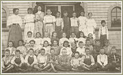
What are known as the "first families" to Norwalk (including the Sprouls, the Dewitts, the Settles, and the Orrs) settled in the area in the years before 1900. D.D. Johnston pioneered the first school system in Norwalk in 1880. Johnston was also responsible for the first real industry in town, a cheese factory, by furnishing Tom Lumbard with the money in 1882. Norwalk's prosperity was evident in the 1890s with the construction of a number of fine homes that were located in the middle of orchards, farms and dairies. Headstones for these families can be found at Little Lake Cemetery, which was founded in 1843 on the border between Norwalk and Santa Fe Springs at Lakeland Road.
At the turn of the century, Norwalk had become established as a dairy center. Of the 50 local families reported in the 1900 census, most were associated with farming or with the dairy industry. Norwalk was also the home of some of the largest sugar beet farms in all of Southern California during this era. Many of the dairy farmers who settled in Norwalk during the early part of the twentieth century were Dutch.
After the 1950s, the Hispanic population in Norwalk grew significantly as the area became increasingly residential. In the 1990s, Norwalk gained a significant Asian population from families priced out of wealthier neighboring Cerritos and communities in Orange County.
Airplane disaster
In February 1958, two military aircraft, a Douglas C-118 A military transport and a U.S. Navy P2V-5F Neptune patrol bomber, collided over Norwalk at night. 47 servicemen were killed as well as a civilian 23-year-old woman on the ground who was hit by falling debris. A plaque commemorating the disaster erected by the American Legion in 1961 marks the spot of the accident, today a mini-mall at the corner of Firestone Boulevard and Pioneer Boulevard.
The Hargitt House
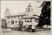
Built in 1891 by the D. D. Johnston family, the Hargitt House was built in 1891 in the architectural style of Victorian Eastlake. The Hargitt House Museum, located at 12426 Mapledale, was donated to the people of Norwalk by Charles ("Chun") and Ida Hargitt. The Museum is open on the first and third Saturday of the month from 1:00 p.m. to 4:00 p.m.
Recent Events
More recently though the city has been heavily influenced by gang violence, mostly centered in the south and central parts of the city leading to many shoot outs in the barrio, one-ways, and circle.
Emergency services
Fire protection in Norwalk is provided by the Los Angeles County Fire Department with ambulance transport by Care Ambulance Service.
The Los Angeles County Sheriff's Department operates the Norwalk Station in Norwalk.[13]
Economy
In 1997 Eva Air moved its United States headquarters to Norwalk from the San Pedro area of Los Angeles.[14]
Education
Norwalk is home to Cerritos College. Founded in 1955, Cerritos College is a public community college serving an area of 52 square miles (130 km2) of southeastern Los Angeles county. The college offers degrees and certificates in 87 areas of study in nine divisions. Over 1,200 students complete their course of studies each year.
Norwalk is served by the Norwalk-La Mirada Unified School District, headquartered at 12820 Pioneer Blvd., Norwalk, CA 90650 as well as the Little Lake City Elementary School District, headquartered at 10515 S. Pioneer Blvd., Santa Fe Springs, CA 90670. Certain areas of West Norwalk are served by the ABC Unified School District, located at 16700 Norwalk Blvd., Cerritos, CA 90703. Among the several parochial schools in Norwalk are Saint John of God School (Roman Catholic), Pioneer Baptist School (Baptist Christian), and Saint Linus School (Roman Catholic). It also contains The California distinguished school J.B. Morrison Elementary
Famous Residents of Norwalk
- Tiffany Darwish, 80's Teen Idol
- Poncho Sanchez, Latin jazz artist
- Pat Nixon Wife of President Richard M. Nixon; Excelsior High School Class of 1929 (Family bought a Truck Farm in Dairy Valley, formerly in Artesia, but now part of Cerritos)
- James Gattuso Analyst and pundit now in Washington, DC who often appears on television and radio to give opinions on domestic policy; Excelsior High School Class of 1975
- Cindy Sheehan, anti-Iraq War activist
- Bob Kevoian Radio Host "The Bob & Tom Show" Norwalk High Class of 1969
- Gene Taylor (musician) acclaimed blues-rock and Boogie Woogie pianist. Norwalk High Class of 1970
- Nikki Schieler Ziering, Playboy Playmate, actress and Ian Ziering's ex-wife
- William Conrad, Graduate of Excelsior High School; Actor, director and producer in film and television (b. 1920, d. 1994)
- Alexandra Nechita, Artist, considered the youngest cubist ever discovered (at the age of 8) and nicknamed "petite Picasso". Attended Moffit Elementary School prior to her fame when she relocated outside of Norwalk.
- Shirley Babashoff, Norwalk High School graduate, 1973 and Olympic Swim Team, 1972 and 1976.
- Dick Bass, born Richard Lee Bass, played professional football as a running back for the Los Angeles Rams from 1960 through 1969.
- Richard Brown Major League Baseball Player Los Angeles Dodgers 1990-93 Oakland Athletics 1993-96
- Keith Ginter, MLB player for the Houston Astros, Milwaukee Brewers, and the Oakland Athletics.
- Ray Herrera Born Ramon Herrera. Norwalk High graduate 1987. signed as a undrafted free agent in 1988. Played Baseball for the SD Padres and Oakland Athletics.
- Hector Ramirez Raised in Norwalk and graduate of John Glenn High School (1995). Commonly known as Sick Dog
- Monico Enriquez Successful wrestling coach, graduate of John Glen 1995, Coached high school and college students to national careers.
Movies & TV Shows filmed in Norwalk
- The Postman Always Rings Twice - (1946) Includes scene filmed on location at the Norwalk train depot near Front Street and Funston Avenue
- Square Pegs (1982) - Filmed at Excelsior High School
- Grease 2 (1982) - Mostly filmed at Excelsior High School
- High School U.S.A. (1983) - Filmed at Excelsior High School
- Suburbia (1984) - Streetscape in the Interstate 105/605 area
- The Karate Kid (1984) - Golf 'N' Stuff
- Things to Do in Denver When You're Dead (1995) - Outside scenes filmed at Keystone Lanes, a bowling alley on Imperial Highway
- Brüno (2009) - Civil Marriage Scene filmed at the LA County Registrar-Recorder/County Clerk Building.
- Best Men (1997) - Mostly filmed on Front Street
- Another Day in Paradise (1989) - Locations include both Front Street and Firestone Boulevard
- Life (1999) - Scene filmed at Greyhound bus station on Front Street
- Corvette Summer (1978) - Scene filmed outside of what was then the Golden West Ballroom on Studebaker between Imperial Highway and Firestone Boulevard
- Heroes (TV series, 2007) - Scene filmed at Greyhound bus station on Front Street at San Antonio Boulevard
- Cutting Class (1989 Horror Film) - Filmed in Norwalk, the movie was Brad Pitt's first major role in a movie. The John Glenn High School band is heard playing their school fight song during the game scene
- Speed (1994) - Shots filmed at the construction site of the 105 Freeway at Studebaker Rd and Imperial Hwy
- Frailty (2001)-Shots filmed at Greyhound bus station on Front Street at San Antonio Boulevard
- Avril Lavigne's "Girlfriend" music video was shot at Golf N' Stuff
CHIPS (70'S) was taped on Imperial Hwy and Studebaker RD
Neighborhoods
- Norwalk Hills (North Norwalk)
- Studebaker (North Norwalk)
- Carmenita (South Norwalk)
- Civic Center (Central Norwalk)
- Norwalk Village (South Norwalk)
- "Barrio" (South East Norwalk)
- "One-Ways" (South East Norwalk)
- "Circle" (South East Norwalk)
- "Dog Patch" (North Norwalk)
References
- ↑ "US Gazetteer files: 2000 and 1990". United States Census Bureau. 2005-05-03. http://www.census.gov/geo/www/gazetteer/gazette.html. Retrieved 2008-01-31.
- ↑ "Weatherbase: Historical Weather for Los Angeles, California, United States of America". Weatherbase.com. http://www.weatherbase.com/weather/weather.php3?s=159227&refer=. Retrieved 2009-01-08.
- ↑ www.weather.com
- ↑ Rasmussen, Cecilia (2005-03-10). "We're Not in Kansas, but We Do Get Twisters - Los Angeles Times". Articles.latimes.com. http://articles.latimes.com/2005/mar/10/local/me-surroundings10. Retrieved 2009-01-08.
- ↑ Burt, Christopher. Extreme Weather: A Guide and Record Book. New York: Norton, 2004: 100.
- ↑ "American FactFinder". United States Census Bureau. http://factfinder.census.gov. Retrieved 2008-01-31.
- ↑ City of Norwalk 2007-08 CAFR Retrieved 2009-06-07
- ↑ City of Norwalk Website retrieved 2009-06-04
- ↑ "Will Gerrymandered Districts Stem the Wave of Voter Unrest?". Campaign Legal Center Blog. http://www.clcblog.org/blog_item-85.html. Retrieved 2008-02-10.
- ↑ "Whittier Health Center." Los Angeles County Department of Health Services. Retrieved on March 18, 2010.
- ↑ "Post Office Location - NORWALK." United States Postal Service. Retrieved on December 6, 2008.
- ↑ "Post Office Location - PADDISON SQUARE." United States Postal Service. Retrieved on December 6, 2008.
- ↑ "Norwalk Station." Los Angeles County Sheriff's Department. Retrieved on January 21, 2010.
- ↑ "EVA AIRWAYS RELOCATES HEADQUARTERS TO NORWALK." Long Beach Press-Telegram. April 28, 1997. Retrieved on September 29, 2009.
External links
- City of Norwalk website
- Norwalk City, California
- Norwalk Chamber of Commerce
- LA County Disaster Communications Service ( DCS ) Norwalk Station
- Norwalk Municipal Code
- Norwalk QuickFacts from the US Census Bureau
 |
Downey | Santa Fe Springs | Santa Fe Springs | |
| Bellflower | Santa Fe Springs | |||
| Cerritos | Artesia | Cerritos |
|
||||||||||||||||||||
|
|||||||||||||||||