Newry
| City of Newry | |
| Irish: Iúr Cinn Trá / an tIúr | |
| Gap of the North | |
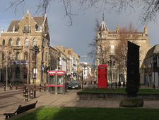
 Newry's Town Hall from the Armagh side of the Clanrye River |
|
 City of Newry
|
|
| Population | 27,430 Census 2001 |
|---|---|
| Irish grid reference | |
| - Belfast | 38 mi (61 km) |
| - Dublin | 67 mi (108 km) |
| District | Newry and Mourne |
| County | County Down |
| County Armagh | |
| Country | Northern Ireland |
| Sovereign state | United Kingdom |
| Post town | NEWRY |
| Postcode district | BT34, BT35 |
| Dialling code | 028 |
| Police | Northern Ireland |
| Fire | Northern Ireland |
| Ambulance | Northern Ireland |
| EU Parliament | Northern Ireland |
| UK Parliament | Newry and Armagh South Down |
| NI Assembly | Newry and Armagh South Down |
| Website | http://www.newryandmourne.gov.uk/ |
| List of places: UK • Northern Ireland • Down | |
Newry (/ˈnjʊəri/; from Irish: Iúr Cinn Trá meaning "Yew at the strand's head" – often shortened to an tIúr) is the fourth-largest city in Northern Ireland and eighth in Ireland. The River Clanrye, which runs through the city, forms the historic border between County Armagh and County Down: Newry was included entirely in the latter by the Local Government (Ireland) Act 1898. It is 34 miles (55 km) from Belfast and 67 miles (108 km) from Dublin. Newry had a population of approximately 27,430 at the 2001 Census,[1][2] while Newry and Mourne Council Area had a population of 87,058.[3] Newry was founded in 1144 alongside a Cistercian monastery and is one of Northern Ireland's oldest towns.
The city of Newry is one of the constituent cities of the Dublin-Belfast corridor and sits at the entry to the Gap of the North, close to the border with the Republic of Ireland. It grew as a market town and a garrison and became a port in 1742 when it was linked to Lough Neagh by the first summit-level canal in Britain or Ireland. In March 2002, as part of Queen Elizabeth's Golden Jubilee celebrations, Newry was granted city status alongside Lisburn in 2002.[4] Despite being the fourth largest city in Northern Ireland, however, it is not the fourth largest settlement. Newry was an important centre of trade in early Ireland because of its position between Belfast and Dublin. Newry has a reputation as one of the best provincial shopping-towns in the north of Ireland, with the Buttercrane Centre and The Quays attracting large numbers of shoppers from as far away as Cork.[5]
Newry's hinterland was predominantly Irish-speaking until the early 20th century and today the city has a vibrant Irish language community, with one of the highest concentrations of Irish speakers not only in the north but throughout Ireland.
In 2006 Newry topped the league of house prices increases across the whole United Kingdom over the last decade, as prices in the city had increased by 371% since 1996.[6] The city itself has become markedly more prosperous in recent years. Unemployment has reduced from over 26% in 1991 to scarcely 2% in 2008.[7]
Since the inception of the global financial crisis of 2008-2009, shoppers from the Republic of Ireland have increasingly been crossing the border to Newry in order to buy cheaper goods. This owes to a combination of factors: the harsh budget in the Republic of Ireland in October 2008; the growing strength of the euro against the pound sterling and VAT reductions in the United Kingdom, compared with increases in the Republic of Ireland. This remarkable increase in cross-border trade has become so widespread that it has lent its name to a general phenomenon known as the Newry effect. In December 2008, The New York Times described Newry as "the hottest shopping spot within the European Union’s open borders, a place where consumers armed with euros enjoy a currency discount averaging 30 percent or more".[8]
However the increased flow of trade has led to resultant tailbacks, sometimes several kilometers long, on approach roads from the south. This has created huge traffic and parking problems in Newry and the surrounding area. It has also become a political issue, with some politicians in the Republic of Ireland claiming that such cross-border shopping is "unpatriotic".[9]
Contents |
Notable buildings
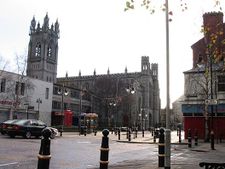
The Cathedral of SS. Patrick and Colman on Hill Street was built in 1829 at a cost of £8,000. The structure, which consists of local granite, was designed and built by Thomas Duff, arguably Newry's greatest architect to date.[10] Incidentally, Thomas Duff also was the architect for the Cathedral in Dundalk, a town just over the border in County Louth, and it is said that he mixed up the plans for both cathedrals and sent Dundalk Cathedral to the builders in Newry, and Newry Cathedral to the builders in Dundalk.
The town hall is notable for being built over the River Clanrye which is the historic boundary between the counties of Down and Armagh.
The city also boasts a museum, an arts centre and, in recent years, has seen a number of art galleries being opened.
The impressive Craigmore Viaduct lies just north of the city on the Northern Ireland Railways Belfast-Dublin mainline. The bridge was designed by Sir John O’Neill with construction beginning in 1849. The bridge was formally opened in 1852. The viaduct consists of eighteen arches the highest being 126 feet, the highest viaduct in Ireland. It is around a quarter of a mile long and was constructed from local granite. The Enterprise Train link from Belfast to Dublin crosses the bridge. Every week the Newry Reporter newspaper highlights a historic building in Newry and the surrounding area, giving a brief outline of its history.
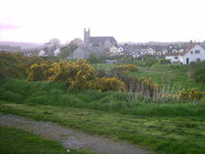
Saint Patrick's church was built in 1578 on the instructions of Nicholas Bagenal, who was granted the monastery lands by Edward VI, and is considered to be the first Protestant church in Ireland.
Administration
The headquarters of Newry and Mourne District Council are in Newry. The area has a majority nationalist population, leading to a council dominated by Sinn Féin and the Social Democratic and Labour Party, but there are some Ulster Unionist and Democratic Unionist Party (DUP) councillors and one councillor from the Green Party. Newry and Mourne District Council is scheduled to be merged with the adjoining Down District Council in 2011 as part of the reorganization of local government in Northern Ireland.
History
The English version of the name of the city comes from the original Irish Iúr Chinn Trá (in older spelling, Iubhar Chinn Trábha), which translates as "the yew at the head of the strand", which relates to an apocryphal story that Saint Patrick planted a yew tree there in the 5th century. In modern Irish, the full name of the town is rarely used; instead it is abbreviated to An tIúr (pronounced [ən̠ʲ tʲuːɾˠ]).
The small medieval town was enlarged in 1142 with the rebuilding of an old monastery, and there is strong evidence of continual human habitation in the area from 6th century. The first monastery only lasted until 1162, when it was burned to the ground, it was later restored to some degree and enlarged by a Cistercian monastery. This monastery itself was later converted to a collegiate church in 1543, before being surrendered to the crown in 1548.
In 1550, an English mercenary, Nicholas Bagenal, secured a 21 year lease on the property confiscated from the Cistercians.[11] It is said he later built a castle in Newry but there is not one scrap of documented evidence to prove this. The remains of the original Cistercian monastery were still standing when Bagenal acquired the land and it may well have been the abbot's house that Bagenal proclaimed as his castle.Locating the Abbots house would be the key to this story, The site was said to consist of a 'church, steeple, and cemetery, chapter-house, dormitory and hall, two orchards and one garden, containing one acre, within the precincts of the college'. The remains of parts of the great Cistercian church of Newry can be found today on Castle Street, near to the LIDL store, on what was once the 2nd site of McCann's Bakery.
A rental roll, dated 1575, provides a unique insight into life in the town at the time. It listed the names of the tenants in 'the High Street', 'tenements within the Fort' and the Irish Street without the Fort'. These three distinct areas also appear in a map of the same time, along with a fake drawing of the castle.
During the Williamite War, the forces of King James II set fire to the town in 1689, while retreating from William.
The town was rebuilt shortly afterwards, and its fortunes changed dramatically. A further period of economic prosperity, evidence of which can be seen in the many fine buildings and public places that can still be seen today.[12]
By 1881 the population of Newry had reached 15,590.[1]
Newry Urban District Council was unusual in that during the period from the 1920s to the 1960s it was one of only a handful of councils in Northern Ireland which had a majority of councillors from the Catholic/Nationalist community. (The others were Strabane UDC and a handful of rural district councils.) The reason according to Michael Farrell was that this community formed such a large majority in the town, around 80% of the population, that it was impossible to gerrymander. Also an oddity was that for a time it was controlled by the Irish Labour Party, after the left wing of the Northern Ireland Labour Party defected to them in the 1940s.[13]
The Troubles
Newry saw a number of violent incidents during the conflict known as the Troubles. These were ongoing into the late 90's and even now trouble such as bomb scares are still being called, disturbing the population of Newry.
See also: The Troubles in Killeen, for information on incidents at the border and customs post at Newry on the border with the Republic of Ireland and close to Newry. The British Army moved in during the 1950s. In 2003, the hilltop watch towers were taken down. The Army finally withdrew from the area in 25 June 2007 when they closed their final base at Bessbrook.[14][15] As there are no garrisons in the area the Army has no official presence in Newry or South Armagh since the end of Operation Banner.
Notable people
- Mountaineer Terence 'Banjo' Bannon is from the town. In 2006 Bannon narrowly survived an attempt to climb K2 in which four team members were killed.[16]
- Joseph Barcroft, respiratory physiologist, (1872–1947)
- W.J. Barre - architect who designed the Ulster Hall in Belfast in the late 1850s.[17]
- The One Show host Christine Bleakley was born in Daisy Hill Hospital, Newry in 1979.
- Thomas Duff, Architect, (1792–1848) was born in Newry. Duff is renowned for having designed the Cathedral of St. Patrick and St. Colman in the town.
- John Dunlop, prominent Presbyterian churchman, was born in Newry in 1939.
- Julia Glover, an 18th and 19th century stage actress was born in the town.[18]
- Seán Hillen, artist, was born and grew up in Newry, and made a large body of photomontage artworks related to the 'troubles', many of which are based on his own photographs taken in and around Newry. They include a series satirically titled "LondoNewry, a Mythical Town.."
- Sir William Hill Irvine GCMG (6 July 1858 - 20 August 1943), the 21st Premier of Victoria was born in Newry.
- Pat Jennings, a former goalkeeper and most capped player for Northern Ireland, was born in the town and played for Newry City F.C.
- Rigsy, (real name David O'Reilly) a broadcaster with the BBC and popular DJ, was born in Newry on 6 December 1978 and lived in the city until he was ten.
- Michael Legge - actor, best known for his recurring role in the Channel 4 series Shameless and for his part in the film Angela's Ashes.[19] He was born in Newry and attended St Colman's Abbey Primary School and St Colman's College
- Actor siblings John and Susan Lynch, were both born in Newry.
- John Magee, Roman Catholic Bishop of Cloyne and former private secretary to three popes, Paul VI, John Paul I and John Paul II.
- Willie Maley (25 April 1868–April 2, 1958), the first manager of Celtic was born in Newry.
- John Martin (8 September 1812 – 29 March 1875) an Irish nationalist was born in Newry.
- Peter McParland, a former soccer player, who scored for Northern Ireland in 1958 FIFA World Cup, was born in Newry.
- John Mitchel, a 19th century Irish patriot who inspired the Young Ireland Movement, is buried in the Old Meeting House cemetery in the town.[20]
- Tomm Moore, Oscar nominated filmmaker[21] was born in Newry before moving to Kilkenny at an early age.
- Actor Gerard Murphy[22] was born in Newry, and was a prominent member of the Newpoint Players theatre group.
- Gaelic footballer, Seán O'Neill, regarded as one of the outstanding forwards in the game, was born in Newry.
- Ronan Rafferty (13 January 1964), golfer, was born in Newry.
- Charles Russell, Baron Russell of Killowen, (1832–1900), Lord Chief Justice of England and Wales, was born in Newry on 10 November 1832.
- Matthew Russell, SJ - Irish Jesuit, poet and editor, was born in Newry in 1834. He established the Irish Monthly in 1873 and served as editor for nearly forty years. He also wrote many volumes of verse, and corresponded with the English Jesuit poet Gerard Manley Hopkins
- The 4 of Us - local band who in 1989 had a number one hit with Mary.
Geography
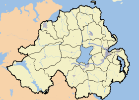
Newry lies in the most south-eastern part of both Ulster and Northern Ireland. Approximately half of the city lies in County Down and the other half in County Armagh, however officially lies completely in Down since the Local Government (Ireland) Act 1898.
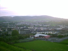
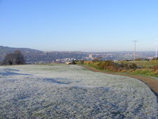
The city sits in a valley, nestled between the Mourne Mountains to the east, and the Ring of Gullion to the south-west, both of which are designated Areas of Outstanding Natural Beauty. Newry also lies in the shadow of the Cooley Mountains to the south east. The Clanrye River runs through the centre of town, parallel to the canal. The city also lies at the extreme northernmost end of Carlingford Lough, where the canal enters the sea at Victoria Locks.
Sport
Association football (soccer)
Newry City F.C. play at the Showgrounds in the city.
GAA
- The Down GAA team plays at Páirc Esler in the city
- Newry Bosco GFC
- Newry Shamrocks GAC
- John Mitchel GFC
- Thomas Davis GFC, Corinshego
- Ballyholland GFC
- St. Monnina GFC, Killeavy
Rugby Union
Newry RFC(also known as Newry Rugby Club, Newry RFU or Newry) is an Irish amateur rugby union club, founded in 1925. The club is a member of the Irish Rugby Football Union's Ulster branch. The club currently fields three senior teams and several junior teams ranging from under-12 to under-18 and a women's team for the first time in 2010-2011 season. The club's home ground is known as Telford Park. The team currently has two playing fields located at this ground along with the clubhouse on the outskirts of Newry.
Hockey
Newry Olympic HC is a field hockey team located at the north of the city. The men's first XI currently play in the ONE1918 Senior 1 league.
Transport
- The Newry Canal opened in 1742. It ran for 18 miles to Lough Neagh. In 1777, Newry was ranked the fourth largest port in Ireland. Some surviving 18th and 19th century warehouses still line the canal, and now many houses, shops and restaurants.
- In 1885 an electric tramway was opened between Newry and Bessbrook.
- MacNeill's Egyptian Arch is a railway bridge located near Newry. It was selected for the design of the British One Pound coin to represent Northern Ireland for 2006.
- Newry is served by an Ulsterbus bus station, located in the city centre, that offers local, regional and cross-border services.
- A Northern Ireland Railways station, just off the Camlough road, offers cross border services on the Dublin-Belfast line. Planning permission for the construction of a new station, to the east of the current station, was granted in May 2006 and the new station opened on 7 September 2009.
- Newry is on the main M1/A1 route from Dublin to Belfast. Originally the route passed through the town centre, but in the 60s was bypassed by the Abbey Link. This remained the sole relief road until the 1980s when it was superseded by a single carriageway bypass round the western side of the town. By 2008 the road on either side of the town had been upgraded to motorway/high quality dual carriageway standard (southwards from Cloghogue) and low quality dual carriageway (northwards from Beechill). In July 2010 a new high quality dual carriageway with motorway characteristics was opened to bridege the gap, thus connecting Dublin with Belfast by motorway/dual carriageway for the first time. The opening of this section of Road meant that motorists could travel from Clogh in Co. Antrim to Middletown, Co. Cork by dual carriageway/motorway. Part of this older bypass is still in use between the Camlough Road (A25) and the Belfast Road (A1). Newry suffers from very heavy traffic with shoppers coming from across the border.[23] Newry is connected with Warrenpoint by a lower quality dual carriageway, some 7 miles to the south.
2001 Census
Although officially a city, Newry is classified as a large town by the Northern Ireland Statistics and Research Agency (NISRA) (ie with population between 18,000 and 75,000 people). On Census day (29 April 2001), there were 27,433 people living in Newry. Of these:
- 26.2% were aged under 16 years and 16.0% were aged 60 and over
- 48.5% of the population were male and 51.6% were female;
- 89.6% were from a Roman Catholic background and 9.4% were from a Protestant background.[24]
- 5.5% of people aged 16–74 were unemployed.[25]
- 99% of people are European.
Education
- Abbey Christian Brothers Grammar School
- Ballyholland Primary School
- Bunscoil an Iúir
- Cloughoge Primary School
- Killean Primary School
- Mullaglass Primary School
- Newry High School
- Our Lady's Grammar School
- Sacred Heart Grammar School
- St Clare's Convent Primary School
- St Colman's Abbey Primary School
- St Colman's College
- St. John's Primary School
- St Joseph's Boys' High School
- St Joseph's Convent Primary School
- St Mary's High School
- St Patrick's Primary School
- St. Paul's High School, Bessbrook
- St Ronan's Primary School
- Southern Regional College
- Windsor Hill Primary School
- Newry and Kilkeel Institute
Churches
- Newry Cathedral - Roman Catholic Cathedral and parish church
- St. Mary's; St Patrick’s - Church of Ireland
Newry has two evangelical Presbyterian Churches: 1st Newry (known as Sandys Street), whose minister is Rev. Dr. Michael Barry, and Downshire Road, whose minister is currently Rev. Brian Colvin. It also has one Non-Suscribing Presbyterian Church, whose minister is Rev. Norman Hutton
Housing areas
- Altnaveigh
- Ashton Heights
- Barcroft Park
- Carlingford Park
- Carnagat
- Ashfield Avenue
- Carnagh Park
- Carrivemaclone
- Courtenay Hill
- Daisy Hill Gardens
- Damolly
- Upper Damolly
- Derrybeg Park
- Drumalane
- Drumcashellone
- Drumgullion
- Dublin Road
- Glen Hill
- High Street
- Hollywood Grove
- Liska Road
- Loanda
- Monk's Hill
- Mount Pleasant
- Mourne View Park
- Old Warrenpoint Road
- Parkhead
- Shandon Park
- Rooney's Meadow
See also
- List of towns in Northern Ireland
- List of villages in Northern Ireland
References
- ↑ 1.0 1.1 http://www.planningni.gov.uk/index/policy/dev_plans/devplans_az/bnm_2015/bnm_district_proposals/bnm_proposals_newry/bnm_newry_city/bnm_newrycity_background.htm
- ↑ http://www.newrychamber.com/areainfo/index.asp
- ↑ NI Planning Service: District Proposal For Newry City
- ↑ BBC report
- ↑ "David McKittrick: The great nappy rush (no, not rash)". The Independent (London). 1 January 2009. http://www.independent.co.uk/opinion/commentators/david-mckittrick-the-great-nappy-rush-no-not-rash-1219998.html. Retrieved 7 April 2010.
- ↑ Halifax House Price Survey
- ↑ Article by Frances McDonnell, Belfast Briefing, page 21, Irish Times, 9 December 2008, quoting Dr Gerard O'Hare
- ↑ Quinn, Eamon (18 December 2008). "A Northern Ireland Town Is a Shoppers' Paradise". The New York Times. http://www.nytimes.com/2008/12/18/world/europe/18ireland.html. Retrieved 7 April 2010.
- ↑ Irish Times, 9 December 2008, op cit
- ↑ "Newry Cathedral". Newry and Mourne District Council. http://www.newryandmourne.gov.uk/tourism/attractions/historical/newry_cathedral.asp. Retrieved 2008-06-25.
- ↑ Ciaran Brady, Jane Ohlmeyer (2005). British Interventions in Early Modern Ireland. Cambridge University Press. ISBN 0521835305. http://books.google.co.uk/books?id=HHh4ViNVV5kC&pg=PA57&dq=%22Nicholas+Bagenal%22+newry+1550&hl=en&ei=2TNITJGIJIje4Aax9u3-DA&sa=X&oi=book_result&ct=result&resnum=2&ved=0CDEQ6AEwAQ#v=onepage&q=%22Nicholas%20Bagenal%22%20newry%201550&f=false. Retrieved 22 July 2010.
- ↑ Down County Museum
- ↑ Michael Farrell Northern Ireland: The Orange State
- ↑ BBC News. http://news.bbc.co.uk/mobile/bbc_news/northern_ireland/623/62355/story6235514.shtml?=. Retrieved 7 April 2010.
- ↑ Soldiers depart Bessbrook Mill for the final time
- ↑ Newry Democrat
- ↑ http://www.belfastcity.gov.uk/ulsterhall/faqs.asp
- ↑ Taylor & Francis Group; Cathy Hartley, Susan Leckey (2003). A Historical Dictionary of British Women. Routledge. pp. 186. ISBN 1857432282. http://books.google.co.uk/books?id=pDtEe4FKolUC.
- ↑ Michael Legge at the Internet Movie Database
- ↑ Culture Northern Ireland
- ↑ Tomm Moore at the Internet Movie Database
- ↑ Gerard Murphy at the Internet Movie Database
- ↑ "Northern Ireland Assembly debates, 9 March 2009, 2:45 pm". mySociety. http://www.theyworkforyou.com/ni/?id=2009-03-09.5.51. Retrieved 2009-12-01.
- ↑ Data supplied by Northern Ireland Statistics and Research Agency
- ↑ NI Neighbourhood Information Service
External links
- Newry at the Open Directory Project
- Newry and Mourne District Council
- ActivNewry.com - Newry's business, events, and community directory
- Newry City.com
- Newry.info - Newry's Newest Up to Date Website with Events and latest News
- NewryCity.eu
- in Newry.com
- Newry Memoirs
|
|||||||||||
|
||||||||||||||
|
||||||||||||||||||||
|
|||||||||||||||||||||||