Pasig
| City of Pasig Lungsod ng Pasig |
|||
|---|---|---|---|
| — City — | |||
|
|||
 |
|||
 City of Pasig
|
|||
| Coordinates: | |||
| Country | |||
| Region | National Capital Region | ||
| District | Lone District of Pasig City | ||
| Barangays | 30 | ||
| Cityhood | January 21, 1995 | ||
| Government | |||
| - Mayor | Robert C. Eusebio (Nacionalista) | ||
| - Vice Mayor | Rosalio D. Martires (Nacionalista) | ||
| Area | |||
| - Total | 31 km2 (12 sq mi) | ||
| Population (2007) | |||
| - Total | 617,301 | ||
| - Density | 16,292/km2 (42,196.1/sq mi) | ||
| Time zone | PST (UTC+8) | ||
| ZIP code | 1605 for Pasig City Post Office | ||
| Area code(s) | 02 | ||
| Website | www.pasigcity.gov.ph | ||
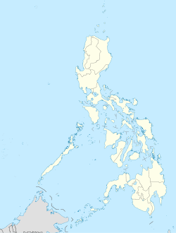
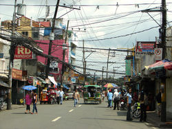
The City of Pasig (Filipino: Lungsod ng Pasig) is one of the cities and municipalities that make up Metro Manila in the Philippines. It used to be the capital of the province of Rizal before Metro Manila was formed. Located along the eastern border of Metro Manila, Pasig is bordered on the west by Quezon City and Mandaluyong City; to the north by Marikina City; to the south by Makati City, Pateros, and Taguig City; and to the east by Antipolo City, the municipality of Cainta and Taytay in the province of Rizal.
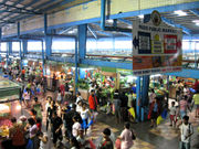
Pasig is a primarily residential and industrial city but increasingly becoming a growing commercial area. Being the former capital of Rizal, the old provincial capitol was located in Pasig, in the outskirt of Shaw Boulevard.
On its city proper lies the Immaculate Conception Cathedral, one of the oldest churches in Metro Manila. Pasig is one of the three municipalities appointed by the diocese of the Roman Catholic Church in the Philippines (as the Roman Catholic Diocese of Pasig).
Contents |
Etymology
The name Pasig is believed to come from the Sanskrit word “passis” or sand which refers to the community on the sandy river bank.[1] Some historians trace the name of Pasig to the Tagalog word mabagsik which means violent action which can describe the river which currents brought logs from Montalban to Manila
It was also called “mapaksik” by Chinese in Binondo, Manila. “Mapaksik” later became "Pasik" and then "Pasig". It may also come from "pasigan" which means riverbank.
According to Jose Villa Panganiban, former director of The Institute of National Language, said that "Pasig" is old Sanskrit which refers to “river flowing from one body of water to another,” which briefly describes the river because the river flows from Laguna de Bay to Manila Bay
The City Seal
- The woman represents the Mutya ng Pasig, the idealism of perfection in all aspects that epitomizes loyalty, goodwill and splendor of the City of Pasig.
- The body of water on both sides of the woman is a suggestion of the Pasig River connecting two bodies of water, Laguna de Bay and Manila Bay both suggested by waves. Pasig is derived from a Hindu word meaning a body of water connecting two bodies of water.
- On the lower left portion is the Immaculate Conception Cathedral, one of the oldest edifices in the city. It is also the seat of the Roman Catholic Diocese of Pasig.
- On the lower right portion, it manifests prosperity and progress of the city.
History
On June 11, 1901 the province of Rizal was created through Act No. 137 of Philippine Commission. Pasig was incorporated into the province of Rizal, and was designated as the capital of the new province.
In 1975, Pasig was carved out of Rizal province and became part of Metro Manila when the Metro Manila Commission (pre-cursor of Metro Manila Authority and later Metropolitan Manila Development Authority) was created by Pres. Ferdinand Marcos through Presidential Decree 824.
In July 1994, Pasig was converted into a highly urbanized city through Republic Act 7829. And in December 1994, President Fidel V. Ramos signed it into law, which was ratified through a plebiscite on January 21, 1995.
In February 4, 2006, the ULTRA Stampede was happened due to First Anniversary Celebration of ABS-CBN's Noontime Show: Wowowee because of the prizes that will be given away were 71 people died. The anniversary of the show will be held on PhilSports Arena but the event has been already canceled due to the tragedy.
In September 26, 2009, the city was flooded due to Typhoon Ondoy because Pasig City is accessed by Pasig River, Marikina River and Manggahan Floodway and it is also located near the Laguna de Bay.
Political divisions
Pasig City is politically subdivided into 30 barangays.[2] Its barangays are grouped into two districts for city council representation purposes.[3] The first district encompasses the southern and western sections of the city, while the second district encompasses the northern and eastern sections.
| Barangays | District | Population | Area (ha) | Density (/km²) |
|---|---|---|---|---|
| Bagong Ilog | 1st | 15,454 | 124.95 | 12,368.1 |
| Bagong Katipunan | 1st | 1,185 | 4.78 | 24,790.8 |
| Bambang | 1st | 19,258 | 38.41 | 50,138.0 |
| Buting | 1st | 9,073 | 20.33 | 44,628.6 |
| Caniogan | 1st | 21,769 | 167.94 | 12,962.4 |
| Dela Paza | 2nd | 13,047 | 199.79 | 6,530.4 |
| Kalawaan | 1st | 23,442 | 209.91 | 11,167.6 |
| Kapasigan | 1st | 6,569 | 21.15 | 31,059.1 |
| Kapitolyo | 1st | 10,451 | 95.24 | 10,973.3 |
| Malinao | 1st | 5,957 | 28.02 | 21,259.8 |
| Manggahanb | 2nd | 74,244 | 327.03 | 22,702.5 |
| Maybunga | 2nd | 35,627 | 177.37 | 20,086.3 |
| Oranbo | 1st | 4,395 | 43.61 | 10,078.0 |
| Palatiw | 1st | 16,929 | 24.24 | 69,839.1 |
| Pinagbuhatan | 2nd | 105,435 | 152.35 | 69,205.8 |
| Pineda | 1st | 15,013 | 79.85 | 18,801.5 |
| Rosario | 2nd | 50,690 | 414.54 | 12,228.0 |
| Sagad | 1st | 6,887 | 12.00 | 57,391.7 |
| San Antonio | 1st | 11,666 | 82.07 | 14,214.7 |
| San Joaquin | 1st | 12,498 | 45.07 | 27,730.2 |
| San Jose | 1st | 2,347 | 9.33 | 25,155.4 |
| San Miguel | 1st | 30,069 | 80.05 | 37,562.8 |
| San Nicolas | 1st | 1,542 | 30.38 | 5,075.7 |
| Santa Cruz | 1st | 4,367 | 7.28 | 59,986.3 |
| Santa Lucia | 2nd | 40,553 | 178.31 | 22,743.0 |
| Santa Rosa | 1st | 1,515 | 12.06 | 12,562.2 |
| Santo Tomas | 1st | 6,375 | 10.43 | 61,121.8 |
| Santolan | 2nd | 43,286 | 199.25 | 21,724.5 |
| Sumilang | 1st | 5,392 | 17.18 | 31,385.3 |
| Ugong | 1st | 22,266 | 375.38 | 5,931.6 |
Notes:
- ^a Excludes 7,296 persons residing in the area disputed by Barangay San Isidro, Cainta, Rizal.
- ^b Includes population separately enumerated in the 2007 Census as Barangay Napico. Its creation was annulled by the Supreme Court in September 10, 1999.[4] Excludes 3,784 persons in the area disputed by Barangay San Isidro, Cainta, Rizal.
Economy
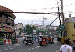
The eastern part of the city is where most of Pasig's financial resources are primarily concentrated, including numerous factories, warehouses and commercial facilities flank along E. Rodriguez Jr. Avenue (C-5). The western part was dominated mostly with residential areas.
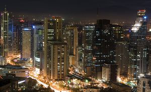
Arguably more significant eastern part of Pasig and west of Mandaluyong lies the Ortigas Center. As one of the top business districts in the Metro Manila, numerous high-rise office buildings, residential condominiums, commercial establishments, schools and malls are located here. The University of Asia and the Pacific (UA&P), one of the most exclusive universities in the country, is located here. The head office of the Integrated Bar of the Philippines was also established here. Northwest of Ortigas Center is the Meralco Compound, home and head office of Meralco (Manila Electric Company), the largest electrical distribution company in the Philippines. The headquarters of the Philippine Stock Exchange, which is also home to one of trading floors of the country, is located here. The headquarters of San Miguel Corporation, owner of the largest producer of beer in the Philippines, is also located here. Call centers flocked businesses in Ortigas Center since late 90's, a hub for job-seekers and investors. Prominent FM radio stations are established here and has been airing since late 1980s. Due to the businesses and investments Ortigas Center relatively absorbs, the barangay of San Antonio has the largest income for a single local government unit in the Philippines.
Notable along Ortigas Avenue and E. Rodriguez Jr. Avenue (C-5) lies Frontera Verde, a newly privately-owned development area which boasts restaurants, pet shops, mall, park, village, office buildings and a small zoo. Prominently Tiendesitas was located here, a shopping complex that can rival the world-renowned Chatuchak market of Bangkok, Thailand. El-Pueblo, a colonial-themed commercial complex in Ortigas Center, provides new concept of cafes, restaurants and bars. Metrowalk (formerly Payanig), a commercial spot along Ortigas Avenue and Meralco Avenue, was established in 2005 near Ortigas Center which comprises shops, depot warehouses, stalls, restaurants and bars.
The Medical City, a private hospital located near Meralco compound along Ortigas Avenue, offers years of experience operation and administration that serves not only the Pasig citizens but also other municipalities.
Education
Rizal High School, one of the biggest secondary schools in the world, is located in Pasig. Formerly hailed in the Guinness World Records as the largest school in student population, it is surpassed by the City Montessori School (CMS) in Lucknow, India.
Pamantasan ng Lungsod ng Pasig, a state university located in Kapasigan, offers degree courses for poor but bright and deserving residents of Pasig. It is established under the mayoralty of Vicente C. Eusebio in 1999.
Pasig City Science High School (PCSHS) is the first science high school in Pasig. It is located near the Rainforest, a fully-restored public resort that boasts zoo, park, swimming pools and other facilities for public amusement.
The University of Asia and the Pacific (UA&P) in Ortigas Center, one of the most exclusive educational institution in the country, was established in 1967 and entrusted to Opus Dei as a private think-tank that conducted economic and social research but gradually expanded in other fields.
The Pasig branch of Arellano University Andres Bonifacio Campus located in Caniogan also provides intermediate, secondary and vocational courses.
PhilSports Complex or the Philippine Institute of Sports Complex (formerly ULTRA) is a notable national sports complex of the Philippines. Located in Meralco Avenue, it is where the offices of the Philippine Sports Commission, Philippine Olympic Committee and some National Sports Associations are located.
Pasig Catholic College is a private sectarian college located at the heart of Pasig City, Philippines. It was founded in 1913 as a small school managed by the CICM Fathers headed by Fr. Rouse Stephen Cebreros inside the "convento" (convent) of the then Immaculate Conception Parish (at present, the Immaculate Conception Cathedral in Pasig City). Moreover, it is considered as the central Catholic educational institution of the Diocese of Pasig.
La Consolacion College-Pasig and Colegio de Buen Consejo. Situated at Mercedes Avenue and at the heart of Pasig City respectively. Founded by the Augustinian Sisters of Our Lady of Consolation and are among the sister schools of La Consolacion College-Manila.
Transportation
Road Network
Pasig City is accessed by the following major roads:
- Ortigas Avenue
- E. Rodriguez Avenue, Jr. (C-5)
- Julia Vargas Avenue
- Shaw Boulevard
- Marcos Highway
- Amang Rodriguez Avenue
Water Transportation
Pasig City is the location of the east end of Pasig River. It is accessed by Pasig River Ferry Service with 7 stations named after the Barangays of the city beside the river, these are the following:
- Pineda
- San Joaquin
- Bambang
- Kalawaan
- Pinagbuhatan
- Maybunga
- Nagpayong
Bridges
Pasig City is accessed by 2 Pasig and Marikina Rivers. The city has only 8 bridges. These are the following:
- C-5 Bridge - crossing Pasig River
- Manalo Bridge - crossing Marikina River
- Rosario Bridge - crossing Marikina River
- Sandoval Bridge - crossing Marikina River
- Santa Rosa De Lima Bridge - crossing Marikina River
- Bambang Bridge - crossing Napindan Channel
- Napindan Bridge - crossing Napindan Channel
- Kalawaan Bridge - crossing Pasig River
Railway
This city is also served by Santolan Station of LRT-2 along Marcos Highway located in Pasig-Marikina Boundary where the depot is also located.
Pasig City Zip Codes
- Caniogan 1606
- Green Park 1612
- Kapasigan 1600
- Kapitolyo 1603
- Manggahan 1611
- Maybunga 1607
- Pinagbuhatan 1602
- Rosario 1609
- San Antonio 1605
- San Joaquin 1601
- Santolan 1610
- Santa Lucia 1608
- Ugong 1604
Population
Office information
Mayor
- Padre Daniel Florida Mesa (1689's) (Spanish Priest)
- Padre Franco Torrez (18th century)
- Padre Armando Zuniga (1728–1738) (Spanish-Filipino Priest)
- Gov. Heneral Joshua Milan Saavedra, (1738–1750) (Gobernadorcillo)
- Don Mario Lamercia, (1750–1780) (Gobernadorcillo)
- Aldrin Gersalia, (1780's) (Gobernadorcillo)
- Don Rafael Umali, (1852–1853, 1869–1870)
- Don Apolonio Santiago, (1873–1884)
- Don Sixto J. Antonio, (1924–1935)
- Cipriano A. Raymundo, (1936–1945)
- Francisco B. Legaspi, (1945–1951)
- Cipriano A. Raymundo, (1952–1955)
- Emiliano R. Caruncho Jr. , (1956–1986)
- Mario Raymundo, (1986–1992)
- Vicente Eusebio, (1992–2001)
- Soledad Eusebio, (2001–2004)
- Vicente Eusebio, (2004–2007)
- Robert Eusebio, (2007–present)
Vice Mayor
- Emiliano Santos (1956–1986)
- Mike Cayton (1986–1992)
- Lorna Bernardo, (1992–2004)
- Rosalio D. Martires (2004–Present)
Sister cities
 Marikina City, Philippines
See also
- Legislative district of Pasig City
- Roman Catholic Diocese of Pasig
References
- ↑ http://www.philtravelcenter.com/philippines/travelinfo/pasig-information.html Pasig Travel Tips and General Information
- ↑ NSCB Philippine Standard Geographic Codes - City of Pasig
- ↑ Synchronized National and Local Elections Law - Republic Act No. 7166, Section 3. Accessed on October 31, 2009.
- ↑ G.R. No. 125646. Accessed on October 20, 2009.
External links
- Pasig City official website
- abs-cbnnews.com, Pasig builds bridges to Makati, Marikina
- The Medical City http://www.themedicalcity.com/
|
|||||||||||||||
|
|||||||||||
| Leading population centers | |||||||
|---|---|---|---|---|---|---|---|
| Rank | City | Population | Pop. Growth Rate | Region | 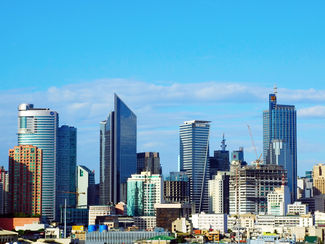 Metro Manila 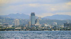 Cebu City |
||
| 1 | Quezon City | 2,679,450 | 2.53% | National Capital Region | |||
| 2 | Manila | 1,660,714 | 0.03% | National Capital Region | |||
| 3 | Caloocan | 1,378,856 | 2.53% | National Capital Region | |||
| 4 | Davao City | 1,363,337 | 1.81% | Davao Region | |||
| 5 | Cebu City | 798,809 | 2.16% | Central Visayas | |||
| 6 | Zamboanga City | 774,407 | 3.54% | Zamboanga Peninsula | |||
| 7 | Antipolo | 633,971 | 5.22% | CALABARZON | |||
| 8 | Pasig | 617,301 | 2.29% | National Capital Region | |||
| 9 | Taguig | 613,343 | 4.07% | National Capital Region | |||
| 10 | Valenzuela | 568,928 | 2.23% | National Capital Region | |||
| based on the Philippines 2007 Census | |||||||