Williston, North Dakota
| Williston, North Dakota | |
|---|---|
| — City — | |
 |
|
| Coordinates: | |
| Country | United States |
| State | North Dakota |
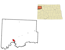
| County | Williams |
| Area | |
| - Total | 7.0 sq mi (18.2 km2) |
| - Land | 7.0 sq mi (18.1 km2) |
| - Water | 0.1 sq mi (0.2 km2) |
| Elevation | 1,877 ft (572 m) |
| Population (2000) | |
| - Total | 12,512 |
| - Density | 1,794.1/sq mi (693.1/km2) |
| Time zone | Central (CST) (UTC-6) |
| - Summer (DST) | CDT (UTC-5) |
| ZIP codes | 58801-58802 |
| Area code(s) | 701 |
| FIPS code | 38-86220[1] |
| GNIS feature ID | 1032815[2] |
| Highways | US 2, US 2 Bus., US 85, US 85 Bus., ND 1804 |
Williston is the county seat of Williams County, North Dakota, USA.[3] The population was 12,512 at the 2000 census. Founded in 1887, Williston was named for Daniel Willis James, a board member of the Northern Pacific Railroad Company, by his friend, railroad owner, James J. Hill.[4][5][6]
Williston's newspaper is the daily Williston Herald. Sloulin Field International Airport is a public airport two miles north of the business district. Williston is the home of Williston State College and the Miss North Dakota Scholarship Pageant.
Contents |
Geography
Williston is located at (48.156477, -103.628064)[7]. It is located at the crossroads of US Highways 2 and 85.
It is near the confluence of the Yellowstone River and the Missouri River, at the upper end of the Lake Sakakawea reservoir.
According to the United States Census Bureau, the city has a total area of 18.2 km² (7.0 mi²). 18.1 km² (7.0 mi²) of it is land and 0.2 km² (0.1 mi²) of it (0.99%) is water.
Climate
| Monthly Normal and Record High and Low Temperatures | ||||||||||||
| Month | Jan | Feb | Mar | Apr | May | Jun | Jul | Aug | Sep | Oct | Nov | Dec |
|---|---|---|---|---|---|---|---|---|---|---|---|---|
| Rec High °F | 53 | 66 | 78 | 92 | 106 | 106 | 109 | 107 | 104 | 93 | 76 | 58 |
| Norm High °F | 19.4 | 27.6 | 40.1 | 56 | 68.2 | 77.3 | 83.4 | 82.8 | 70 | 57 | 36.2 | 24 |
| Norm Low °F | -3.3 | 5.9 | 17.2 | 29.1 | 40.9 | 50.1 | 55.2 | 53.8 | 42.2 | 30.2 | 14.9 | 2.1 |
| Rec Low °F | -40 | -41 | -31 | -15 | 10 | 26 | 34 | 34 | 15 | -9 | -27 | -50 |
| Precip (in) | 0.54 | 0.39 | 0.74 | 1.05 | 1.88 | 2.36 | 2.28 | 1.48 | 1.35 | 0.87 | 0.65 | 0.57 |
| Source: USTravelWeather.com [1] | ||||||||||||
Demographics
| Historical populations | |||
|---|---|---|---|
| Census | Pop. | %± | |
| 1900 | 763 |
|
|
| 1920 | 4,178 |
|
|
| 1930 | 5,106 | 22.2% | |
| 1940 | 5,790 | 13.4% | |
| 1950 | 7,398 | 27.8% | |
| 1960 | 11,866 | 60.4% | |
| 1970 | 11,230 | −5.4% | |
| 1980 | 13,336 | 18.8% | |
| 1990 | 13,131 | −1.5% | |
| 2000 | 12,512 | −4.7% | |
| Est. 2008 | 12,641 | 1.0% | |
According to the census of 2000[1], there were 12,512 people, 5,255 households, and 3,205 families residing in the city. The population density was 693.1/km² (1,794.1/mi²). There were 5,912 housing units at an average density of 327.5/km² (847.7/mi²). The racial makeup of the city was 93.69% White, 0.17% African American, 3.65% Native American, 0.24% Asian, 0.02% Pacific Islander, 0.17% from other races, and 2.06% from two or more races. Hispanic or Latino of any race were 1.23% of the population.
The top 6 ancestry groups in the city are Norwegian (47.8%), German (31.6%), Irish (9.6%), English (5.8%), Swedish (4.5%), French (4.0%).
There were 5,255 households out of which 30.7% had children under the age of 18 living with them, 47.4% were married couples living together, 10.5% had a female householder with no husband present, and 39.0% were non-families. 34.1% of all households were made up of individuals and 13.7% had someone living alone who was 65 years of age or older. The average household size was 2.30 and the average family size was 2.96.
In the city the population was spread out with 25.6% under the age of 18, 9.3% from 18 to 24, 25.8% from 25 to 44, 22.5% from 45 to 64, and 16.8% who were 65 years of age or older. The median age was 38 years. For every 100 females there were 91.9 males. For every 100 females age 18 and over, there were 88.3 males.
The median income for a household in the city was $29,962, and the median income for a family was $38,713. Males had a median income of $29,578 versus $18,879 for females. The per capita income for the city was $16,656. About 11.3% of families and 13.4% of the population were below the poverty line, including 19.1% of those under age 18 and 7.8% of those age 65 or over.
Economy
Williston's economy is driven by agriculture and the oil industry. Williston is near the geographic center of the Williston Basin. Daily oil activity.
A major regional grain elevator is served by the Burlington Northern Santa Fe railroad. Williston's livestock arena has weekly auctions.
Forts Union and Buford, as well as the confluence of the Yellowstone and Missouri Rivers—a part of the history of the Lewis and Clark Expedition—encourages area tourism. Williston is also comparatively close to the North Unit of Theodore Roosevelt National Park.
Transportation
- Local airline service at Williston Sloulin Field International (KISN) is provided by Great Lakes Airlines, a codeshare partner with United Airlines and Frontier Airlines. Flights are three times daily on weekdays and twice daily on weekends. Service is to Denver, CO (KDEN) with a stop in Dickinson, ND (KDIK). Aircraft utilized are Embraer EMB-120ER Brasilias.
- Servair West, Inc. of Williston, ND, provides charter service from the Williston Airport (ISN) utilizing Cessna 310, Cessna 402, and Beechcraft Baron 58 aircraft.
- Amtrak, the national passenger rail system, serves Williston, operating its Empire Builder daily in each direction between Portland, Oregon/Seattle, Washington and Chicago.
Education
The Williston Public School District#1 serves the city. The surrounding rural area, is served by New Public School District #8. Trinity Christian School is a private K-12 school located in Williston. St. Joseph Catholic School is a private K-6 school located in Williston.
Sports
- Williston Keybirds of North Dakota American League Baseball
- Williston State College Tetons: women's and men's basketball, women's Volleyball, and men's baseball.
Healthcare
Williston clinics include Craven-Hagan Clinic, Fairlight Medical Center, and Trinity Medical Clinic. Fairlight has the only Veteran's Affairs clinic in northwestern North Dakota and also serves residents of northeastern Montana. Fairlight includes a walk-in clinic with four health care professionals. Mercy Medical Center is the Williston hospital It provides 24-hour emergency and trauma care but lacks a walk-in clinic.
Media
- Williston Herald
- Plains Reporter
- Oil Patch Hotline
- The Christian Weekly
Television
- 4.1 KWSE (PBS) Prairie Public Television (Digital 51 (will switch to 11))
- 4.2 KWSE (PBS) Prairie Public Television
- 4.3 KWSE (PBS) Prairie Public Television
- 4.4 KWSE (PBS) Prairie Public Television
- 8.1 KUMV (NBC)
- 11.1 KXMD (CBS)
- 11.2 (ABC) rebroadcasts KMCY of Minot, ND
- 38.1 (Fox) rebroadcasts KXND of Minot, ND
- 40 (analog) K40DE (TBN) religious programming
In the late 1970s and early 1980s, KXMD and KUMV were rebroadcast across Saskatchewan as part of that region's first terrestrial-based cable television system. By 1984, however, the Williston signals had been replaced by those of similar stations in Detroit.
Radio
- FM
- 88.1 K201FJ CSN network - Christian
- 88.5 K203DU Rejoice Radio network - Christian
- 89.5 KPPR North Dakota Public Radio/NPR affiliate
- 90.3 K212DW K-LOVE network - contemporary Christian music
- 91.7 K219CB American Family Radio network - Christian
- 93.1 KGCX "Eagle 93" Classic rock - based in Sidney, MT
- 95.1 KTHC "Power 95.1" Hot Adult Contemporary
- 96.1 KYYZ "Z96.1 Country Thunder" Country
- 101.1 KDSR "Hot 101" Jack FM
- 102.7 K274AD KHRT translator - contemporary Christian music
- AM
- 660 KEYZ "Keyz NewsRadio" News/Talk/Country
- 1070 KATQ Country - based in Plentywood, MT
- 1090 KTGO Country - based in Tioga, ND
Sites of interest
- Fort Union Trading Post National Historic Site - a reconstructed fur-trade era fort owned and maintained by the National Park Service.
- Fort Buford - a pioneer age military fort. An interesting site is the military graveyard.
- Missouri-Yellowstone Confluence Interpretive Center A museum highliting the history of the area where the Missouri River and the Yellowstone River merge.
- Lake Sakakawea - a large man-made lake located close to Williston. The lake offers plenty of recreational activities.
- The Confluence - where the Missouri River and the Yellowstone River meet. A historical center, boat ramp, camp site, and bike path are located here.
- Eagle Ridge Golf Club - an eighteen-hole golf course located on Highway 2 north of Williston. It measures 6,240 yards (5,710 m) from the back tees.
- Williston Municipal Golf Course - a 9-hole golf course located at 3600 42nd Street West in Williston.
- The Links of North Dakota at Red Mike Resort - an 18-hole links course east of Williston. "GOLFWEEK" ranked it 41st among America's 100 best modern courses in 1997, 75th in 1998, and 81st in 1999. Lying alongside Lake Sakakawea it is reminiscent of the links at St Andrews, Scotland. It is located 24 miles (39 km) east of Williston on Highway 1804.
- Cut Bluff Overlook - a historic sight located about two miles (3 km) east of Williston on the south side of Highway 1804. Commemorating Lewis and Clark's campsite near Cut Bluff on the south banks of the Missouri River.
Notable residents
- Phil Jackson - professional basketball player and coach (New York Knicks, Chicago Bulls, Los Angeles Lakers). Jackson was born in Montana, but spent the later part of his childhood, including his teenage years, in Williston, and graduated from Williston High School. The Williston High School fieldhouse is named after Jackson. As a player he won championships with the Knicks in 1970 and 1973. He later coached the Bulls to championships from 1991–93 and 1996–98, and later, the Lakers from 2000–2002, 2009, and 2010.
- Virgil Hill - a silver medalist in boxing at the 1984 Olympics and a four-time world champion boxer, often winning and defending his titles in North Dakota cities, most notably Bismarck and Grand Forks. Hill spent his last year of high school at Williston High School.
- Darlene Hooley, Democratic member of Congress from Oregon, 1996–2009, was born in Willison and spent her early childhood there before moving to Oregon.
- Mark Lee, MLB player for the Kansas City Royals, Milwaukee Brewers, and the Baltimore Orioles.
See also
- Williston (Amtrak station)
- List of golf courses in North Dakota
- Williston Herald
References
- ↑ 1.0 1.1 "American FactFinder". United States Census Bureau. http://factfinder.census.gov. Retrieved 2008-01-31.
- ↑ "US Board on Geographic Names". United States Geological Survey. 2007-10-25. http://geonames.usgs.gov. Retrieved 2008-01-31.
- ↑ "Find a County". National Association of Counties. http://www.naco.org/Template.cfm?Section=Find_a_County&Template=/cffiles/counties/usamap.cfm. Retrieved 2008-01-31.
- ↑ John Matzko, Reconstructing Fort Union (Lincoln: University of Nebraska Press, 2001), 26; Ben Innis, Sagas of the Smoky-Water (Williston, ND: privately published, 1985), 344.
- ↑ Wick, Douglas A. (1988). North Dakota Place Names. Bismarck, North Dakota: Hedemarken Collectibles. ISBN 0-9620968-0-6. OCLC 191277027.
- ↑ Williams, Mary Ann (Barnes) (1966). Origins of North Dakota Place Names. Bismarck, North Dakota: Bismarck Tribune, 1966. OCLC 431626.
- ↑ "US Gazetteer files: 2000 and 1990". United States Census Bureau. 2005-05-03. http://www.census.gov/geo/www/gazetteer/gazette.html. Retrieved 2008-01-31.
External links
- Williston Herald
- City of Williston official website
- The Williston Oil Basin
- The Confluence of the Missouri and the Yellowstone Rivers
- Map of Williston, ND
|
||||||||||||||||||||
|
||||||||||||||||||||