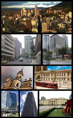
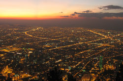
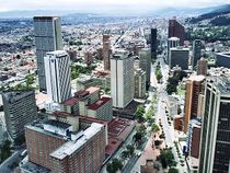
Bogotá
|
||||||||||||||||||||||||||||||||||||||||||||||||

.svg.png)
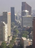
Bogotá, Distrito Capital (Spanish pronunciation: [boɣoˈta] (![]() listen)), formerly called Santa Fé de Bogotá, is the capital city of Colombia, as well as the most populous city in the country, with an estimated 7,304,384 inhabitants as of 2009. Bogotá and its metropolitan area, which includes municipalities such as Chía, Cota, Soacha, Cajicá and La Calera, had an estimated population of 8,566,926 in 2009.[2] In terms of land area, Bogotá is the largest city in Colombia, one of the biggest of Latin America, figures in the 30th largest cities of the world, and its altitude (2,640 metres) makes it the third-highest capital city in the world, after La Paz and Quito.[4] With its many universities and libraries, Bogotá has become known as "The Athens of South America".[5] Bogotá owns the biggest moorland of the world, it is located in the Sumapaz Locality.[6]
listen)), formerly called Santa Fé de Bogotá, is the capital city of Colombia, as well as the most populous city in the country, with an estimated 7,304,384 inhabitants as of 2009. Bogotá and its metropolitan area, which includes municipalities such as Chía, Cota, Soacha, Cajicá and La Calera, had an estimated population of 8,566,926 in 2009.[2] In terms of land area, Bogotá is the largest city in Colombia, one of the biggest of Latin America, figures in the 30th largest cities of the world, and its altitude (2,640 metres) makes it the third-highest capital city in the world, after La Paz and Quito.[4] With its many universities and libraries, Bogotá has become known as "The Athens of South America".[5] Bogotá owns the biggest moorland of the world, it is located in the Sumapaz Locality.[6]
Contents |
History
Bogotá was originally called "Bacatá" (which means "planted fields") by the Muiscas.[7] It was the center of their civilization before Spanish explorers colonized the area, and it sustained a large population. The European settlement was founded on August 6, 1538 by Gonzalo Jiménez de Quesada and was named "Santa Fé de Bacatá" after his birthplace Santa Fé and the local name. "Bacatá" had become the modern "Bogotá" by the time it was made the capital of the New Kingdom of Granada, which was then part of the Viceroyalty of Peru, and later of the Viceroyalty of New Granada. The city soon became one of the centers of Spanish colonial power and civilization in South America.
In 1810–11 its citizens revolted against Spanish rule and set up a government of their own, but had to contend with internal divisions and the temporary return to power of Spanish military loyalists who regained control of the city in 1816. In 1819 Simón Bolívar liberated it after his victory at Boyacá. Bogotá was then made the capital of Gran Colombia, a federation combining the territories of modern Panama, Colombia, Venezuela, and Ecuador. When Gran Colombia was broken up, Bogotá remained the capital of New Granada, which later became the Republic of Colombia. See History of Colombia.
In 1956 the municipality was joined to other neighboring municipalities forming a "Special District" (Spanish: Distrito Especial).[8] The Constitution of 1991 confirmed Bogotá as the Capital of Colombia, gave it the name "Santafé de Bogotá",[9] and changed the category from Special District to "Capital District" (Distrito Capital).
In August 2000 the official name was changed back to simply "Bogotá".
Geography
Location
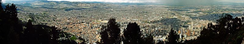
Bogotá is located on the west of the Savannah of Bogotá (Sabana de Bogotá), 2640 meters (8661 ft) above sea level.[1] Although it is located in what is popularly called the "sabana", literally meaning "savannah", the geographical site is actually a high plateau in the Andes mountains. The extended region is also known as "Altiplano Cundiboyacense" which literally means "high plateau of Cundinamarca and Boyacá".
The Bogotá River crosses the "sabana", forming Tequendama Falls (Salto de Tequendama) to the south. Tributary rivers form valleys with flourishing villages, whose economy is based on agriculture, livestock raising and artisanal production.
The "sabana" is bordered to the east by the Eastern Cordillera of the Andes mountain range. Surrounding hills, which limit city growth, run from south to north, parallel to the Guadalupe and Monserrate mountains. The western city limit is the Bogotá River. The Sumapaz Paramo (moorland) borders the south and to the north Bogotá extends over the plateau up to the towns of Chía and Sopó.
Climate
| Bogota | ||||||||||||||||||||||||||||||||||||||||||||||||||||||||||||
|---|---|---|---|---|---|---|---|---|---|---|---|---|---|---|---|---|---|---|---|---|---|---|---|---|---|---|---|---|---|---|---|---|---|---|---|---|---|---|---|---|---|---|---|---|---|---|---|---|---|---|---|---|---|---|---|---|---|---|---|---|
| Climate chart () | ||||||||||||||||||||||||||||||||||||||||||||||||||||||||||||
|
||||||||||||||||||||||||||||||||||||||||||||||||||||||||||||
|
||||||||||||||||||||||||||||||||||||||||||||||||||||||||||||
Bogota has a subtropical highland climate (Köppen Cwb). The average temperature on the "sabana" is 14.0 °C (57 °F),[11] varying from 3 to 25 °C (37 to 77 °F) during the course of the day. Dry and rainy seasons alternate throughout the year. The driest months are December, January, February and March. The warmest month is March, bringing a maximum of 19.7 °C (67.5 °F). The coolest nights occur in January, with an average of 5.4 °C (41.7 °F) in the city; temperatures can fall below freezing in the nearby towns causing frosts and fog in early morning, with the lowest recorded temperature within the city being −7.2 °C (19.0 °F).[12] in February 2007.
The official highest recorded temperature is 24.9 °C (77 °F) reached in January 1992 and March 1995.[13]
The rainiest months are April, May, September, October and November, in which typical days are mostly overcast, with low clouds and some winds, bringing maximum temperatures of 18 °C (64 °F) and lows of 7 °C (45 °F). June and July are usually rainy periods and August is sunny with high winds. Hailstorms are very common during the rainy season, and can be very strong, especially in October. Days are mild or cool and nights can get moderately cold due to the city having mild winds in the night all year round.
While temperatures are relatively consistent throughout the year, weather conditions can change dramatically during the course of a single day. Climatic conditions are irregular and variable due to the El Niño and La Niña climatic phenomena which occur in and around the Pacific basin and are responsible for pronounced climatic changes. This makes the city's weather unpredictable; sunny mornings can turn out into a severe-storm afternoon (something commonly referred as "Sol de Lluvia" (literally, "Rainy Sun").
| Climate data for Bogota D.C. (El Dorado Airport, 1972-1990) | |||||||||||||
|---|---|---|---|---|---|---|---|---|---|---|---|---|---|
| Month | Jan | Feb | Mar | Apr | May | Jun | Jul | Aug | Sep | Oct | Nov | Dec | Year |
| Average high °C (°F) | 19.6 (67.3) |
19.7 (67.5) |
19.7 (67.5) |
19.3 (66.7) |
19.0 (66.2) |
18.3 (64.9) |
18.1 (64.6) |
18.3 (64.9) |
18.7 (65.7) |
18.8 (65.8) |
19.1 (66.4) |
19.2 (66.6) |
19.0 (66.2) |
| Average low °C (°F) | 5.4 (41.7) |
6.1 (43) |
7.4 (45.3) |
8.2 (46.8) |
8.4 (47.1) |
8.0 (46.4) |
7.5 (45.5) |
7.0 (44.6) |
6.9 (44.4) |
7.6 (45.7) |
7.7 (45.9) |
6.1 (43) |
7.2 (45) |
| Rainfall mm (inches) | 33 (1.3) |
43 (1.69) |
66 (2.6) |
111 (4.37) |
94 (3.7) |
57 (2.24) |
41 (1.61) |
49 (1.93) |
73 (2.87) |
115 (4.53) |
88 (3.46) |
54 (2.13) |
824 (32.44) |
| Avg. rainy days | 8 | 11 | 14 | 18 | 20 | 19 | 17 | 16 | 17 | 20 | 18 | 12 | 190 |
| Sunshine hours | 189.1 | 152.6 | 145.7 | 111 | 114.7 | 111 | 142.6 | 139.5 | 123 | 120.9 | 135 | 167.4 | 1,652.5 |
| Source: Hong Kong Observatory [10] | |||||||||||||
Urban layout and nomenclature
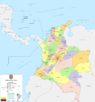
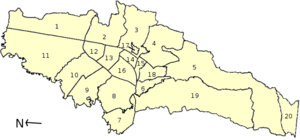
Bogotá has 20 localities, or districts, forming an extensive network of neighborhoods. Areas of higher economic status tend to be located to the north and north-east, close to the foothills of the Eastern Cordillera. Poorer neighborhoods are located to the south and south-east, many of them squatter areas. The middle classes usually inhabit the central, western and north-western sections of the city.
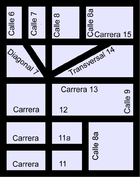
The urban layout in the center of the city is based on the focal point of a square or plaza, typical of Spanish-founded settlements, but the layout gradually becomes more modern in outlying neighborhoods. The current types of roads are classified as calles (streets), which run perpendicular to the Cordillera, with street numbers increasing towards the north, and also towards the south (with the suffix "Sur") from Calle 1. Carreras run parallel to the hills, with numbering increasing as one travels east or west of Carrera 1 (with the suffix "Este" for roads east of Carrera 1). Other types of roads more common in newer parts of the city may be termed "Eje" (Axis), "Diagonal" or "Transversal".
The numbering system for street addresses recently changed, and numbers are assigned according to street rank from main avenues to smaller avenues and local streets. Some of Bogota's main roads, which also go by a proper name in addition to a number, are:
- Norte-Quito-Sur or N.Q.S. (North Quito South Avenue, from 9th road at north following railway to 30th road Avenue, or Quito City Avenue, and Southern Highway)
- Autopista Norte-Avenida Caracas (Northern Highway, or 45th road, joined to Caracas Avenue, or 14th road)
- Avenida Circunvalar (from downtown following hillside on eastern hills going to La Calera)
- Avenida Suba (60th transversal from 100th street to the Suba Hills; 145th street from Suba Hills westward)
- Avenida El Dorado (El Dorado Avenue, or 26th street)
- Avenida de las Américas (Americas Avenue, from 34th street at east to 6th street at west)
- Avenida Primera de Mayo (May First Avenue, or 22nd south street)
- Avenida Ciudad de Cali (Cali City Avenue, or 86th road)
- Avenida Boyacá (Boyacá Avenue, or 72nd road)
- Autopista Sur (Southern Highway)
Localities (Districts)
|
|
|||||
|---|---|---|---|---|---|
|
|||||
Surrounding cities
 |
Cota | Chía | La Calera | |
| Mosquera | Choachí | |||
| Tequendama | Soacha | Chipaque |
Demographics
| Year | Population |
|---|---|
| 1775 | 16,233 |
| 1800 | 21,964 |
| 1832 | 28,341 |
| 1870 | 40,883 |
| 1912 | 121,257 |
| 1918 | 143,994 |
| 1928 | 235,702 |
| 1938 | 325,650 |
| 1951 | 715,250 |
| 1964 | 1,697,311 |
| 1973 | 2,855,065 |
| 1985 | 4,236,490 |
| 1993 | 5,484,244 |
| 1999 | 6,276,428 |
| 2005 | 7,185,889 |
| Source: Biblioteca Luis Angel Arango[14] | |
The largest and most populous city in Colombia, Bogotá has 8,566,926 inhabitants in its metropolitan area (2009 census),[2] with a population density of approximately 3912 inhabitants per square kilometer. In 2009 it was estimated that the city houses about 7,362,520 and 8,566,926 inhabitants in the metropolitan area. Only 15,810 people are located in rural areas of Capital District. 47.5% of the population are male and 52.5% women.
99.5% of households have electricity service, while 98.7% have water service and 87.9% have telephone service. However, 32.6% of citizens were in poverty (living on less than US$2 a day) in 2005.
In Bogotá, as in the rest of the country, the acceleration of the urbanization process is not only due to industrialization, since there are complex political and social reasons such as poverty and violence which led to migration from rural to urban areas throughout the twentieth century and beyond. This has led to an exponential growth of population in urban areas and belts of misery in their surroundings. A dramatic example of this is the number of displaced people who have arrived in Bogotá. According to the Consultancy for Human Rights, Codhes, in the period 1999-2005 more than 260,000 people arrived in Bogotá as a result of displacement, about 3.8% of the total population of Bogotá.
The majority of the displaced population lives in the Ciudad Bolívar, Kennedy, Usme, and Bosa sections.
The racial composition of the city's population includes people of Mestizo origin (those of mixed Amerindian and European descent), in addition to Europeans, mostly Spaniards, Italians, French, Germans, and other European ethnic groups. It has a very large Middle Eastern population, made up mostly of Lebanese and Syrian immigrants. The Afro-Colombian population in Bogotá is smaller than cities along the coast such as Cartagena, where Colombians of African descent have historically resided.
Crime
Bogotá has gone to great lengths to change its crime rate and its image with increasing success after being considered in the mid-90s to be one of the most violent cities in the world.[15] In 1993 there were 4,352 intentional homicides at a rate of 81 per 100,000 people;[16] in 2007, Bogotá suffered 1,401 murders at a rate of 19 per 100,000 inhabitants.[17] This success was the result of a participatory and integrated security policy, "Communidad Segura", that was first adopted in 1995 and continues to be enforced.
Government
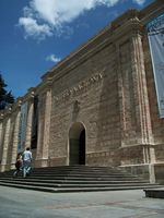
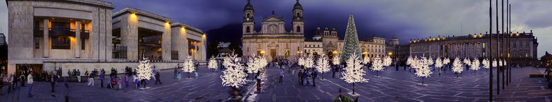
Bogotá is the capital of the Republic of Colombia, and houses the national legislature, the Supreme Court of Justice, and the center of the executive administration as well as the residence of the President of the Republic (Casa de Nariño).[18] These buildings, along with the Principal Mayor's office, the Lievano Palace (Palacio de Liévano), are located within few meters from each other on the Bolívar Square (Plaza de Bolívar). The square is located in the city's historical center, La Candelaria, which features architecture in Spanish Colonial and Spanish Baroque styles.
The Principal Mayor and District Council – both elected by popular vote – are responsible for city administration. In 2007 Samuel Moreno Rojas was elected Mayor; his term runs from 2008 to 2011. Previous recent mayors of Bogotá include Luis Eduardo Garzón, Antanas Mockus Sivickas and Enrique Peñalosa Londoño.
The city is divided into 20 localities: Usaquén, Chapinero, Santa Fe, San Cristóbal, Usme, Tunjuelito, Bosa, Kennedy, Fontibón, Engativá, Suba, Barrios Unidos, Teusaquillo, Los Mártires, Antonio Nariño, Puente Aranda, La Candelaria, Rafael Uribe Uribe, Ciudad Bolívar, Sumapaz.
Each of the 20 localities is governed by an administrative board elected by popular vote, made up of no fewer than seven members. The Principal Mayor designates local mayors from candidates nominated by the respective administrative board.
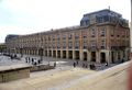
 Nariño Palace, the presidential house. |
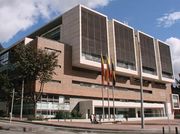
 Palace of Justice. |
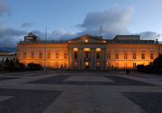
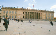 Colombian National Capitol. |
 Liévano Palace houses the office of the Mayor of Bogota. |
Economy
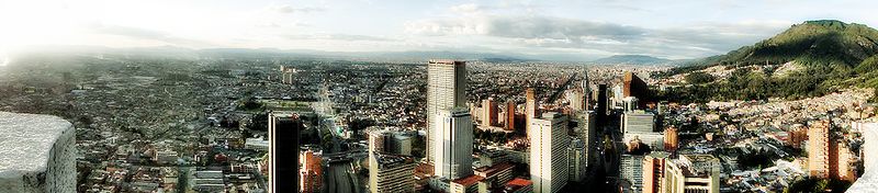
Bogota is the main economic and industrial center of Colombia. In 2008 the city ranked as the fourth most influential financial center of Latin America. In the period 2003-2006, its commercial GDP grew by 10.3% annually, accounting for 25.3% of GDP national trade. However, the unemployment rate reached 11.3% and a 31.6 percent underemployment. The city is one of the largest industrial centers in Latin America. Nationally, the import of capital goods has been spurred by the government, benefiting in particular the city of Bogotá which is involved in 24.4% of total domestic industry (2003). This is due in part to its geographical location, which makes the city a strategic point in terms of logistics, since transportation of goods to other parts of the country is relatively fast. This also facilitates the supply of raw materials for industry in the city, by its proximity to agricultural regions like the Eastern Plains. Several multinational companies have established their regional operations here during the last decades. However, the distance from the ports reduces the competitive advantages for exporting industrial products. Thus services (including telecommunications and trade) are gaining share versus industry.
,
In 2005, consumer goods led industrial production, followed by intermediate and capital goods. Of the 248,000 companies available to Bogotá, 78% are linked to service activities, contributing to 76% employment and 79% of GDP. [39] The highest concentrations of industrial establishments are in Puente Aranda, Fontibón, Kennedy, Los Mártires, and Barrios Unidos Engativá (in that order). Important business include the food industries, chemical, pharmaceutical, textile, publishing and metalworking. Also in 2005, the town with the highest labour productivity was Tunjuelito, followed by Teusaquillo and Chapinero.
Bogotá is a major tourist destination, an industry which has seen positive growth at the national level in recent years. Another industry that has grown is construction, contributing directly to reactivate economic activity in the capital.
The main international trading partner in Bogotá in 2003 was the United States, followed by the European Union. The city exports mainly agricultural products (30%), chemicals (10%) and textiles (7%), and imports transportation materials (17%), machinery except electrical (17%) and electrical machinery (14%).
In 2008, the World Cities Study Group and Network (GaWC) from the United Kingdom ranked Bogotá as a beta level city, one of their highest rankings. Beta level cities are important world cities that are instrumental in linking their region or state into the world economy.[19]
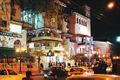
Tourism
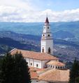 Monserrate Sanctuary, a famous landmark. |
 Atlantis Plaza Mall, featuring the Hard Rock Cafe. |
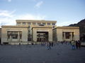
 Casa de la Moneda (Colombian Mint). |
Despite the bad reputation Colombia bore in the 1980s and early 1990s, tourism in Bogotá has increased since the 2000s due to aggressive publicity campaigns and improvements in both infrastructure and safety. In 2007 the Instituto Distrital de Turismo (District Institute of Tourism) was created with the goal of making Bogotá a sustainable tourist destination.
In Bogotá, there is a wide variety of accommodation ranging from backpacker lodges and five star hotels. The hotels in the historical center of La Candelaria and its surrounding areas cater to lovers of culture and the arts. The hotels located near Ciudad Salitre are intended for visitors who make short stops in Bogotá or need proximity to El Dorado International Airport. The hotels located in the north of the city mainly cater to business visitors, or those travelers seeking shopping or pleasure.
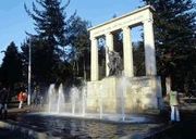
Important landmarks and tourist stops in Bogota include the botanical garden José Celestino Mutis, La Quinta de Bolivar, the national observatory, the planetarium, Maloka, the Colpatria observation point, the observation point of La Calera, the monument of the American flags, and La Candelaria (the historical district of the city). The city has numerous green parks and amusement parks like Salitre Magico, Mundo Aventura and Camelot.
Shopping malls
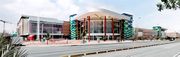
Bogotá's economy has significantly been boosted due to new shopping malls built within the last few years:
- Atlantis Plaza
- Centro Andino
- Centro Mayor (the biggest mall in the country)
- El Retiro Mall
- Plaza imperial
- Hacienda Santa Barbara
- Gran Estación
- Hayuelos
- Palatino
- Bulevar
- Portal de la 80
- Salitre Plaza
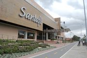
- Santafé (the second biggest mall in the country)
- Tintal Plaza
- Unicentro
- Plaza de las Américas
- Cedritos
Infrastructure
Media
The city has : Canal Capital and Citytv are local stations, Canal 13 is a regional station, and is home to the national channels Caracol TV, RCN TV, Canal Uno, Canal Institucional, and Señal Colombia. It has multiple satellite television services like DirecTV and Telefonica; cable TV is mostly provided by the Mexican company Telmex (formerly TV Cable Bogotá, Superview, and Cablecentro) and the Venezuelan company Super Cable, and satellite dishes which offer hundreds of international channels, plus several exclusive channels for Bogotá.
In the capital all the major radio networks in the country are available, in both AM and FM; 70% of the FM stations offer RDS service.
There are several newspapers, including El Tiempo, El Espectador, El Periódico, and El Nuevo Siglo, plus economical dailies La República and Portafolio, tabloids El Espacio, Q'Hubo, and Extra, and Communist Party's Voz Proletaria. Bogotá Positiva is a free weekly.
Telecommunications
Telecommunication services are provided by three main operators: Empresa de Telecomunicaciones de Bogotá (ETB), Telefónica and Telmex. Below is a list of the companies offering various services:
- Telephone: ETB, Telmex, UNE (EPM Bogotá), Telecom (Colombia)|Telefónica Telecom (owned by Telefónica)
- Internet: ETB, Telmex, UNE (EPM Bogotá), Telecom (Colombia)|Telefónica Telecom
- Mobile phone: Colombia Móvil|Tigo (also known as Tigo; co-owned by ETB, Empresas Públicas de Medellín|EPM and Millicom), Comcel Colombia|Comcel (owned by Telmex), Movistar (owned by Telefónica)
- Cable television: ETB (partnership with DirecTV), UNE (EPM Bogotá), Telmex, Telecom (Colombia)|Telecom](owned by Telefónica)
Energy
Energy is provided by Empresa de Energía de Bogotá through its branch CODENSA, and Gas Natural.
Water and sewer
Full water and sewer services are provided by Empresa de Acueducto de Bogotá.
Socioeconomical stratums and billing
Energy and sewer bills are stratified based on the location of owner's residence and income,[20] with the intended purpose that wealthier branches of society subsidize the energy bills of the poorer. Bogota is divided into six socio-economic estratos (stratums):
- Estrato 1 (lowest)
- Estrato 2 (low)
- Estrato 3 (mid-low)
- Estrato 4 (mid-high)
- Estrato 5 (high)
- Estrato 6 (highest)
Transportation
Bogotá's growth has placed a strain on its roads and highways, but within the past decade significant efforts to upgrade the infrastructure have been undertaken. Private car ownership, despite being under 27%, forms a major part of the congestion, in addition to taxis, buses and commercial vehicles. Buses remain the main means of mass transit. There are two bus systems: the traditional system and the TransMilenio. The traditional system runs a variety of bus types, operated by several companies on normal streets and avenues: Bus (large buses), Buseta (medium size buses) and Colectivo (vans or minivans). The bigger buses were divided into two categories: Ejecutivo, which was originally to be a deluxe service and was not to carry standing passengers, and corriente or normal service. Since May 2008, all buses run as corriente services. Bogotá is a hub for domestic and international bus routes. The Bogotá terminal serves routes to most cities and towns in Colombia[21] and is the largest in the country. There is international service to Ecuador, Perú and Venezuela.
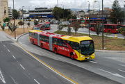
The TransMilenio rapid transit system, created during Enrique Peñalosa's mayoral term,[22] is a form of bus rapid transit that has been deployed as a measure to compensate for the lack of a subway or rail system. TransMilenio combining articulated buses that operate on dedicated bus roads (busways) and smaller buses (feeders) that operate in residential areas, bringing passengers to the main grid. TransMilenio's main routes are: Caracas Avenue, Northern Highway (Autopista Norte), 80th Street, Americas Avenue, Jiménez Avenue, and 30th Avenue (also referred to as Norte Quito Sur or N.Q.S. for short). Routes for Suba Avenue and Southern Highway (Autopista Sur), the southern leg of the 30th Avenue, were opened in April 2006. The third phase of the system will cover 7th Avenue, 10th Avenue, and 26th Street (or Avenida El Dorado). The system is planned to cover the entire city by 2030. Although the Transmilenio carries commuters to numerous corners of the city, it is more expensive than any public transport except taxis, and fares increase with petroleum fuel prices. As of July 2009 the price of a ticket was C$1500 (about US$0.75); however, a single ticket allows unlimited transfers until the passenger leaves the system, and passengers travel on feeder routes for free. Transmilenio does not yet cover some main routes, and buses are overcrowded.
Despite the city's chronic congestion, many of the ideas enacted during the Peñalosa years are regarded worldwide to be cost-effective, efficient and unique solutions. In addition to TransMilenio, the Peñalosa administration and voter-approved referenda helped to establish travel restrictions on cars with certain licence plate numbers during peak hours called Pico y placa; "Car Free Days" on Sundays; a massive system of bicycle paths and segregated lanes called ciclorrutas; and the removal of thousands of parking spots in an attempt to make roads more pedestrian-friendly. Ciclorrutas is one of the most extensive dedicated bike path networks of any city in the world, with a total extension of 303 km. It extends from the north of the city, 170th Street, to the south, 27th Street, and from Monserrate on the east to the Bogotá River on the west. The ciclorruta was started by the 1995–1998 Antanas Mockus administration, and considerably extended during the administration of Mayor Peñalosa.[23] Since the construction of the ciclorruta bicycle use in the city has increased.
Airports
Bogotá's principal airport is El Dorado International Airport, west of the city's downtown, at the end of Avenue El Dorado. Due to its central location in Colombia and in Latin America, it is a hub for domestic and international airlines.
El Dorado is heavily congested, as it handles more passengers than its optimal capacity. Work on a major expansion of El Dorado airport started in September 2007. When completed, this will expand capacity from the current 8 million passengers a year to 25 million.[24]
A secondary airport, Catam, serves as a base for Military and Police Aviation; there is also Guaymaral Airport, for private aviation activities.
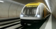
Urban and suburban railways
Colleges and universities
Previously known as the Athens of South America,[25] Bogotá has many schools. The city has an extensive educational system of both primary and secondary schools and colleges. Due to the constant migration of people into the nation's capital, the availability of quotas for access to education offered by the State free of charge is often insufficient. The city also has a diverse system of colleges and private schools.
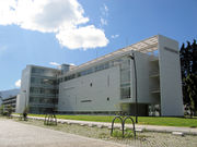
There are a number of universities, both public and private. In 2002, there were a total of 106 higher education institutions; in Bogotá there are several universities, most partially or fully accredited by the NAC (National Accreditation Council): National University of Colombia, University of the Andes, Colombia, District University of Bogotá, University of the Savannah, Pontifical Xavierian University, Our Lady of the Rosary University, Universidad Externado de Colombia, Military University Nueva Granada, Sergio Arboleda University, Jorge Tadeo Lozano University and Saint Thomas Aquinas University.
The city has a University City at the National University of Colombia campus located in the traditional sector Teusaquillo. It is the largest campus in Colombia and one of the largest in Latin America. The town of La Candelaria is home to the largest concentration of private universities in Latin America.
In Colombia, the primary and secondary schools educational system goes from pre-kindergarten to eleventh grade, that being the high school senior year. Education in Colombia is not obligatory as in other countries, but the government has implemented a promotional campaign nationwide to influence families with low economic levels to get their children enrolled in school.
There is a great variety of private bilingual schools typically attended by English speaking students and those from a high economic status.
Culture

Bogota has many cultural venues including 58 museums, 62 art galleries, 33 library networks, 45 stage theatres, 75 sports and attraction parks, and over 150 national monuments.[26] Many of these are renowned globally such as:
- The Luis Angel Arango Library, the most important in the region which receives well over 6 million visitors a year;[27]
- The Colombian National Museum, one of the oldest in the Americas, dating back to 1823;[28]
- The Ibero-American Theater Festival, largest of its kind in the world, receives 2 million attendees enjoying over 450 performances across theaters and off the street;[29]
- The Bogota Philharmonic is the most important symphony orchestra in Colombia, with over 100 musicians and 140 performances a year;[30]
- The Cristobal Colon Theater, the Country's oldest Opera House, opened in 1892, is home to the National Symphony Association's major act, the National Symphony Orchestra of Colombia;[31]
- Rock al Parque or Rock at the Park, the most important open air rock music festival in Latin America. Recurring annually, it gathers over 320,000 music fans who can enjoy over 60 band performances for free during three days a year.[32] The series have been so successful during its 15 years of operation that the city has replicated the initiative for other music genres, resulting in other recent festivals like Salsa at the Park, Hip Hop at the Park, Ballet at the Park, Opera at the Park, and Jazz at the Park.
Bogotá has worked heavily in recent years to position itself as leader in cultural offerings in South America, and it is increasingly being recognized worldwide as a hub in the region for the development of the arts.[33][34][35][36] In 2007 Bogota was awarded the title of Cultural Capital of Ibero-America by the UCCI (Union of Capital Cities in Ibero-America), and it became the only city to have received the recognition twice, after being awarded for the first time in 1991.[37]
Architecture
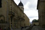
The urban morphology and typology of colonial buildings in Bogota have been maintained since the late nineteenth century, long after the independence of Colombia (1810). This persistence of the colonial setting is still visible, particularly in La Candelaria, the historical center of Bogotá. Also kept up are the colonial houses of two stories, with courtyards, gabled roofs, ceramic tiles and balconies. In some cases, these balconies were filled with glass during the Republican period, a distinguishing feature of the architecture of the sector (for example, the House of Rafael Pombo).
"Republican Architecture" was the style that prevailed between 1830 and 1930. Although there were attempts to consolidate a modern architectural language, the only examples seen are University City and White City at the National University of Colombia (constructed 1936 to 1939). This work was developed by German architect James Daly, although architects of rationalist trends participated in the design of campus buildings. We also see in Bogotan architecture trends such as art deco, expressionism and organic architecture. This last trend was typified by Bogotan architects in the second half of the twentieth century such as Rogelio Salmona.
In 2006 Bogotá won The Golden Lion Award at the Tenth International Architecture Exhibition of the Venice Biennale of Architecture, in recognition of "their efforts towards social inclusion, education, housing and public space, particularly through innovations in transportation."
Although renowned for its beautiful preservation of colonial architecture, there are also significant contemporary architecture examples found in the downtown and at the north of the city.
In 2014 BD Bacatá will be inaugurated, taking the place from Colpatria tower to become the tallest building of the city. The building its expected to be the beginning of the renovation of the city's downtown.
Libraries and archives
In 2007 Bogotá was named World Book Capital by UNESCO.[38] Bogota is the first Latin American city to receive this recognition, and the second one in the Americas after Montreal. It stood out in programs, the library network and the presence of organizations that, in a coordinated manner, are working to promote books and reading in the city. Several specific initiatives for the World Book Capital program have been undertaken with the commitment of groups, both public and private, engaged in the book sector.
The city is home to the Biblored, an institution which administers 16 small and four large public libraries (Biblioteca Virgilio Barco, Biblioteca El Tintal, Biblioteca El Tunal and Biblioteca Julio Mario Santodomingo). It also has six branches of the Library Network of the Family Compensation Fund Colsubsidio and libraries and documentation centers attached to institutions like the Museo Nacional de Colombia (specializing in old books, catalogs and art), Museum of Modern Art in Bogota, the Alliance Francaise, and the Centro Colombo Americano.
Another set of libraries are the new collaborative initiatives between the state, city and international agencies. Examples are the Cultural Center Gabriel García Marquez, custom designed by the Fondo de Cultura Economica in Mexico, and the Spanish Cultural Center, which will begin construction with public funds and of the Spanish Government in the downtown Bogotá.
The National Library of Colombia (1777) under the Ministry of Culture and the Biblioteca Luis Angel Arango (1958) under the Bank of the Republic are the two largest public libraries in the city. The first is the repository of more than two million volumes, with an important collection of ancient books. The latter has almost two million volumes. 45 thousand square meters in size, it hosts 10 thousand visitors a day. Bank of the Republic depends also on the Library Alfonso Palacio Rudas, north of the city, with about 50 thousand volumes. Other large public libraries are the Library of Congress in Colombia (with 100 thousand volumes), of the Instituto Caro y Cuervo (with nearly 200 thousand volumes, the largest Latin American library in Philology and Linguistics), the Library of the Academy of History The Library of the Academy of Language, the Library of the Colombian Institute of Anthropology and History ICANH, and many university libraries.
Bogotá is home to historical records housed the General National Archive, a collection of about 60 million documents, one of the largest repositories of primary historical sources in Latin America. Bogotá is also home to the Musical Archive of the Cathedral of Bogota (with thousands of books and choral song-colonial period), the Archdiocesan Archive, the Archive of the Conciliar Seminary of Bogotá, the Archive History National University of Colombia and the Archive of the Mint in Bogotá, under the Bank of the Republic.
Museums and galleries
The city offers 58 museums and over 70 art galleries. The National Museum of Colombia has acquisitions divided into four collections: art, history, archeology and ethnography. The Gold Museum, with 35 thousand pieces of tumbaga gold, along with 30 thousand objects in ceramic, stone and textiles, represents the largest collection of pre-Columbian gold in the world.
The Botero Museum has 123 works of Fernando Botero and 87 works by international artists. The Museum of Modern Art in Bogota has a collection of graphic arts, industrial design and photography. The Museum of Colonial Art is home to an important collection of colonial art from Colombia. Fundación Gilberto Alzate Avendaño hosts activities related to the performing arts and shows temporary exhibits of art in its halls and galleries.
Among the scientific museums are the Archeological Museum - Casa del Marqués de San Jorge, which has about 30 thousand pieces of pre-Columbian art, Instituto de Ciencias Naturales (UN), one of the four largest museums of natural sciences in Latin America, and the Geological Museum, which has a collection specializing in Geology and Paleontology.
Bogotá has historical museums like the Casa Museo Jorge Eliecer Gaitan, the Museum of Independence, the Quinta de Bolivar and the Casa Museo Francisco José de Caldas, as well as the headquarters of Maloka and the Children's Museum of Bogota. New museums include the Art Deco and the Museum of Bogotá.
Theater and scenic arts
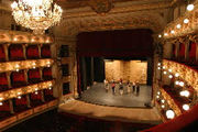
Besides the Ibero-American Theater Festival, the city has forty-five theaters; the principal ones are the Colon Theater, the National Theater with its two venues, the traditional TPB Hall, the Theater of La Candelaria, the Carmarin Theater of Carmen (over 400 years old, formerly a convent), the Colsubsidio, and a symbol of the city, the renovated Teatro Jorge Eliecer Gaitan (the highest capacity currently in South America), León de Greiff Auditorium (home of the Bogota Philharmonic Orchestra), and the Open Air Theater "La Media Torta", where musical events are also held.
Bogota has its own film festival, the Bogota Film Festival, and many theatres, showing both contemporary films and art cinema.
The main cultural center of the city is the La Candelaria, historic center of the city, with a concentration of universities and museums. In 2007 Bogota was designated the Ibero-American cultural Capital of Iberoamerica.
Sports

The District Institute for Recreation and Sport promotes recreation, sports and use of the parks in Bogota, a city where according to 1998 estimates only 10% of the people play sports, and only 0.7% do so regularly.
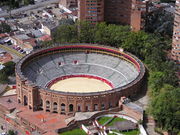
Football has been declared a symbol of Bogotá, and is widely played in the city. Colombian professional Football is popular. There are three professional clubs in the city, Millonarios, La Equidad, and Santa Fe. The nineteen titles won by two of these teams (Millonarios have 13 and Santa Fe have six) make Bogota second only to Cali in number of championships won. The main football stadium is the Estadio Nemesio Camacho El Campin (known as the Campin Stadium), which is the headquarters of the Colombia national Football team, where they won the Copa América in 2001.
Other major sporting venues are the covered Coliseum El Campin, the aquatic complex of Parque Simón Bolívar, the Sports Palace, and the El Salitre Sports venue which includes the Velódromo Luis Carlos Galán (which hosted the 1995 UCI Track Cycling World Championships) and Diamond El Salitre ballpark.
Bogota hosted the first Bolivarian Games held in 1938. The city hosted the National Games in 2004, winning the championship. It was a sub-venue Bolivarian Pan American Games. In addition, the city on the route of the Tour of Colombia.
Religion
As in the rest of Colombia, the value of family unity is quite important in Bogota society, which is especially prominent in religious celebrations and special times of the year.
Historically, the city has had a tradition of attachment to Roman Catholicism, although the 1991 Constitution has facilitated the presence of Protestant movements and other religious groups in the population.
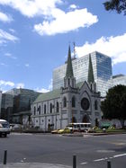
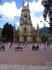
Proof of this religious tradition is the number of churches built in the historic city center. The city has been seat of the Roman Catholic Archdiocese of Bogota since March 22, 1564. The seat of the Archdiocese is the Cathedral of Colombia.
The city has a Muslim mosque located in the area of Chapinero, a Jewish synagogue located on Avenida Pepe Sierra (Calle 116), an Orthodox church located in Chapinero, and a Temple of the Church of Jesus Christ of Latter-day Saints located on the street North Highway 127. There are four Buddhist centers located in the north of the city, and there are Protestant churches in different parts of the city.
Gastronomy
A broad array of restaurants can be visited in Bogota where typical and international food can be enjoyed. The G Zone, La Candelaria and the International Centre are some of the main sectors where a number of international restaurants are found. Typical dishes of Bogota include the Ajiaco, a delightful soup prepared with chicken; a variety of potatoes, cob, and "guascas" (a spice), usually served with milk, capers and curaba cream.
Tamale with chocolate is a very traditional dish here. Colombian tamal is a paste made with rice, meat or chicken, chickpea, carrot, and spices, wrapped in banana leaves and steam cooked.
Figs with arequipe, strawberries with cream, postre de natas and cuajada con melao are some of the main desserts offered in the city. Canelazo is a hot drink from the Altiplano prepared with agua de panela, cinnamon and aguardiente.
Parks and recreation
There are many parks, many with facilities for concerts, plays, movies, storytellers and other activities.
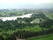
- "Simón Bolívar Metropolitan Park" is a large park regularly used to stage free concerts (such as the annual Rock al Parque, a festival in which new and popular Latin rock bands play free of charge). Kites are flown in the park.
- The public Parque Nacional (National Park) has many trees and green spaces, ponds, games for children, foot and bicycle paths, and venues for entertainment such as public screenings of movies and concerts and events organized by the Council of Bogotá. It is located between two main streets, the Circunvalar Avenue and the 7th Avenue.
- The Bogotá Botanical Garden (Jardín Botánico de Bogotá).
- The Children's Museum of Bogotá (Museo de los Niños) is a science, technology and art interactive museum specializing in children and youngsters ages 2 to 19.
- "Parque de la 93" is located between 93rd and 93Ath street, and 12th and 13th avenue, and has day-time leisure activities and nightlife. Several of the top restaurants and bars in the city are in this park.
- There are restaurants and bars in the vicinity of a T-shaped pedestrian strip dubbed "La T" (The T) at the corner of 82nd street and Cra.12. More recently, restaurant activity has begun in the "Zona G" (Gourmet Zone) in and around 67th and 70th Streets and other locations including Usaquen in the north-east and La Macarena (downtown).
- Mundo Aventura is an amusement park, with an entry charge and charges for the different attractions. It has rides for adults and children, a petting zoo, and the "cerdodromo", where pigs race.
- "Salitre Mágico" is another amusement park with rides and attractions. The park is near the Simón Bolívar park, where concerts are held throughout the year.
- Parque del Chicó has trees, gardens, artificial creeks and ponds, and a colonial style house converted into a museum.
- To the north Parque Jaime Duque has rides, a giant map of Colombia, popular exhibits, a zoo, and a big hand holding the world symbolizing God. There is a reproduction of the Taj Mahal in the park with a collection of reproductions of famous paintings. The park is also used for large concerts, mainly electronic music ones.
- Maloka is an interactive museum of sciences.
- Tourist train is a sightseeing train, popular with Bogotá residents, which runs to outlying towns Zipaquirá, Cajicá and Nemocón along the lines of the former Bogotá Savannah Railway on weekends. The route to Zipaquirá (famous for its salt cathedral) is 53 km long. Another line goes towards the north for 47 km and ends at Briceño.
Simon Bolivar Metropolitan Park
|
.jpg)
Journalists's park
|
National Park
|
Symbols
The flag originated with the insurgency movement against the colonial authorities which began on July 20, 1810, during which the rebels wore armbands with yellow and red bands, as these colours were those of the Spanish flag used as the flag for the New Kingdom of Granada.
In October 9, 1952, exactly 142 years after these events, decree 555 of 1952 officially adopted the patriotic armband as the flag of Bogotá.[39] The flag of Cundinamarca follows the same pattern, plus a light blue tile which represents the Virgin Mary's cape.
The flag itself is a yellow band above a red one. The yellow denotes the gold from the earth, as well as the virtues of justice, clemency, benevolence, the so-called "mundane qualities" (defined as nobility, excellence, richness, generosity, splendour, health, steadfastness, joy and prosperity), long life, eternity, power and constancy. The red denotes the virtue of charity, as well as the qualities of bravery, nobility, values, audacity, victory, honour and furor, Colombians call it the blood of their people.
The coat of arms of the city was granted by emperor Charles V (Charles I of Spain) to the New Kingdom of Granada, by royal decree given in Valladolid, Spain on December 3, 1548. It contains a black eagle in the center, which symbolises steadfastness. The eagle is also a symbol of the Habsburgs, which was the ruling family of the Spanish empire at the time. The eagle is crowned with gold and holds a red pomegranate inside a golden background. The border contains olive branches with nine golden pomegranates on a blue background. The two red pomegranates symbolize audacity, and the nine golden ones represent the nine states which constituted the New Kingdom of Granada at the time. In 1932 the coat of arms was officially recognized and adopted as the symbol of Bogotá.
Bogotá's anthem lyrics were written by Pedro Medina Avendaño; the melody was composed by Roberto Pineda Duque. The song was officially declared the anthem by decree 1000 of July 31, 1974, by then Mayor of Bogotá, Aníbal Fernandez de Soto.
International relations
Twin towns and sister cities
Bogotá is twinned with:
See also
- Bogotá's Carnival
- Children's Museum of Bogotá
References
Notes
- ↑ 1.0 1.1 "Bogotá Distrito Capital" (in Spanish). CORFERIAS. 2008. http://www.corferias.com/en/index.cfm?doc=sobre_bogota&ids=7. Retrieved 29 December 2008.
- ↑ 2.0 2.1 2.2 ""Secretaria Distrital de Planeacion"". Sdp.gov.co:8443. http://www.sdp.gov.co/section-2117.jsp. Retrieved 2010-04-17.
- ↑ "Informe de Desarrollo Humano para Bogotá" (in Spanish). IDH. 2008. http://www.idhbogota.pnud.org.co/informe/IDH%20Bogota.pdf. Retrieved 29 December 2008.
- ↑ "Elevation of major cities". 2747.com. 2008. http://www.2747.com/2747/world/city/elevation.htm. Retrieved 29 December 2008.
- ↑ ""Athens of South America"". Revista. http://www.javeriana.edu.co/pensar/Prof-Dr-Rinc%F3n.pdf. Retrieved 2010-07-15.
- ↑ http://www.samuelalcalde.com/index.php?option=com_content&view=article&id=2180%3Aacueducto&Itemid=29
- ↑ Arias, S.; Meléndez, M. (2002). "Sacred and Imperial Topographies in kam de Castellanos's Elegías de varones ilustres de Indias". Mapping Colonial Spanish America: Places and Commonplaces of Identity, Culture and Experience. Bucknell University Press. ISBN 0838755097. http://books.google.com/books?id=ivG2-KHjc-UC&pg=PA96&hl=es&sig=StGVJBVWOk5cKM0nujRxEkH7gTU. Retrieved 2009-07-22.
- ↑ "Programa Ciudades hermanas" (in Spanish). City of Miami. 2005. http://www.ci.miami.fl.us/mic/pages/Spanish/SisterCities/Bogota.asp. Retrieved 29 December 2008.
- ↑ "Los Nombres de Santafé y Bogotá" (in Spanish). Alcaldía Mayor de Bogotá. 2005. http://www.bogota.gov.co/histo.php?idh=10968&patron=1. Retrieved 29 December 2008.
- ↑ 10.0 10.1 "Climatological Normals of Bogota". Hong Kong Observatory. http://www.hko.gov.hk/wxinfo/climat/world/eng/s_america/col_ve/bogota_e.htm. Retrieved 2010-05-09.
- ↑ "Respuestas fisiológicas de los niños al ejercicio ante las variaciones climáticas en Bogotá" (in Spanish). Universidad Pedagógica Nacional. 2008. http://www.pedagogica.edu.co:8080/portal/resumenproyecto.php?py=54. Retrieved 29 December 2008.
- ↑ ""Cambios de Clima arrasan con Cultivos"" (in Spanish). 2010. http://www.semana.com/wf_InfoArticulo.aspx?idArt=100878. Retrieved 20 February 2010.
- ↑ "Bogota passes 24 degrees" (in Spanish). 2010. http://www.eltiempo.com/colombia/bogota/ARTICULO-WEB-PLANTILLA_NOTA_INTERIOR-7170969.html. Retrieved 20 February 2010.
- ↑ "Algunos datos históricos" (in Spanish). Biblioteca Luis Angel Arango. 2001. http://www.banrep.gov.co/blaavirtual/revistas/credencial/enero2001/colmundo.htm. Retrieved 13 March 2009.
- ↑ "Bogotá's lesson in crime fighting". Comunidad Segura. 2005. http://www.comunidadesegura.org/?q=en/node/32000. Retrieved 2008-12-28.
- ↑ "Seguridad, ciudadanía y políticas públicas en Bogota" (in Spanish). IRG. http://www.institut-gouvernance.org/en/conference/fiche-conference-36.html. Retrieved 29 December 2008.
- ↑ "Homicidios" (in Spanish) (PDF). Instituto Nacional de Medicina Legal y Ciencias Forenses. p. 36. http://www.medicinalegal.gov.co/drip/2007/2%20Forensis%202007%20homicidio-1.pdf. Retrieved 29 December 2008.
- ↑ "Bogotá se consolida como centro para la inversión extranjera" (in Spanish). Alcaldía Mayor de Bogota. 2007. http://www.bogota.gov.co/portel/libreria/php/frame_detalle.php?h_id=21539&patron=01.11. Retrieved 29 December 2008.
- ↑ The World According to GaWC; 2008 http://www.lboro.ac.uk/gawc/world2008t.html
- ↑ "Proyecto de Acuerdo 651 de 2008" (in Spanish). Secretaria de Gobierno de Bogota. 2008. http://www.gobiernobogota.gov.co/component/option,com_docman/task,doc_details/Itemid,/gid,432/. Retrieved 29 December 2008.
- ↑ "Bogotá Transportation Terminal & Train Station" (in Spanish). Bogotá-dc.com. 2008. http://www.bogota-dc.com/trans/terminal.htm. Retrieved 29 December 2008.
- ↑ "Millonaria condena al Distrito por fallas en Transmilenio" (in Spanish). El Espectador. 2008. http://www.elespectador.com/noticias/bogota/articulo-millonaria-condena-al-distrito-fallas-transmilenio. Retrieved 29 December 2008.
- ↑ "Bogotanos olvidaron para qué fue creado el Día sin carro" (in Spanish). Cambio. 2 November 2008. http://www.cambio.com.co/paiscambio/762/ARTICULO-WEB-NOTA_INTERIOR_CAMBIO-3948271.html. Retrieved 29 December 2008.
- ↑ "Cinco firmas de disputan la modernización del aeropuerto El Dorado" (in Spanish). Caracol Radio. 2006. http://www.caracol.com.co/nota.aspx?id=299375. Retrieved 29 December 2008.
- ↑ "Colombia". Drclas.harvard.edu. http://www.drclas.harvard.edu/revista/articles/view/242. Retrieved 2009-07-25.
- ↑ Colombia Official Tourism Portal "Bogotá: a city for experiencing culture"
- ↑ Banco de la Republica "2008 Press Release". Retrieved Sept. 3 2009.
- ↑ Museo Nacional de Colombia "History". Retrieved Sept. 3 2009.
- ↑ Colombia Official Tourism Portal "Ibero-American Theater Festival of Bogotá: The Largest Theater Showcase in the World"
- ↑ Filarmonica de Bogota "Philarmonic Timeline"
- ↑ Ministerio de Cultura "Cristobal Colon Theater"
- ↑ Rock at the Park "15th Edition of the Concert is over"
- ↑ Scoop Independent News, New Zealand "Cultural Diversity Highlighted" 24 April 2007
- ↑ Sun Sentinel, FL "GIVE BOGOTA A TRY (NO KIDDING) CITY BOASTS ARTS, CULTURE, SCENERY AND GREAT FOOD." Feb 26 2006
- ↑ Inter Press Service "COLOMBIA: Open Your Books, Please, Bogota"
- ↑ Noticias de Bogotá: Arte "ArtBo 2009 - Reportaje"
- ↑ Universia "Bogota Ibero-American Capital of Culture for Second Time"
- ↑ UNESCO "World Book Capital City" 2007
- ↑ "Simbolos de Bogotá" (in Spanish). Alcaldía Mayor de Bogota. 2007. http://www.bogotaturismo.gov.co/ciudad/simbolos/. Retrieved 29 December 2008.
- ↑ Madrid city council webpage "Mapa Mundi de las ciudades hermanadas". Ayuntamiento de Madrid. http://www.munimadrid.es/portal/site/munimadrid/menuitem.dbd5147a4ba1b0aa7d245f019fc08a0c/?vgnextoid=4e84399a03003110VgnVCM2000000c205a0aRCRD&vgnextchannel=4e98823d3a37a010VgnVCM100000d90ca8c0RCRD&vgnextfmt=especial1&idContenido=1da69a4192b5b010VgnVCM100000d90ca8c0RCRD Madrid city council webpage. Retrieved 2009-07-22.
External links
- Bogotá travel guide from Wikitravel
- City Official Site
- Harvard Gazette Archives Text on Antanas Mockus's many inspired strategies to change Bogotá
- Plaza Capital - Digital magazine about Bogotá
- Noticias de Bogota - News in Spanish on Bogotá & its Districts
- District Planning Secretariat
|
||||||||||||||||||||||||||||||||||||||||||||||||