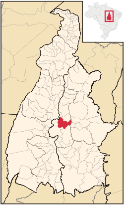
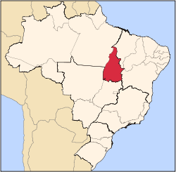
Palmas, Tocantins
| Palmas | |||
|---|---|---|---|
| — Municipality — | |||
| The Municipality of Palmas | |||
|
|||
| Nickname(s): "Capital Ecológica" ("Ecological Capital") | |||
| Motto: "Essa terra é nossa" ("This Land is Ours") | |||
 |
|||
 |
|||
| Coordinates: | |||
| Country | |||
| Region | North | ||
| State | |||
| Founded | May 20, 1989 | ||
| Government | |||
| - Mayor | Raul Filho (PT) | ||
| Area | |||
| - Total | 2,218.9 km2 (856.7 sq mi) | ||
| Elevation | 230 m (755 ft) | ||
| Population (2005) | |||
| - Total | 208,165 | ||
| - Density | 93.8/km2 (242.9/sq mi) | ||
| Postal Code | 77000-000 | ||
| HDI (2000) | 0.800 – high | ||
| Website | palmas.org | ||

Palmas (lit. "Palm trees") is the capital of the Brazilian state of Tocantins. According to IBGE estimates from 2008, the city had 184,010 inhabitants. It has an area of 2474.95 km².
Palmas is located at the state geographic centre. The average altitude is 230 m (755 ft). The city is located between these hills and the Tocantins River. In the east Palmas is bordered by the Serra do Lajeado. The city is clearly investing in gardens, squares, flower beds and parks. The yearly average temperature variation is between 24°C (75°F) and 28°C (82°F) during the rain season (October-March) and 28°C (82°F) and 35°C (95°F) during the dry season (May-September). There is only little to moderate wind. Humidity: 76%. Palmas has several parks that offer some refreshment and calmness in the city that can be hot and restless.
Palmas was founded in 1990, with the purpose of being the capital of the newest Brazilian state Tocantins, which was established after the promulgation of the new 1988 Brazilian Constitution. The city has a well-designed road system, and its urban zoning is modelled on that of Brasília. It has a symmetrical park in the city centre. In 2002, the Lajeado Hydroelectric Power Plant reservoir was completed, at which point the city gained many river beaches, and also the huge Ponte da Amizade Presidente Fernando Henrique Cardoso, which crosses over 8 kilometers (5 miles) over the reservoir, connecting Palmas with the major highway BR-153.
The Palmas Airport connects Palmas with many Brazilian cities.
The city is also home to the Federal University of Tocantins.
Contents |
Geography
Tocantins form the boundary between the Amazon Rainforest and the coastal savanna. As a result, the state's geography is varied. Many rivers cross through the state (including one of the same name), and there are over 20 archaeologically significant sites found in Tocantins.
Climate
Tocantins hosts tropical rainforest climate, which is a type of tropical climate in which there is no dry season – all months have mean precipitation values of at least 60 mm. It is usually found at latitudes within five degrees of the equator – which are dominated by the Intertropical Convergence Zone. The equatorial climate is denoted Af in the Köppen climate classification. Tropical rainforest is an abundant natural vegetation in the equatorial regions.
Vegetation
The Amazon represents over half of the planet's remaining rainforests and comprises the largest and most species-rich tract of tropical rainforest in the world. Wet tropical forests are the most species-rich biome, and tropical forests in the Americas are consistently more rich in animal species than in the wet forests of Africa and Asia.[1] As the largest tract of tropical rain-forest in the Americas, the Amazonian rain-forests have an unparalleled biodiversity. More than 1/3 of all species in the world live in the Amazon Rainforest.[2]
History
The area where Palmas was built was originally used for agriculture. Before 1990, the only village in the location was Vila Canela (near the river Tocantins, and near the Graciosa beach). The village and the beach were often flooded by the new lake. The flat area of Palmas is right between the river and the Serra do Lajeado hills in the east, and the vegetation is the typical 'cerrado'. In 1989 Miracema was the temporary capital of the state. The new capital was initially designed by the architects Luiz Fernando Cruvinel Teixeira and Walfredo de Oliveira Filho. From 20 May 1989, some of the roads and baracas were built. It was decided to be built on the east side of the river, so the forgotten east side of the state would develop as well. The location may have been chosen because it is the geodesic center of Brazil.
At the time before the lake's formatiom, the Tocantins River made curves, forming what would look like the English letter S when looking at bird's eye view. It is said that Mr. Siquera Campos enjoyed the S-like formation, and that added to the choice of the location for Palmas. When the area was chosen in January 1989, Campos decided he wanted the Palacio (the state headquarter) to be built on the highest place in Palmas. Although the architects said the hill was too soft to build on, it was still built. The temporary Palacinho (said to be the first building in Palmas) still exists close from the new one, and it is kept as a monument. Since 2002, it was used as a museum for Tocantins' history.
Economy
The most dynamic areas of commercial activities are civil engineering, furniture, and food and drinks. The JK is used as the main street for shopping, banks and restaurants. The largest is shopping center is the Palmas Shopping center. Palmas has several river beaches with sand and infrastructure. When the Orla project is finished, Palmas will have 15 km (9 mi) of beach, which will attract many tourists.
The GDP for the city was R$ 1,733,266,000 in 2005,[3] and the per capita income for the city was R$ 8,326 (2005).[4]
Education
Portuguese is the official national language, and thus it is primary language taught in schools although English and Spanish are still part of the official high school curriculum.
Educational Institutions
- Universidade Federal do Tocantins (UFT);
- Centro Universitário Luterano de Palmas (Ceulp-Ulbra);
- Faculdade Católica do Tocantins (Católica do Tocantins);
- Fundação Universidade do Tocantins (Unitins);
- Faculdade Objetivo;
- and a few others.
Transport
Airport
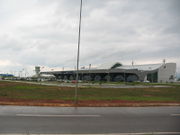
The city is served by the Palmas Airport.
Highways
Rodovia Coluna Prestes (TO-050), that connects with Brasília. BR-153 and BR-010.
Sports
In sports, the most notable football club in the city is Palmas FR, which plays at the Nilton Santos Stadium.
References
- ↑ Turner, I.M. 2001. The ecology of trees in the tropical rain forest. Cambridge University Press, Cambridge. ISBN 0-521-80183-4
- ↑ Amazon Rainforest, Amazon Plants, Amazon River Animals
- ↑ (in Portuguese) (PDF) GDP. Palmas, Brazil: IBGE. 2005. ISBN 85-240-3919-1. http://www.ibge.gov.br/home/estatistica/economia/pibmunicipios/2005/tab01.pdf. Retrieved 2007-07-18.
- ↑ (in Portuguese) (PDF) per capita income. Palmas, Brazil: IBGE. 2005. ISBN 85-240-3919-1. http://www.ibge.gov.br/home/estatistica/economia/pibmunicipios/2005/tab01.pdf. Retrieved 2007-07-18.
External links
- Tocantins Official Site to.gov.br
- Palmas Official Site palmas.to.gov.br
- Palmas English Site palmas.org
|
||||||||||||||||||||||||||||||||||||||||||||||||||||||||||||||||||||||||||||||||||||||||||||||||||