Kathmandu
| Kathmandu येँ महानगरपालिका कान्तिपुर काठमांडौ (Kaa-th-maan-dau) |
|
|---|---|
| — City — | |
| Kathmandu Metropolitan City | |
 |
|
 |
|
 Kathmandu
|
|
| Coordinates: | |
| Country | |
| Development Region | Central |
| Zone | Bagmati Zone |
| District | Kathmandu District |
| Established | 900s AD[1] |
| Government | |
| - Mayor | (none at the moment) |
| Area | |
| - City | 50.67 km2 (19.6 sq mi) |
| Elevation | 1,400 m (4,593 ft) |
| Population (2009)[2][3] | |
| - City | 949,486 |
| - Density | 18,738.6/km2 (48,532.8/sq mi) |
| - Metro | 1,687,102 |
| Time zone | Nepal Time (UTC+5:45) |
| Website | kathmandu.gov.np |
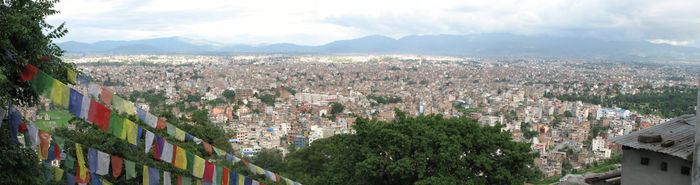
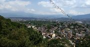
Kathmandu (Nepali: काठमांडौ, pronounced: [kɑːʈʰ.mɑːɳ.ɖuː]; Nepal Bhasa: येँ महानगरपालिका) is the capital and largest metropolitan city of Nepal. The city is the urban core of the Kathmandu Valley in the Himalayas, which also contains two sister cities namely Patan or Lalitpur, 5 kilometres (3.1 mi) to its southeast (an ancient city of fine arts and crafts) and Bhaktapur, 14 kilometres (8.7 mi) to its east (city of devotees). It is also acronymed as 'KTM' and named 'tri-city'.[4] Kathmandu valley is only slightly smaller than Singapore in terms of area.
The city stands at an elevation of approximately 1,400 metres (4,600 ft) in the bowl-shaped valley in central Nepal surrounded by four major mountains, namely: Shivapuri, Phulchowki, Nagarjun and Chandragiri. It is inhabited by 671,846 (2001) people. The Kathmandu valley with its three districts including Kathmandu District accounts for a population density of only 97 per km2 whereas Kathmandu metropolitan city has a density of 13,225 per km2. It is by far the largest urban agglomerate in Nepal, accounting for 20% of the urban population in an area of 5,067 hectares (12,520 acres) (50.67 square kilometres (19.56 sq mi)).[5][6][7][8]
Kathmandu is not only the capital of the Federal Democratic Republic of Nepal but also the headquarters of the Central Region (Madhyamanchal) among the five development regions constituted by the 14 administrative zones of Nepal located at the central part of the country. The Central region has three zones namely, Bagmati, Narayani and Janakpur. Kathmandu is located in the Bagmati Zone.[9]
Kathmandu, as the gateway to Nepal Tourism, is the nerve centre of the country’s economy. With the most advanced infrastructure among urban areas in Nepal, Kathmandu's economy is tourism centric accounting for 3.8% of the GDP in 1995–96 (had declined since then due to political unrest but has picked up again).
The city’s rich history is nearly 2000 years old, as inferred from an inscription in the valley. Its religious affiliations are dominantly Hindu followed by Buddhism. People of other religious beliefs also live in Kathmandu giving it a cosmopolitan culture. Nepali is the common language of the city, though many speak the Nepal Bhasa Newari as it is the center of the Newar (meaning: citizens of Nepal) people and culture. English is understood by all of the educated population of the city. The literacy rate is 98% in the city.[6]
Kathmandu is now the premier cultural and economic hub of Nepal and is considered to have the most advanced infrastructure among urban areas in Nepal. From the point of view of tourism, economy and cultural heritage, the sister cities of Patan(lalitpur) and Bhaktapur are integral to Kathmandu. Even the cultural heritage recognition under the World Heritage list of the UNESCO has recognized all the monuments in the three urban agglomerates as one unit under the title “Kathmandu Valley-UNESCO World Heritage Site.[10][11]
Toponymy
The city of Kathmandu is named after a structure in Durbar Square called the Kasthamandap. In Sanskrit, Kasth (काष्ठ) is "wood" and Mandap (मंडप/मण्डप) is "covered shelter." This unique temple, also known as Maru Sthal, was built in 1596 by King Laxmi Narsingh Malla. The entire structure contains no iron nails or supports and is made entirely from wood. Legend has it that the timber used for this two-story pagoda was obtained from a single tree.[12]
Kathmandu is also sometimes called "Kantipur". "Kanti" is an alternate name of the Goddess Lakshmi, and "pur" means the place where such a goddess resides. Thus, the name Kantipur demonstrates the ancient belief that it is the place where Lakshmi dwells.
History
Ancient history
The history of the city of Kathmandu, which is inseparable from that of the Kathmandu valley, dates back to ancient times.[13] Archaeological explorations indicate that Kathamandu and the two other sister towns in the valley were the oldest towns and are traced to the period between 167 BC and 1 AD Excavations conducted at Hadigaon and Lubhu in southern part of the valley, in Kathmandu, have unearthed brick walls and stone age tools. The Buddha was also born in 563 B.C in the Kapilvastu District of Nepal near the Indian border.
In 1992, workers digging a trench for the foundation of a house in Maligaon in Eastern Kathmandu discovered a life size (171 x 49 cm) standing male figure carved in pale sandstone, clearly made in the Kushan style. The sculpture was donated by an early Licchavi or pre-Licchavi monarch, named Jaya Varman with an inscription on the pedestal. Although the identity of the figure is contested, it is the authors' opinion that it is likely Jaya Varman himself who is portrayed. It is the oldest known inscription from the Kathmandu Valley. "The inscription on this sculpture, clearly dated to samvat 107, most likely corresponding to AD 185, provides this previously missing evidence, and pushes back the epigraphical documentation of royal rule in the Kathmandu valley nearly three hundred years."[14]
The geological setting of the valley points to the existence of a lake near Chobar gorge on the Bagmati River, below the present Pashupatinath Temple, which was a pilgrimage place during the period of the Buddha.[15] This lake was drained by Manjushree Bodhisatva, a Buddhist saint, by cutting open an outlet in the southern rim of the valley. As a result the valley that was created was fertile and people started cultivating here and building their homes here. As the valley grew, Manjushree is said to have worshipped Swayambhu on the hillock where the present Swayambhu temple is located.[15] He also founded the city of Manjupatan, which today lies within the present Kathamandu Metropolitan area, located between Swayambu and Gujeswari near the airport. He even declared his disciple Dharmakarma as the ruler of that city.[13][15]
Following establishment of this city, it is said that Krakuchanda Buddha, Kanak Muni Buddha and Kashyapa Buddha visited the Kathmandu valley to worship Swayambhu and Gujeshwari. Prachanda Deva, King of Gaur (Bengal) built the Swayambu stupa encasing the eternal flame and his nephew Gunakadeva was anointed as the King of Nepal. The last ruler of his dynasty, Singhakhetu, brought prosperity to the kingdom. Subsequent to the rule of the Gunakadeva dynasty, rulers from India, particularly from Bengal and the then Madras province (the present day Tamil Nadu) ruled Kathmandu. Dharma Dutta of Kanchipuram in Tamil Nadu is cited as the builder of the Pashupatinath Temple in Kathmandu.[15] This was followed by the reign of Abhir dynasty (of cowherds) of eighth rulers and the Kiratis said to be originally of the northeastern hill region of India (700 BC). Their succession of 29 rulers reigned here until the Lichhavis came into power.[15]
Four stupas around the city of Patan, near Kendra Hiranyavarna Mahavihara (called "Patukodon"), 5 kilometres (3.1 mi) away from Kathmandu, is said to have been erected by Charumati, attests to the ancient history.[13]
Licchavi Kingdom (400–750)
During the reign of the Licchavi (clan) (400–750 AD), two adjoining settlements, Yambu or Thahne (‘Yambu’ in Nepal Bhasa means the field of Kathmandu and Thahne means “northern land") and Yangal/Kone (‘Yangal’ in Nepal Bhasa means the depressed area of Kathmandu, Kone means “southern land") formed Kathmandu, also known as Koligram. Koligram is believed to be settlement of Koliyas, some of whom migrated to Kathmandu valley after Mahajanapada era.[16] Yambu is the area north of present-day Makhan Tole, next to Durbar Square. The southern sector, called Yangal, is also known as Dakshin Koligram; and a neighborhood by this name (Yengal) exists in the city today.[13] The Licchavi king Gunakamadeva founded a city in between these two settlements on the bank of Bishnumati river called Kantipur. The city was formed in the shape of a Chandrahrasa (Manjushri's sword) mentioned in Swayambhu Purana,[17] which was used to drain Nagdaha to create the Kathmandu valley and fortified with 8 barracks which were guarded by Ajimas. According to folklore, Gunakamadeva dreamt of being asked to found a city by Laxmi (or Kanti),[18] so the city was formed in her name, Kantipur. According to Nepal Sambat, the city is believed to have been founded on the auspicious date of Yenya Punhi, with the founding stone laid by Gunakamadeva at Maru Tole, which is still present. In order to appease relations between the citizens of Yembu and Yengal, the king is believed to have started a festival where the Majipa Lakhey dance of Kone (Yengal) and Pulukishi dance of Yembu (Thahne) were performed together along the main road of the newly formed city connecting the two settlements (now called Gunakamadeva Marg). The festival is still celebrated as Yenya or Indra Jatra today but the main focus of the festival has shifted to Indra and Kumari over a long period of time.
A marketplace was formed at the center of city in a circular shape (Chakrakar) according to Tantric traditions.[18] A temple, dedicated to Bhimsen, the god of merchants, was built at the center of Bhimsenthan to attract merchants.[18] However, very few trade passed through the Himalayas between India and China during this period, and the founding of this fortified city provided a secure trading point, promoting trade between the two markets and boosting the economy of the city. This also had a profound effect on the culture of the city, and brought a diversity of ethnicities, religions and cultures together harmoniously.
The Licchavi were in Bihar during the Mahajanapada era and Licchavi inscriptions have been found in Sanskrit with their particular script closely related to official Gupta scripts. The Lichhavi, having lost their political fortune in India, came to Nepal, attacking and defeating the last Kirat King Gasti.
There were 48 Licchavi rulers, including Mana Deva I, who ruled from 464 and had been referred to as their greatest ruler.[13][15] A connoisseur of art and architecture, he introduced the Pagoda roofed architecture, erected exquisite sculptures and built the temples of Changunarayan, Vishabjynarayan, Sikhomanarayan and Ichabgunarayan. The reclining Vishnu of Budhanilkantha, the gilded roof of the Pashupatinath Temple, the struts of Hanuman Dhoka and the Basantapur Tower, the Uku Bahal in Patan, and the Indreshwar Mhadev Temple at Panauti are all credited to Mana Deva.[13][15]
7th to 8th century
The famous Chinese Buddhist monk, Xuanzang (Wade-Giles: Hsüan-tsang), spent about two years between 637 and 642 AD at the great university of Nalanda, which is almost directly south of Nepal. It is not certain that he actually visited Nepal, but he left an fascinating account of it, the capital city which we know as Kathmandu, and its king, which, presumably, dates from this period:
"The country is about 4000 li in circuit, and is situated among the Snowy Mountains. The capital city is about 20 li round [approx 8 km (5.0 mi)]. Mountains and valleys are joined together in an unbroken succession. . . . There are believers and heretics mixed together. The saṅghârâmas [Buddhist monasteries or temples] and Dêva [Hindu] temples are closely joined. There are about 2000 priests, who study both the Great [Mahayana] and Little [Hinayana] Vehicles. The number of heretics and sectaries of different sorts is uncertain. The king is a Kshattriya, and belongs to the family of the Licchavas. His mind is well-informed, and he is pure and dignified in character. He has a sincere faith in the law of Buddha. Lately there was a king called Aṁśuvarman (An-chu-fa-mo), who was distinguished for his learning and ingenuity. He himself composed a work on "sounds" [a Sanskrit grammar](Śabdavidyâ); he esteemed learning and respected virtue, and his reputation was spread everywhere. To the south-east of the capital is a little stream and a lake. If we fling fire into it, flames immediately arise; other things take fire if thrown in it, and change their character.[19]
The Chinese sent Princess Wencheng to marry the Tibetan king in 641 AD. Following this, the Chinese Emperor Taizong of Tang sent an envoy via Tibet to the great Indian Emperor Harsha. Another larger mission under Wang Xuance sent in 647-8 was robbed of the gifts they were carrying; some of the emissaries were killed, others put in prison. Narendradeva sent 7,000 troops with their allies, the Tibetans, attacked Kanauj, the Gupta capital, captured the usurper, Arjuna, and his family, and sent them as a captives to China.[20] This was the last known official contact between China and India until the 13th century[21] and so, the following account of Nepal from the Tang Annals, most probably dates to information brought back about that time:
"Their king, Narendadeva, is adorned with genuine pearls, with rock-crystal, with mother of pearl, with coral and amber; he wears earrings of gold and pendants of jade, and he wears a small Buddha-image as an amulet. He sits on a lion-throne and inside the audience-hall where flowers and perfumes are scattered. The ministers of state and the courtiers are seated on the ground to the left and right, and on both sides there are hundreds of soldiers on guard. In the middle of the palace [Bhadrādhivāsa] there is a seven-story tower, its roofs covered with copper tiles. The balustrades and railings, the columns and the beams, all are ornamented with precious stones. On the four corners of (the roofs of) the tower there are fixed copper pipes at the end of which are golden dragon spouts. The water from above flows down the pipes and comes out from the mouths of the dragons like so many natural fountains."[22]
The Tang Annals also include the information that Narendradeva's father lost his throne to his elder brother and sought refuge in Tibet. The Tibetans re-established him on his throne and "that is how he became subject to Tibet."[22]
Thomas Watters says that the Shih-ka-fang-chih (Pinyin: Shiga fangzhi), 'A record of the country of Sakya(muni),' which is dated 650 AD,[23] reports that there was at the capital, "a large building in seven stories, above200 feet (61 m) high and 80 paces in circumference, the upper part of which accommodated 10000 [or, preferably, "a myriad"] persons; the chambers of this building had exquisite carvings, and were adorned with precious stones." There also was a Buddhist monastery "in several stories and of fantastic shapes" on a hill more than 10 li [approx5 kilometres (3.1 mi)] south of the capital."[24]
A Buddhist legend says Narendradeva retired to a monastery. He was followed by Śivadeva II who, although he was Hindu, was supportive of Mahayana Buddhism. Seven inscriptions from his reign have survived covering the period from 685–701 AD. His wife, Vatsadevī, was the granddaughter of Aditiyasena, the King of the Magadha. He was succeeded by his son, Jayadeva II, who married the daughter of the King of the Gauḍa region, in northeastern India, and whose inscriptions range from 713–733. These are followed by a series of inscriptions from a number of rather poorly-known Licchavi rulers which range up to 879 AD, when King Rāghadeva ascended the throne.[25]
750–1200
The period 750–1200 is considered as a transitional kingdom in power in Kathmandu Valley, though concrete verifiable records are not available. According to custom, however, in the late 900's, Kathmandu was established by the King Gunakama Deva at the banks of Bishnumati river whose southern limit was marked by the confluence of the Bagmati River and Bishnumati River in a place called Teku Dovan. The pre-existing settlements of Yambu and Yangal were merged into the Kantipur city. The town was planned in the shape of Manjushree's sword with the tip positioned to north and the base to the south, with the perimeter of Kathmandu defined by building temples of the eight mother goddesses (Ajima); which still exist today. The important structures built in Kathmandu during this period were the Kasthamandap, amidst temples and narrow streets lined with multi-storey houses around the Durbar Square, with the old royal palace complex occupying the center stage. Thanhiti, an upper fountain, marked the southern section. Similar old water spouts, seen at several locations in the city, were a source of drinking water to the inhabitants residing in the vicinity.[13]
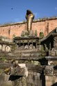
Malla Dynasty (1200–1768)
 |
 |
|
|
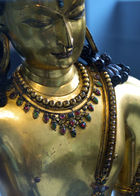
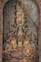
Left:Malla statue in Patan. Right:Bodhissatva Avalokiteshvara statue. Dated 1300–1400. Malla Dynasty.
|
||
Khasa Mall kings ruled in western Nepal during 1100–1484. However, Arimalla, first monarch of the Malla Dynasty, ruled in Kathmandu Valley from 1200–16. Other notable rulers of the Malla dynasty were Jayasthitimalla who ruled as king of united Malla kingdom from 1382–95 and Yakshamalla reigned from 1428–82 at the height of united Malla kingdom.
The Malla dynasty period (1200–1768) witnessed further boost in enhancing the cultural heritage of Kathmandu by building pagodas, houses decorated with carved windows, exquisite open-air shrines and courtyards filled with brilliant sculptures. Kathmandu became a larger city and as observed by Father Giuseppe, a Capuchin missionary, in the 1760s, 'Catmandu' contained about 18,000 houses.[13] During the 14th century, the dynasty was threatened and Kathmandu was subject to many attacks by outside invaders. In 1312, the Khasa king Ripumalla lead a raid in the Kathmandu Valley and in 1345–46 Sultan Shams ud-din Ilyas of Bengal invaded the city,[26] and the Mughals left long lasting damage, destroying many earlier buildings and settlements which led to widespread reconstruction of the city. In 1484, the Malla kingdom divided into the three kingdoms of Kathmandu, Bhadgaon, and Patan.[26]
 |
 |
|
|
Left:Old palace of the rulers of the Malla dynasty. Right: Royal palace of Patan.
|
||
Early modern Nepal began its evolution in the sixteenth century with the founding of the House of Gorkha by Dravya Shah in 1559. During the rule of the Gorkhas there was further frenzied activity in building up the city.[13] Ram Shah of Gorkha reigned from 1606–33 and started expanding the Gorkha kingdom.
Kings such as Jitamitra Malla, King of Bhaktapur from 1673 to 1696 was noted in particular for his construction projects. In 1674, he built a Shikara-style Shiva temple with a gilded repousse mask of the God on each side in Bhaktapu. In 1682 he built, near the Durbar square, the two-storied Dharmasala Palace in which there is a golden Mahadeva.[1] The palace was used by royalty until 1769 and today is a museum and part of the World Heritage Site on Durbar Square. To the east of this he erected the temple and statue of Narayana, along with the temples of Dattatrikasa and Pashupati. An inscription in 1678 states that he built the royal palace Thanathu Durbar, its gardens and courtyard. Jitamitra was also credited with restoring Kumari Chowk, the images of Astamatrikas and in 1690, donated two large copper kettledrums (nagara) or bells to his favourite deity, the goddess Taleju for the gilded roof of Taleju.[27] He also contributed a finely carved wooden tympanum above the main entrance to the Mul Chowk and also erected many memorials in Bhaktapur.[1]
His son, Bhupatindra Malla replaced him after his death in 1696 and was equally as fascinated with architecture, and continued the development of the Dharmsala Palace, its 55 windows and gardens.[1]
1769–1845
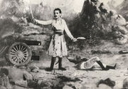
After Jayayakshya Malla conquered lands that was far larger than what Nepal had been before him, he decided to create a confederation for his sons so that they could rule the nation more efficiently. The Malla confederacy, with more than one ruler overlooking the nation, was more stable than the monarchial rule before. So, the monarchs focussed more on trade, arts and literature than in developing army. By the time Prithvi Narayan Shah had ascended to the throne of Gorkha in 1743. When Prithvi Narayan Shah first attacked Kirtipur in 1745–46, the combined army of Malla confederacy defeated him and killed Kalu Pandey, the Mul Kaji. Even after the conquest of Kirtipur and Kantipur, the Malla confederacy fought from Bhaktapur, where, the rulers of all the three states of Malla confederacy surrendered. By 1769 enabled Prithvi Narayan Shah, the king of Gorkha, to conquer the valley, forming the foundations for the modern Kingdom of Nepal. Finally Gorkha conquered Kathmandu and Patan, Bhadgaon, eastern Nepal, and western Nepal between 1768 and 1790. Prithvi Narayan Shah, the first king of united Nepal died in 1775.
In 1767, a request to the British for help by the traditional valley kings under threat from Gorkha expansion resulted in an ill-equipped and ill-prepared expedition numbering 2,500 led by Captain Kinloch. The expedition was a disaster; the Gorkha army easily overpowered those who had not succumbed to malaria or desertion. This ineffectual British force provided the Gorkhas with firearms and filled them with suspicion, causing some to underestimate their future opponents.
This conquest of the Kathmandu valley was only the beginning of an explosion of Gorkha power throughout the region. The Gorkha armies had overrun all of eastern Nepal by 1773 – by 1788. Gorkha forces had also annexed some western portions of Sikkim. In the west, all rulers as far as the Kali River had submitted or been replaced by 1790. Farther west still, the Kumaon region and its capital Almora had also succumbed to the Gorkhas.
To the north however, aggressive raids into Tibet (concerning a long-standing dispute over trade and control of the mountain passes) forced the Chinese emperor in Peking to act. In 1792 he sent a huge army, expelling the Nepalese from Tibet to within 5 km (3 mi) of their capital at Kathmandu. Acting regent Bahadur Shah, (Prithvi Naryan’s son), appealed to the British Governor-General of India, Francis Rawdon-Hastings, Lord Moira for help. Anxious to avoid confrontation with the Chinese, Lord Moira sent Captain Kirkpatrick as mediator, but before he arrived the war with China had finished. The Nepalese were forced into signing a humiliating treaty revoking their trading privileges in Tibet and requiring them to pay tribute to Peking every 5 years.
The Tibet affair had postponed a previously planned attack on the Garhwal Kingdom, but by 1803 Raja of Garhwal Pradyuman Shah had also been defeated. He was killed in the struggle in January 1804, and all his land annexed. Further west, general Amar Singh Thapa overran lands as far as the Kangra – the strongest fort in the hill region – and laid siege to it (although by 1809, Ranjit Singh the ruler of the Sikh state in the Punjab, had intervened and driven the Nepalese army east of the Sutlej river). The British were also expanding their sphere of influence. The recent acquisition of the Nawab of Awadh's lands by the British East India Company brought the region of Gorakhpur into the close proximity of the raja of Palpa – the last remaining independent town within the Gorkha heartlands. Suspicion of the raja’s collusion with the British led first to his imprisonment by the Gorkhas, then to his assassination. Bhimsen Thapa, Nepalese Prime Minister from 1806 to 1837, installed his own father as governor of Palpa, leading to serious border disputes between the two powers.
These disputes arose because there was no fixed boundary separating the Gorkhas and the British. A border commission imposed on Nepal by the Governor-General failed to solve the problem. Gorkha raids into the flatlands of the Tarai, a much prized strip of fertile ground separating the Nepalese hill country from India, increased tensions – the British felt their power in the region and their tenuous lines of communication between Calcutta and the northwest were under threat. Since there was no clear border, confrontation between the powers was inevitable.
As a result of border tensions and ambitious expansionism conflict came to heads in the Anglo-Nepalese Warof 1814–1816 between the Kingdom of Nepal (now Federal Democratic Republic of Nepal) and the British East India Company. After the successful initial campaign by Ochterlony, however, the Kathmandu durbar failed to ratify the peace agreement signed on 28 November 1815. This reticence to sign soon led to the second campaign. Unsurprisingly, Lord Moira placed Ochterlony in command of the 20,000 strong invasion force of Nepal.
After the decisive Battle of Makwanpur on 28 February 1816 and the fall of the fort of Hariharpur, the Gurkhas were forced to surrender and as a result the Treaty of Sugauli was ratified on 4 March 1816. Nepal lost Sikkim, the territories of Kumaon and Garhwal, and most of the lands of the Tarai; the British East India Company would pay 200,000 rupees annually to compensate for the loss of income from the Tarai region. However, the Tarai lands had proved difficult to govern and some of them were returned to Nepal later in 1816 and the annual payments abolished.
The Mechi river became the new eastern border and the Mahakali river the western boundary of Nepal. Kathmandu was also forced to accept a British Resident, a position that was loathed as it was seen as a symbol of its reduction to client status in relation to the British administration in Calcutta under the British Raj.
Modern history (1846–1999)
 |
 |
|
|
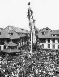
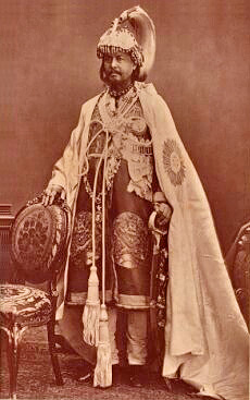
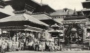
Left:Chariot procession or Jatra of Janabahadya in Kathmandu in the late 19th century. Right:Prime Minister Jang Bahadur in 1877.
|
||
With the Shahs establishing their rule over the Gorkhas, dictatorship ensued, with Ranas becoming all powerful. Jang Bahadur Kunwar was the first Prime Minister in 1846 followed by succession of Rana prime ministers, which lasted till 1950. Rana rule from Kathmandu was mainly governance by a landed aristocracy, with the parliamentary government functioning only as a facade. Even though there was stability in the country, political and economic development was on the back-burner with the Ranas adopting isolation of the country with absolute total control over domestic affairs. All this was possible because of support of the army.
During all this period, Shahs as Monarchs were figurehead monarchs, while the real power rested with the Ranas.[13] The Nepali Congress Party was founded in 1946, diplomatic relationship was established with USA and. In 1948 the country's first constitution, the Government of Nepal Act, was promulgated. But Prime Minister Padma Shamsher Rana resigned in the wake of opposition to the new constitution from conservative Ranas and Mohan Shamsher becomes prime minister; constitution is suspended. By 1950 Ranas fell into open conflict with King Tribhuvan as they suspected Nepali Congress Party's conspiracy against Rana power was instigated by the King. The king then sought and was granted asylum in India. at this stage, Government troops rebelled and over 140 Ranas joined the dissidents. During this period a Treaty of Peace and Friendship and Treaty of Trade and Commerce was signed with India.
An extensive earthquake occurred in 1934 when many parts of the city were damaged. However, they were later rebuilt to their original form. From the 1980s, the city has witnessed a building boom with farmlands within the city limits getting converted into urban building developments with the old core area getting encircled by high-rise buildings of business houses, wide boulevards and upscale residential suburbs.[13]
However, in January 1951, the tide turned in favour of monarchy of Shahs, when the Ranas were forced to surrender all executive powers: financial management, appointment of government officials, and command of the armed forces to the Monarchy. Mohan Shamsher capitulated and King Tribhuvan was restored to the throne. Several Prime Minsires took executive control ending with the king assumin direct rule.
Local elections to a municipal council were first held on September 9, 1953. Candidates nominated by the illegal Communist Party of Nepal got 50% of the total votes cast. Out of a total of 19 seats, six were won by communists, four by Nepali Congress, four by Praja Parisad, one by Gorkha Parishad and four by independents.[28]
Amongst the elected communists was the chairman of the council, Janak Man Singh. However, his tenure became short. A jurisdictional dispute emerged between the municipal council and the national government. A no-confidence vote removed Singh from his office and the national government banned him from entering the municipal council office. Singh was arrested when attempting to enter the office, and was jailed.[29]
Following the death of King Tribhuvan in 1955, Mahendra assumed power.[15] During this period Nepal joined the United Nations, National Police Force was formed, In the 1950s many events occurred such as the signing of border treaty with China, the USSR opening an embassy at Kathmandu and the United States opening an embassy at Kathmandu in 1959. A new constitution was also promulgated in 1959, superseding Constitution of 1951. The first general elections were also held in 1956 with the Nepal Congress Party winning absolute majority; and the Tribhuvan University was founded.
In December 1960, King Birendra abolished the mulitparty democracy and brought in the Panchayat Raj into force. This was fully controlled by the Monarchy. In 1962, King Mahendra Bir Bikram Shah Dev adopted a new constitution, the third since 1951, and established the centrally controlled partyless council system of governance called panchayat. This system served as the institutional basis of the king's rule. The palace claimed it a democratic administration although it functioned only at the king's behest. It was then established at the village, district, and national levels. Even with successive changes in executive wing of government in Kathmandu and constitutional revisions, the absolute powers of the monarchy remained solid. Land Reorganization Act and Mulki Ain, new legal code, were also promulgated.
But political unrest simmered as the events testify: In 1963 after Emergency was lifted Panchayat elections were held and the National Guidance Council was formed. In 1965, the local government was reorganized. In 1971 a new trade and transit treaty was negotiated with India from Kathmandu.
In 1972 King Mahendra died and was succeeded by King Birendra. Development regions were established under National Development Council.[15] But a fire in the same year burns down Singha Durbar, the seat of government. King Birendra was crowned in 1973. He soon thereafter launched the "Go to the Village".
In the May 1980 referendum while reaffirming the status quo of the panchayat system, against the reintroduction of political parties and concurred continuation rule by the king. Elections in 1981 and 1986 were characterized by the lack of political programs. Political turmoil continued. Second election to Rastriya Panchayat were held in 1986; [15] In 1989, failure to renegotiate trade and transit treaties with India disrupted the economy. Following this in 1990 demonstrations for the restoration of democracy were held. On April 9, 1990, the King restored the multi-party democracy with due lifting of the ban on agitating political parties. Panchayat system was dissolved and an interim government made up of various parties and king's representatives was formed with promulgation of new constitution.
Yet again in 1988, an earthquake centered around Bihar struck Kathmandu, destroying numerous buildings.
Following restoration of multi-party democracy, the first general elections to Parliament were held on May 12, 1991, under the new constitution. Nepali Congress won a narrow majority and G.P. Koirala became prime minister. But President of Nepali Congress and interim prime minister, K.P. Bhattarai, was defeated in the polls by the leader of CPN-UML, Madan Bhandari.
In 1992 Local elections were held and Nepali Congress won a majority of the seats. But in 1993 Madan Bhandari was killed in a mysterious car crash which resulted in violent demonstrations by communists to overthrow Koirala's government. During this year, devastating floods also killed hundreds.
Contemporary history (2000–present)
Kathmandu has experienced a turbulent history and political instability, marred by outbreaks of violence and protest, which have often caused considerable damage to buildings or caused loss of lives. On June 1, 2001, a gruesome royal massacre occurred when the Crown Prince Dipendra supposedly gunned down his immediate family consisting of his father King Birendra, his mother Queen Aishvarya, his brother and sister, and also five of his relatives at the Narayanhiti Royal Palace. He turned the gun on himself and died two days later. The reason for this massacre is unknown but his love for Devyani Rana, which was not acceptable to his parents, is conjectured as the reason for this massacre. Following this tragedy, King Gyanendra, brother of deceased King Birendra was crowned the king at the palace. The Tribhuvan Sadan where the massacre took place was subsequently demolished at the orders of the Queen mother.[30][31][32]

In April 2004, some 4000 people, mainly youths, expressed anger at the killing of 12 Nepalese jobseekers in Iraq, and burned down and vandalised many buildings, including more than a dozen private employment agencies and the city's Jama Masjid Mosque. In summer 2008, Kathmandu reached global headlines when political protests capitulated, and political protests have occurred ever since.
In November 2009, protests by Communist Party of Nepal (Maoist) rebels continued, following the collapse of the Maoist-led government in May 2009. They demanded a referendum in parliament about the extent of presidential powers, and accused the head of the army of opposing the integration of thousands of former Maoist rebels into the national army.[33] The demonstrators blocked the entrances to the main government complex and caused traffic jams, protesting with slogans such as "Down with the puppet government" and waving Maoist flags.
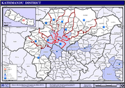
Geography
|
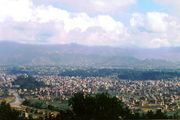 |
|
|
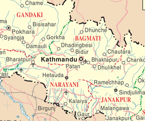
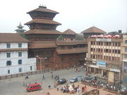
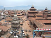
Left:Map showing Kathmandu and the surrounding area.Right:Kathmandu Valley
|
||
The city is located in the northwestern part of Kathmandu Valley. The city covers an area of 50.67 square kilometres (19.56 sq mi). The average elevation is 1,350 metres (4,430 ft) above the sea level. The city is bounded by the Lalitpur Sub-metropolitan City in its south, Kirtipur Municipality in south-west, Madyapur Thimi Municipality in east and different Village Development Committees of Kathmandu in north, west and north-east.
Eight rivers flow through the city of which the Bagmati, Bishnumati, Dhobikhola, Manohara, Hanumant and Tukucha rivers are predominant. The mountains from where these rivers originate are in the elevation range of 1,500–3,000 metres (4,900–9,800 ft) and have passes, which provide access to and from Kathmandu and its valley. It falls in the central development region and it is the headquarters of the region.[8][34][35]
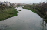 |
 |
|
|
Bagmati River
|
||
The Bagmati river originates at Bagdwaar, also known as Bag Tiger or Dwar Gate.[36] in the northern hills of Kathmandu valley about fifteen kilometres northeast of Kathmandu where three steams come together.[37] The mountain streams that cascaded over boulders become a wide, swiftly flowing river, with a high load of suspended solids, giving the river a grey appearance.[37] The bottom here is coated with the grey silt of glacial flour. The Bagmati flows southwesterly for about ten kilometres along the Kathmandu Valley which is predominately rice-patties in terraces up the slopes.[37] A number of resistant rock strata interrupt the flow down the valley, among these is the outcrop that the Pashupatinath Temple is built upon.[37] Afer passing the temple, the river flows south across the plain where it is joined by the larger Manohara River and turns westward. After entering the city the Bagmati is joined by a number of tributaries, notably the Dhobi Khola[38] and the sewage-laden Tukucha Khola.[37][39]
The natural vegetation is dictated by the climatic conditions and accordingly five vegetation zones have been defined for Nepal, out of which Kathmandu and its valley fall under the Deciduous Monsoon Forest Zone (altitude range of 1,200–2,100 metres (3,900–6,900 ft)). The dominant tree species under this zone comprises oak, elm, beech, maple and so forth with coniferous trees at higher elevation.[40]
Climate
Climatic conditions vary to a large extent in view of several geographical factors (topography and altitude). Five major climatic regions have been deciphered in Nepal, out of which Kathmandu valley falls under the Warm Temperate Zone (elevation ranging from 1,200–2,300 metres (3,900–7,500 ft)) where the climate is fairly pleasant, atypical of the region. This zone is followed by the Cool Temperate Zone with elevation varying between 2,100 metres (6,900 ft) and 3,300 metres (10,800 ft). Under Koppen’s climate classification, portions of the city with lower elevations features a mild form of a humid subtropical climate while portions of the city with higher elevations generally feature a subtropical highland climate. In the Kathmandu valley, which is representative of its valley’s climate the average temperature during the summer season varies from 28–30 °C (82–86 °F). During the winter season the average temperature is 10.1 °C (50.2 °F).
The city generally has a salubrious climate with comfortable warm days followed by the cool mornings and nights. Unpredictability of weather is expected as during winter, temperatures during the winter months have dropped to 3 °C (37 °F). The rainfall which is mostly monsoon based (about 65% of the total concentrated during the monsoon months of June to August), which decreases (100 cm to 200 cm) substantially from eastern Nepal to western Nepal, has been recorded as about 1,400 millimetres (55 in) for the Kathmandu valley and an average of 1,407 millimetres (55.4 in) specifically for the Kathmandu city. On an average Humidity is 75%.[8][41][42]
| Climate data for Kathmandu | |||||||||||||
|---|---|---|---|---|---|---|---|---|---|---|---|---|---|
| Month | Jan | Feb | Mar | Apr | May | Jun | Jul | Aug | Sep | Oct | Nov | Dec | Year |
| Average high °C (°F) | 18.0 (64.4) |
20.2 (68.4) |
24.3 (75.7) |
27.4 (81.3) |
28.2 (82.8) |
28.3 (82.9) |
27.7 (81.9) |
28.0 (82.4) |
27.2 (81) |
25.8 (78.4) |
22.7 (72.9) |
19.4 (66.9) |
24.8 (76.6) |
| Average low °C (°F) | 2.1 (35.8) |
3.8 (38.8) |
7.5 (45.5) |
11.3 (52.3) |
15.5 (59.9) |
19.0 (66.2) |
20.0 (68) |
19.7 (67.5) |
18.2 (64.8) |
13.0 (55.4) |
7.4 (45.3) |
3.0 (37.4) |
11.7 (53.1) |
| Precipitation mm (inches) | 14.2 (0.559) |
16.7 (0.657) |
31.2 (1.228) |
54.4 (2.142) |
114.2 (4.496) |
256.4 (10.094) |
359.6 (14.157) |
314.2 (12.37) |
183.1 (7.209) |
59.4 (2.339) |
7.5 (0.295) |
14.2 (0.559) |
1,425.1 (56.106) |
| Avg. rainy days | 2 | 3 | 4 | 6 | 12 | 17 | 23 | 22 | 15 | 4 | 1 | 1 | 110 |
| Source: World Meteorological Organisation (UN) [43] | |||||||||||||
Based on the data source of the Nepal Bureau of Standards & Metrology, "Weather Meteorology" for 2005, climatic data chart is given, which provides Minimum and Maximum temperatures (the lowest and highest temperatures recorded during the month respectively). Annual amount of Precipitation is 1,124 millimetres (44.3 in) for 2005, as per monthly data included in the table above.[42]
Pollution
 |
 |
|
|
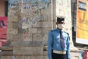
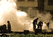
Left:Police officer taking pollution precautions by wearing a mask. Right:Industry in Kathmandu.
|
||
Air pollution is a serious problem in Kathmandu. Aside from the obvious human generated degradation produced by industry, by extensive traffic and congestion in the city and frequent burning associate with its temples, natural meteorological factors play a dynamic role and interact with air pollution in the Kathmandu Valley, shaping atmospheric stability, wind speed and direction, and precipitation, thus having considerable control over air dynamics in the urban climate. Its location in the Kathmandu Valley means that it is subject to mountain-valley circulations which may cause air pollution circulating away from the city to return at night, increasing pollution levels in the city in the evenings.[44]
Economy
Kathmandu’s trade is an ancient profession that flourished along the trade route between India and Tibet. Trading caravans of merchants were famous for trading with Lhasa. Other trades in which people have been involved since ancient times are Farming, metal casting, woodcarving, painting, waving and pottery are other popular traditional occupations.[45]
Even now Kathmandu is the most important industrial and commercial centre of Nepal and the headquarters of most companies, banks and organizations in the country are located here. The major economic hubs are the New Road of Kathmandu, the Durbar Square, Ason and Putalisadak.[45]
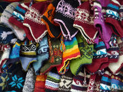
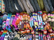
The city's economic output is worth more than NRs. 170 billion per year.[46] Kathmandu exports handicrafts, artworks, garments, carpets, pashmina, paper etc. and trade accounts for 21% of its finances.[45][46] Manufacturing comes next in importance and accounts for 19% of the revenue that Kathmandu generates with garments and woolen carpets being the most notable manufacturers.[46]
The top five countries importing Nepali handicrafts are the U.S.A. (Rs. 223 million), Germany (Rs. 87 million), Japan (Rs. 74 million), the U.K. (Rs. 69 million) and Canada (Rs. 51 million).[46]
 |
 |
|
|
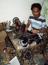
Left: Silk garments. Right:A shoemaker at work.
|
||
In November 2009, The Kathmandu Post reported that Nepali handicraft products to third countries had decreased by 8.1% during the first quarter of the current fiscal year compared to the same period last year.[47] According to the Federation of Handicraft Associations of Nepal (FHAN), the fall was mainly due to a decrease in the export of pashmina products, woollen goods, silk products, handmade paper products and wood crafts, of which Kathmandu is renowned for.[47] Pashmina exports, which is one of the major export products, declined by 31.26% to Rs. 154 million and woollen commodities decreased by 10.94% to Rs. 159 million.[47] Silk products had declined by 26.88% and handmade paper products and wood crafts declined by 16.55% and 31.38% respectively.[47] According to data published by the FHAN, the export of textile products declined by 14.87% to Rs. 487 million against Rs. 572 million during the same quarter last year.[47]
 |
 |
|
|
Kathmandu wool commodities
|
||
However, non-textile products has grown by 3.63%, leargely to the growing production and export of silverware which had increased by 18.09%, accounting for Rs. 121 million as compared to Rs. 102 million in 2008.[47]
Other money making sectors in Kathmandu include agriculture (9%), education (6%), transport (6%), and hotels and restaurants (5%).[46] Although some of Nepal's wealthiest citizens live in Kathmandu, much of the city is living in poverty with a per capita income of just US $400 (World Bank, 2008).[8][48]
The city has the headquarters of Agni Air.[49]
Tourism
Tourism, considered as another important industry in Nepal, opened up as the country's political equation changed in 1950 and thus isloation with the rest of the world ended. In the following year, establishing air services and the opening of the Tribhuvan Highway between Kathmandu and Raxaul at the border with India in 1956 were started. Separate organizations to promote this activity was created in the form of the Tourism Development Board, Department of Tourism and Civil Aviation Department in Kathmandu. Further, Nepal became a member of several international tourists associations. Establishing diplomatic relations with other nations further accentuated this activity. The hotel industry, travel agencies, training of tourist guides and targeted publicity campaigns are the chief reasons attributed for the remarkable growth of this industry in Nepal and in Kathmandu, in particular.[50]
Since then tourism has opened up in the country manifold and as a result it is sometimes said to be the 'third religion' of Nepal, as the country's most important industry that plays a large role in the economic activity of Kathmandu. This activity is central to Kathmandu, the gateway to Nepal. It is a major source of income for most of the people of the city with some several hundred thousands of visitors annually. Hindu and Buddhist pilgrims from all over the world visit various religious places located in Kathmandu and the surrounding district such as Pashupatinath, Swayambhunath, Baudhanath, Budhanilkantha, etc. From a mere 6,179 tourists in 1961–62, the number jumped to 491,504, but with political instability in the country in recent years, it dropped to 275,468 in 2002–03, but since then has shown a rising trend with the country turning into a Democratic Republic. In economic terms, the foreign exchange earning showed a remarkable trend registering 3.8 % of the GDP in 1995–96 but started declining. All this tourism is attributed to the natural grandeur of the Himalayas and rich cultural heritage of the country.[50]
The neighborhood of Thamel is Kathmandu's primary 'traveler's ghetto,' packed with guest houses, restaurants, shops and bookstores catering to tourists from abroad. Freak Street, also known as Jochhen Tole, is Kathmandu's original traveler's haunt made popular by the hippies of the 1970s and remains a popular alternative to Thamel.
Government and politics
Civic administration
- Local
Metropolitan Kathmandu is divided into five sectors namely the Central Sector, the East Sector, the North Sector, the City Core and the West Sector. For civic administration, the city is further divided into 35 administrative wards.The Council administers the Metropolitan area of Kathmandu city through its 177 elected representatives and 20 nominated members. It holds biannual meetings to review, process, approve the annual budget and make major policy decisions.[8][51] The ward profile documents for the 35 wards prepared by the Kathmandu Metropolitan Council is exhaustive and provides information for each ward on population, the structure and condition of the houses, the type of roads, educational, health and financial institutions, entertainment facilities, parking space, security provisions and so forth. It also includes lists of development projects completed, on-going and planned, along with informative data about the cultural heritage, festivals, historical sites and the local inhabitants. Ward 16 is the largest with an area of 437.4 ha and Ward 26 is the smallest with an area of 4 ha.[52]
Kathmandu is also the metropolitan city centre of the surrounding Kathmandu District. The city of Kathmandu forms this district with some 57 Village Development Committees.
According to 2001 census, there are 235,387 households in the metropolitan city[53]
- National
During the time when the 1990 Constitution was in effect, the Parliament of Nepal had a two chamber parliament (Sansad). This included the House of Representatives (Pratinidhi Sabha) which had 205 members elected for five year term in single-seat constituencies and the House of the States (Rashtriya Sabha) which had 60 members, 35 members elected by the Pratinidhi Sabha, 15 representatives of Regional Development Areas and 10 appointed members. Since 2002, the parliament has had a turbulent history due to ongoing political unrest, and was dissolved by King Gyanendra of Nepal in 2002, on the grounds that it was incapable of handling the Maoist rebels, but in April 2006, in response to major pro-democratic protests, it was announced that Parliament would be reestablished. However, on January 15, 2007, the old parliament was dissolved and replaced by the 330-member interim legislature of Nepal.
- Democratic Republic
After 10 years of Moasists’ rebel activities, Nepal became a Republic in May 2008. Monarchy in the modern history of Nepal ended in April 2009 when King Gyanedra had to end his rule in April 2006 under public pressure. By then insurrection had resulted in death of more than 10,000 people and displacement of 100,000 people. After holding discussions with the Maoist rebels, Parliament acceded to the condition of holding general elections to the Parliament, which was held in April 2006. With this, Gyanendra’s rule ended and Monarchy was finally abolished in May 2008. Two months after the country's new constituent assembly voted to abolish the 239-year-old monarchy, in July 2008, Mr Ram Baran Yadav became the first president of the Republic of Nepal. In August 2008, Maoists led Government with Prachanda as Prime Minister was formed,. But this government was short lived because Prachanda resigned in protest as his decision to sack the army chief was not supported by the President. After a short impasse, Madhav Kumar Nepal was elected as Nepal’s new prime minister, on 23 May 2009. Moaists have protested and agitation is continuing. The Prime Minister is optimistic about bringing the Maoists' back into the government. He is also hopeful of introducing a new Nepalese constitution by May 2010.[48]
- International relations
Kathmandu Metropolitan City (KMC), in order to promote international relations with the objective of mobilization of resources and modernization of Kathmandu city, has established an International Relations Secretariat (IRC). KMC’s first international relationship was established in 1975 with the city of Eugene, Oregon, United States (USA). This activity has been further enhanced by establishing formal relationships with 8 other cities namely, the Motsumoto City of Japan, Rochester in addition to Eugene, Yangon (earlier Rangoon) of Myanmar, Xi'an of the People’s Republic of China, Minsk of Belarus and Pyongyang of the Democratic Republic of Korea. KMC's constant endeavour is to enhance its interaction with SAARC countries, other International agencies and many other major cities of the world to achieve better uraban management and developmental programs for Kathmandu.[54]
Law and order
Police
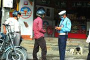
Kathmandu Police is the law enforcing body in the city and under the wider administration of the Nepal Police Force. The police force was officially established in 1864, but enforcement was loosely based and it wasn't until the 1950s that the first police head quarters were established in Kathmandu. The police force developed under royal insistence and the Nepalese government sought advice from India. The Police Act of Kathmandu and Nepal was passed in 1956, and the first Inspector General of Police in Nepal and Kathmandu was Toran Shamsher J.B. Rana.
Departments of the Nepal Police include intelligence division, motor transport and radio sections, counter intelligence branch, criminal investigation branch, the human resource department, the community department and the narcotics department. The police force also operates missing persons squad and offers services for the protection of women and children. Today there are several police stations in the Kathmandu metropolitan area, including one around the Durbar. Police uniform is light blue with a policeman cap and it is common to see policemen with face masks, protecting themselves from the pollution.
Fire service
パグマティ川火葬場俯瞰Img158.jpg)
The fire service, known as the ‘Barun Yantra Karyalaya', opened its first station in Kathmandu in 1937, with a single vehicle.[55] An iron tower was erected to monitor the city and watch out for fire and as a precautionary measure, fire servicemen were sent to the areas which were designated as accident prone areas.[55] In 1944, the fire service was extended to the neighbouring cities of Lalitpur and Bhaktapur and in 1966, the fire service was established in Kathmandu airport.[55] A German government donation in 1975, added seven fire engines to Kathmandu's fire service.[55] The fire service in the city is also overlooked by an international non-governmental organization, the Firefighters Volunteer Association of Nepal (FAN) which was established in 2000 with the purpose of raising public awareness among the public about fire and improving safety.[55]
Utility services
Water supply
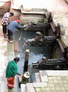
Water supply in Kathmandu is derived from two sources, namely, surface water (rivers and ponds) and groundwater; rainfall precipitation is the major contributor of these two sources.[6] Nepal Water Supply Corporation (NWSC)is responsible for drinking water supply, both from surface water and ground water sources, to Kathmandu City.[56]
Most of the drinking water source is from surface water of the Bagamati river. However, the supply is insufficient and there is chronic shortage of water. The daily demand is 200 million liters in Kathmandu but the supply is only 160 million litres.[57] To overcome the shoratge ground water is being extracted increasingly and it is said that 60% of the household are resorting to ground water extraction by pumping from the sources, which has also caused lowering of ground water levels; this depletion as per ground water department sources is taking place at the rate of 2.5 m per year. A solution to address this problem has been evolved with project assistance from the Asian Development Bank (ADB)and Japan Bank for International Cooperation (JBIC) by diverting the perennial snow fed river flows of Melamachi through a 20 km (12 mi) tunnel. The project is stated to be under implemenation and is expected to be complete in the next about four years.[57]
Public health
Realizing the basic need of public health in the city, in 1994 Kathmandu Metropolitan City (KMC) launched a Community Urban Basic Health Service Programme in the city . Seven (7) community urban health clinics at ward level and Medical Facility Section in the Central level were established. An exclusive Public Health and Social Welfare Department (PHSWD) was also established. As of date, 21 community urban health clinics are functional. Acupuncture Service Center has also been added. Ministry of Health has also planned and launched several Social mobilization/health education awareness programmes to ensure the welfare of citizens by educating & empowering the people and mainstreaming the women, children, youth, elder people, Dalit, handicap backward people in the process of development.[58]
Demographics
Kathmandu’s urban cosmopolitan character has made it the most populous city in Nepal, recording a population of 671,846 residents living in 235,387 households in the metropolitan city according to the 2001 census.[53] It is a trend displayed since historical times created by its unique Newari people who continue to be one of the dominant groups in the city. The city has, over the years, absorbed people of various ethnicity resulting in an agreeable range of different traditions and cultural practices. In a decade, the population has increased from 427,045 in 1991 to 671,805 in 2001 and is projected to touch a figure of 915,071 in 2011 and 1319,597 by 2021. To keep up this population growth, KMC controlled area of 5,076.6 hectares (12,545 acres) has expanded to 8214 ha in 2001. With this new area, the density of population which was 85 in 1991 is still 85 in 2001 (due to increase in area) and is likely to be 111 in 2011 and 161 in 2021.[59]
Ethnic groups
The largest ethnic groups are Newars, Brahmins and Kshetris. Tamangs originating from surrounding hill districts can be seen quite clearly in Kathmandu. More recently, other hill ethnic groups and Caste groups from Terai have shown their presence as well. The major languages are Nepali and Nepal Bhasa. The major religions are Hinduism and Buddhism. The city has also a significant and growing Muslim population.
The linguistic profile of Kathmandu underwent drastic changes during the Shah dynasty rule on account of their very strong bias towards the Brahminic culture. Sanskrit language, therefore, got a boost and people were encouraged to learn this language even by attending Sanskrit learning centres in India. Sanskrit schools were specially set up in Kathmandu and in the terai region to inculcate traditional Hindu culture and practices.[60]
Architecture and cityscape
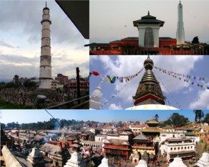
| Kathmandu Valley World Heritage Site (WHS) Seven Monuments and Buildings
Pashupatinath temple in Kathmandu• Pashupatinath temple behind the Bagmati River Swayambhunath at night•Boudhanath temple Durbar square at Patan•Durbar square at Bhaktapur Vishnu Vishvarupa - 9th century at Changu Narayan • Changunarayan temple precincts |
|---|

The ancient and refined traditional culture in Kathmandu, for that matter in the whole of Nepal, is an uninterrupted and exceptional meeting of the Hindu and Buddhist ethos practiced by its highly religious people. It has also embraced in its fold the cultural diversity provided by the other religions such as Jainism, Islam and Christianity. The ancient trade route between India and Tibet that passed through Kathmandu enabled fusion of artistic and architectural traditions of other cultures to be amalgamated with local architectural and artistic culture.[61]
Kathmandu has also been described variously as "Land of Gods" and as "land of the largest congregations of magnificent historical monuments and shrines ever built".[62]
The City Core has most of the remarkable cultural wealth that evolved during the reign of the Malla (Nepal) kings between 15th and 18th centuries. The city was filled with sculptures, pagodas, stupas and palace buildings of exceptional beauty. There are also 106 monastic courtyards (known as baha or bahi) known for their art and piety. The level of skill of the local artisans are the exquisite wood carving, stone carving, metal casting, weaving, pottery and other crafts. The finest wood carvings are seen on the ornate windows of old buildings and on the roof struts of temples. Carving skills of the local artisans are seen at every street corner in the form of images of gods and goddesses and sunken water spouts.[62]
Architectural heritage of Kathmandu city is integral to that of the Kathmandu valley since all monuments have evolved over centuries of craftsmanship influenced by Hindu and Buddhist religious practices. The architectural treasure of the Kathmandu valley has been categorized under the well known seven groups of heritage monuments and buildings. In 2006, UNESCO declared these seven groups of monuments as World Heritage property under the title “World Heritage Site (WHS)”. The seven monuments zones cover an area of 188.95 hectares (466.9 acres), with the buffer zone extending to 239.34 hectares (591.4 acres). The Seven Monument Zones (Mzs) inscribed originally in 1979 with a minor modification in inscribed year as 2006, are: Five monuments in Kathmandu – Durbar square of Hanuman Dhaka, Hindu temples of Pashupatinath and Changunarayan, the Buddha stupas of Swayambu and Boudhanath; and two monuments outside Kathmandu city limits, in the satellite towns of Patan and Bhktapur – Durbar square at Patan, Durbar square at Bhaktapur. Brief details of the five Kathmandu city monuments (template shows all seven for sake of completeness) are elaborated here.[10][11]
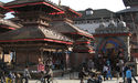
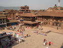
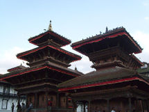
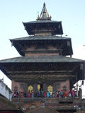
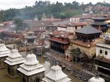
Durbar square
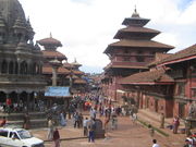
The literal meaning of Durbar Square is a place of palaces. There are three preserved Durbar Squares in Kathmandu valley and one unpreserved in Kirtipur. The Durbar Square of Kathmandu is located in the old city and has heritage buildings representing four kingdoms (Kantipur, Lalitpur, Bhaktapur, Kirtipur), built over centuries, the earliest being the Licchavi dynasty. There were further additions and refurbishments during the reign of Mallas (9th century) and then the Ranas. The complex has 50 temples and is distributed in two quadrangles of the Durbar Square. The outer quadrangle has the Kasthamandap, Kumari Ghar and Shiva-Parvati Temple while the inner quadrangle has the Hanuman dhoka and the main palace.
Kasthamandap
Kasthamandap is a three storied temple enshrining the deity of Goraknath – (Sanskrit for Gau+Raksha+Nath: Cow+Protect+Lord; The Lord who protects cows) – a form of the god Shiva. It was built in the 16th century in Pagoda style. It is said to be one of the oldest wooden buildings in the world. The name of Kathmandu is a derivative of the Kashtamandap. It was built under the reign of King Laxmi Narsingha Malla and an interesting legend is stated to its wooden construction. The story narrated is about Gorakhnath, a disciple of Machindranath (Nepal Bhasa: Janamaadya) Gorakhnath, who was spotted by a tantrik in human form, during the chariot procession of his guru Machhindranath (Nepal Bhasa: Janamaadya). The tantrik held him under a spell and sought his help seeking materials to build a temple in Kathmandu. Once the boon was bestowed, a huge tree started growing at the location where the present temple exists. With the wood of this single tree, the tantrik built the Kastamantap temple. Once a year a huge ceremony is performed in the temple. On that day people gather around the temple, and they stay up all night. This temple is one of the major tourist attractions too. There are no restrictions on entry to the temple. However, photography is prohibited inside the temple. The temple is open after midday until midnight.[63]
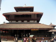
Hanuman Dhoka
 |
 |
|
|
Left:Hanuman Dhoka palace. Right:Taleju.
|
||
Hanuman Dhoka is a complex of structures with the Royal Palace of the Malla kings and also of the Shah dynasty. It is spread over five acres. The eastern wing with ten courtyards is the oldest part dated to the mid-16th century. It was expanded by King Pratap Malla in the 17th century with many temples. Sundari Chowk and Mohan Chowk in the north part of the palace are both closed. In 1768, in the southeast part of the palace, four lookout towers were added by Prithvi Narayan Shah. The royal family lived in this palace till 1886, where after they shifted to Narayanhiti Palace. The stone inscription outside is in fifteen languages and legend states that if all the 15 are read milk would spring from the middle of stone tablet.[64]
Kumari Ghar

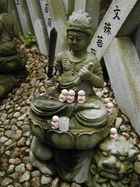
Kumari Ghar is a palace in the center of the Kathmandu city, next to the Durbar square where a Royal Kumari selected from several Kumaris from several places resides. Kumari, or Kumari Devi, is the tradition of worshipping young pre-pubescent girls as manifestations of the divine female energy or devi in South Asian countries. In Nepal the selection process for her is very rigorous. Kumari is believed to be the bodily incarnation of the goddess Taleju (the Nepalese name for Durga) until she menstruates, after which it is believed that the goddess vacates her body. Serious illness or a major loss of blood from an injury are also causes for her to revert to common status. The current Royal Kumari, Matina Shakya, aged four, was installed in October 2008 by the Maoist government that replaced the monarchy.[65]
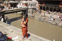
Pashupatinath temple
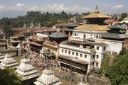 |
 |
|
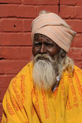
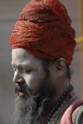
The Pashupatinath Temple is the largest Hindu temple of Lord Shiva (Pashupati) in the world and regarded as the most sacred. Located on the banks of the Bagmati River in the eastern part of Kathmandu, Pashupatinath Temple is the oldest Hindu temple in Kathmandu and was established in the 5th century,[66] and served as the seat of national deity, Lord Pashupatinath, until Nepal was secularized. However, a significant part of the temple was destroyed by Mughal invaders in the 14th century and little or nothing remains of the original 5th century temple exterior. The temple as it stands today was built in the nineteenth century, although the image of the bull and the black four headed image of Pashupati are at least 300 years old.[67] The temple is listed in UNESCO World Heritage Sites list.[66][67] Shivaratri or the night of Lord Shiva is the most important festival, attracting thousands of devotees and sadhus.
 |
 |
|
|
Sadhu's in Pashupatinath after the night of Shivaratri.
|
||
Believers in Pashupatinath (mainly Hindus) are allowed to enter the temple premises but non-Hindu visitors are allowed to view the temple from the across the bank of Bagmati river.[67] The priests who perform the services at this temple have been Brahmins from South India since the time of Malla king Yaksha Malla.[68] This tradition is believed to have been started at the request of Adi Shankaracharya who sought to unify the different states of Bharatam (Unified India) by encouraging cultural exchange. This procedure is also followed in other temples around India, which were sanctified by Adi Shankaracharya.
The temple is built in the pagoda style of architecture, with cubic constructions, beautifully carved wooden rafters on which they rest (tundal) and two level roofs made of copper and gilded in gold. It has four main doors, all covered with silver sheets and the western door has a statue of large bull or Nandi, again covered in gold. The deity is of black stone, about 6 feet in height and the same in circumference.
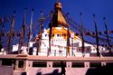
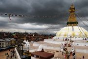
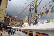
Boudhanath
The Boudhanath, (also written Bouddhanath, Bodhnath, Baudhanath or the Khāsa Chaitya), is one of the holiest Buddhist sites in Nepal along with Swayambhunath, and it is one of the most popular tourist sites in the Kathmandu area. It is known as Khāsti by Newars and as Bauddha or Bodh-nāth by modern speakers of Nepali.[69] Located about 11 km (7 mi) from the center and northeastern outskirts of Kathmandu, the stupa's massive mandala makes it one of the largest spherical stupas in Nepal.[70] Boudhanath became a UNESCO World Heritage Site in 1979.
 |
 |
|
The Gopālarājavaṃśāvalī documents that the Boudhanath was founded by the Nepalese Licchavi king Śivadeva (c. 590–604 AD); though other Nepalese chronicles date it to the reign of King Mānadeva (464–505 AD).[71][72] Tibetan sources claim a mound on the site was excavated in the late 15th or early 16th century and the bones of king Aṃshuvarmā 605–621 were discovered there while other Nepali sources claim it was constructed by a prince to seek forgiveness for unwittingly killing his own father .[73][74] However, the Emperor of the Tibetan Empire, Trisong Detsän (r. 755 to 797) is also traditionally associated with the construction of the Boudhanath Stupa, after Songsten Gampo was converted to Buddhism by his wives the Nepali princess Bhrikuti Devi and Princess Wen Cheng of China in the seventh century and passes it on to Detsän.[75] However, given that Kathmandu was invaded by the Mughals in the fourteenth century who would have destroyed the monument, the current stupa is believed to date to sometime after this.
The base of the stupa has 108 small depictions of the Dhyani Buddha Amitabha and is surrounded with a brick wall with 147 niches, each with four or five prayer wheels engraved with the mantra, om mani padme hum.[74] At the northern entrance where visitors must pass is a shrine dedicated to the goddess of smallpox, Ajima.[74] The stupa attracts many Tibetan Buddhist pilgrims annually who perform full body prostrations in the inner lower enclosure, circumambulate the stupa with prayer wheels and chant and pray.[74] Thousands of prayer flags are hoisted up from the top of the stupa downwards and dot the parameters of the complex. The influx of large populations of Tibetan refugees from China has seen the construction of over 50 Tibetan Gompas (Monasteries) around Boudhanath.
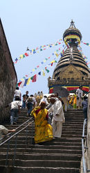
Swayambhunath
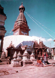 |
 |
|
Swayambhunath, also known as the Monkey Temple as there are holy monkeys living in parts of the temple in the north-west, is among the oldest religious sites in Nepal. Although the site is considered Buddhist, the place is revered by both Buddhists and Hindus. Numerous kings, Hindu followers, are known to have paid their homage to the temple, including Pratap Malla, the powerful king of Kathmandu, who is responsible for the construction of the eastern stairway in the 17th century.[76] According to the Gopālarājavaṃśāvalī Swayambhunath was founded by the great-grandfather of King Mānadeva (464–505 AD), King Vṛsadeva, about the beginning of the 5th century AD. This seems to be confirmed by a damaged stone inscription found at the site, which indicates that King Mānadeva ordered work done in 640 AD.[77] However, Emperor Ashoka is said to have visited the site in the 3rd century BC and built a temple on the hill, which was later destroyed. Legend has it that the Buddha himself visited Swayambhunath and gave teachings there two hundred years earlier.[78]
The stupa consists of a dome at the base. Above the dome, there is a cubical structure present with eyes of Buddha looking in all four directions with the word "unity" in the main Nepali dialect between them. There are pentagonal Toran present above each of the four sides with statues engraved in them. Behind and above the torana there are thirteen tiers. Above all the tiers, there is a small space above which the Gajur is present.
Changu Narayan
Changu Narayan is an ancient Hindu temple located near the village of Changunarayan in the Kathmandu Valley on top of a hill at the eastern end of the valley. Its location is 6 kilometres (3.7 mi) to the north of Bhakathapur and 22 kilometres (14 mi) from Kathmandu. The temple is one of the oldest Hindu temples of the valley, and is believed to have been constructed first in the 4th century. Changu Narayan is the name of Vishnu, and the temple is dedicated to him. A stone slab discovered in the vicinity of the temple dates to the 5th century, and is the oldest such stone inscription discovered in Nepal. It was rebuilt after the old temple was devastated. Many stone sculptures here date to the Licchavi period. Changu Narayan Temple is listed by UNESCO as a World Heritage Site.[79][80]
The temple is a double-roofed structure where the idol of Lord Vishnu in his incarnation as Narayana is deified. The exquisitely built temple has intricate roof struts showing multi-armed Tantric deities. A kneeling image of Garuda (dated to the 5th century), the vahana or vehicle of Vishnu with a snake around its neck, faces the temple. The gilded door depicts stone lions guarding the temple. Gilded windows also flank the door. A conch and a disc, symbols of Vishnu, are carved on the two pillars at the entrance. Non-Hindus are not allowed inside the temple.[80]
Bhimsen Tower (Dharahara)
Dharahara, also known as the Bhimsen Tower is a nine story (50.2 metres (165 ft)) tall tower in the center of Kathmandu. It was originally built in 1832 by the Prime Minister of the time, Bhimsen Thapa, under the command of Queen Lalit Tripura Sundari. It survived an earthquake just two years after construction in 1834, but on January 15, 1934, another earthquake destroyed the tower and it was then rebuilt by the prime minister of the time, Juddha Shumsher, who renovated Dharahara to its previous form.[81]
The tower has a spiral staircase inside containing 113 steps or none because there is an elevator. The 8th floor holds a circular balcony for observers that provides a panoramic view of the whole Kathmandu valley. The tower has a 5.2 metres (17 ft)) bronze mast on the roof. The tower has been open for the general public since 2005 for a small fee.[81]
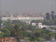
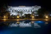
Narayanhiti Royal Palace
Narayanhiti, in Narayanhiti Palace, is made up of two words ‘narayan’ and ‘hiti’. 'Naryan' is a form of Hindu god "Lord Vishnu” whose temple is located opposite to the palace and ‘hiti’ means “water spout” which is also located to the east of main entrance in the precincts of the palace, and which has a legend associated with it. The entire enclosure surrounded by a compound wall, located in the north-central part of Kathmandu, is called the Narayanhiti palace. It was a new palace, in front of the old palace of 1915 vintage, built in 1970 in the form of a contemporary Pagoda. It was built on the occasion of the marriage of King Birenda Bir Bikram Shah, the then heir apparent to the throne. The southern gate of the palace is located at the crossing of Prithvipath and Darbar Marg roads. The palace area covers (30 hectares (74 acres)) and is fully secured with gate controlled walls on all sides.[30][31][82] The palace, as previously discused in Kathmandu's history, was the scene of a gruesome tragedy, termed “Nepal’s greatest tragedy”, on June 1, 2001 at the hall in the palace where the Crown Prince Dipendra in an inebriated state supposedly gunned down his immediate family consisting of his father King Birendra, his mother Queen Aishvarya, his brother and sister, and also five of his relatives, later killing himself.
Hotels
With the opening of the tourist industry after the change over in the political scenario of Nepal in 1950, hotel industry got a boost.[83] Now, Kathmandu boasts of several five star hotels such as Hotel Yak & Yeti, The Everest Hotel, Hotel Radisson, Soaltee Holiday Inn and De L'annapurna, The Shanker Hotel (Heritage hotel: formerly a Rana Palace), the four star hotels, Hotel Vaishali, Hotel Narayani, The Blue Star, Hotel Sherpa, Grand Hotel, The Malla Hotel, Shangri-La Hotel, Woodlands Dynasty Plaza, Royal Singi Hotel and Hotel Woodlands and the 3 star The Garden Hotel, Hotel Ambassador and Aloha Inn and many others.Hotels like The Hayyat and The Salty are also famous which provide casinos as well to entertain their customers and make huge profits on this account.[84]
Culture
Arts
Kathmandu valley has been described as "an enormous treasure house of art and sculptures". These treasures are made of wood, stone, metal and terracotta, and found in profusion in various temples, shrines, stupas, gompas, chaityas and palaces. The art objects are also seen in street corners, lanes, private courtyards and in open ground; mostly in the form of icons of gods and goddesses. Kathmandu valley has been the repositary of all this art treasure for a long time but it got a world wide exposure only after the country opened its doors to the outside world in 1950.[60]
The religious art of Nepal and Kathmandu in particular is iconic symbolism of the Mother Goddesses such as: the Bhavani, Durga, Gaja -Lakshmi, Hariti-Sitala, Mahsishamardini, Saptamatrika (seven mother goddesses) and Sri-Lakshmi. From the 3rd century BC, apart from the Hindu Gods and Goddesses, Buddhist monuments from the Ashokan period (it is said that Ashoka visited Nepal in 250 BC) have also embellished Nepal in general and the valley in particular. These art and architectural edifices encompass three major periods of evolution namely, the Licchavi or classical period (500 to 900 AD) with motivation from the Gupta period in India; the post-classical period (1000 to 1400 AD) with strong influence of the Palla art form that extended to Tibet as well; and of the Malla period (1400 onwards) that exhibited explicitly tantric influences coupled with the demonic art from of Tibetan Demonology.[85]
A broad typology has been ascribed to the decorative designs and impressive carvings created by the creative and artistic people of Nepal, who have maintained a perfect blend of the two religious faiths of Hinduism and Buddhism. This typology based on the type of material used in the art forms is five in number. These are: the Stone Art, the Metal Art; the Wood Art; the Terracotta Art; and the Painting.[86] These are briefly elaborated.
- Stone art
In the earliest times, at the dawn of civilization, stone heaps (made of boulders, pebbles etc.) were worshipped in Nepal, which is seen at several locations. The first real stone carvings started under the influence of the Mathura Art of India; some of thse carvings are seen in the Pashupathinath temple complex. Later in mid 5th century AD Nepal Art evolved under the Ikshvaku, Gupta, Pala and Deccan Schools of Art forms. But the Nepalese sculptors improved on these forms which provide a typical style of Nepal.[85]
- Metal art
Metal images made of ashtadhatu (amalgam of eight metals) are common in Nepal and Indi, under both Hindu and Buddhist religious traditions. During the Licchavi period bronze in solid form was widely used for casting metallic sculptures; mostly between the seventh and eight centuries. But in the Medieval period Pala influence evolved into a distinct form. These can be seen in the form of large royal figures fixed on top of pillars in Durbar Squares of Kathmandu, Patan and Bhaktapur. Smaller and hollow cast bronze statues were made as icons for worship. In Tiebtan metal work, a hole was left in the bronze statues for filling with mantras written on paper or filling with offering of grains, precious stones or miniature icons. But the hole was sealed with copper in the presence of a Lama before formal consecration of the image. Here again there are two forms- one of Gods and Goddesses of Mahayana school in Pala art form and the other iconography inspiration of the Shamanic practice of Tibetan Demonology.[87]
- Wood art
It is the traditional architecture in the Kathmandu valley in temples, palaces, monasteries and houses a perfected Neawri art form generally carved very artistically out of Sal (Shorea), teak (agarth), deodar (cedrus) and Sisso (dalbegia). Malla Kings patronized this art form from 12th century onwards. Its life span is affected by mild climate, linches, mosses, insects, borers, dry rots and biochemical defects. In the 14th century earthquake many of the wooden monuments were destroyed.[88]
- Terra cotta
Tera cotta art in Nepal is traced to the 300 BC. It was perfected between 16th and 18th centuries Archeological excavations have unearthed hand-pressed moulds at Dhum Varahi at the fringes of Kathmandu, which are preserved in the museums in Kathmandu, Patan and Bhaktapur. The male and female figures decorated in bands around temples, called Nagabands were made of terra cotta. Other fine examples examples of terra cotta art mentioned are Mahabuddha and Mayadevi temples in Patan and gateway of the Teleju temple in Hanumandhoka complex. Clay is the basic ingredient of this art form .[88]
- Paintings
Painings are categorized under two broad head namely the religious and the non-religious. The religious category is further subdivided into three forms of painted manuscripts, Thankhas or Paubhas and Pattas (banners) or metal strips.[89]
Museums
Kathmandu is home to a number of museums and art galleries, including the National Museum of Nepal and the Natural History Museum of Nepal. Nepals’s art and architecture is a dazzling display from medieval to the present, which is a heady amalgamation of two of the ancient and greatest religions of the world – Hinduism and Buddhhism. These are amply reflected not only in the many temples, shrines, stupas, monasteries and palaces in the seven well defined Monument Zones of the Kathmandu valley recognized by UNESCO as a World Heritage site but also in its well planned and well exhibited displays in museums and art galleries spread all over the Metropolitan area and also in its sister cities of Patan and Bhaktapur. The museums display unique artifacts and paintings from 5th century AD onwards to date, including archeological exportations.[90]
The Museums and Art galleries are: the National Museum; the Natural History Museum; Hanumandhoka Palace Complex; the Tribhuvan Museum; the Mahendra Museum; the Birendra Museum; National Library: the Birendra Museum; the Kaiser Library; the Asa Archives; the Patan Museum; the National Art Gallery; the Pujarimath Museum; the Bronze and Brass Museum; the NAFA Gallery; the Srijana Contemporary Art Gallery; the J Art Gallery; the NEF-ART (Nepal Fine Art) Gallery; the Moti Azima Gallery; and the Nepal Art Council Gallery.[90] Some of the important museums and galleries are elaborated.
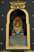
The National Museum is located in the western part of Kathmandu near the Swoyambhunath stupa in the historical building which was constructed in early 19th century by General Bhimsen Thapa. It is the most important museum in the country, housing an extensive collection of weapons, art and antiquities of historic and cultural importance.[91] The museum was established in 1928 as a collection house of war trophies and weapons, and the initial name of this museum was Chhauni Silkhana, which literally means "the stone house of arms and ammunition". Given its focus, the museum contains an extensive quantity of weapons, including locally made firearms used in various wars and leather canons from the 18th–19th century and medieval and modern works in wood, bronze, stone, and paintings.[91]
The Natural History Museum is located in the southern foothills of Swoyambhunath hill and has a sizeable collection of different species of animals, butterflies and plants. The museum is noted in particular for its serial display of diverse life species from prehistoric shells to the stuffed animals, birds, crocodiles and many others.[91]
The Tribhuvan Museum contains artifacts related to the King Tribhuvan (1906–1955). It has a variety of pieces including his personal belongings, letters and papers and memorabilia related to events he was involved in and a rare collection of photos and paintings of Royal family members.[91] The Mahendra Museum is also dedicated to a king, Mahendra (1920–1972 ). Like the Tribhuvan Museum, it includes his personal belongings such as decorations, stamps and coins and personal notes and manuscripts, but it also has structural reconstructions of his cabinet room and office chamber.[91]
The Hanumandhoka Palace, a lavish medieval palace complex in the Durbar, contains three separate museums of historic importance, including the Birendra museum containing items related to the current monarch, King Birendra Bir Bikram Shah, including royal dress worn during various state and historic occasions, medals and honorary titles received from other head of states and many more.[91]
Art galleries
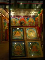 |
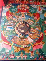 |
|
|
Left:Buddhist art shop in Kathmandu near the stupa. Right: Buddhist artwork, a thangka at Kopan Monastery
|
||
Kathmandu is a center for art in Nepal, displaying the work of contemporary artists in the country and also collections of historical artists. Patan is particular is an ancient city noted for its fine arts and crafts. Art in Kathmandu is vibrant, demonstrating a fusion of traditionalism and modern art, derived from a great number of national, Asian and global influences. Nepalese art though is commonly divided into two areas, the idealistic traditional painting known as 'Paubhas' in Nepal and perhaps more commonly known as Thangkas in Tibetan, which are usually highly colorful and bold and closely linked to the country's religious history and then the contemporary western style painting, including nature based compositions or abstract artwork based on Tantric elements and social themes of which painters in Nepal are well noted for.[91] Internationally, the British based charity, the Kathmandu Contemporary Art Centre is involved with protecting arts in Kathmandu.[92]
Kathmandu contains many notable art galleries. The NAFA Gallery, operated by the Arts and crafts Department of the Royal Nepal Academy is housed in Sita Bhavan, a neo- classical old Rana palace, divided into two galleries, the permanent Birendra Art Gallery which displays works of successful contemporary painters and sculptors. and a temporary gallery featuring artwork of up and coming Nepalese artists of the country.[91]
The Srijana Contemporary Art Gallery, located inside the Bhrikutimandap Exhibition grounds, hosts the work of contemporary painters and sculptors, and regularly organizes exhibitions, both solo and group shows. It also runs morning and evening classes in the various schools of art.[91] Also of note is the Moti Azima Gallery, located in a three storied building in Bhimsenthan which contains an impressive collection of traditional utensils and handmade dolls and items typical of a medieval Newar house, giving an important insight into Nepalese history.[91] The J Art Gallery is also located in Kathmandu, near the Royal Palace in Durbarmarg, Kathmandu and displays the artwork of eminent, established Nepalese painters and the Nepal Art Council Gallery, which is located in the Babar Mahal, on the way to Tribhuvan International Airport which contains artwork of both national and international artists and contains extensive halls regularly used for art exhibitions.[91]
Literature
The National Library of Nepal, is located in Patan, the largest in country with in excess of more than 70,000 books, mostly in English, but also with many in Nepali, Sanskrit, Hindi and Newari.[91] The library is in possession of rare scholarly books in Sanskrit and English dating from the 17th century AD. Kathmandu contains the Kaiser Library, located in the Kaiser Mahal on the ground floor of Ministry of Education building. The collection which totals around 45,000 books, is derived from a personal collection of the Field Marshal Kaiser Shumsher Rana.[91] It covers a wide range of subjects including history, law, art, religion, philosophy etc. and a Sanskrit manual of 'Tantra', believed to be over 1000 years old.[91]
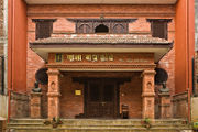
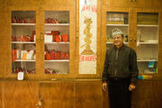
The Asa Archives are also of major note and specialise in medieval history and religious traditions of the Kathmandu Valley. The archives are located in Kulumbbhula, and have a valuable collection of some 6,000 loose-leaf handwritten books and 1000 palm- leaf manuscripts, mostly in Sanskrit or Nepal Bhasa and a manuscript dated to 1464.[91]
Theatre and cinema
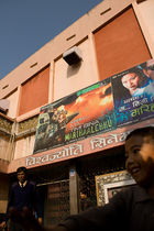
Kathmandu is home to the Nepalese theatre. The city contains several theatres of note including the National Dance Theatre in Kanti Path, the Ganga Theatre, the The Himalayan Theatre and the Aarohan Theatre Group, founded in 1982 and the M. Art Theatre is based in the city. The Gurukul: School of Theatre organizes the Kathmandu International Theatre Festival, attracting artists from all over the world.[93] A mini theatre is also located at the Hanumandhoka Durbar Square, established by the Durbar Conservation and Promotion Committee.
Kathmandu is also the centre of the Nepalese film industry and for production. Kathmandu has a number of cinemas showing Nepali, Indian and western films including the Biswajyoti Cinema Hall, Ranjana Cinema Hall, Kumari Cinema Hall, Jai Nepal Cinema Hall, Tara Cinema Hall, Gopi Krishna Cinema Hall and the Kalanki Cinema Hall.
Music
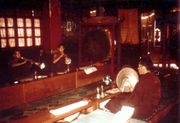
Kathmandu is the centre of music and dance in Nepal and is integral to understanding the city.Various musical performances are organized in the cultural venues of the city throughout the year. The city contains prestigious musical training schools such as the Asian Himalayan Music School. There are various music venues and musical performances may include the Bhanchha Gharin Kamaladi, Bhojan Griha in Dillibazar and the Nepali Chulo in Durbar Marg. Given the importance of Kathmandu to Tibetan Buddhists, the city also attracts monks from Tibet and across the Himalayan region who in coordination with their rituals in visiting sites such as the Boudhanath, will perform music there.
Kathmandu is noted internationally for its jazz festival, popularly known as Jazzmandu. It is the only jazz festival in the entire Himalayan region and was established in March 2002. The festival attracts musicians from countries worldwide such as Australia, Denmark, United States, Benin, and India.[94]
The city has been referenced in numerous songs, including works by Cat Stevens "Katmandu", Mona Bone Jakon (1970)), Bob Seger ("Katmandu", Beautiful Loser (1975)), Rush ("A Passage to Bangkok" ("Pulling into Kathmandu"), 2112, 1976), Krematorij ("Kathmandu", Three Springs (2000)), Fito Páez ("Tráfico por Katmandú" – "Traffic through Kathmandu"); Will Ackerman ("A Happy Home in Kathmandu", The Opening of Doors (1993)); Tantra ("The Hills of Katmandu", early 1980s); and Godiego ("Coming Together in Kathmandu", 1980).
On June 9, 2008, US Cultural Envoy Gene Aitken inaugurated the Kathmandu Jazz Conservatory (KJC) in nearby Lalitpur. A 10-day workshop for over 50 music teachers and Nepali jazz educators was initially held.[95] The mandate of the Conservatory is to create a musical environment where musicians can become knowledgeable in various musical subjects, be exposed to different music genres, and most importantly, where all musicians, from beginners to advanced, can receive a proper music education. Investment in the school has been substantial. Facilities include a music hall which can seat 200 people, a music library, a listening lab, five practice rooms, two large rooms for ensemble rehearsal and group classes, separate rooms for both drum kit and percussion instruments, a piano practice room and a recording studio.
Cuisine
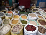
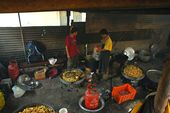
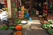
The cultural diversity of Nepal has facilitated the growth of a number of cuisines based on the ethnic groups and the geographical features of the nation. Popularly served though is Dal bhat, which is a dish of lentils and rice, generally served with vegetable curries and forms a staple part of the diet. Given that Kathmandu only had one restaurant in 1955,[96] a large number of restaurants in Kathmandu have since grown up catering in Nepalese cuisine, Tibetan cuisine and Indian cuisine in particular and many others to accommodate both for Nepalese people and for tourists from all around the world. The growth of tourism in Kathmandu has led to culinary creativity and the development of hybrid foods to accommodate for tourists such as American chop suey, which is a sweet and sour sauce with crispy noodles, with a fried egg commonly added on top and other westernized adaptions of traditional cuisine.[96]
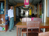
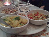
The national drink of Nepal is tea, widely served in Kathmandu, but is served extremely weak by western standards. Chai, however, is richer and contains tea leaves boiled with milk, sugar and spices and the drink lassis, made of curds and sugar is also served in cafes and restaurants. Nepalese beer is available in such venues and in markets, including the national Gorkha beer brand. The popular Himalayan drinks of Chhaang and Tongba, typically made from fermented millent or barley and also sold, as are the harder spirit drinks of arak, made from fermented potatoes and rice. and rakshi, a modern type of Newari wine. Shops and bars in Kathmandu do, however, widely sell western and Indian beers, although shops are forbidden to sell alcohol on the first two days and last two days of the Newari month.[96]
Fresh vegetables and fruit are widely sold in Kathmandu, particularly around the Durbar. The assortment of produce is diverse and some sellers may specialise in the sale of different forms of specific vegetables, such as beans for instance. Western convenience foods are sold in abundance in most of the shops, including Carlsberg beer, Coca Cola and various potato snacks and candy.
Festivals
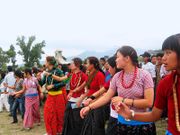
Most of the fairs and festivals that are observed in Kathmandu have their origin to the Malla period. This was further given an urban cultural touch, not limiting it to the Newari festivities, subsequent to the Gorkha conquest in 1768–69. The culture of Parbatiyas and new migrant communities were also harmoniously amalgamated. The festivities usch as the Ghode (horse) jatra, Indra-Jatra, Dasai Durga Puja festivals, Shivratri and many more are observed by all Hindu and Buddhist communities of Kathmandu with great devotional fervour and enthusiasm. Social regulation in the codes enacted incorporated the Hindu religious traditions and ethics. These were followed by the Shah Kings as had been followed by previous kings, as devout Hindus and protectors of Buddhist religion. Christian proselytizing was not allowed by the Shahs though Christian missionaries did try to spread the message of Christ in the Himalayan kingdom.[97]
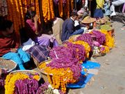 |
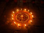 |
|
|
Tihar Festival.
|
||
Cultural continuity has been maintained for centuries – from ancient to modern period – in the exclusive worship of goddesses and deities such as the Ajima, Taleju (or Tulja Bhavani), Degutaleju, Kumari (the living goddess) and so forth in Kathmandu and the rest of the country.[97]
The artistic edifices have now become places of worship in every day life of the people and thus a roaster is maintained to observe the annual festivals, which is intimately linked with the daily life of the people. It is said that there are 133 festivals held in year.[62]
Some of the traditional festivals observed in Kathmandu now are: Bada Dashain, Tihar , Maghe Sankranti : (January), Naga Panchami, Janai Poornima, Pancha Dan Teej/Rishi Panchani, Indrajatra, Ghanta Karna, Buddha Jayanti, Sri Panchami, Maha Shivaratri, Phagu Poornima , Ghodejatra, Chaite Dashain, Nava Varsha, Seto Machchhendranath and Matatirtha Aunsi, apart from those mentioned earlier.[61]
Religion
The main religions in Kathmandu as in the rest of Nepal are Hinduism and Buddhism, although there are minorities of Kirats, Sikhs, Jains, Muslims, Baha'ais and Christians.
Hinduism
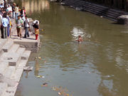
Many Hindu temples in Kathmandu and the surrounding district are centuries old with some temples of national importance to Hindus. As discussed previously, the Pashupatinath Temple, Changu Narayan temple (the oldest) and the Kasthamandap are of particular importance. Other notable Hindu temples in Kathmandu and the surrounding valley include Bajrayogini Temple, Dakshinkali Temple, Guhyeshwari Temple and the Sobha Baghwati shrine.
The Bagmati river which flows through Kathmandu is considered a holy river both by Hindus and Buddhists, and many Hindu temples are located on the banks of this river. The importance of the Bagmati also lies in the fact that Hindus are cremated on the banks of this holy river, and Kirants are buried in the hills by its side. According to the Nepalese Hindu tradition, the dead body must be dipped three times into the Bagmati river before cremation. The chief mourner (usually the first son) who lights the funeral pyre must take a holy river-water bath immediately after cremation. Many relatives who join the funeral procession also take bath in the Bagmati River or sprinkle the holy water on their bodies at the end of cremation as the Bagmati River is believed to purify the people spiritually.
Buddhism
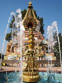 |
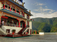 |
|
|
Left:Kopan Monastery. Right:Amitabh Monastery
|
||
Kathmandu and its historic stupas have been of major importance to Newar Buddhism and Tibetan Buddhist for centuries and attracts thousands of pilgrims annually. Kathmandu is the only place where Buddhism is still practiced in Sanskrit. Princess Bhrikuti and Araniko of Kathmandu valley had played a significant role in spread of Buddhism in Tibet. Besides, the clan of Shakyamuni Buddha are believed to have settled in Kathmandu valley. So, the valley imposes a large role for Buddhist pilgrims esp of the Bajrayana sect. Since the 1960s, the permanent Tibetan Buddhist population of Kathmandu has risen significantly so that there are now over 50 Buddhist monasteries in the area. Of major note are the International Buddhist Academy, Kopan Monastery, Amitabh Monastery and Tharlam Monastery.
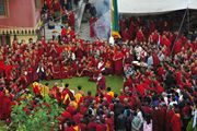
The International Buddhist Academy (IBA) provides a academy for non-monastic Buddhist study and teaches the key Classic Indian Buddhist treatises studied by all Mahayana and Tibetan traditions. Kopan Monastery is located near the Boudhanath on the outskirts and belongs to the Foundation for the Preservation of the Mahayana Tradition (FPMT), an international network of Gelugpa dharma centers.[98] Kopan has become especially noted for teaching Buddhism to visiting Western foreigners. The first of what would become annual month-long (November–December) meditation courses was held in 1971 and was initially known as the Mount Everest Centre.[99] These courses generally combine traditional Lam Rim teachings with informal discussion, several periods of guided meditation, and a vegetarian diet. Today the monastery is home to about 360 monks.[99]
Kirant Mundhum
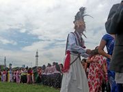
Kirant Mundhum is one of the indigenous animistic practices of Nepal. It is practiced by Kirat people. Some animistic aspects of Kirant beliefs, such as ancestor worship (worship of Ajima) is also found in Newars of Kirant origin. Ancient religious sites believed to be worshipped by ancient Kirats, such as Pashupatinath, Wanga Akash Bhairabh (Yalambar), Ajima are now worshipped by people of all Dharmic religions in Kathmandu. Kirats who have migrated from other parts of Nepal to Kathmandu practice Mundhum in various parts of city.
Sikhism
Sikhism is practiced primarily in Gurudwara at Kupundole. An earlier temple of Sikhism is also present in Kathmandu which went defunct.
Jainism
Jainism is practiced by the small Jain community of Kathmandu. A Jain temple is present in Gyaneshwar, where Jains practice their faith.
Bahai
According to the records of the Spiritual Assembly of the Baha'is of Nepal, there are approximately 300 Baha'is in Kathmandu valley. They have a National Office located in Shantinagar, Baneshwor. The Baha'is also have classes for children at the National Centre and other localities in Kathmandu.
Islam
.JPG)
Islam is practised in Kathmandu but Muslims are a minority, accounting for about 4.2% of the population of Nepal.[100]
In 2004, the largest mosque in Kathmandu, Jama Masjid Mosque, was set ablaze by some 2000 people, and pulled furniture and electrical equipment out of the mosque and torched them on the sidewalk. It was a response to the killing of 12 Nepalese jobseekers in Iraq. The mosque was burned and more than a dozen private employment agencies vandalised who the protesters blamed for the loss of Nepalese citizens in the Iraq war.[101]
Christianity
Even though Nepal's constitution provides freedom of religion, Proselytization is forbidden. In this regard, the Christian population is a minority (a small percentage of 0.45 % of the total population of Nepal) but is growing. Christian churches have been established only since 1950, after multiparty democracy was instituted, even though efforts were made in the nineteenth century to bring Christianity to Nepal. The New Testament was translated into Nepali language as far back as 1821 and the complete Bible in 1914. It is said that in Kathmandu alone there are 170 Christian churches. Christian missionary hospitals, welfare organizations, and schools are also operating. Nepali citizens who served as soldiers in Indian and British armies, who had converted to Christianity while in service, on return to Nepal continue to practice their religion. They have contributed richly to the spread of Christianity and the building of churches in Nepal and in Kathmandu, in particular. Their numbers is also steadily growing, as the latest population estimates indicate their strength at 2% of the total population.[102][103]
Education

The oldest school of Nepal, Durbar School and the oldest college, Tri Chandra College, are located in Kathmandu city. The largest (according to number of students and colleges), oldest and most distinguished university in Nepal is located in the Kathmandu Valley, near Kathmandu city, in Kathmandu district, in Kirtipur called Tribhuvan University. The second largest university, Kathmandu University (KU), is located in outskirts of Kathmandu, in a place called 28 kilos (28 km away from Kathmandu). It is the second oldest university in Nepal, established in November 1991,[104] and the predecessor of the university was the Kathmandu Valley Campus founded in 1985.
Sports
Football and Cricket are the most popular sport among the younger generation in Nepal and there are several stadiums in the city.[105] The sport is governed by the All Nepal Football Association (ANFA) from its headquarters in Kathmandu. The only international football stadium in the city is the Dasarath Rangasala Stadium, a multi-purpose stadium used mostly for football matches and cultural and entertainment programs in the neighborhood of Tripureshwor. It is the largest stadium in Nepal with a capacity of 25,000 and was built in 1956. Martyr's Memorial League is also held in this ground every year. The stadium was renovated with the help of China before the 8th South Asian Games were held in Kathmandu and had floodlights installed so that it is able to organise matches and events in the evenings. Kathmandu is home to the oldest football clubs of Nepal such as RCT, Sankata, NRT. Besides these, most of other prominent football clubs such as MMC, Machhindra FC, Tribhuwan Army Club (TAC), MPC etc.
Cricket is also very popular in Kathmandu. Nepal's U-18 Cricket team is known to be one of the best. Even though Nepal Soccer has not improved at all, Nepal cricket has improved a lot over these years, and it is capturing the eyes of more and more youth in the country. It has become like what baseball is to America, and almost as how Football is to Europe. Kathmandu is also home of some of the oldest cricket clubs of Nepal such as Yengal Sports club.
Sports complexes in Kathmandu are not well maintained and most of them are not up-to-date because of the lack of funding from the government or other sources.
Another international stadium for swimming events, is located in Satdobato, Lalitpur near Kathmandu. ANFA Technical Football Center is located just adjacent to this stadium.
Transport
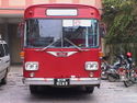
The total length of roads in Nepal is recorded to be (17,182 kilometres (10,676 mi)) , as in 2003–04. This fairly large network (still considered a very inadequate connectivity with the rural hill areas) has helped in the economic progress of the country in the field of agriculture, horticulture, vegetable farming, industry and also tourism.[106] In view of the hilly terrain, transportation facilities in Nepal in general and Kathmandu in particular, are mainly by road and air with limited rail link in the terai region.
Through the process of Five Year Plan developments, the first transmountain highway, later named Tribhuvan Highway, linking Kathmandu with Bhaise, a distance of 126 km (78 mi), was built and further extended via Hetauda through Birganj to Raxaul in India, a distance of 64 kilometres (40 mi) (built by Government of India in 1956). Another trans-Himalayan highway that was built in 1963 connects Kathmandu with Kodari, a distance of 114 kilometres (71 mi) (built by the Chinese), and links to Tibet. Another highway called the Prithvi Highway, within the country, connects Kathmandu with the Pokhara Valley over a distance of 200 kilometres (120 mi) (built by the Chinese).

Air transport, the next in importance to Nepal (since it is a landlocked country) was also developed since 1953, first by the Indian Air Lines, and subsequently in 1959 by the Royal Nepal Airlines Corporation (RNAC) with internal services starting with Kathmandu as the hub linking with many towns and cities within Nepal. Gradually, it spread to Indian and other international destinations. Now, Nepal boasts of 44 airports throughout the country.[107] The main international airport serving Kathmandu and indeed Nepal is the Tribhuvan International Airport, located about six kilometres from the city center in the Kathmandu valley. Operated by the Civil Aviation Authority of Nepal[108] it has two terminals, one domestic and one international. At present, about 22 international airlines connect Nepal to various other destinations in Asia and the Middle East, connected to cities such as Delhi, Kolkata, Doha, Dubai, Abu Dhabi, Seoul, Hong Kong, Singapore, Bangkok, Kuala Lumpur, Dhaka, Islamabad, Karachi, Paro, Lhasa, Chengdu and Guangzhou.[108] A recent extension to the international terminal has made the distance to the airplanes shorter and in October 2009 it became possible to fly directly to Kathmandu from Amsterdam by Arkefly[109] Regionally, several Nepalese airlines operate from the city including Agni Air, Buddha Air, Cosmic Air, Gorkha Airlines, Nepal Airlines and Yeti Airlines connecting Kathmandu to many other major towns across Nepal.
Ropeways
Ropeway is also another important transportation means in hilly terrain. A ropeway operated between Kathmandu and Hetauda over a length of 43 kilometres (27 mi), constructed with assistance from the USA, could carry 25 tons of goods per hour. It has since been discontinued due to poor carrying capacity and maintenance issues. During the Rana period, a rope way was constructed between Kathmandu (then Mathathirtha) to Dhorsing (Makawanpur) over 22 km (14 mi) length, which could carry cargo of 8 tons per hour. Now, a cable car ropeway (3.1 km long), a modern one, has been built linking Kurintar (on the Prthvi Highway, near Kathmandu) with Manakamana, a famous temple in the Gorkha district.[110]
Healthcare
Healthcare in Kathmandu is the most developed in Nepal, and the city and surrounding valley is home to some of the best hospitals and clinics in the country. Notable hospitals include Bir Hospital, Trubhuwan University Institute of Medicine (Teaching Hospital), Patan Hospital, Kathmandu Model Hospital, Tribhuwan Chandra Army Hospital, B & B Hospital, Om Hospital, Norvic Hospital and the city is supported by specialist hospitals such as Shahid Shukra Tropical Hospital, Kathmandu Veterinary Hospital, Nepal Eye Hospital, Kanti Children's Hospital, Prasuti Griha (Obstetrics & Gynecology center), Hospital and Rehabilitation Center for Disabled Children (HRDC), Gangalal Cardiology Hospital, Neuro Center, Spinal Rehabilitation center, Bhaktapur Cancer hospital. Most of the general hospitals are located in the city centre. although several clinics are located elsewhere in Kathmandu district.
Bir Hospital is the oldest (and busiest), established in July 1889 by Bir Samsher Janga Bahadur Rana. The hospital has been run by the National Academy of Medical Sciences, a government agency since 2003 and has a capacity of 458 beds. The hospital provides high quality medical and surgical treatments to people from all across the country. Nephrology service in Nepal started at Bir Hospital, though although 40 kidney biopsies are done every year, due to lack of well trained manpower in the field of renal histopathology, glomerular diseases cannot be easily diagnosed with accuracy. Many patients from the rural areas come to this hospital to get free treatment. Every year the hospital produces qualified efficient and well trained post graduates in different subjects of clinical medicine such as general surgery, internal medicine, orthopaedic surgery, pathology etc. It has become an Internship centre for students who had passed MBBS from China and Russia and other parts of the world. Hundreds of nurses of different levels get nursing training in this hospital. The yearly budget of the hospital is about NRs 27 Crore (About US$ 4.1 million), two thirds of which is funded by the government but adequate funding is always a problem in running the hospital.[111]
Media
Kathmandu is the television hub of Nepal. Nepal Television, established 1985, the oldest and most watched television channel in Nepal, as is the government owned NTV 2 Metro, Channel Nepal, Image Channel, Avenues TV and other channels. The headquarters of many of the country's news outlets are also located in the city including the government owned Gorkhapatra which is the oldest national daily newspaper in Nepal, The Kathmandu Post, Nepali Times, Kantipur Publications and its paper Kantipur which is the largest selling Nepali language paper, The Himalayan Times which is the largest selling English broadsheet in Nepal, Karobar Daily only economic daily in Nepal, Jana Aastha National Weekly, MyRepublica and many others. There is a state run National News Agency (RSS). The Internet address is nepalnews.com, which provides private online news. Radio service of Radio Nepal, a state-run organization operates national and regional Radio stations. The Radio stations, which are operational are: Hits FM – commercial; music-based -HBC 94 FM – operated by Himalayan Broadcasting Company, Radio Sagarmatha – FM, public, community station, Kantipur FM – commercial and Image FM. British Broadcasting Corporation (BBC) has also a FM broadcasting station at Kathmandu.[48]
In popular culture
In some travelogues, the Kathmandu valley has been referred to as the "Emerald Valley".[112] Numerous works of literature have been set in Kathmandu, including Kim Stanley Robinson's 1989 work, Escape from Kathmandu. Recently, the book ("Arresting God in Kathmandu") by Samrat Upadhyay received international acclaim, as well as the non-fictional book written by Manjushree Thapa "Forget Kathmandu". Pico Iyer, an American writer, also has a non-fiction book named "Video nights in Kathmandu", although only one chapter of the book is dedicated to Kathmandu. The song called "Kathmandu" is upbeat rock 'n' roll by Bob Seger.
Kathmandu has also been mentioned in numerous films including in the film Bewitched as the title of a fictional movie Will Ferrell's character stars in prior to his role in the Bewitched remake and by Cameron Diaz in There's Something about Mary.
Uncharted 2: Among Thieves, a video game by Naughty Dog for the PlayStation 3, includes several chapters in Kathmandu (though it does not mention the city by name) and depicts a pagoda-style temple and old Newari houses.
A film industry, nicknamed "Kollywood", though small, has been established.
Notable Kathmanduites
Twin Towns – Sister Cities
Kathmandu is twinned with:
 Dortmund, Germany
 Edinburgh, United Kingdom
 Eugene, Oregon, USA
 Isfahan, Iran
 Johannesburg, South Africa
- Kansas City, USA
 Kyoto, Japan
 Lahore, Pakistan
- Matsumoto, Nagano, Japan
 Minsk, Belarus
 Pau, France
 Pyongyang, North Korea
 Québec City, Canada
- Rochester, New York, USA
 Xi'an, China
 Yangon, Burma
Footnotes
- ↑ 1.0 1.1 1.2 1.3 "History". http://www.kathmandu.gov.np/index.php?cid=4&pr_id=4. Retrieved 16 May 2010.
- ↑ "World-Gazetteer". World-Gazetteer. http://world-gazetteer.com/wg.php?x=&men=gpro&lng=en&des=wg&srt=npan&col=abcdefghinoq&msz=1500&geo=423782531. Retrieved 2010-07-04.
- ↑ "World-Gazetteer". World-Gazetteer. http://world-gazetteer.com/wg.php?x=&men=gpro&lng=en&des=wg&srt=npan&col=abcdefghinoq&msz=1500&geo=-1049454. Retrieved 2010-07-04.
- ↑ "Kathmandu". Urban Dictionary. http://www.urbandictionary.com/define.php?term=kathmandu. Retrieved 2009-12-20.
- ↑ "About Kathmandu Metropolitian City Office". Kathmandu Metropolitan City. http://www.kathmandu.gov.np/. Retrieved 2009-12-12.
- ↑ 6.0 6.1 6.2 "Bleak Outlook for Environment in Kathmandu Valley". United Nations Environment Programme: Environment for development. http://new.unep.org/Documents.Multilingual/Default.asp?DocumentID=498&ArticleID=5500&l=en. Retrieved 2009-11-24.
- ↑ "About Kathmandu Metropolitian City Office". Kathmandu Metropolitan City Council, Government of Nepal. http://www.kathmandu.gov.np/. Retrieved 2009-12-14.
- ↑ 8.0 8.1 8.2 8.3 8.4 "Kathmandu Facts". Kathmandu Metropolitan City Council, Government of Nepal. http://www.kathmandu.gov.np/index.php?cid=2&pr_id=2. Retrieved 2009-12-12.
- ↑ "The World Fact Book”Geography". Central Intelligence Agency (CIA), USA. https://www.cia.gov/library/publications/the-world-factbook/geos/np.html. Retrieved 2009-11-23.
- ↑ 10.0 10.1 "Kathmandu Valley-Unesco World Heritage site". World Heritage- UNESCO.org. http://whc.unesco.org/en/list/121. Retrieved 2009-11-25.
- ↑ 11.0 11.1 "Kathmandu Valley World Heritage site: Nepal" (PDF). Heritage Homeowner’s Preservation Manual. Unesco, Kathmandu and Bangkok. 2006. http://unesdoc.unesco.org/images/0015/001520/152020m.pdf. Retrieved 2009-11-25.
- ↑ "Introduction". Kathmandu Metropolitan City, Government of Nepal. http://www.kathmandu.gov.np/index.php?cid=1&pr_id=1. Retrieved 2009-12-12.
- ↑ 13.00 13.01 13.02 13.03 13.04 13.05 13.06 13.07 13.08 13.09 13.10 "History". Government of Nepal. http://www.kathmandu.gov.np/index.php?cid=4&pr_id=4. Retrieved 2009-12-12.
- ↑ Talmot and Alsop (2001, and a later revision).
- ↑ 15.0 15.1 15.2 15.3 15.4 15.5 15.6 "History:Ancient Nepal". New Travels and Tours Ltd. http://www.newatravels.com/nepal/index.html. Retrieved 2009-12-18.
- ↑ Bajracharya, Prakash (2007). Buddha ra Buddha pachhi. Kathmandu: Dharmakirti Publication, Nepal.
- ↑ Bajracharya, Rajendra Man (2004). Samkshipta Swayambhu Purana. Kathmandu.
- ↑ 18.0 18.1 18.2 Pasa, Basu. Kantipur. Kathmandu.
- ↑ Beal (1884), Vol. II, pp. 80–81.
- ↑ Shaha (1992), p. 20.
- ↑ Snellgove (1987), Vol. II, p. 371.
- ↑ 22.0 22.1 Snellgove (1987), Vol. II, p. 372.
- ↑ Nanjio (1904–5) No. 1470
- ↑ Watters (1923), Vol. II, pp. 84–85.
- ↑ Shaha (1992), pp. 21–22.
- ↑ 26.0 26.1 "Nepal: Chronology of Important Events". Nepal Homepage. http://www.nepalhomepage.com/general/history.html. Retrieved 2009-12-19.
- ↑ "Bhaktapur Durbar Square". Government of Nepal Ministry of Culture, Tourism and Civil Aviation, Department of Archaeology. http://www.doa.gov.np/index/bhaktapur.html. Retrieved 8 October 2009.
- ↑ Rawal, Bhim. The Communist Movement in Nepal: Origin and Development. Kathmandu: Accham-Kathmandu Contact Forum, 2007. p. 41-42.
- ↑ Levi, Werner. Politics in Nepal, published in Far Eastern Survey, Vol. 25, No. 3, (Mar., 1956), pp. 39–46
- ↑ 30.0 30.1 Woodhatch, Tom (1999). Nepal handbook. Footprint Travel Guides. p. 194. ISBN 978-1-900949-44-6. http://books.google.com/?id=NmltSI-xt8wC&pg=PA194. Retrieved 2009-12-17.
- ↑ 31.0 31.1 Mayhew, Bradley; Bindloss, Joe; Armington, Stan (2006). Lonely Planet. Lonely Planet. p. 38. ISBN 978-1-74059-699-2. http://books.google.com/?id=dtSIz1vwg4YC&pg=PA38. Retrieved 2009-12-17.
- ↑ Reed, David; James McConnachie (2002). The rough guide to Nepal. Rough Guides. p. 135. ISBN 978-1-85828-899-4. http://books.google.com/?id=lcbUIOTcE18C&pg=PA135. Retrieved 2009-12-17.
- ↑ "Mass Maoist protest in Kathmandu". BBC News. 2009-11-12. http://news.bbc.co.uk/1/hi/8356132.stm. Retrieved 2009-12-18.
- ↑ "Geography". Kathmandu Metropolitan City. http://www.kathmandu.gov.np/index.php?cid=3&pr_id=3. Retrieved 2009-12-12.
- ↑ Shreshta, S.H (2005). Nepal in Maps. Kathmandu: Educational Publishing House. p. 129.
- ↑ The water flows out through a gargoyle shaped like a tiger's mouth. Fisher, James F. with Acharya, Tanka Prasad and Acharya, Rewanta Kumari (1997) Living martyrs: individuals and revolution in Nepal Oxford University Press, New York, page 220, ISBN 978-0-19-564000-7
- ↑ 37.0 37.1 37.2 37.3 37.4 Davis, John A. (1977) "Water Quality Standards for the Bagmati River" Journal: Water Pollution Control Federation 49(2): pp. 227–234, page 227
- ↑ "Map of Kathmandu" United States Department of State, 1985
- ↑ Kannel, Prakash Raj; Lee, S.; Lee, Y.-S.; Kanel, S.R.; Pelletier, G.J. (2007). "Application of automated QUAL2Kw for water quality modeling and management in the Bagmati River, Nepal". Ecological Modelling 202: 503. doi:10.1016/j.ecolmodel.2006.12.033.
- ↑ Shrestha S.H. p.35
- ↑ Shreshta, Vinod Prasad (2007). A Concise Geography of Nepal. Kathmandu: Mandal Publications. p. 126. ISBN 978-99946-55-04-5.
- ↑ 42.0 42.1 "Average Temperature and Rainfall of Kathmandu City". Nepal Vista. http://www.nepalvista.com/travel/kathmandu-temperature.php. Retrieved 2009-11-06.
- ↑ "World Weather Information Service – Kathmandu". UN. http://worldweather.wmo.int/031/c00114.htm. Retrieved 2010-05-01.
- ↑ "hhh". gg. http://www.cleanairnet.org/caiasia/1412/article-58960.html. Retrieved 2009-12-20.
- ↑ 45.0 45.1 45.2 "Economy". Kathmandu Metropolitan City, Government of Nepal. http://www.kathmandu.gov.np/index.php?cid=5&pr_id=5. Retrieved 2009-12-20.
- ↑ 46.0 46.1 46.2 46.3 46.4 "Economy". Kathmandu Metropolitan City Office. http://www.kathmandu.gov.np/index.php?cid=5&pr_id=5. Retrieved 2009-12-18.
- ↑ 47.0 47.1 47.2 47.3 47.4 47.5 "Business/Handicraft Export Down 8 Percent". The Kathmandu Post. 2009-11-12. http://www.ekantipur.com/the-kathmandu-post/2009/11/12/Business/Handicraft-export-down-8-percent/1974/. Retrieved 2009-12-18.
- ↑ 48.0 48.1 48.2 "Nepal Country Profile". British Broadcasting Corporation (BBC). 2009-08-19. http://news.bbc.co.uk/2/hi/americas/country_profiles/1166502.stm. Retrieved 2009-12-22.
- ↑ "How to find Us." Agni Air. Retrieved on 24 March 2010. "Agni Air Pvt. Ltd. P. O. Box: 23650 Prayag Marg, Shantinagar, Kathmandu, Nepal,"
- ↑ 50.0 50.1 Shrestha pp.86-89
- ↑ "Metropolis Council". Kathmandu Metropolitan City Council, Government of Nepal. http://www.kathmandu.gov.np/index.php?cid=9&pr_id=9. Retrieved 2009-12-14.
- ↑ "Ward Profile". Kathmandu Metropolitan City Council, Government of Nepal. http://www.kathmandu.gov.np/index.php?cid=915&pr_id=15. Retrieved 2009-12-14.
- ↑ 53.0 53.1 "Census Nepal 2001". http://www.cbs.gov.np/Population/National%20Report%202001/VDC.pdf. Retrieved 13 July 2007.
- ↑ "Outline of International Relations of Kathmandu Metropolitan City" (PDF). Katamandu Metropolitan City, Government of Nepal. http://www.kathmandu.gov.np/pdf/27IRelation.pdf. Retrieved 2009-12-20.
- ↑ 55.0 55.1 55.2 55.3 55.4 "History and problem". Firefighters Volunteer Association of Nepal (FAN). http://www.fan.org.np/. Retrieved 2009-12-20.
- ↑ "Water supply dips with daily power cuts". http://www.nowpublic.com/kathmandu_water_supply_dips_with_daily_power_cuts. Retrieved 2009-12-22.
- ↑ 57.0 57.1 "NEPAL: Kathmandu faces worsening water crisis". http://urbanhealthupdates.wordpress.com/2009/09/24/nepal-kathmandu-faces-worsening-water-crisis/. Retrieved 2009-12-20.
- ↑ "KathmanduMetropolitan City Public Health and SocialWelfare Department Bagdurbar, Kathmandu, Nepal". KathmanduMetropolitan City, Government of Nepal. http://www.kathmandu.gov.np/?action=ND&id=Ng==&cid=MjA=. Retrieved 2009-12-20.
- ↑ "Population". Kathmandu Metropolitan City, Government of Nepal. http://www.kathmandu.gov.np/index.php?cid=6&pr_id=6. Retrieved 2009-12-12.
- ↑ 60.0 60.1 Jha p.21
- ↑ 61.0 61.1 "Festivals". Kathmandu Metropolitan City ,Government of Nepal. http://www.kathmandu.gov.np/index.php?cid=142&pr_id=172. Retrieved 2009-12-12.
- ↑ 62.0 62.1 62.2 "Katmandu as a world Heritage Site". publisher= Kathmandu Metropolitan City, Government of Nepal. http://www.kathmandu.gov.np/index.php?cid=137&pr_id=167. Retrieved 2009-12-12.
- ↑ "Kathmandu-Kashtamandap". Nepalopedia. http://www.nepalopedia.com/default.aspx?TOUR=0005. Retrieved 2009-12-14.
- ↑ "Hanuman Dhoka (Old Royal Palace)". http://www.vegetarian-restaurants.net/Nepal/Kathmandu/Hanuman-Dhoka.htm. Retrieved 2009-12-20.
- ↑ "Kumari Devi – The Living Goddess". http://www.visitnepal.com/nepal_information/kumari.php. Retrieved 2009-12-19.
- ↑ 66.0 66.1 "SAARC tourism". Nepal.saarctourism.org. http://nepal.saarctourism.org/pashupatinath-temple.html. Retrieved 2010-07-04.
- ↑ 67.0 67.1 67.2 Mayhew, Bradley; Bindloss, Joe; Armington, Stan (2006). Nepal. Lonely Planet. p. 166. ISBN 978-1-74059-699-2. http://books.google.com/?id=dtSIz1vwg4YC&pg=PA166&dq=Pashupatinath&cd=3#v=onepage&q=Pashupatinath.
- ↑ "Spiritual guides". Vegetarian-restaurants.net. 2006-01-01. http://www.vegetarian-restaurants.net/Nepal/Kathmandu-Valley/Pashupatinath-Temple.htm. Retrieved 2010-07-04.
- ↑ Snellgrove (1987), p. 365.
- ↑ "Fables of Boudhanath and Changunarayan". nepalnews.com. http://www.nepalnews.com.np/contents/englishweekly/independent/11-09/tourism.htm. Retrieved 2009-12-13.
- ↑ Shaha, Rishikesh. Ancient and Medieval Nepal. (1992), p. 123. Manohar Publications, New Delhi. ISBN 978-81-85425-69-6.
- ↑ Ehrhard, Franz-Karl (1990). "The Stupa of Bodhnath: A Preliminary Analysis of the Written Sources." Ancient Nepal – Journal of the Department of Archaeology, Number 120, October–November 1990, pp. 1–6.
- ↑ Ehrhard, Franz-Karl (1990). "The Stupa of Bodhnath: A Preliminary Analysis of the Written Sources." Ancient Nepal – Journal of the Department of Archaeology, Number 120, October–November 1990, pp. 7–9.
- ↑ 74.0 74.1 74.2 74.3 Mayhew, Bradley; Bindloss, Joe; Armington, Stan (2006). Nepal. Lonely Planet. pp. 170–1. ISBN 978-1-74059-699-2. http://books.google.com/?id=dtSIz1vwg4YC&pg=PA170&dq=Pashupatinath&cd=3#v=onepage&q=Bodhnath.
- ↑ The Legend of the Great Stupa and The Life Story of the Lotus Born Guru, pp. 21–29. Keith Dowman (1973). Tibetan Nyingma Meditation Center. Dharma Books. Berkeley, California.
- ↑ Lonely Planet Nepal (2005). Swayambhunath.
- ↑ Shaha, Rishikesh. Ancient and Medieval Nepal. (1992), p. 122. Manohar Publications, New Delhi. ISBN 978-81-85425-69-6.
- ↑ Wills, Kendall J. On the Trail Of the Buddha. New York Times, March 8, 1987. Online: NYtimes.com
- ↑ "UNESCO". http://whc.unesco.org/en/list/121.
- ↑ 80.0 80.1 "Introducing Changu Narayan Temple". http://www.lonelyplanet.com/nepal/around-the-kathmandu-valley/changu-narayan-temple. Retrieved 2009-12-19.
- ↑ 81.0 81.1 "Dharahara". Nepalopedia. http://www.nepalopedia.com/Default.aspx?TOUR=0013. Retrieved 2009-12-14.
- ↑ Vibhaga, Nepal Sūcanā (1975). Narayanhity Royal Palace, home of the King of Nepal. His Majesty's Govt., Ministry of Communications, Dept. of Information. p. 5. http://books.google.com/?id=N2kKAQAAIAAJ&q=Narayanhity+Royal+Palace&dq=Narayanhity+Royal+Palace&cd=1. Retrieved 2009-12-17.
- ↑ Shrestha pp.86-87
- ↑ "Hotels in Kathmandu". Kathmandu- hotels.com. http://www.kathmandu-hotels.com/. Retrieved 2009-12-13.
- ↑ 85.0 85.1 Jha p.23
- ↑ Jha pp.23–24
- ↑ Jha p.24
- ↑ 88.0 88.1 Jha p.25
- ↑ Jha p.26-28
- ↑ 90.0 90.1 "Museums and Art Galleries of Nepal". http://www.asiatravel.com/nepal/nepalgal.html. Retrieved 2009-12-18.
- ↑ 91.00 91.01 91.02 91.03 91.04 91.05 91.06 91.07 91.08 91.09 91.10 91.11 91.12 91.13 91.14 "Museums and art galleries". Asia Travel. http://www.asiatravel.com/nepal/nepalgal.html. Retrieved 2009-12-18.
- ↑ "Kathmandu Contemporary Art Centre". Kathmanduarts.org. http://www.kathmanduarts.org/. Retrieved 2010-07-04.
- ↑ "Kathmandu International Theatre Festival 2008". Aarohan Theatre Group. http://www.aarohantheatre.org/festivals.php. Retrieved 2009-12-22.
- ↑ "The jazz peace". Nepali Times. 2006-09-29. http://www.nepalitimes.com.np/issue/317/Music/12568. Retrieved 2009-12-18.
- ↑ "U.S. Cultural Envoy Inaugurates KJC". US Department of State. 2008-06-09. http://nepal.usembassy.gov/ep-06-09-20010.html. Retrieved 2009-12-20.
- ↑ 96.0 96.1 96.2 Lonely Planet (2003), pp.91–2
- ↑ 97.0 97.1 JHa, Makhan (1995). The sacred complex of Kathmandu, Nepal: religion of the Himalayan kingdom. Gyan Books. p. 208. ISBN 978-81-212-0490-3. http://books.google.com/?id=mhsdlmhFl-gC&pg=PA21&dq=Arts+in+Kathmandu&cd=1#v=onepage&q=Arts%20in%20Kathmandu. Retrieved 2009-12-18.
- ↑ "FPMT Centers, Projects and Services in Nepal". Foundation for the Preservation of the Mahayana Tradition. http://www.fpmt.org/centers/nepal.asp. Retrieved 2009-12-18.
- ↑ 99.0 99.1 "About us". Kopan Monastery. http://www.kopan-monastery.com/about.html. Retrieved 2009-12-18.
- ↑ "Nepal in Figures 2006". Government of Nepal. http://www.cbs.gov.np/Nepal%20in%20figure/nepal%20in%20figures%202006.pdf. Retrieved 2009-12-18.
- ↑ "Kathmandu mosque ablaze after hostage killings". The Sydney Morning Herald. 2004-09-01. http://www.smh.com.au/articles/2004/09/01/1093938981160.html?from=storylhs. Retrieved 2009-12-18.
- ↑ "Churches in Nepal". http://across.co.nz/NepalChurches.html. Retrieved 2009-12-20.
- ↑ "US Department of State: Diplomacy in Action". US Department of State. http://www.state.gov/g/drl/rls/irf/2004/35518.htm. Retrieved 2009-12-20.
- ↑ "Science, research and technology in Nepal" (PDF). Bajracharya, Dayanand; Bhuju, Dinesh Raj; Pokhrel, Jiba Raj. UNESCO Kathmandu Office.. http://unesdoc.unesco.org/images/0014/001461/146117e.pdf. Retrieved 2009-11-13.
- ↑ "Goal Programme – All-Nepal Football Association – 2001". FIFA. http://www.fifa.com/associations/association=nep/goalprogramme/newsid=521692.html. Retrieved 2009-12-20.
- ↑ Shrestha pp.91–96
- ↑ Shrestha p.98
- ↑ 108.0 108.1 "Tribhuvan International Airport at Civil Aviation Authority of Nepal". http://www.caanepal.org.np/tia.htm.
- ↑ "New routes launched during the last week 10-16-october/". http://www.anna.aero/2009/10/16/.
- ↑ Shrestha pp.99-100
- ↑ "Mercantile Communications Pvt. Ltd". Nepalnews.com. http://www.nepalnews.com/archive/2007/jul/jul30/news05.php. Retrieved 2010-07-04.
- ↑ "About Nepal". http://www.focusnepal.com/index.php?action=AboutNepal. Retrieved 2009-12-22.
References
- Beal, Samuel (1884). Si-Yu-Ki: Buddhist Records of the Western World, by Hiuen Tsiang. 2 vols. Translated by Samuel Beal. London. 1884. Reprint: Delhi. Oriental Books Reprint Corporation. 1969.
- Jha, Makhan (1995). The sacred complex of Kathmandu, Nepal: religion of the Himalayan kingdom. Gyan Books. p. 208. ISBN 978-81-212-0490-3. http://books.google.com/?id=mhsdlmhFl-gC&pg=PA21&dq=Arts+in+Kathmandu&cd=1#v=onepage&q=Arts%20in%20Kathmandu.
- Mayhew, Bradley; Bindloss, Joe; Armington, Stan (2006). Lonely Planet. Lonely Planet. p. 416. ISBN 978-1-74059-699-2. http://books.google.com/?id=dtSIz1vwg4YC&pg=PA38.
- Mayhew, Bradley; Bindloss, Joe; Armington, Stan (2006). Nepal. Lonely Planet. p. 166. ISBN 978-1-74059-699-2. http://books.google.com/?id=dtSIz1vwg4YC&pg=PA166&dq=Pashupatinath&cd=3#v=onepage&q=Pashupatinath.
- Mayhew, Bradley; Brown, Lindsay, Vivequin, Wanda (2003). Lonely Planet Nepal. Lonely Planet. ISBN 978-1-74059-422-6.
- Nanjio, Bunyiu (1883). A Catalogue of the Chinese Translation of the Buddhist Pantheon. Oxford at the Clarendon Press.
- Shaha, Rishikesh (1992). Ancient and Medieval Nepal. Manohar Publications, New Delhi. ISBN 978-81-85425-69-6.
- Shreshta, S.H (2005). Nepal in Maps. Kathmandu: Educational Publishing House. p. 129.
- Shreshta, Vinod Prasad (2007). A Concise Geography of Nepal. Kathmandu: Mandal Publications. p. 126. ISBN 978-99946-55-04-5.
- Snellgrove, David (1987). Indo-Tibetan Buddhism: Indian Buddhists & Their Tibetan Successors. Two Volumes. Shambhala Publications, Boston. ISBN 978-0-87773-311-9 (v. 1); ISBN 978-0-87773-379-9 (v. 2).
- Tamot, Kashinath, and Ian Alsop. (2001). "A Kushan-period Sculpture from the reign of Jaya Varma-, AD 184/185, Kathmandu, Nepal." (2001). Asianart.com
- Tamot, Kashinath, and Ian Alsop. (date unknown. Update of previous article). "A Kushan-period Sculpture from the reign of Jaya Varman, AD 185, Kathmandu, Nepal." Asianart.com
- Thapa, Rajesh Bahadur, Murayama, Yuji, and Ale, Shailja (2008). "City Profile: Kathmandu". Cities, Vol.25(1), 45–57. DX.doi.org
- Thapa, Rajesh Bahadur and Murayama, Yuji (2009). Vol.1(3), 534–556. "Remote Sensing | Free Full-Text | Examining Spatiotemporal Urbanization Patterns in Kathmandu Valley, Nepal: Remote Sensing and Spatial Metrics Approaches". Dx.doi.org. doi:doi:10.3390/rs1030534.
- Thapa, Rajesh Bahadur and Murayama, Yuji (2010). Applied Geography, Vol. 30(1), 70–83. "ScienceDirect – Applied Geography : Drivers of urban growth in the Kathmandu valley, Nepal: Examining the efficacy of the analytic hierarchy process". Dx.doi.org. 2009-11-04. doi:doi:10.1016/j.apgeog.2009.10.002.
- Vibhaga, Nepal Sūcanā (1975). Narayanhity Royal Palace, home of the King of Nepal. His Majesty's Govt., Ministry of Communications, Dept. of Information. p. 14. http://books.google.com/?id=N2kKAQAAIAAJ&q=Narayanhity+Royal+Palace&dq=Narayanhity+Royal+Palace&cd=1.
- Watters, Thomas. (1904–5). On Yuan Chwang’s Travels in India. (AD 629–645). Royal Asiatic Society. Second Indian Edition. Munshhiram Manoharlal Publishers, New Delhi. (1973).
- Woodhatch, Tom (1999). Nepal handbook. Footprint Travel Guides. p. 194. ISBN 978-1-900949-44-6. http://books.google.com/?id=NmltSI-xt8wC&pg=PA194. Retrieved 2009-12-17.
External links
- Kathmandu travel guide from Wikitravel
- A Kushan-period Sculpture from the reign of Jaya Varma-, AD 184/185 Kathmandu, Nepal.
- A Kushan-period Sculpture from the reign of Jaya Varman, AD 185. Kathmandu, Nepal Updated but shortened version of previous entry
- Kathmandu Sights and Scenes
- Kathmandu Destination Guide from whl.travel
|
|||||||||||||||||||||||||||||
|
||||||||||||||
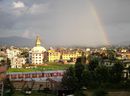
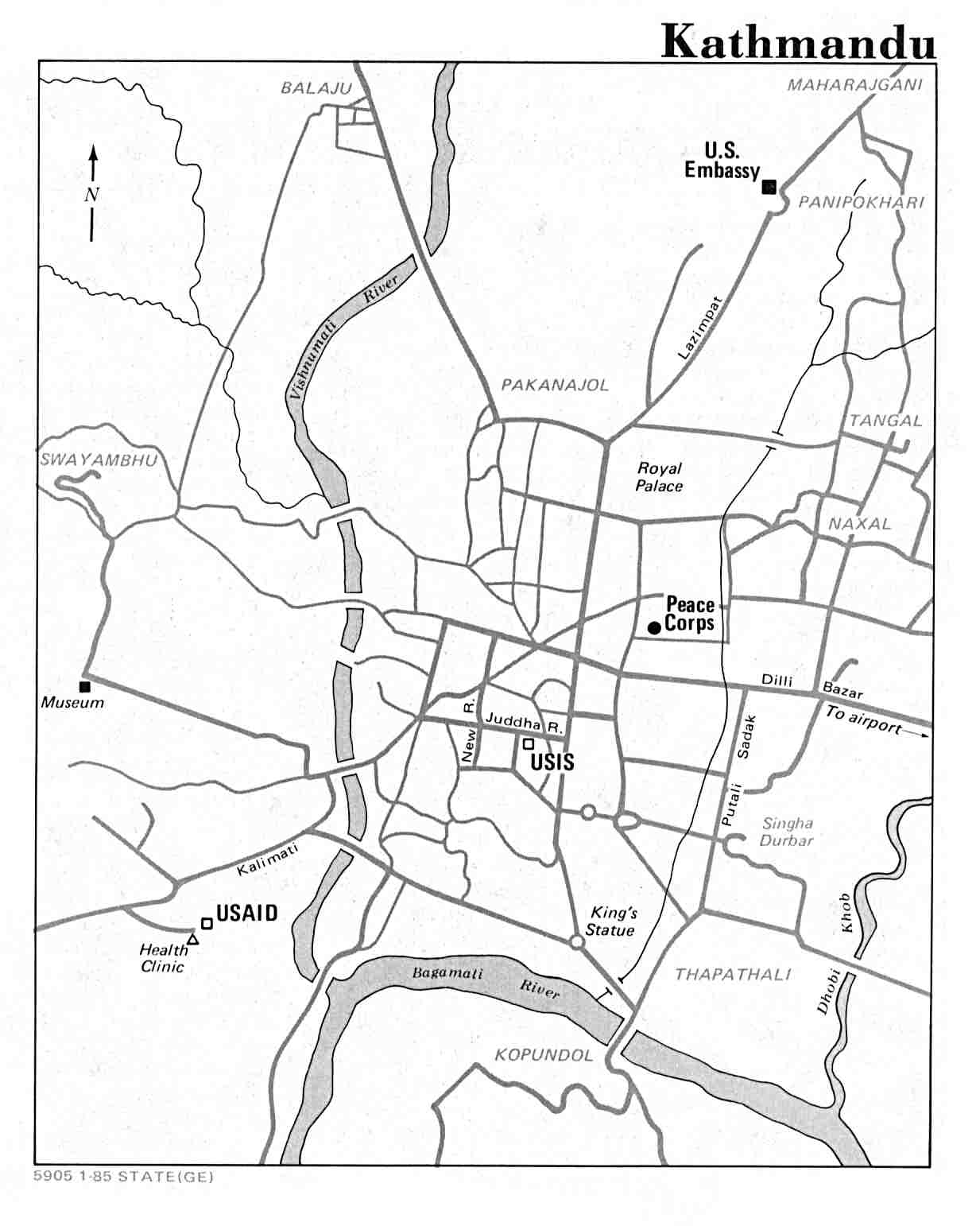