Oaxaca
| Oaxaca Estado Libre y Soberano de Oaxaca |
|||
|---|---|---|---|
| — State — | |||
 |
|||
|
|||
 |
|||
| Country | |||
| Capital | Oaxaca | ||
| Municipalities | 570 | ||
| Admission | December 21, 1823[1] | ||
| Order | 3rd | ||
| Government | |||
| - Governor | Ulises Ruiz Ortiz (PRI) | ||
| - Federal Deputies | PRD: 7 PRI: 2 Convergencia: 1 PT: 1 |
||
| - Federal Senators | PRI: 1 PRD: 1 Convergencia: 1 |
||
| Area Ranked 5th |
|||
| - Total | 93,952 km2 (36,275.1 sq mi) | ||
| Population (2005) | |||
| - Total | 3,506,821 (Ranked 10th) | ||
| - Density | 37/km2 (95.8/sq mi) | ||
| Time zone | CST (UTC-6) | ||
| - Summer (DST) | CDT (UTC-5) | ||
| HDI | 0.7560 - medium Ranked 30th |
||
| ISO 3166-2 | MX-OAX | ||
| Postal abbr. | Oax. | ||
| Website | http://www.oaxaca.gob.mx | ||


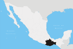
The Free and Sovereign State of Oaxaca (Estado Libre y Soberano de Oaxaca, Spanish pronunciation: [waˈxaka] (![]() listen)) is one of the 31 states of Mexico, located in the southern part of the country, bordering the states of Guerrero to the west, Puebla to the northwest, Veracruz to the north, Chiapas to the east, and the Pacific Ocean in the south. With an area of 95,364 km² (36,820.2 sq mi), Oaxaca is the fifth largest state in the republic. According to the 2005 census it had a population of 3,506,821 inhabitants. The state is named for its capital and largest city.
listen)) is one of the 31 states of Mexico, located in the southern part of the country, bordering the states of Guerrero to the west, Puebla to the northwest, Veracruz to the north, Chiapas to the east, and the Pacific Ocean in the south. With an area of 95,364 km² (36,820.2 sq mi), Oaxaca is the fifth largest state in the republic. According to the 2005 census it had a population of 3,506,821 inhabitants. The state is named for its capital and largest city.
The state is best known for its indigenous peoples and cultures. The most numerous and best known are the Zapotecs and the Mixtecs, but there are sixteen that are officially recognized. These cultures have survived better to the present than most others in Mexico due to the state’s rugged and isolating terrain. Most live in the Central Valleys region, which is also an important area for tourism, attracting people for its archeological sites such as Monte Albán, native culture and crafts. Another important tourist area is the coast, which has the major resort of Huatulco. The state also has some of the largest biodiversity in Mexico.
Contents |
History
Name
The name of the state comes from the name of its capital city, Oaxaca. This name comes from the Nahuatl word “Huaxacac”,[2] which refers to a tree called a “guaje” (Leucaena leucocephala), found in area around the capital city. The state was created in 1824, and the state seal was designed by Alfredo Canseco Feraud and approved by the government of Eduardo Vasconcelos.[3]
Pre-historic and pre-Hispanic period
Most of what is known about pre-historic Oaxaca comes from archeological work in the Central Valleys region. Evidence of human habitation dating back to about 11,000 years B.C.E has been found in the Guilá Naquitz cave near the town of Mitla. More finds of nomadic peoples date back to about 5000 B.C.E., with some evidence of the beginning of agriculture. By 2000 B.C.E., agriculture had been established in the Central Valleys region of the state, with sedentary villages.[4] The diet developed around this time would remain until the Spanish Conquest, consisting primarily of harvested corn, beans, chocolate, tomatoes, chili peppers, squash and gourds. Meat was generally hunted and included tepezuintle, turkey, deer, jabali, armadillo and iguana.[5]
The oldest known major settlements, such as Yanhuitlán and Laguna Zope are located in this area as well. The latter settlement is known for its small figures called “pretty women” or “baby face.” Between 1200 and 900 B.C.E., pottery was being produced in the area as well. This pottery has been linked with similar work done in La Victoria, Guatemala. Other important settlements from the same time period include Tierras Largas, San José Mogote and Guadalupe, whose ceramics show Olmec influence.[4] The major native linguistic group, Oto-Manguean, can be traced back to at least 4400 B.C.E. By 1500 B.C.E., there were nine branches of this language.[5]
There is historical records from the area dating back as far as the 12th century, but except for the Zapotecs and Mixtecs, there is very little records of the native peoples of the state from the pre-Hispanic era into much of the colonial era.[6] By 500 B.C.E., these valleys were mostly inhabited by the Zapotecs, with the Mixtecs on the eastern side. These two groups would be in near constant conflict until the end of the pre-Hispanic period.[7] Archeological evidence indicates that between 750 and 1521, there may have been population peaks of as high as 2.5 million.[6]
The Zapotecs were the earliest to gain dominance over the Central Valleys region.[5] The first major dominion was centered in Monte Albán, which flourished from 500 B.C.E. until 750 C.E.[6] At its height, Monte Albán was home to some 25,000 people and was the capital city of the Zapotec nation.[5] It remained a secondary center of power for the Zapotecs until the Mixtecs overran it in 1325.[7] The site contains a number of notable features including the Danzantes, a set of stone reliefs and the finding of fine quality ceramics.[4]
Starting from 750 C.E. previous large urban centers such as Monte Alban fell across the Oaxaca area and smaller dominions grew and evolved until the Spanish Conquest in 1521.[6] Between 700 and 1300, the Mixtec were scattered among various dominions, including those of Achiutla, Tequixtepec-Chazumba, Apoala and Coixtlahuaca. The Zapotecs occupied a large region from Central Valleys region to the Isthmus of Tehuantepec.[6] However, no major city state like Monte Albán arose again, with villages and city-states remaining small, between 1,000 and 3,000 people with a palace, temple, market and residences. In a number of cases, there were Mesoamerican ball courts as well. These and larger centers also functioned as military fortresses in time of invasion. Important Zapotec and Mixtec sites include Yagul, Zaachila, Inguiteria, Yanhuitlan, Tamazulapan, Tejupan, and Teposcolula. During nearly all of this time, these various entities were at war with one another, and faced the threat of Aztec expansion.[6]
While the Zapotec remained dominant in many parts of the Central Valleys and into the Isthmus of Tehuantepec, the Mixtec were pushing into Zapotec territory, taking Monte Alban. In areas they conquered, they became prolific builders, leaving behind numerous and still unexplored sites. However, the conquest of the Central Valleys was never completed with pressure coming from the Aztecs in Tenochtitlan in the 14th and 15th centuries. The Zapotecs and Mixtecs both allied themselves and fought among themselves as they tried to maintain their lands and valuable trade routes between the high central plains of Mexico and Central America.[5][7]
The first Aztecs arrived to the Oaxaca area in 1250, but true expansion into the region began in the 15th century. In 1457, Moctezuma I invaded the Tlaxiaco and Coixtlahuaca areas, gaining control, demanding tribute and establishing military outposts.[6] These were Mixtec lands at first, pushing these people even further into Zapotec territory.[4] Under Axayacatl and Tizoc, the Aztec began to take control of trade routes in the area and part of the Pacific Coast. By this time, the Zapotec were led by Cosijoeza with the government in Zaachila in the latter 15th century. Under Ahuitzotl, the Aztecs temporarily pushed the Zapotecs into Tehuantepec and established a permanent military base at Huaxyacac (Oaxaca city). The Aztecs were stopped only by the Spanish Conquest.[4] These conquests would change most of the place names in parts of Oaxaca to those from the Nahuatl language.[6] In 1486 the Aztecs established a fort on the hill of Huaxyácac (now called El Fortín), overlooking the present city of Oaxaca. This was the major Aztec military base charged with the enforcement of tribute collection and control of trade routes.[5]
However, Aztec rule in Oaxaca would last only a little more than thirty years.[5]
Colonial period
Very soon after the fall of Tenochtitlan (Mexico City), Spaniards arrived in Oaxaca. Moctezuma II had informed Hernán Cortés that the area had gold.[4] In addition, when Zapotec leaders heard about the Spanish conquest of the Aztec Empire, they sent an offer of an alliance.[5] Several captains and representatives were sent to the area to explore the area, looking for gold, and routes to the Pacific to establish trade routes to Asian spice markets. The most prominent of Cortés’ captains to arrive here were Gonzalo de Sandoval, Francisco de Orozco and Pedro de Alvarado. They overcame the main Aztec military stronghold only four months after the fall of Tenochtitlan.[4] Their reports about the area prompted Cortés to seek the title of the Marquis of the Valley of Oaxaca from the Spanish Crown.[5]
The valley Zapotecs, the Mixtecs of the Upper Mixteca, the Mazatecas and the Cuicatecas, for the most part, choose not to fight the newcomers, instead negotiating to keep most of the old hierarchy but with ultimate authority to the Spanish.[4][5] Resistance to the new order was sporadic and confined to the Pacific coastal plain, the Zapotec Sierra, the Mixe region and the Isthmus of Tehuantepec. The Mixes put the most resistance to intrusions on their lands. They not only resisted during the first decade or so of Spanish occupation, like other groups, but through the rest of the 16th century. The last major Mixe rebellion came in 1570, when they burned and looted Zapotec communities and threatened to annihilate the Spanish presidio of Villa Alta. However, this rebellion was put down by the Spanish, in alliance with about 2,000 Mixtecs and Aztecs. From this point, the Mixe retreated far into the mountains to isolate themselves, where they are found today.[5]
The first priest in the territory was Juan Diaz, who accompanied Francisco de Orozco and build the first church in what is now the city of Oaxaca. He was followed by Bartolome de Olmade and others who began the superficial conversion of a number of indigenous, including the baptism of Zapotec leader Cosijoeza. In 1528, the Dominicans settled in the city of Oaxaca, forming the Bishopric of Oaxaca in 1535, and began to spread out from there, eventually reaching Tehuantepec and the coast. Other orders followed such as the Jesuits in 1596, the Mercedarians in 1601, and others in the 17th and 18th centuries.[4][5]
Spanish conquest and subsequent colonization had a devastating effect on the native population, due to European diseases and forced labor. In some areas the native population nearly or completely disappeared.[6] It has been estimated that the native population of the region declined from 1.5 million in 1520 to 150,000 in 1650.[5] Eventually, this would prompt the Spanish to import African slaves to some regions of the state, mostly in the Costa Chica. This poor treatment of indigenous and African populations would continue though the colonial period.[8] Initially, the Spanish did not change native power structures and allowed nobles to keep their privileges as long as they were loyal to the Spanish crown. However, all indigenous were eventually lumped into the category as the Spanish halted warfare among the city-states and creating the official category of “indio” (Indian).[6] Settlers arriving from Spain brought with them domestic animals that had never been seen in Oaxaca: horses, cows, goats, sheep, chickens, mules and oxen.[5] New crops such as sugar cane, vanilla and tobacco were introduced.[6] However, landholding still remained mostly in indigenous hands, in spite of the fact that only nine percent of Oaxaca’s terrain is arable. Spanish official and merchants would try to take indigenous privileges due to their social status, but this was resisted. While some of this was violent, the dominant response was to resort to the administrative-judicial system or yield. Violence was reserved for the worst of situations.[5] One native product to reach economic importance during the colonial period was the cochineal insect, used for the making of dyes for textiles. This product was exported to Europe, especially in the 17th and 18th centuries. The use of this insect faded in the 19th century with the discovery of cheaper dyes.[6]
For much of the colonial period, the state (then an intendencia or province) was relatively isolated with few roads and other forms of communication. Most politics and social issues were strictly on the local level. Despite Spanish domination, the indigenous peoples of Oaxaca have to maintain much of their culture and identity, more so than most other places in Mexico. Part of this is due to the geography of the land, making many communities isolated.[6]
Independence
By 1810, the city of Oaxaca had 18,000 inhabitants, most of whom where mestizos or mixed indigenous/European. During the Mexican War of Independence the government of this area remained loyal to the Spanish Crown. When representatives of Miguel Hidalgo y Costilla came to meet with them, they were hanged and their heads left out in view. Some early rebel groups emerged in the state, such as those led by Felipe Tinoco and Catarino Palacios, but they were also eventually executed. After 1812, insurgents began to have some success in the state, especially in the areas around Huajuapan de León, where Valerio Trujano defended the city against royalist forces until José María Morelos y Pavón was able to come in with support to keep the area in rebel hands. After that point, insurgents had greater success in various parts of the state, but the capital remained in royalist hands until the end of the war.[4]
The state was initially a department after the war ended in 1821, but after the fall of emperor Agustín de Iturbide, it became a state in 1824 with Jose Maria Murguia named as its first governor.[4]
During the 19th century, Oaxaca and the rest of Mexico was split between liberal (federalist) and conservative (centralist) factions. The political and military struggles between the factions resulted in wars and intrigues. Vicente Guerrero, a liberal, was executed by firing squad in Cuilapam in 1831. Liberal Manuel Gomez Pedraza became governor in 1832 but was opposed by General Estaban Moctezuma. He and commandant Luis Quintanar persecuted liberals in the state, including Benito Juárez. The constant warfare had a negative effect on the state’s economy and those in the Tehuantepec area supported a separatist movement which was partially successful in the 1850s.[4]
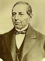
Two Oaxacans, Benito Juarez and Porfirio Díaz were prominent players in the Reform War. It is difficult to overstate Juárez’s meaning to the state. He was born on March 21, 1806 in the village of San Pablo Guelatao and was full blooded Zapotec. He began his career studying to be a priest then a lawyer.[5][9] In 1847, Juarez became governor of Oaxaca, but still faced stern opposition from conservatives such as Lope San Germán. With the success of the Plan de Ayutla, Juarez became governor again, and worked to remove privileges and properties from the Church and landed classes. The Constitution of 1857, was ratified in Oaxaca city, and Juarez left the governor’s position to become President of Mexico.[4] He was president during one of Mexico’s most turbulent times, fighting invading French forces and conservatives. As a liberal, he imposed many of the reforms which remain today including those in education and separation of church and state. He is also considered to be a legend and a symbol for the indigenous population of the state.[5]
Porfirio Díaz was Juárez’s ally through the French Intervention. French imperial forces took Oaxaca city, which was defended by Porfirio Diaz, landing the latter in prison. The capital was later recaptured by the liberals under Carlos Oronoz. However, soon after Juarez took back the presidency, Porfirio Diaz declared rebellion against him from Oaxaca in 1872 under the Plan de Tuxtepec. Juárez died in office.(bjarezgob) Diaz would succeed in obtaining the presidency and did not relinquish it until the Mexican Revolution.[4]
Late 19th century to present
During Diaz’s rule, called the Porfiriato, a number of modernization efforts were undertaken in the state such as public lighting, first with gas then with electricity, railroad lines, new agriculture techniques and the revitalization of commerce. However, most of the benefits of these advances went to national and international corporations and workers and indigenous farmers organized against the regime.[4]
After the Mexican Revolution broke out, Diaz was soon ousted and the rest of the war was among the various factions that had power in different parts of the country. Various leaders such as Francisco I. Madero, Victoriano Huerta and Venustiano Carranza came to the state during this time. However; the most important force in the area was the Liberation Army of the South under Emiliano Zapata. This army would ally and fight against the previous leaders, especially Venustiano Carranza,[4] and hold various portions of the state until 1920.[5] At the end of the Revolution, a new state constitution was written and accepted in 1922.[4]

A series of major disasters occurred in the state from the 1920s to the 1940s. In 1928, a serious of earthquakes destroyed many of the buildings in the capital. A much larger earthquake in 1931, was the largest in the state’s history, devastating a number of cities along the coast. The 1930s brought the Great Depression, which along with the disasters, prompted wide scale migration to Mexico City. In 1944, torrential rains caused massive flooding in the Tuxtepec region, causing hundreds of deaths.[10]
In the 1940s and 1950s, new infrastructure projects were begun. These included the Izúcar-Tehuantepec section of the Panamerican Highway and the construction of the Miguel Alemán Dam.[10] From the 1980s to the present, there has been much development of the tourism industry in the state. This tourism, as well as the population growth of the capital, prompted the construction of the Oaxaca-Mexico City highway in 1994.[11] Development of tourism has been strongest in the Central Valleys area surrounding the capital, with secondary developments in Huatulco and other locations along the coast. This development was threatened by the violence associated with the 2006 uprising, which severely curtailed the number of incoming tourists for several years.[12] On February 12, 2008, a 6.4 magnitude earthquake was recorded in Oaxaca.[13]
From the Mexican Revolution until the 2000s, the ruling PRI party held control of almost all of Oaxacan politics from the local to the state level.[14] Challenges to the rule were sporadic and included the student movements of the 1970s, which did bring down the state government.[15] Teachers’ strikes had been frequent since then, culminating in the 2006 uprising in Oaxaca city, which brought in groups protesting the heavy marginalization of the poor.[12] The PRI lost its 80-year hold on the state government in 2010 with the election of the PAN gubernatorial candidate Gabino Cué Monteagudo. This has led to speculation of major changes for the state.[14]
Geography
 |
 |
|
|
Maps of Oaxaca
|
||
 |
 |
|
|
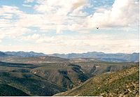
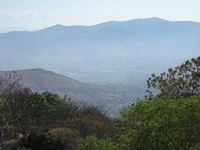
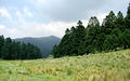
Left:A view of the Sierra Mixteca region. Right:Solaga
|
||
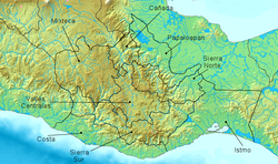
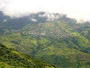
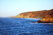
The state is located in the south of Mexico, bordered by the states of Puebla, Veracruz, Chiapas and Guerrero with the Pacific Ocean to the south. It has a territory of 95,364 km2, accounting for less than 5% of Mexico’s territory.[2][16] Here several mountain chains come together,[5] with the elevation varying from sea level to 3,759 masl,[16] averaging at 1,500 masl.[5] Oaxaca has one of the most rugged terrains in Mexico, with mountain ranges that abruptly fall into the sea. Between these mountains are mostly narrow valleys, canyons and ravines. Major elevations in the state include Cempoaltepetl (3,396 masl), El Espinazo del Diablo, Nindú Naxinda Yucunino and Cerro Encantado.[16] Oaxaca’s has 533 km of coastline with nine major bays.[2]
The mountains are mostly formed by the convergence of the Sierra Madre del Sur, the Sierra Madre de Oaxaca and the Sierra Atravesada into what is called the Oaxaca Complex (Complejo Oaxaqueño). The Sierra Madre del Sur runs along the coast with an average width of 150 km and a minimum height of 2,000 meter with peaks over 2,500. In various regions, the chain is locally known by other names, such as the Sierra de Miahuatlán and the Sierra de la Garza. The Sierra Madre de Oaxaca enters the state from the Puebla and Veracruz borders in the Tuxtepec region, running northwest to southeast towards the Central Valleys region, then onto the Tehuantepec area. Local names for parts of this range include Sierra de Tamazulapan, Sierra de Nochixtlan, Sierra de Huautla, Sierra de Juárez, Sierra de Ixtlan and others. Average altitude is 2,500 masl with peaks over 3,000 and width averages at about 75 km. The Sierra Atravesada is a prolongation of the Sierra Madre de Chiapas. This range is not as high as the other two with an average elevation of just over 600 meters. Most of it is located in the Juchitán district running east-west.[16]
The only valleys of any real size are the Central Valleys between Etla and Miahuatlan, which contains the city of Oaxaca. Smaller populated valleys include Nochixtlan, Nejapa, Cuicatlan and Tuxtepec. Small mesas contain population centers such as Putla, Juxtlahuaca, Tamazulapan, Zacatepec, Tlaxiaco and Huajuapan. The largest canyons in the state are those in the Cuicatlan area and include the Cortés, Galicia and María in the municipality of Tlaxiaco. There are a very large number of small canyons as well as ravines and arroyos of all sizes.[16]
The mountainous terrain allows for no navigable rivers; instead, there are a large number of smaller ones, which often change name from area to area. The continental divide passes through the state, meaning that there is drainage towards both the Gulf of Mexico and the Pacific Ocean. Most of the drainage towards the Gulf is represented by the Papaloapan and Coatzacoalcos Rivers and their tributaries such as the Grande and Salado Rivers. Three rivers account for most of the water headed for the Pacific: the Mixteco, Atoyac and Tehuantepec Rivers with their tributaries.[16] Other important rivers and streams include the Tequisistlán, Santo Domingo, Putla, Minas, Puxmetacán-Trinidad, La Arena, Cajonos, Tenango, Tonto, Huamelula, San Antonio, Ayutla, Joquila, Copalita, Calapa, Colotepec, Aguacatenango-Jaltepec, Los Perros, El Corte, Espíritu SAnto, Sarabia, Ostuta, Petapa and Petlapa.[17]
Major communities
Major cities include Huajuapan de León, Juchitán de Zaragoza, Oaxaca (Oaxaca de Juárez), Puerto Escondido, Salina Cruz, San Pedro Pochutla, San Juan Bautista Cuicatlan, San Juan Bautista Tuxtepec, Santa Cruz Xoxocotlán, Santa Lucía del Camino, Santa María Asunción Tlaxiaco, Santiago Pinotepa Nacional and Tehuantepec (Santo Domingo Tehuantepec).
Climate
 |
 |
|
While the state is within the tropical latitudes, its climate varies due to altitude.[16] There are three principle climate regions in the state. The first is the hot and semi humid lands. This accounts for about 30% of the state. The next is the semi hot and semi humid regions which account for about 18%, and temperate and semi humid at about 16%. All of these climate experience a rainy season in the summer and early fall.[17] As most of the state is over 2,000 m above sea level, average temperature is about 18 °C, except near the coast. The coastline along with the regions of Yautepec, Putla, parts of Huahuapan and Silacayoapan are hot and relatively dry. Hot and humid climates predominate in Villa Alta, and the Central Valleys area and all others over 2,000 m above sea level have a temperate climate. A few of the highest peaks, such as those in Tehuantepec and Putla have a cold climate. Precipitation varies from between 430mm to 2,700 mm per year. The Sierra Mazteca, Textepec and other areas near the Veracruz border have rains year round. The rest of the state receives the majority of its rain during the summer and early fall. The higher elevations can experience freezing temperatures in December and January.[16]
Nature and conservation
 |
 |
|
|
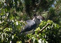
Left:Buzzard. Right:Turtle.
|
||
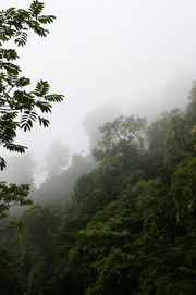
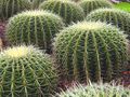
Although it is the fifth-largest state in Mexico, it has the most biodiversity. There are more than 8,400 registered plant species, 738 bird species and 1,431 terrestrial vertebrate species, accounting for 50 percent of all species in Mexico. It is also among the five highest-ranking areas in the world for endangered species.[12][18] The state has important ecological zones such as the Selva Zoque in the northeast.[19] Vegetation varies from those adapted to hot and arid conditions such as cacti to evergreen tropical forest on the coasts.[16] Forests in the higher elevations consist of conifers, broadleafed trees and a mixture of the two. In the lower elevations by the coast there are evergreen and deciduous rainforest, with those dropping leaves doing so in the dry season. In the driest areas mesquite, some cactus and grasslands can be found.[20] There are also 58 species of aquatic plants.[12]
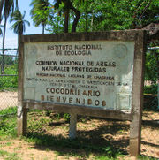
Wildlife includes a wide variety of birds, small to medium sized mammals and some larger ones such as deer and wildcats, reptiles and amphibians. Off the coast there are fish and shellfish, as well as dolphins and whales which pass by on migration.[16] The state is a prolific place for reptiles such as turtles, lizards, snakes and crocodiles. Of the 808 registered reptile species nationwide, 245 are found in the state.[18] The state has the most amphibian species at 133,[12] with one-third of all Mexican species of frogs and salamanders.[18] It is home to 120 species of freshwater fish, 738 species of birds (70% of Mexico’s total) and 190 species of mammals.[12] Some insect forms such as grasshoppers, larvae and cochineal have economic important for the state.[12] The most important ocean creatures commercially are shrimp, tuna, bonito, huachinango and mojarra. Sea turtles used to be exploited for both their meat and eggs but this was stopped by the federal government in the 1990s.[16] The coast of Oaxaca is an important breeding area for sea turtles such as the leatherback(Dermochelys coriacea), which is classified as endangered throughout its global range. Despite conservations efforts starting in the 1970s, the number of nesting sites and nesting turtles has dramatically decreased.[21]
Conservation efforts in the state are hampered by high marginalization, lack of economic alternatives, agricultural conflicts, change of land use (agricultural activities, fires), over exploitation and pollution of natural water sources, inadequate forest management and illegal tree felling, unsustainable coastal tourist developments, climate change, limited local capacity, and limited local knowledge and valuation of natural resources.[18] However, there are seven officially protected natural areas in the state: Benito Juárez National Park at 3,272 ha, Huatulco National Park at 11,845 ha, Lagunas de Chacahua National Park at 14,920 ha, Playa de Escobilla Sanctuary at 30 ha, Playa de la Bahía de Chacahua Sanctuary at 31 ha, Tehuacán-Cuicatlán Biosphere Reserve at 490,678 ha and Yagul Natural Monument at 1,076 ha.[20]
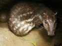
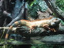
| Flora and fauna of Oaxaca | |||||||
 |
 |
 |
 |
 |
|||
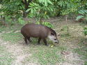
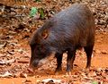
| Cuniculus paca | Iguana | Eretmochelys imbricata | Harpia harpyja | Tapirus bairdii | |||
 |
 |
 |
 |
.jpg) |
|||
| Panthera onca | Pelican | Tayassu pecari | Leopardus pardalis | Boa constrictor | |||
 |
 |
 |
 |
 |
|||
| Ceiba pentandra | Abies religiosa | Echinocactus grusonii | Taxodium mucronatum | Agave potatorium | |||
Lagunas de Chacahua National Park
Lagunas de Chacahua National Park, created in 1937,[22] lies about 54 km west of Puerto Escondido, near a village called Zapotalito. It can be reached via Federal Highway 200 or by boat from Puerto Escondido. The park encompasses 132.73 square kilometres, about 30 km² of which is taken by various lagoons such as the ‘’’Laguna de Chacahua,’’’ ‘’’Laguna de La Pastoria,’’’ and Laguna Las Salinas.[23] There are various smaller lagoons that are connected by narrow channels.[22] The rest of the park consists of dry land.[23]
The park has 10 different types of vegetation: “selva espinosa", swampland, deciduous, sub tropical broadleaf, mangroves, savannah, “bosque de galleria”, “tular”, palm trees, and coastal dunes. 246 species of flowers and 189 species of animals have been documented so far in the park. Birds such as storks, herons, wild ducks, blue-winged teals, pelicans, and spoonbills can be found here. Three species of turtles also visit the park to lay their eggs.[23]
Government and political geography
The state was created by a federal decree in 1824, and is the fifth largest state in Mexico.[6] The state government consists of an executive branch, headed by the governor, a unicameral legislature and a judiciary branch headed by a state supreme court presided over by seven judges.[24]
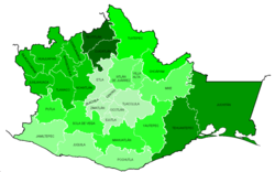
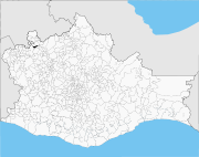
The area of Oaxaca has been divided into small entities since far back into the pre-Hispanic period. Much of the reason for this is the highly mountainous geography, although the occupation of the area by numerous ethnicities is a factor as well. The area resisted large scale Spanish domination through the colonial era, and maintained local traditions and customs better than other areas of Mexico. Even today, the state has far more municipalities and semi autonomous local authorities than any other state in the nation.[6] Oaxaca is divided into 570 municipalities, about one-quarter of the total of the country.[5] Many of the municipalities of the state had been ill-defined from colonial times until the 1990 INEGI survey which delineated them with exact coordinates.[6] The most populated municipality is the capital, followed by San Juan Bautista Tuxtepec and Juchitán de Zaragoza.[25] There is also a system of thirty districts to group municipalities.[6][26]
The state has traditionally been divided into seven regions, which took into account variables such as ethnic makeup, economics and geography. Today, the state is divided into eight regions called Valles Centrales, La Cañada, La Mixteca, Sierra Madre del Sur, Sierra Norte, el Istmo, La Costa and El Golfo. These still take into account the traditional variables, but geography plays a larger role.[26] The Cañada Region is comprised of the fourth and fifth districts with a total of 45 municipalities. The Coast Region consists of the 21st, 22nd and 30th districts with a total of 50 municipalities; the Isthmus Region consists of the 28th and 29th districts with a total of 41 municipalities; the Mixteca Region consists of the 1st, 2nd, 3rd, 8th, 9th, 10th and 16th districts with a total of 155 municipalities; the Papaloapam Region consists of the 6th and 7th districts with a total of 20 municipalities; the Sierra Sur Region consists of the 15th, 23rd, 26th and 27th districts with 70 municipalities; the Sierra North Region consists of the 12th, 13th and 14th districts with 68 municipalities; the Central Valleys Regions consists of the 11th, 17th, 18th, 19th, 20th, 24th and 25th districts with 121 municipalities.[27]
Demographics
The state has a total population of about 3.5 million, with women outnumbering men by 150,000 and about 60% of the population under the age of 30. It is ranked tenth in population in the country. Fifty three percent of the population lives in rural areas.[28] Most of the state’s population growth took place between 1980 and 1990. Life expectancy is 71.7 for men and 77.4 for women, just under the national average. Births far outpace deaths. In 2007, there were 122,579 birth and 19,439 deaths.[29] Approximately 85% profess the Catholic faith.[30]
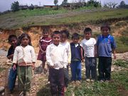
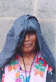
Demographically, Oaxaca stands out due to the high percentage of indigenous peoples.[18][31] It is estimated that at least a third are speakers of indigenous languages (with 5% not able to speak Spanish), accounting for 53% of Mexico’s total indigenous population.[18][30] The state straddles two Mesoamerican cultural areas. The first extends into the state from the Mayan lands of Chiapas, Yucatan and Guatemala. The northeast of the state is part of the cultures of the Valley of Mexico, with historical influence seen from ancient cities such as Teotihuacan, Tula and Tenochtitlan.[6]
The main reason that indigenous languages and cultures have been able to survive here is the rugged terrain, which isolate communities.[5][32] This also has the effect of dividing the state into small secluded communities, which have developed independently over time. There are 16 ethno linguistic groups recognized by the Instituto Nacional Indigenista[33] who maintain their individual languages, customs and traditions well into the colonial period and to some extend to the present day.[5] However, some studies put the number of cultures in the state as high as 4,000.[6] This make Oaxaca the most ethnically complex of Mexico’s 31 states.[5]
Most indigenous in the state are either Zapotec or Mixtec. The Triques, Amuszos and Cuicatecos are related to the Mixtecs and have similar languages, The Chochopopolocas and Ixcatecos are similar to the Mazatecos; the Zoques are related to the Mixes, and the Chatinos are related to the Zapotecs. Unrelated groups include the Chontals, Chinatecos, Huaves and Nahuas.[34] As of 2005, a total of 1,091,502 people were counted as speaking an indigenous language.[33]
The largest indigenous group in the state are the Zapotecs at about 350,000 people or about 31% of the total indigenous population.[5][30][33] The Zapotec have an extremely long history in the Central Valleys region and unlike other indigenous groups, do not have a migration story. For them, they have always been here. Zapotecs have always called themselves Be'ena'a, which means The People. Zapotec territory extends in and around the Central Valleys region of the state, around the capital city of Oaxaca. The Zapotec language has historically been and is still the most widely spoken in the state, with four dialects that correspond to the four subdivisions of these people: Central Valleys and Isthmus, the Sierra de Ixtlan, Villa Alta and Coapan.[31] Zapotec communities can be found in 67 municipalities. The various Zapotec dialects account for 64 of the total 173 still surviving forms of Oto-Manguean.[5]
The second largest group are the Mixtecs at just over 240,000 people or 27% of the indigenous population.[30][33] These people established themselves in the northwest of Oaxaca and far southern Puebla over 3,000 years ago, making them one of the oldest communities in the region. These same people put pressure on the Zapotec kingdoms until the Spanish conquered both peoples in the 16th century.[31] Mixtec territory is divided into three sub regions. The Upper Mixteca covers 38 municipalities and is the most populated region. The Lower Mixteca includes 31 municipalities. The Coastal Mixtecs are a small group. Today, the Mixtecs call themselves Ñuu Savi, the people of the rain. The Mixtecan language family, as one of the largest and most diverse families in the Oto-Manguean group, includes three groups of languages: Mixtec, Cuicatec, and Trique.[5]
The Mazatecos number at about 165,000 or 15% of Oaxaca’s indigenous population.[30] (perfil soc) These people occupy the northernmost area of the state, in the upper Sierra Madre Oriental mountains and the Papaloapan Basin. The Mazatecos call themselves Ha shuta enima, which means People of Custom. Some historians believe that the Mazatecos descend from the Nonoalca-Chichimecas, who migrated south from Tula early in the 12th century. While most live in Oaxaca, a significant number of Mazatecos also occupy Veracruz and Puebla.[5]
The Chinantecos account for about ten percent of Oaxaca’s indigenous people, numbering at about 104,000.[33][35] They inhabit the Chinantla region of north central Oaxaca near the border of Veracruz. The Chinanteco language has as many as 14 different dialects and is part of the Oto-Manguean linguistic group. The Chinantecos presently inhabit an area in which archaeologists have located temples that were apparently used as ceremonial centers, and where prisoners were supposedly sacrificed during the most important celebrations of the year. Historians believe that those living in this region struggled to maintain their independence against sudden and numerous attacks by the Zapotecs, Mixtecs, Mixes and Aztecs. The latter, led by Moctezuma I, finally conquered the Chinantla region during the 15th century.[5][35]
The Mixe people account for another ten percent of the indigenous population at just over 103,000 people.[30][33] The Mixe are an isolated group in the northeastern part of the state, close to the border of Veracruz. Their region includes 19 municipalities and 108 communities. The Mixes call themselves Ayuuk, which means The People. It is unknown where the Mixe migrated from, with some speculating from as far as Peru, but they arrived in waves from 1300 to 1533. They came into conflict with the Mixtecs and Zapotecs, but allied themselves with the Zapotecs against the Aztecs, then resisted the Spanish. The Mixe language has seven dialects and this group has more monolingual speakers than any other indigenous group.[5]
Minorities include the Chatino (42,477),[5] the Trique (18,292),[35] the Huave people (15,324),[35] the Cuicatecos (12,128),[35] the Zoque, also called the Aiyuuk (roughly 10,000), the Amuzgos (4,819),[35] the Chontales of Oaxaca (4,610), the Tacuates (1,725),[35] the Chocho or Chocholtec (524), the Ixcatecos (207),[35] the Popolocas (61)[35] and a small population of Nahuatl speaking peoples in the border area with Puebla.[31]
Economy
According to the Mexican government agency Conapo (National Population Council), Oaxaca is the third most economically marginalized state in Mexico.[12][36] The state has 3.3% of the population but produces only 1.5% of the GNP.[37] The main reason for this is the lack of infrastructure and education, especially in the interior of the state outside of the capital. Eighty percent of the state’s municipalities do not meet federal minimums for housing and education. Most development projects are planned for the capital and the surrounding area. Little has been planned for the very rural areas and the state lacks the resources to implement them.[36] The largest sector of Oaxaca’s economy is agriculture, mostly done communally in ejidos or similar arrangements. About 31% of the population is employed in agriculture, about 50% in commerce and services and 22% in industry.[17] The commerce sector dominates the gross domestic product at 65.4%, followed by industry/mining at 18.9% and agriculture at 15.7%.[38]
Migration
In 45.5% of Oaxaca’s municipalities, the population has declined due to migration. Poverty and migration are caused mostly by the lack of economic development in the state, which leaves most of the population working in the least productive sector. This has led to wide scale migration, mostly from the rural areas, to find employment. Within Oaxaca, many people leave rural villages to work in the city of Oaxaca, the Papaloapan area and the coast. Within Mexico, many leave for Mexico City, Mexico State, Sinaloa, Baja California and Baja California Sur. Most of those leaving the state are agricultural workers. As of 2005, over 80,000 people from Oaxaca state live in some other part of Mexico.[36][39] Most of those leaving Oaxaca and Mexico go to the United States. Much of the current wave of emigration began in the late 1970s, and by the 1980s Oaxaca ranked 8th in the number of people leaving for the US from Mexico. Today, that percentage has fallen to 20th. Most of those migrate to the United States, concentrated in California and Illinois.[36]
Agriculture
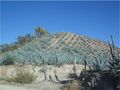
The economy of Oaxaca based on agriculture, especially in the interior of the state.[37] Only 9% of the territory is suitable for agriculture due to the mountainous terrain, so there are limits to this sector.[5][36] The production of basics, such as corn and beans, is mostly for auto consumption, but this production cannot meet demand.[36] The total agricultural production of the state was estimated at 13.4 million tons with a value of 10,528 million pesos in 2007. As of 2000, 1,207,738 hectares are used for the raising of crops, most of which occurs during the annual rainy season, with only 487,963 having crops growing year round. Only 81,197 hectares have irrigation.[38] The variation of climate allows for a wider range of agricultural crops than would otherwise.[16] Oaxaca is the nation’s second highest producer of grains and agave. It is third in the production of peanuts, mango and sugar cane. It is the second largest producer of goat meat, providing about 10% of the national total.[17] In the more temperate areas crops such as corn, beans, sorghum, peanuts, alfalfa and wheat are grown. In more tropical areas, crops also include coffee, sesame seed, rice, sugar cane and pineapple.[38]
Livestock is raised on 3,050,106 hectares or 32% of the state’s land. Cattle dominate in the Tuxtepec, Isthmus and Coast regions, with pigs dominating in higher elevations such as the Central Valleys Region. Other animals include sheep, goats, domestic fowl and bees. The Value of this production was estimated at 2,726.4 million pesos with cattle comprising over half of this.[38] Coffee is grown in mountain areas near the Pacific Ocean in municipalities such as Santa María Huatulco, Pluma Hidalgo, Candelaria Loxicha, San Miguel del Puerto and San Mateo Piñas. The growing of coffee here dates back to the 17th and 18th centuries when English pirates introduced the plant. Coastal fishing is also a major source of income and in 2007, the total fishing catch was estimated at 9,300 tons with a value of over 174 million pesos.[38]
Mining and industry
Mining has traditionally been important to the economy and history. Hernán Cortés sought and received the title of the Marquis of the Valley of Oaxaca in order to claim mineral and other rights.[5] Currently coal, salt, chalk, petroleum, marble, lime, graphite, titanium, silver, gold and lead are still extracted.[16][38] Most mines today are located in Etla, Ixtlán, San Pedro Taviche, Pápalo and Salinas Cruz. There is an oil and natural gas refinery in Salinas Cruz, which provides products to the state and other areas on Mexico’s Pacific coast.[38]
Commerce
 |
 |
|
|
Left:Shambala Hotel at Zipolite Beach. Right:Hosteria de Alcala, Oaxaca city.
|
||
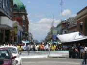
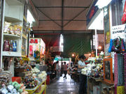
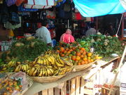
Tourism is important to the state as it is the only sector that is growing and brings substantial income from outside the state, although most tourism is concentrated in the capital and along the coast.[12][37] In 2007, there were 1,927 small grocery stores, 70 tianguis and 167 municipal markets. Tourism accounts for about 30% of the commerce sector of Oaxaca’s economy.[38] The state attracts visitors from both Mexico and abroad.[12] The state government has been pushing this sector heavily as a means of growing the economy,[12] with major infrastructure projects such as the Oaxaca-Puerto Escondido-Huatulco highway (scheduled to finish in 2012) and the Iberdrola hydroelectric dam.[37]
In 2000, there were 612 hotels with 15,368 rooms. Thirteen of these were classed as five stars. The state received 1,564,936 visitors that year, over 80% of whom were from Mexico. The Central Valleys region receives the most visitors (60%), followed by the La Mixteca and Papaloapan regions (29%) and the coast (11%), in spite of the fact that only 7% of the states attractions are located in the Oaxaca city area.[38] One reason for this is that the city of Oaxaca is only four and a half hours away from Mexico City via the federal highway.[2]
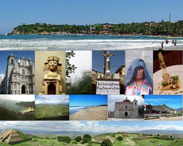
Landmarks and tourist attractions
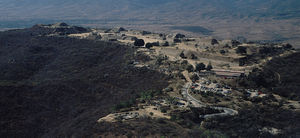
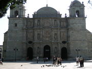
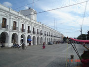
Most tourist attractions are located in the city of Oaxaca and the Central Valleys region that surrounds it. This area is the cultural, geographical and political center of the state, filled with pre-Hispanic ruins, Baroque churches and monasteries, indigenous markets and villages devoted to various crafts. The capital city, along with nearby Monte Albán together are listed as a World Heritage Site.[12][32] Many of the attractions in the city proper are located between the main square or Zocalo and along Andador Macedonio Alcalà Street, known as the Andador Turístico or Tourist Walkway. These include the Cathedral, the Basilica of Nuestra Señora de la Soledad, Museum of Contemporary Art (MACO), Rufino Tamayo Museum and the Mercado 20 de Noviembre Market, known for its food stands.[12] The most important annual festival is the Guelaguetza, also called the Fiesta del Lunes del Cerro (Festival of Mondays at the Mountain) which occurs each July.[40][41] The largest and most important archeological site is Monte Albán, which was capital of the Zapotec empire.[2] Also important as an archaeological site is the ancient Zapotec center of Mitla at the eastern end of the Central Valleys which is noted for its unique ancient stone fretwork and abstract mosaics.[2][12] Between Mitla and Monte Albán there are a number of other important archeological sites such as Yagul, Dainzú and Lambiteyco.The most important of these three is Lambiteyco, in the middle of the Tlacolula Valley. It was occupied from 600 B.C.E. to 800 C.E. and coincides with Monte Alban. It was important at that time for its production of salt.[12] Yagul is a ceremonial center on the side of a mountain. Features include a Mesoamerican ball court, the La Rana courtyard,a temple, palace and other buildings.[40]
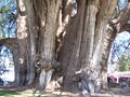
Other attractions in the area include colonial constructions such as the monasteries in Cuilapan, Tlaxiaco, Coixthlahuaca, Yanhuitlán and Santo Domingo. Churches include the Cathedral in Oaxaca and the main church of Teposcolula.[40] Hierve el Agua is an area with “petrified” waterfalls, where water with extremely high mineral content falls over the side of cliffs, forming stone waterfall-like structures. The name means “boil the water” but the water is not hot; rather it pushes up from the ground in places which looks like water boiling.[40] Santa María del Tule is home to an enormous Montezuma cypress (Taxodium mucronatum) tree which is over 2,000 years old. The town of Zaachila is known for its archeological site and weekly market.[12]
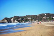
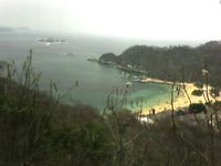
The second most important zone for tourism is the coast especially from Puerto Escondido to Huatulco, with sandy beaches on the Pacific Ocean, dolphins, sea turtles, sea turtles and lagoons with water birds. Many beaches are nearly virgin with few visitors but several areas have been developed such as Puerto Escondido, Huatulco, Puerto Ángel, Zipolite, San Agustinillo and Mazunte.[12][32] Puerto Escondido is an important destination for tourism from within Mexico with beaches such as Playa Carrizillo and also attracts international surfers to Zicatela Beach, where an annual surfing competition is held.[12] There are also areas of Oaxaca that are promoted for ecotourism such as Lagunas de Chacahua National Park set in 14,267 hectares of lagoons, rivers, beaches, mangroves, rainforest and grasslands with some 136 species of birds, 23 of reptiles, 4 amphibians and twenty types of mammals.[12]
Culture
The arts

From the latter half of the 20th century, the state has produced a number of notable painters such as Rufino Tamayo, Rodolfo Morales, and Francisco Toledo. These three painters have been influential in the establishment of new movements of art from the state. These movements have spurred exhibitions, galleries and museums such as the Museo de Arte Contemporaneo (MACO). Many of today’s artists from Oaxaca have been inspired by past indigenous paintings as well as the colonial era works of Miguel Cabrera.[42]
The state has not produced as many writers as painters but some important names include Adalberto Carriedo, Jacobo Dalevuelta, Andrés Henestrosa and Natalia Toledo.[43]
Music and dance are almost inextricably linked to the state’s folkloric heritage. Even more modern composers such as Macedonio Alcalá, Samuel, Mondragón Noriega and José López Alavés are strongly influenced by traditional melodies. Traditional music and dance has its roots in the indigenous traditions that existed long before the Spanish arrived. To these traditions were added elements from European culture and Catholicism. The three main traditions to be found in the state are those of the Zapotecs and the Mixtecs, with a small but distinct community of Afro-Mexicans. Some of the best known dances include Los Diablos, La Tortuga, Las Mascaritas and Los Tejorones. In the Afro-Mexican Costa Chica region, a dance called Las Chilenas stands out. La Sandunga is a song that typifies the musical style of the Tehuantepec region and a musical style called “son bioxho” is an endemic form of the son style played with drums, an empty tortoise shell and a reed flute.[44]
Handcrafts
Because of its indigenous tradition and abundance of raw materials, Oaxaca is a leading producer of handcrafts in Mexico. Handcrafted items here are noted for their variety and quality. Oaxacan handcrafts are traditionally made with wood, wool, clay and leather and are sold in many venues from local tianguis markets to upscale international stores. The best-known wood craft is the making of “alebrije” figures, which are usually miniature, brightly colored real or imaginary animals. These were originally created from paper and cardboard in Mexico City, but this craft was adapted to native Oaxacan woodcarving to the form it has today. Carver Manuel Jiménez of Arrazola is credited with the creating of the Oaxacan version of this craft. Other wood crafts include the making of masks, toys and utensils. Major woodcarving areas include San MartínTilcajete and Arrazola.[40][45]

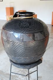
Pottery has a long tradition that extends far back into the pre-Hispanic period. Oaxaca shares many pottery types with other parts of Mexico along with two of its own tradition: barro negro and the green glazed pottery of Atzompa. The first is centered in the town of San Bartolo Coyotepec near the capital city. This pottery gets its color from the local clay used to make it and its shine from a technique developed by Doña Rosa Nieto in the mid 20th century. The Atompa green-glazed ware is made much the same way it was in colonial times, although there have been some recent innovations with color and decorative techniques. This pottery is found in Santa María Atzompa, also near Oaxaca city.[40]
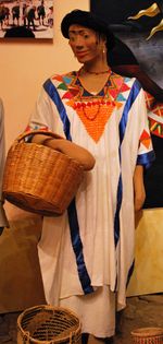
Another major craft category is textiles. Textiles from cotton and other fibers date back to early in the pre-Hispanic period on backstrap looms. This form of weaving has been dominated by women since that time. The Spanish introduced the wide European frame loom, which is mostly used by men. Traditional clothing items such as huipils are still made on backstrap looms, while the European looms are used to produce larger and heavier items such as rugs, ponchos and blankets. Most items are produced with cotton or wool fibers, although some maguey fibers can be found and palm fronds are used to produce mats and hats. Embroidery is an important part of indigenous clothing, especially for women. One municipality noted for its indigenous and embroidered clothing is Santo Tomás Jalietza, just south of the city of Oaxaca. The Xochimilco neighborhood of the capital is known for its embroidered tablecloths, napkins and other tableware.[46]
Both precious and non-precious metals are worked in the state. Many gold and silver jewelry items are made with filigree (fine metal thread) which is weaved and wrapped into shapes. This technique is Arab in origin and was introduced by the Spanish. The municipalities of Santo Domingo Tehuantepec, Juchitán de Zaragoza and Huajuapan de León are known for this work. Other metals, especially iron, are forged into utilitarian and decorative items in places such as Santiago Jamiltepec and Tlacolula de Matamoros. Items produced include mirrors, frames, figures, knives, machetes and more.[40][47]
Food and drink
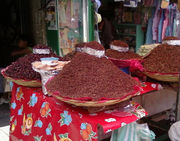
Oaxaca’s cuisine varies widely due to the relative geographic isolation of its peoples, and the climates in which foods are produced.[48] Oaxaca’s gastronomy is known for its “seven moles,” chapulines, Oaxaca tamales in banana leaves, chapulines, tasajo and mescal.[40] Regional variations include the wide variety of vegetables in the Central Valleys region, fish and shellfish in the Coast and Isthmus regions and the year-round availability of tropical fruit in the Papaloapan area on the Veracruz border. Like most of the rest of Mexico, corn is the staple food, with corn tortillas, called “blandas” accompanying most meals. Black beans are preferred.[48] Oaxaca produces seven varieties of mole called manchamanteles, chichilo, Amarillo, rojo, verde, coloradito and negro.[49] These moles and other dishes are flavored with a variety of chili peppers such as pasilla Oaxaqueña, amarillos, chilhuacles, chilcostles and costeños. Epazote, pitonia and hoja santa are favored herbs in Oaxacan cooking. The last is indispensable for the preparation of verde version of mole.[48]

Chocolate, which is grown in the state, plays an important part in the making of certain moles, but is best known for its role as a beverage. The beans are ground then combined with sugar, almonds, cinnamon and other ingredients to form bars. Pieces of these bars are mixed with hot milk or water and drunk.[48][49] Oaxaca cheese is a soft white string cheese which is appears similar to mozzarella. It is sold in “ropes” which are wound onto themselves into balls. It is eaten cold or lightly melted on quesadillas and other dishes. One unique aspect to Oaxacan cuisine is the consumption of “chapulines,” which are a type of grasshopper which has been fried and seasoned with salt, lime and chili pepper.[49]
There is a saying in Oaxaca, “Para todo mal, mezcal, para todo bien, también” (For everything wrong, mezcal; for everything right, too.) Alcoholic and non alcoholic drinks (as well as food items) based on the maguey plant have been consumed in many parts of Mexico since early in the pre-Hispanic period. The tradition of the making of the distilled liquor called mezcal has been a strong tradition in the Oaxacan highlands since the colonial period. One reason for this is the quality and varieties of maguey grown here. Some varieties, such as espadín and arroquense are cultivated but one variety called tobalá is still made with wild maguey plants. It is made with the heart of the plant which is roasted in pits (giving the final product a smokey flavor) and is sometimes flavored with a chicken or turkey breast added to the mash. It is mezcal, not tequila, which may contain a “worm,” which is really a larvae which can be found in maguey plants. The final distilled product can be served as is or can be flavored (called cremas) with almonds, coffee, cocoa fruits and other flavors.[50]
The town of Santiago Matatlán calls itself the world capital of mezcal. The best known producer here is Rancho Zapata, which also has a restaurant. It is owned by a man that goes only by the name of Tío (uncle) Pablo, who won first prize for his mescal in Chicago in 2003. In many parts of the Central Valleys area, one can find small stands and stores selling locally made mezcal on roadsides.[12]
Education

While the educational system of the state provides services to 1.1 million students in 12,244 schools, with 54,274 teachers,[51] the Mexican government agency Conapo ranks Oaxaca as the third most marginalized state in Mexico, based on factors such as education and housing. 80% of the municipalities of the state do not meet minimum requirements for these services. The Sierra Sur and La Mixteca regions has the most number of municipalities in this category.[36] The average child in Oaxaca attends school for 6.39 years, below the national average of 8 years.[36] Most of those aged 15 years or older have finished primary school, but completion of secondary school is well below the national average.[52] Just over 21% of the population is illiterate, above the national average of 12.4%. 45% of those over 15 years of age have not finished primary school. Only a small minority of the population has professional aspirations with 6.7% attaining studies at the bacchelaurate level or above.[36]
Universities include Instituto Tecnológico de Oaxaca (ITO), Universidad Autónoma Benito Juárez de Oaxaca (UABJO) and Universidad de la Sierra Juárez (USJ).
Health
Ninety five percent of Oaxaca’s population receives health care from one or more government programs.[51] Government health services used include IMSS; Seguridad Social, ISSSTE and that related to PEMEX.(infraes) The state sponsors the Servicios de Salud de Oaxaca (SSO) which primarily Works to provide antibiotics and other medicines to public dispensaries. It is meant to supplement other federal and state services such as IMSS.[53] There are 1,020 primary care medical facilities and 28 hospitals in the state, 3,240,024 people are registered in one or more government programs and are attended by 3,337doctors, 5,400 paramedics and 6,887 other health providers.[51]
One particular health problem the state has is outbreaks of dengue fever during the rainy season, which occurs from June to October. Some of these cases are hemorrhagic. The problem is more severe in the tropical lowlands of the state, near the ocean.[54]
Despite the health services that exist, there are serious problems and deficiencies. As of 1997, life expectancy in the state was 71.5 years, 9 years higher than in 1990. The death rate has decreased from 5.79 deaths per thousand to 5.14.[51] While much of Mexico’s health care system struggles to meet needs, the system in Oaxaca, one of the country’s poorest states, has it particularly bad. The relatively prosperous state of Nuevo León has 3,207 hospital beds, while Oaxaca has only 1,760, despite the fact that the two states have about the same population. There is about the same ratio of doctors between the two states.[55] Forty four percent of pregnant women receive pre-natal care from people who are not medically qualified. 70 women each year die from complications from pregnancy and childbirth, and most of these are avoidable, due to bleeding and eclampsia. For every 100,000 live births in Oaxaca, there are 95.1 maternal deaths, over the national average of 63.3, putting the state in the top five.[56]
The state lacks sufficient numbers of health care workers and lacks specialized hospital and other facilities. Other problems include obsolete medical equipment, lack of medicines. Many of these problems have persisted for decades.[57] Health care providers offer an average of 20,000 consults each day, covering a population of 800,000 people.[58].[59] In 2000, there was only one doctor for every 180 people.[57] Health care providers offer an average of 20,000 consults each day, covering a population of 800,000 people.[58]
In 2006, health care workers held a work stoppage and march, demanding improvements in the health care system along with the ouster of Governor Ulises Ruiz Ortiz. Most of the participating strikers were from the hospital and emergency room sectors, from 15 hospitals and 650 health centers in the state.[58]
Sport


Soccer, baseball and basketball are popular in Oaxaca. Football is most popular in Oaxaca city and in Huajuapan de Leon, having a notable international player by the name of Ricardo Osorio. The baseball team, Guerreros de Oaxaca, play at the Eduardo Vasconcelos Stadium in Oaxaca de Juarez and play in the Mexican League.[60] Vinicio Castilla is the most notable player hailing from Oaxaca, having played third base in Major League Baseball for the Atlanta Braves, Colorado Rockies, Tampa Bay Devil Rays, Houston Astros and San Diego Padres. He became the owner of the Oaxaca Guerreros in 1995 and three years later they won the championship. Basketball is practiced in all of Oaxaca, mostly played during local festivals, especially in the Sierra Norte. The area also has a tournament with the Copa Juárez as the prize.
Because of its geography and landscape, mountain biking is also common in Oaxaca and is practiced primarily in the Sierra Norte in Ixtlan de Juarez, San Antonio Cuajimoloyas, Santa Catarian Ixtepeji, Benito Juarez Lachatao and San Isidro Llano Grande. Surfing is common in places such as Huatulco Bay and Puerto Escondido, with the annual Zicatela beach tournament held in November. Snorkeling and scuba diving take place in Puerto Escondido, prinicipally in Playa Carrizalillo and Playa Manzanillo, Playa Marinero and Puerto Angelito and at Huatulco. Sport fishing is common in Puerto Escondido and in Huatulco with tournaments held in November and May respectively. Anglers, catch sailfish, dorado, marlin and others. In Huajuapan de Leon there is a fishing tournament at the Yosocuta Dam in July. Kayaking also takes places along the Copalita River in Huatulco.
Transport
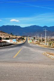
The state has a total of 18,933.4 km of roadways. Most of these roadways are in the Papaloapam, Mixteca, Isthmus and Coast Regions.[51] The major highways serving the city of Oaxaca are Federal Highways 175 and 131, southwards to the Oaxacan coastal resorts; National Highways 190 and 125, southwest to Pinotepa Nacional; National Highways 190 and 130, to Mexico City; the autopista 150D/131D, offering a more rapid route to Mexico City; and National Highway 175 north to Veracruz city.
Oaxaca-Xoxocotlan airport (IATA code OAX) is approximately 7 km south of Oaxaca city centre. Most flights are to Mexico City for onward connection, but there are also flights to Huatulco, Cancún, Tuxtla Gutierrez and Tijuana. Continental Airlines flights between Oaxaca and Houston have also been initiated. According to figures published by Grupo Aeroportuario del Sureste (ASUR), the airport received 523,104 passengers in 2009.
Oaxaca city has separate first class and second class bus stations, offering services to most places within the state of Oaxaca, including the coastal resorts of Huatulco, Puerto Escondido, Puerto Ángel and Pinotepa Nacional, and also long-distance services to Puebla and Mexico City and other Mexican locations such as Veracruz.
Notes
- ↑ La diputación provincial y el federalismo mexicano Google Libros
- ↑ 2.0 2.1 2.2 2.3 2.4 2.5 Consular, Gaceta (October 1996). "Oaxaca". MexConnect. http://www.mexconnect.com/articles/2815-oaxaca. Retrieved August 15, 2010.
- ↑ "Nomenclatura [Nomenclature]" (in Spanish). ) Enciclopedia de los Municipios de México Estado de Oaxaca. Mexico: Instituto Nacional para el Federalismo y el Desarrollo Municipal. 2009. http://www.e-local.gob.mx/work/templates/enciclo/oaxaca/. Retrieved August 15, 2010.
- ↑ 4.00 4.01 4.02 4.03 4.04 4.05 4.06 4.07 4.08 4.09 4.10 4.11 4.12 4.13 4.14 4.15 4.16 "Historia [History]" (in Spanish). ) Enciclopedia de los Municipios de México Estado de Oaxaca. Mexico: Instituto Nacional para el Federalismo y el Desarrollo Municipal. 2009. http://www.e-local.gob.mx/work/templates/enciclo/oaxaca/. Retrieved August 15, 2010.
- ↑ 5.00 5.01 5.02 5.03 5.04 5.05 5.06 5.07 5.08 5.09 5.10 5.11 5.12 5.13 5.14 5.15 5.16 5.17 5.18 5.19 5.20 5.21 5.22 5.23 5.24 5.25 5.26 5.27 5.28 5.29 5.30 5.31 5.32 Schmal, John P. (2006). "Oaxaca: A Land of Diversity". Houston, TX: Houston Institute for Culture. http://www.houstonculture.org/mexico/oaxaca.html. Retrieved August 15, 2010.
- ↑ 6.00 6.01 6.02 6.03 6.04 6.05 6.06 6.07 6.08 6.09 6.10 6.11 6.12 6.13 6.14 6.15 6.16 6.17 6.18 Ardóñez, Maria de Jesús (January 10, 2000). "El territorio del estado de Oaxaca: una revisión histórica [The territory of the state of Oaxaca: A historical review]" (in Spanish) (pdf). Investigaciones Geográficas, Boietin del Instituto de Geografia (Mexico: UNAM) 42: 67–86. http://www.igeograf.unam.mx/instituto/publicaciones/boletin/bol42/b42art5.pdf. Retrieved August 15, 2010.
- ↑ 7.0 7.1 7.2 Akaike Garrido, Yuki (2010). Jiménez González, Victor Manuel. ed. Oaxaca: Guia para descubrir los encantos del estado [Oaxaca: Guide to discover the charms of the state]. Mexico City: Editorial Océano de Mexico, SA de CV. pp. 30–31. ISBN 978-607-400-233-1.
- ↑ Akaike Garrido, Yuki (2010). Jiménez González, Victor Manuel. ed. Oaxaca: Guia para descubrir los encantos del estado [Oaxaca: Guide to discover the charms of the state]. Mexico City: Editorial Océano de Mexico, SA de CV. p. 31. ISBN 978-607-400-233-1.
- ↑ "Benito Juárez" (in Spanish). Oaxaca: Government of Oaxaca. http://www.oaxaca.gob.mx/index.php?option=com_content&view=article&id=263&Itemid=108. Retrieved August 15, 2010.
- ↑ 10.0 10.1 Akaike Garrido, Yuki (2010). Jiménez González, Victor Manuel. ed. Oaxaca: Guia para descubrir los encantos del estado [Oaxaca: Guide to discover the charms of the state]. Mexico City: Editorial Océano de Mexico, SA de CV. p. 32. ISBN 978-607-400-233-1.
- ↑ Akaike Garrido, Yuki (2010). Jiménez González, Victor Manuel. ed. Oaxaca: Guia para descubrir los encantos del estado [Oaxaca: Guide to discover the charms of the state]. Mexico City: Editorial Océano de Mexico, SA de CV. p. 33. ISBN 978-607-400-233-1.
- ↑ 12.00 12.01 12.02 12.03 12.04 12.05 12.06 12.07 12.08 12.09 12.10 12.11 12.12 12.13 12.14 12.15 12.16 12.17 12.18 12.19 Ana Luz Ramos Soto; Roberto Gerardo Gómez Brena (August 2008). "Turismos y Economía en el Estado de Oaxaca [Tourism and Economy in the State of Oaxaca]" (in Spanish). Tur y Des 1 (3). http://www.eumed.net/rev/turydes/03/rsgb.htm. Retrieved August 15, 2010.
- ↑ "Earthquake shakes southern Mexico". BBC News Online. February 12, 2008. http://news.bbc.co.uk/1/hi/world/americas/7241234.stm. Retrieved August 23, 2009.
- ↑ 14.0 14.1 "PRI loses Oaxaca, takes PAN states". Mexico City: The News. July 5, 2010. http://thenews.com.mx/articulo/pri-loses-oaxacatakes-pan-states-1075. Retrieved August 15, 2010.
- ↑ Akaike Garrido, Yuki (2010). Jiménez González, Victor Manuel. ed. Oaxaca: Guia para descubrir los encantos del estado [Oaxaca: Guide to discover the charms of the state]. Mexico City: Editorial Océano de Mexico, SA de CV. pp. 32–33. ISBN 978-607-400-233-1.
- ↑ 16.00 16.01 16.02 16.03 16.04 16.05 16.06 16.07 16.08 16.09 16.10 16.11 16.12 "Medio Físico [Geography]" (in Spanish). ) Enciclopedia de los Municipios de México Estado de Oaxaca. Mexico: Instituto Nacional para el Federalismo y el Desarrollo Municipal. 2009. http://www.e-local.gob.mx/work/templates/enciclo/oaxaca/. Retrieved August 15, 2010.
- ↑ 17.0 17.1 17.2 17.3 "Territorio [Territory]" (in Spanish). Oaxaca: Government of Oaxaca. http://www.oaxaca.gob.mx/index.php?option=com_content&view=section&id=17&Itemid=73. Retrieved August 15, 2010.
- ↑ 18.0 18.1 18.2 18.3 18.4 18.5 "The State of Oaxaca". World Wildlife Fund. http://www.worldwildlife.org/what/wherewework/mexico/thestateofoaxaca.html. Retrieved August 15, 2010.
- ↑ "Selva Zoque". EEF Mexico. http://www.wwf.org.mx/wwfmex/prog_bosques_fs_sz.php. Retrieved 2010-06-28.
- ↑ 20.0 20.1 Lucía Madrid La actividad forestall en el Estado de Oaxaca. Consejo Civil Mexicano para la Silvicultura Sostenible. (Report). Retrieved August 15, 2010.
- ↑ Laura Sarti M.; Scott A. Eckert, Ninel Garcia T. and Ana Rebeca Barragan (1996). "Decline of the World's Largest Nesting Assemblage of Leatherback Turtles". Marine Turtle Newsletter 74: 2–5. http://www.seaturtle.org/mtn/archives/mtn74/mtn74p2.shtml. Retrieved August 15, 2010.
- ↑ 22.0 22.1 "Lagunas de Chacahua". http://www.vivanatura.org/Chacahua.html. Retrieved 2008-02-21.
- ↑ 23.0 23.1 23.2 Quintanar Hinojosa, Beatriz (August 2007). "Laguna de Chacahua". Guía México Desconocido: Oaxaca 137: 68. http://www.mexicodesconocido.com.mx.
- ↑ "Gobierno [Government]" (in Spanish). ) Enciclopedia de los Municipios de México Estado de Oaxaca. Mexico: Instituto Nacional para el Federalismo y el Desarrollo Municipal. 2009. http://www.e-local.gob.mx/work/templates/enciclo/oaxaca/. Retrieved August 15, 2010.
- ↑ "Distribución [Distribution]" (in Spanish). Mexico: INEGI. http://cuentame.inegi.org.mx/monografias/informacion/oax/poblacion/distribucion.aspx?tema=me&e=20. Retrieved August 15, 2010.
- ↑ 26.0 26.1 "Las Ocho Regiones Geográficas" (in Spanish). Oaxaca: Government of Oaxaca. http://www.oaxaca.gob.mx/index.php?option=com_content&view=article&id=229&Itemid=94. Retrieved August 15, 2010.
- ↑ "Regionalización [Regions]" (in Spanish). ) Enciclopedia de los Municipios de México Estado de Oaxaca. Mexico: Instituto Nacional para el Federalismo y el Desarrollo Municipal. 2009. http://www.e-local.gob.mx/work/templates/enciclo/oaxaca/. Retrieved August 15, 2010.
- ↑ "Número de habitantes [Number of inhabitants]" (in Spanish). Mexico: INEGI. http://cuentame.inegi.org.mx/monografias/informacion/oax/poblacion/default.aspx?tema=me&e=20. Retrieved August 15, 2010.
- ↑ "Dinámica [Dynamics]" (in Spanish). Mexico: INEGI. http://cuentame.inegi.org.mx/monografias/informacion/oax/poblacion/educacion.aspx?tema=me&e=20. Retrieved August 15, 2010.
- ↑ 30.0 30.1 30.2 30.3 30.4 30.5 "Diversidad [diversity]" (in Spanish). Mexico: INEGI. http://cuentame.inegi.org.mx/monografias/informacion/oax/poblacion/diversidad.aspx?tema=me&e=20. Retrieved August 15, 2010.
- ↑ 31.0 31.1 31.2 31.3 Akaike Garrido, Yuki (2010). Jiménez González, Victor Manuel. ed. Oaxaca: Guia para descubrir los encantos del estado [Oaxaca: Guide to discover the charms of the state]. Mexico City: Editorial Océano de Mexico, SA de CV. p. 22. ISBN 978-607-400-233-1.
- ↑ 32.0 32.1 32.2 "Oaxaca". Lonely Planet. http://www.lonelyplanet.com/mexico/oaxaca-state. Retrieved August 15, 2010.
- ↑ 33.0 33.1 33.2 33.3 33.4 33.5 "Perfil Sociodemografico [Socio-demographic profile]" (in Spanish). ) Enciclopedia de los Municipios de México Estado de Oaxaca. Mexico: Instituto Nacional para el Federalismo y el Desarrollo Municipal. 2009. http://www.e-local.gob.mx/work/templates/enciclo/oaxaca/. Retrieved August 15, 2010.
- ↑ "Mosaico Étnico" (in Spanish). Oaxaca: Government of Oaxaca. http://www.oaxaca.gob.mx/index.php?option=com_content&view=article&id=239&Itemid=105. Retrieved August 15, 2010.
- ↑ 35.0 35.1 35.2 35.3 35.4 35.5 35.6 35.7 35.8 Schmal, John P. (January 28, 2007). "Oaxaca: Land of Diversity". http://www.latinola.com/story.php?story=3908. Retrieved January 1, 2008.
- ↑ 36.0 36.1 36.2 36.3 36.4 36.5 36.6 36.7 36.8 Alvarado Juárez, Ana Margarita. "Migración y pobreza en Oaxaca [Migration and poverty in Oaxaca]" (in Spanish). El Cotidiario, Revista de la Realidad Mexicana Actual. http://www.elcotidianoenlinea.com.mx/pdf/14808.pdf. Retrieved August 15, 2010.
- ↑ 37.0 37.1 37.2 37.3 "Fundamento: Estado de Oaxaca, México [Fundamentals:State of Oaxaca, Mexico]" (in Spanish). Standard & Poor’s. http://www2.standardandpoors.com/portal/site/sp/es/la/page.article/2,1,7,0,1069424853819.html. Retrieved August 15, 2010.
- ↑ 38.0 38.1 38.2 38.3 38.4 38.5 38.6 38.7 38.8 "Actividad Econónica [Economic activity]" (in Spanish). ) Enciclopedia de los Municipios de México Estado de Oaxaca. Mexico: Instituto Nacional para el Federalismo y el Desarrollo Municipal. 2009. http://www.e-local.gob.mx/work/templates/enciclo/oaxaca/. Retrieved August 15, 2010.
- ↑ "Movimientos migratorios [Migratory movements]" (in Spanish). Mexico: INEGI. http://cuentame.inegi.org.mx/monografias/informacion/oax/poblacion/m_migratorios.aspx?tema=me&e=20. Retrieved August 15, 2010.
- ↑ 40.0 40.1 40.2 40.3 40.4 40.5 40.6 40.7 "Atractivos Culturales y Turísticos [Cultural and Tourist Attractions]" (in Spanish). ) Enciclopedia de los Municipios de México Estado de Oaxaca. Mexico: Instituto Nacional para el Federalismo y el Desarrollo Municipal. 2009. http://www.e-local.gob.mx/work/templates/enciclo/oaxaca/. Retrieved August 15, 2010.
- ↑ "Guelaguetza" (in Spanish). Oaxaca: Secretaria de Turismo. http://www.aoaxaca.com/index.php?te=TE0002&ds=TE0028&st=TE0045&at=AT0119&pagina=1. Retrieved August 15, 2010.
- ↑ Akaike Garrido, Yuki (2010). Jiménez González, Victor Manuel. ed. Oaxaca: Guia para descubrir los encantos del estado [Oaxaca: Guide to discover the charms of the state]. Mexico City: Editorial Océano de Mexico, SA de CV. pp. 12–15. ISBN 978-607-400-233-1.
- ↑ Akaike Garrido, Yuki (2010). Jiménez González, Victor Manuel. ed. Oaxaca: Guia para descubrir los encantos del estado [Oaxaca: Guide to discover the charms of the state]. Mexico City: Editorial Océano de Mexico, SA de CV. pp. 15–19. ISBN 978-607-400-233-1.
- ↑ Akaike Garrido, Yuki (2010). Jiménez González, Victor Manuel. ed. Oaxaca: Guia para descubrir los encantos del estado [Oaxaca: Guide to discover the charms of the state]. Mexico City: Editorial Océano de Mexico, SA de CV. pp. 20–22. ISBN 978-607-400-233-1.
- ↑ Akaike Garrido, Yuki (2010). Jiménez González, Victor Manuel. ed. Oaxaca: Guia para descubrir los encantos del estado [Oaxaca: Guide to discover the charms of the state]. Mexico City: Editorial Océano de Mexico, SA de CV. pp. 40–44. ISBN 978-607-400-233-1.
- ↑ Akaike Garrido, Yuki (2010). Jiménez González, Victor Manuel. ed. Oaxaca: Guia para descubrir los encantos del estado [Oaxaca: Guide to discover the charms of the state]. Mexico City: Editorial Océano de Mexico, SA de CV. p. 43. ISBN 978-607-400-233-1.
- ↑ Akaike Garrido, Yuki (2010). Jiménez González, Victor Manuel. ed. Oaxaca: Guia para descubrir los encantos del estado [Oaxaca: Guide to discover the charms of the state]. Mexico City: Editorial Océano de Mexico, SA de CV. pp. 42–44. ISBN 978-607-400-233-1.
- ↑ 48.0 48.1 48.2 48.3 Hursh Graber, Karen (January 1, 2006). "The Cuisine of Oaxaca, Land of the Seven Moles". MexConnect. http://www.mexconnect.com/articles/2266-the-cuisine-of-oaxaca-land-of-the-seven-moles. Retrieved August 15, 2010.
- ↑ 49.0 49.1 49.2 Akaike Garrido, Yuki (2010). Jiménez González, Victor Manuel. ed. Oaxaca: Guia para descubrir los encantos del estado [Oaxaca: Guide to discover the charms of the state]. Mexico City: Editorial Océano de Mexico, SA de CV. p. 45. ISBN 978-607-400-233-1.
- ↑ Akaike Garrido, Yuki (2010). Jiménez González, Victor Manuel. ed. Oaxaca: Guia para descubrir los encantos del estado [Oaxaca: Guide to discover the charms of the state]. Mexico City: Editorial Océano de Mexico, SA de CV. pp. 44–45. ISBN 978-607-400-233-1.
- ↑ 51.0 51.1 51.2 51.3 51.4 "Infraestructura Social y de Comunicaciones [Social infrastructure and communications]" (in Spanish). ) Enciclopedia de los Municipios de México Estado de Oaxaca. Mexico: Instituto Nacional para el Federalismo y el Desarrollo Municipal. 2009. http://www.e-local.gob.mx/work/templates/enciclo/oaxaca/. Retrieved August 15, 2010.
- ↑ "Educación [Education]" (in Spanish). Mexico: INEGI. http://cuentame.inegi.org.mx/monografias/informacion/oax/poblacion/educacion.aspx?tema=me&e=20. Retrieved August 15, 2010.
- ↑ "Servicios de Salud de Oaxaca [Health Services in Oaxaca]" (in Spanish). Oaxaca: Government of Oaxaca. August 23, 2010. http://www.salud-oaxaca.gob.mx/. Retrieved September 9, 2010.
- ↑ Virgilio Sánchez; Sergio Flores; Jesús Guerrero; Lev García (June 19,2006). "Encabeza Oaxaca los contagios por dengue en el País [Oaxaca has the most people infected with dengue fever in the country]" (in Spanish). El Norte (Monterrey, Mexico): p. 23.
- ↑ Margarita Vega (September 22,2000). "Pronostican desigualdades en sector salud [Forcasting health sector inequalities]" (in Spanish). El Norte (Monterrey, Mexico): p. 13.
- ↑ Martha Izquierdo (November 12,2006). "Alarma en Oaxaca muerte materna [Alarm in Oaxaca over maternal deaths]" (in Spanish). El Norte (Monterrey, Mexico): p. 22.
- ↑ 57.0 57.1 Ivan Rendon (November 15,2000). "Enfrenta crisis sector salud en Oaxaca [Health sector confronting crisis in Oaxaca]" (in Spanish). Reforma (Mexico City): p. 18.
- ↑ 58.0 58.1 58.2 Fernando Paniagua; Virgilio Sánchez (August 17,2006). "Y ahora para sector Salud en Oaxaca [And now the health sector in Oaxaca]" (in Spanish). El Norte (Monterrey, Mexico): p. 14.
- ↑ Martha Izquierdo (March 6,2007). "Faltan medicamentos en Oaxaca [Lacking medicines in Oaxaca]" (in Spanish). Reforma (Mexico City): p. 16.
- ↑ "Guerreros de Oaxaca". Minor League Baseball. http://www.minorleaguebaseball.com/index.jsp?sid=t579. Retrieved September 8, 2010.
Further reading
- Spencer, Charles S., 2007: State Formation in Ancient Oaxaca, History & Mathematics: Historical Dynamics and Development of Complex Societies Moscow: KomKniga, ISBN 5-484-01002-0
- Wasserspring, Lois: Oaxacan Ceramics: Traditional Folk Art by Oaxacan Women, ISBN 0-8118-2358-X
External links
- (Spanish) Official site of the State Government
- (Spanish) (English) Oaxaca's Tourist Guide, on the web since 1995
- (English) Oaxaca Photo Blog
- Oaxaca Travel and Tourism at the Open Directory Project
- Mexican and Central American Archaeological Projects - Electronic articles published by the Division of Anthropology, American Museum of Natural History
- A political analysis of the Oaxaca Commune
- The Art of Revolution - Read how the people of Oaxaca support their cause by selling art
|
||||||||||||||||||||||||||
|
||||||||||