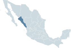
Sinaloa
| Sinaloa Estado Libre y Soberano de Sinaloa |
|||
|---|---|---|---|
| — State — | |||
|
|||
 |
|||
 |
|||
| Country | |||
| Capital | Culiacán | ||
| Municipalities | 18 | ||
| Admission | October 14, 1830[1] | ||
| Order | 20th | ||
| Government | |||
| - Governor | Jesús Aguilar Padilla |
||
| - Federal Deputies | PRI: 6 PAN: 2 |
||
| - Federal Senators | PRI: 2 PAN: 1 |
||
| AreaRanked 18th | |||
| - Total | 58,238 km2 (22,485.8 sq mi) | ||
| Population (2005) | |||
| - Total | 2,650,499 (Ranked 15th) | ||
| - Demonym | Sinaloense | ||
| Time zone | Zona Pacífico (UTC-7) | ||
| - Summer (DST) | Zona Pacífico (UTC-6) | ||
| HDI | 0.8420 - High Ranked 13th |
||
| ISO 3166-2 | MX-SIN | ||
| Postal abbr. | Sin. | ||
| Website | Sinaloa state government | ||


Sinaloa (Spanish pronunciation: [sinaˈloa]) is one of the 31 states of Mexico, located in the northwestern part of the country. The state is bordered to the north by Sonora and Chihuahua; to the south, by Nayarit; to the east by Durango, and to the west, across the Gulf of California, by Baja California Sur. The state covers an area of 57,377 square kilometers (22,153 sq mi), and includes the Islands of Palmito Verde, Palmito de la Virgen, Altamura, Santa Maria, Saliaca, Macapule and San Ignacio.
Sinaloa has 2.2 million inhabitants (2005). The capital of the state is Culiacán, while other important cities include Mazatlán and Los Mochis.
Contents |
Geography and environment
The coastal plain is a narrow strip of land that stretches along the length of the state and lies between the ocean and the foothills of the Sierra Madre Occidental Range, which dominates the eastern part of the state. Sinaloa is traversed by many rivers, which carve broad valleys into the foothills. The largest of these rivers are the Culiacán, Fuerte, and Sinaloa.
Sinaloa has a warm climate on the coastal side, moderately warm in the valleys and foothills, moderately cold in the lower mountains and cold in the higher elevations. Its weather characteristics vary from subtropical, found on the plains, to cold in the nearby mountains. Temperatures range from 22 °C (72 °F) to 43 °C (109 °F) with rains during the summer.
There are numerous species of plants and animals within Sinaloa. Notable among the tree species is the iconic Elephant tree, Bursera microphylla.[2]
Culture
Culturally, it is known for a style of music known as banda, and corrido is also popular. It is the only place in the continent where the ancient ball game of Mesoamerica is still played, in a handful of small, rural communities not far from Mazatlán. The ritual ball game was central in the society, religion and cosmology of all the great Mesoamerican cultures including the Mixtecs, Aztecs, and Maya.
The Sinaloa version of the ball game is called ulama; the consensus is that it is faithful to the original game. There are efforts to avoid the extinction of this 3500-year old unique tradition by supporting the communities and children who still play it.[3]
Demography
According to the 2005 census, Sinaloa is home to 2,608,442 inhabitants, 60% of which reside in the capital city of Culiacán and the municipalities of Mazatlán and Ahome. It is a young state in terms of population, 56% of which is younger than 30 years.
Other demographic particulars report 87% of the state following the Catholic faith; 1% of those over five years of age speaking an indigenous dialect together with the Spanish language; the main ethnic groups still residing in the state are the Mixtecs and Maya, followed by the Nahuatl and the Zapotecs. Life expectancy in the state follows the national tendency of higher rates for women than men, a difference of almost five years in the case of Sinaloa, at 72.5 and 77.4 years respectively.
Education
In terms of education, average schooling reaches 8.5 years, which implies complete secondary school; however, 7% of those over 15 years of age are illiterate, and 5% of children under 14 years of age do not attend school.
Institutions of higher education include
- CEUS
- Universidad Autónoma de Sinaloa
- Centro de Investigación para el Desarrollo Integral Regional (CIIDIR-IPN, Unidad Sinaloa)
- Instituto Tecnológico y de Estudios Superiores de Monterrey, Campus Sinaloa
- Instituto Tecnológico y de Estudios Superiores de Monterrey, Campus Mazatlán
- Universidad TecMilenio, Campus Mazatlán
- Universidad TecMilenio, Campus Culiacán
- Universidad de Occidente
- Instituto Tecnológico de Culiacán
- Universidad Tecnológica de Sinaloa
- Intituto Tecnológico de Los Mochis
- Instituto Tecnológico del Mar Mazatlán
- Universidad del Golfo de México, Campus Culiacán
- Universidad Autónoma Indígena de México
- Universidad Casa Blanca
- Universidad Politécnica de Sinaloa
- Universidad de Durango
- Escuela Normal de Sinaloa
- Universidad Católica de Culiacán
- Instituto Senda del Río
Municipalities
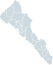
Sinaloa is subdivided into 18 municipios (municipalities) See Municipalities of Sinaloa
The state's major cities include the capital Culiacán, Mazatlán, a tourist resort, and Los Mochis, an agricultural center.
Economy
The main productive activities of Sinaloa are agriculture, fishing, livestock breeding, commerce and industry. The products obtained from these activities are used for both local and national consumption. Agriculture produces tomatoes, beans, corn, wheat, sorghum, potatoes, soybeans, sugarcane and squash. Sinaloa is the most prominent state in Mexico in terms of agriculture, and additionally has the second largest fishing fleet. Livestock produces meat, sausages, cheese and milk also sour creme. Cannabis and Opium are also cultivated in high quantities in this region.
Government and politics
The current governor of Sinaloa is Attorney Jesus Aguilar Padilla (PRI), elected for the period 2005-2010. The state is represented in Mexico City by three senators: Francisco Labastida Ochoa (PRI), María Serrano Serrano (PRI), Mario López Valdéz (PAN) and by eight deputies: 6 of the Institutional Revolutionary Party and 2 of the National Action Party.
Notable natives and residents
- Jorge Arce - Boxer and flyweight champion
- Luis Ayala - Major League Baseball player
- Lola Beltrán - Actress and ranchera singer
- Perla Beltrán Acosta - Super Model
- Jared Borgetti - Football striker
- Julio César Chávez, Jr. - Boxer
- Ana Gabriel - Singer
- Lorena Herrera - Actress
- Pedro Infante - Singer / Actor
- Francisco Labastida - Economist and politician affiliated to the PRI
- Horacio Llamas - Basketball player
- Alberto Medina - Football player
- Fernando Montiel - Boxer
- Patricia Navidad - Actress and singer
- Francisco Javier Rodríguez - Football player
- Antonio Osuna - Major League Baseball player
- Espinoza Paz - Singer
- Óliver Pérez - Major League Baseball player
- María Del Rosario Espinoza - Champion of Taekwondo
- Cesar Millan - TV Personality and Professional Dog Trainer
- Chayito Valdez - Folk Singer
- Omar Bravo - Football striker
- Juan Galindo- explorer and army officer
- Joaquín Guzmán Loera- Mexican Drug Lord
- Jorge Ayala-Runs Sinaloa Crazy Drug Lord
See also
- Sinaloa Cartel
Notes
- ↑ "500 años de México en documentos" (in Spanish). http://www.biblioteca.tv/artman2/publish/1830_135/Ley_Reglas_para_la_divisi_n_del_Estado_de_Sonora_y_Sinaloa.shtml.
- ↑ C.Michael Hogan. 2009
- ↑ Asociacion de Gestores del Patrimonio Historico y Cultural de Mazatlán. 2009
References
- C. Michael Hogan. 2009. Elephant Tree: Bursera microphylla, GlobalTwitcher.com, ed. N. Stromberg
- Asociacion de Gestores del Patrimonio Historico y Cultural de Mazatlán. 2009. The Mesoamerican Ballgame-Ulama
External links
- (Spanish) Sinaloa state government
- The History of Indigenous Sinaloa
- PBS Frontline: The place Mexico's drug kingpins call home
|
||||||||||